-
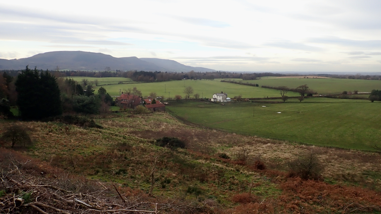
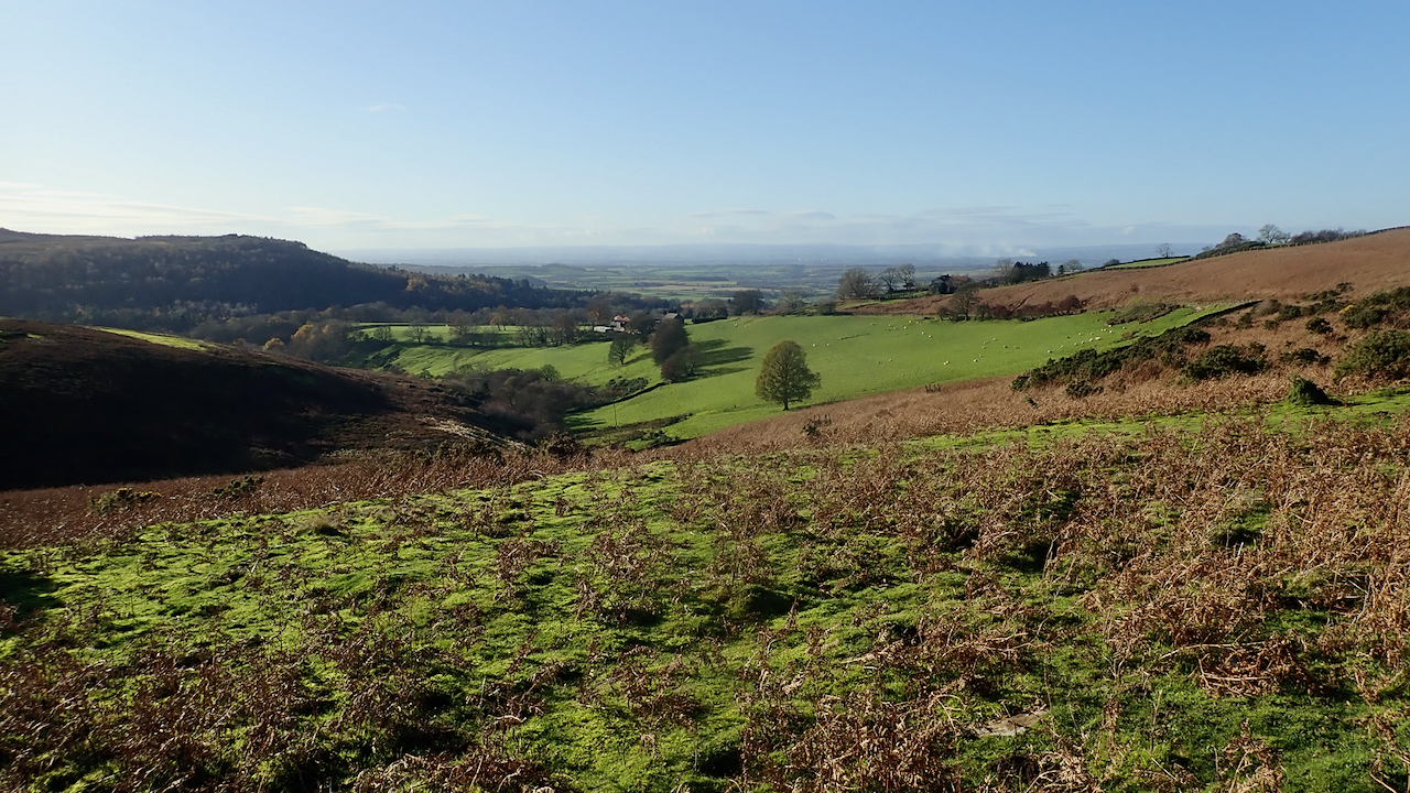
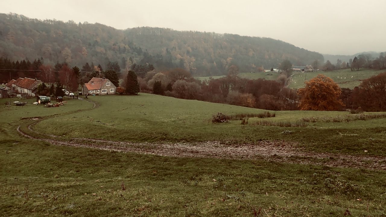
A new vista across Greenhow bottom to the Cleveland Hills
Recent felling on Ingleby Bank has opened up a new vista across Greenhow bottom to the Cleveland Hills. In the near distance are Bank Foot Farm and the old railwayman’s house formerly known as Poultry House Cottage. Poultry House Cottage has a dark history. I wrote about it here on my old site dated 18…
-
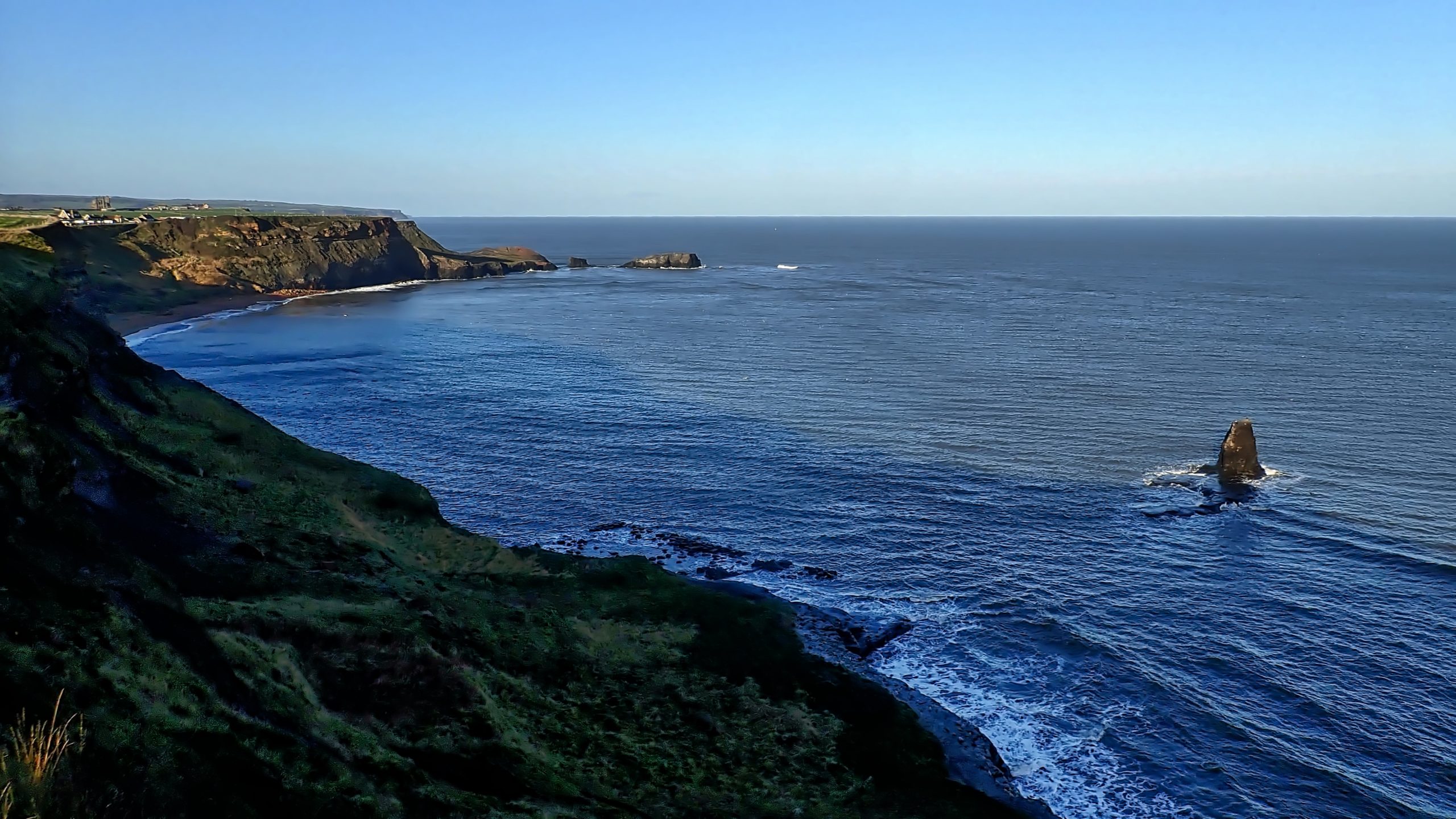
Saltwick Bay
Just east of Whitby lies the once secluded Saltwick Bay, protected by sea cliffs hosting a breeding colony of Kittiwakes and Fulmars. But the huge static caravan park dominates the cliff top. A steep trod allows access to the beach. On Saltwick Nab in the distance, Sir Hugh Cholmley set up his alum works in…
-
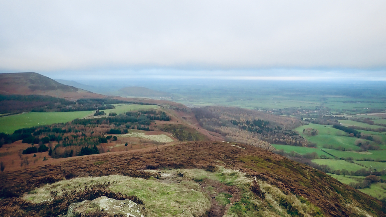
Green Bank from Cringle End
Otherwise known as the Lord Stones Country Park, which should, of course, be the Lords’ Stone as there’s only one stone situated where the lands of three Lords met: Duncombe of Helmsley, Marwood of Busby Hall and Aislesby. A murky day, and windy too. On Cringle Moor holding the camera steading was not easy. No…
-
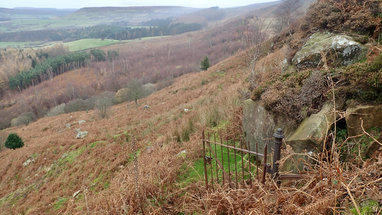
Battersby Crag
I first came across this old rusty gate many years ago when I was planning a night navigation exercise. That must have been in the 1990s. I had waded down through the steep heathery slope, stopping on top of the crag and looking down on to the spikes. For an instance, my heart missed a…
-
View from Solomon’s Temple to Oak Dale
It would have been a fine view that greeted Matthew Walker when he emerged each morning from his farm at Solomon’s Temple. His eyes might follow Slape Stones Beck down to its confluence with Oak Dale. The farmstead stood on the Hambleton Drove Road at an eminence at the top of Stony Bank. A ruin…
-
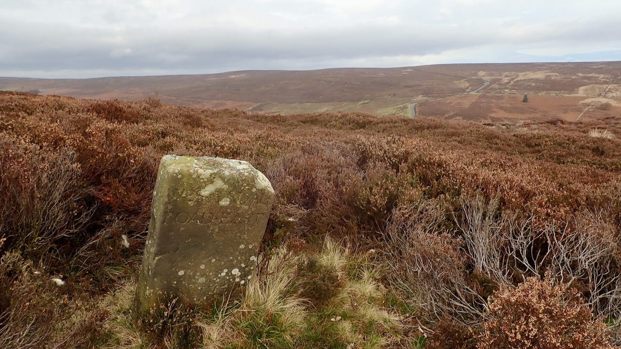
18th-Century Marker Stone
Very close to the ruined farmstead of Jane Frank Garth above Hob Hole and inscribed with ‘WESTERDALE ROAD・EAST‘. It’s located on Little Hograh Moor, about 350 metres from the Hob Hole to Westerdale Road and away from any modern footpaths, Tucked way in the heather. Jane Frank Garth is more locally known as ‘Gin Garth‘…
-
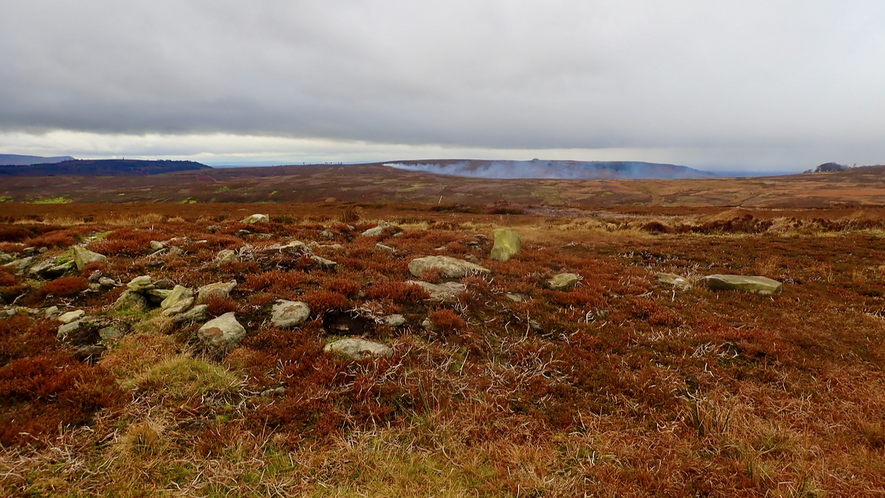
The keepers have been at it again.
This is somewhere near to the WW2 bunker on Great Ayton Moor. The smoke was heading straight towards Guisborough. Now it’s been a year since the Government committed to banning rotational burning on peatlands. However, nothing has happened. This is perhaps not surprising since it has had the coronavirus to deal with, but there is…
-
Commondale from Three Howes Rigg
The North Yorkshire Moors has been my playground since 1973, and yet every so often I get to someplace where I’ve never trod before. I’ve seen this view before, a mere glimpse whilst travelling at 60 mph down along Three Howes Rigg road on the way to Castleton. Cycling allows a longer view, but until…
-
Site of Monastic Cell at Old Byland
Sir Nikolaus Pevsner (1902 – 1983) was an architectural historian who documented the principal historic buildings in every county in his ‘The Buildings of England‘. In his Yorkshire volume under Old Byland, he writes in the introduction to the village “the site of Byland Abbey was 1¼ m. NE of Old Byland“. I was fascinated…
-
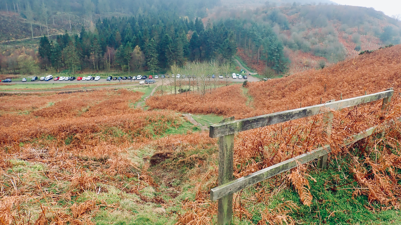
Saturday morning in Gribdale
It’s 10:30 on a dreich Saturday morning. Cloud base is about 270m, Roseberry Topping wears a cap, there’s a brisk wind, and it’s mizzling, that light, fine, mist-like rain that nevertheless slowly wets you through. And Gribdale car park is full. Only the odd space remaining. This year, the first lockdown saw a step-change in…
Care to comment?