Tag: pond
-
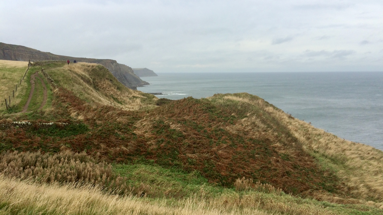
Craze Naze
What a lovely assonant name, although many Cleveland Way walkers will no doubt pass it without giving it a second thought, eager to get to Whitby or Robin Hood’s Bay, in whichever direction they are heading. On the Six-inch Ordnance Survey map of 1853, it is named as Dobson’s Nab. I wonder who Dobson was.…
-
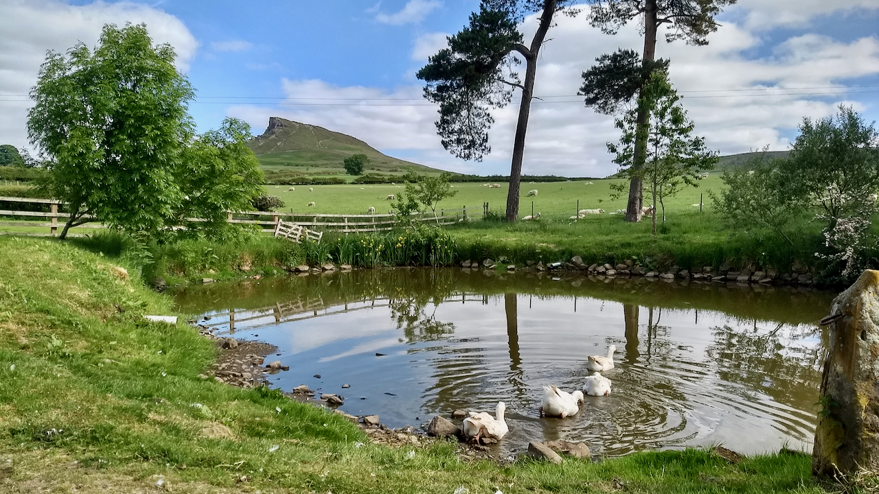
A view of Roseberry from Aireyholme
At a quarter past seven on the evening of 15th June 1920, the world-famous soprano Dame Nellie Melba made history by singing across the airwaves in a live broadcast from the Marconi Company’s site in Chelmsford, Essex. Whilst she was not the first person to broadcast her voice, Dame Nellie was the first professional singer,…
-
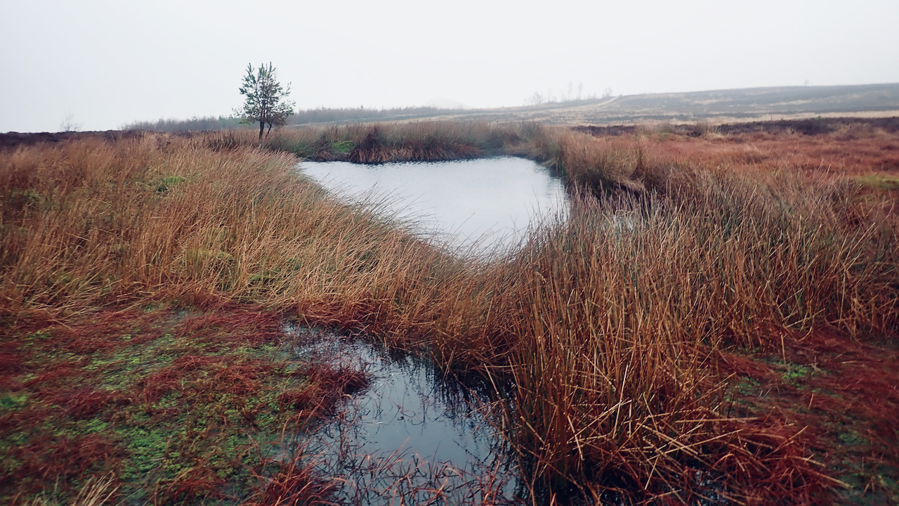
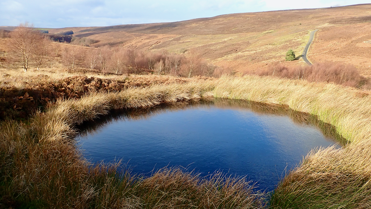
What’s below this pond on Newton Moor?
I’m guessing this is a manmade pond, at the head of Howden Gill. It’s not shown on the 1958 OS Map. I’ve photographed it before but have always assumed it to be on Great Ayton Moor, but on closer inspection it’s actually to the north of the Newton parish boundary, so strictly that will make…
-
Otter Hills, Westerdale
I never know what’s the proper name for this dale. It’s the dale of Tower Beck which becomes Whyett Beck before its confluence with the River Esk which takes the name Westerdale up to the river’s source in the Esklets. Yet if you follow Tower Beck upstream to its source just below Young Ralph Cross…
-
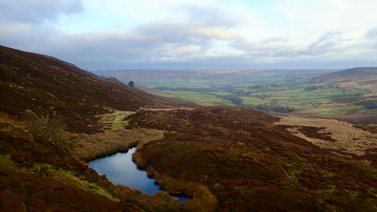
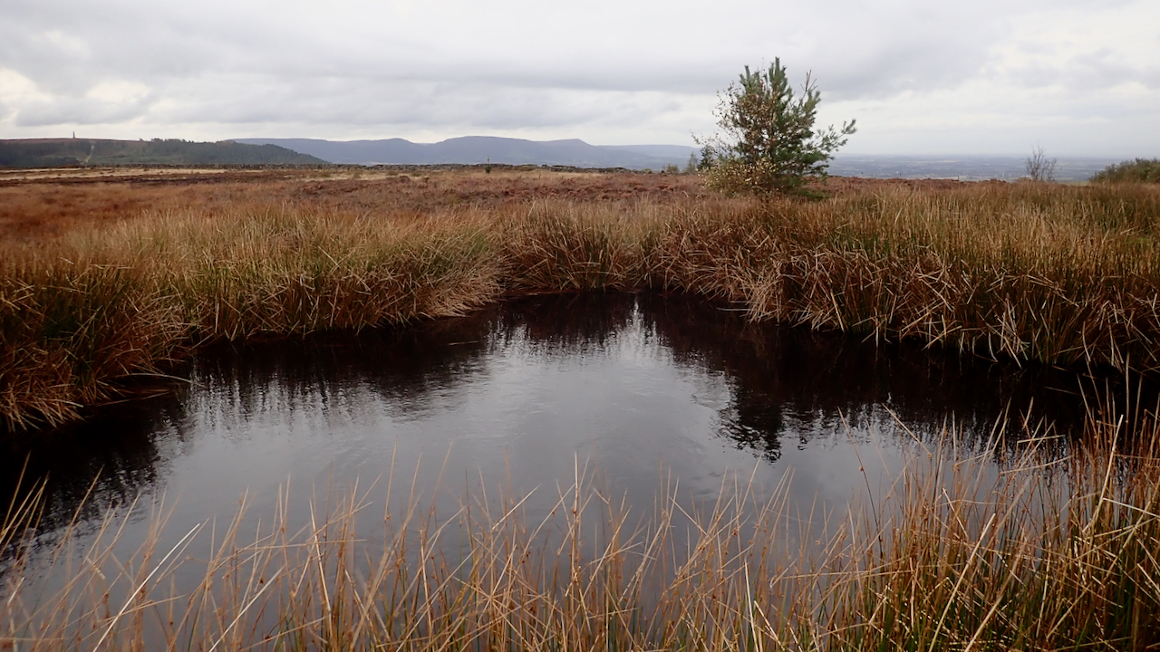
Little Hograh Moor Bomb Crater
Another trip to Little Hograh Moor, above Hob Hole in Baysdale. Honestly, I haven’t been this way for months for my third visit in a fortnight. This small pond, locally dubbed Frank’s Pond, is actually a 1942 bomb crater, according to Tom Burns Scott. A solitary bomb, jettisoned, I imagine, from a Luftwaffe bomber in…
-
Commondale from Three Howes Rigg
The North Yorkshire Moors has been my playground since 1973, and yet every so often I get to someplace where I’ve never trod before. I’ve seen this view before, a mere glimpse whilst travelling at 60 mph down along Three Howes Rigg road on the way to Castleton. Cycling allows a longer view, but until…
-
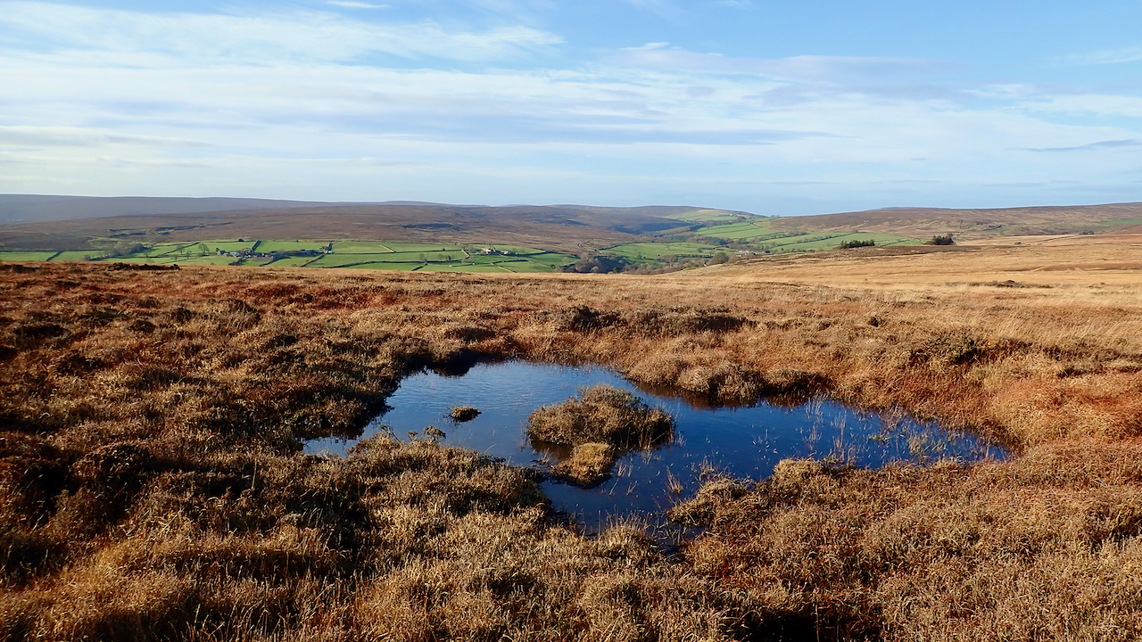
Dub, Great Ayton Moor
A ‘dub‘ is a Northern word for a patch of water, which could be anything from a puddle on a path or road to a pool in a river, deep enough for swimming or a favoured fishing mark. The earliest attestation is in a perambulation of the liberty of Ripon in 1481. Sometimes a stream…
-
Rounton Grange
On me bike for a low-level ride over the quiet roads west of the A19. The bottom bracket is wobbly so I wanted to avoid any big climbs. Bikes are great when they work, but not as simple as running. I took a detour to see if I could find any remains of Rounton Grange,…
-
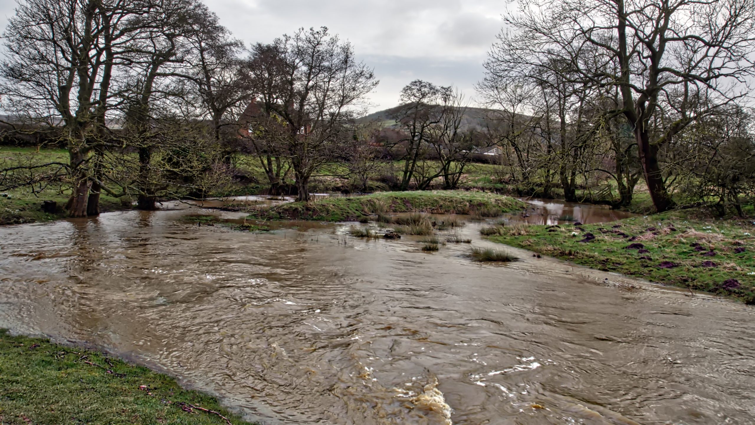
Ox-bow pond near Holmes Bridge
It is perhaps too early to say that Cleveland got off relatively lightly last night from Storm Dennis, as the run-off takes several hours to flow down off the moors to affect river levels. At Little Ayton, the River Leven is high enough to flood a normally dried up ox-bow pond. This is part of…
-
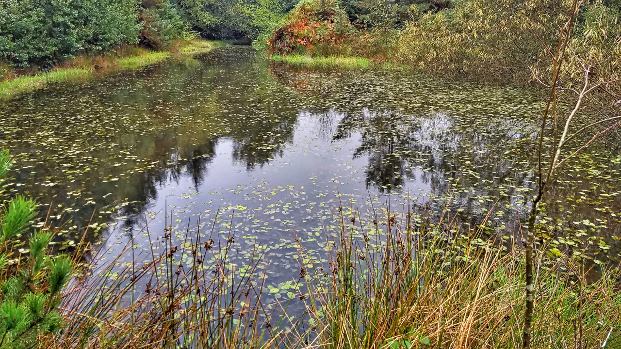
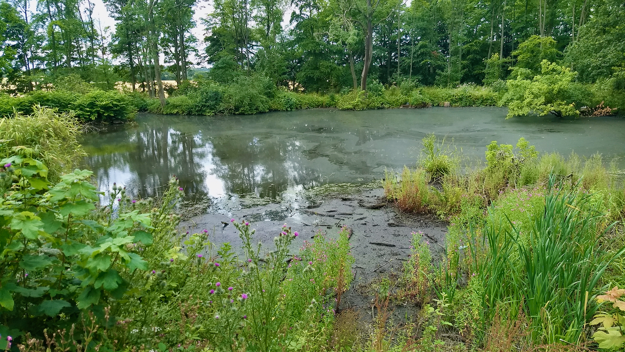
Pond, Sneaton Forest
The first time I orienteered in Sneaton the map was called Maybeck, the spruce trees were impenetrable and any excursion was a hands and knees job along one of the many ditches. Planted in the 1960s the forest is a commercial forest typical of the North York Moors. Today, 40 years later, the trees have…