Category: Kildale
-
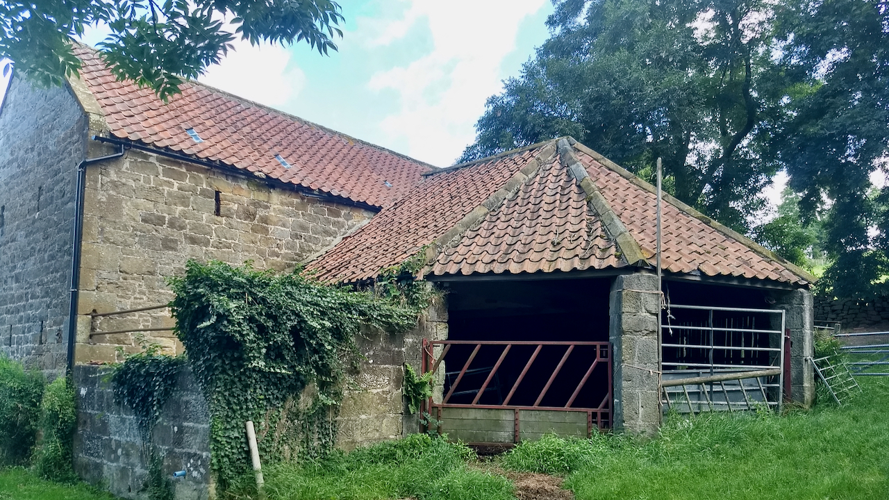
Gin House, Park Farm, Kildale
Horses were once a traditional source of power on the farm and in industry. Threshing, milling, pumping, lifting, sawing, churning would all be done under horse-power. On farms, the ‘gin’, a shortening of the word ‘engine’, was often undercover in a separate building attached to the barn called a ‘gin-house’, and in many cases these…
-
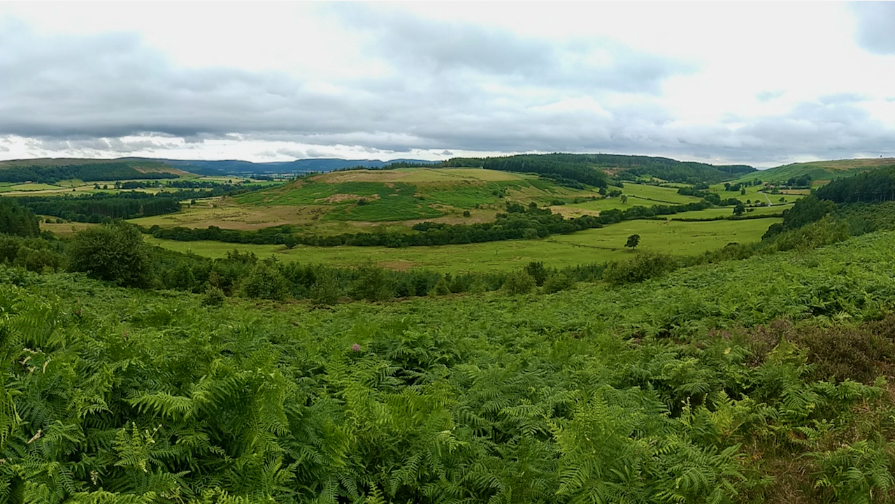
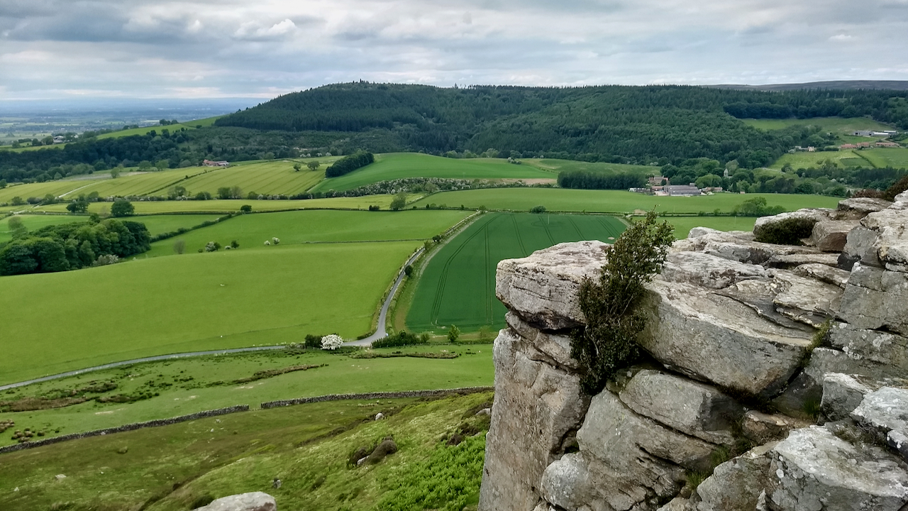
The Pale
I’m always on the look out for an out of the way viewpoint. I discovered this by a short walk across the heather from a bike ride up to Percy Rigg. It shows the full extent of Lonsdale, from its head at Gribdale gate to its confluence with Kildale and portrays a microcosm of history.…
-
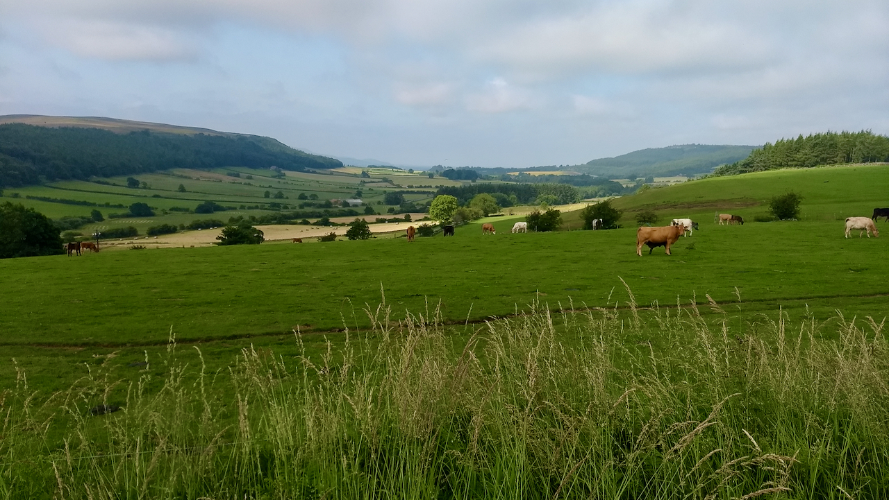
The manuring of Kildale’s fields
The lush fields of the Kildale are the result of generations of cultivation. Under his tenancy agreement, the farmer at Percy Rigg Farm (or Viewley Hill Farm as it was formerly known in the 19th-century) would have been under certain conditions to maintain and improve his fields. He “will lay and spread … in each…
-
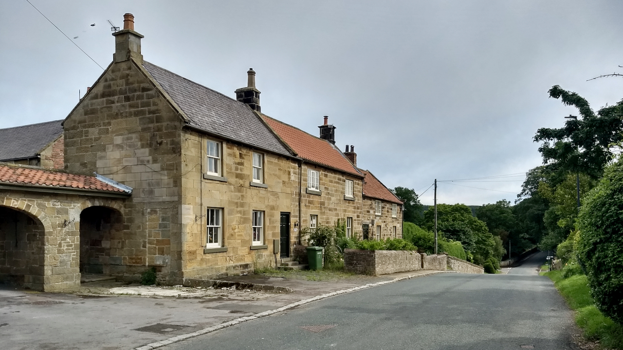
Kildale
There is a cracking photo of Kildale taken by Michael Heavisides in 1903, taken from almost this same spot, perhaps closer to the middle of the road. Much safer in those days. A group of four men stand casually chatting outside the “Blacksmith’s Arms”, the first building in the range. There is bunting hanging between…
-
Holly Tree Wall
That holly tree must be at least 35 years old. I remember it being there when I climbed a route on this face on Park Nab. The large flat field left of centre is a former cricket pitch. The Kildale Cricket Club was founded in 1902, and this field was offered to the club by…
-
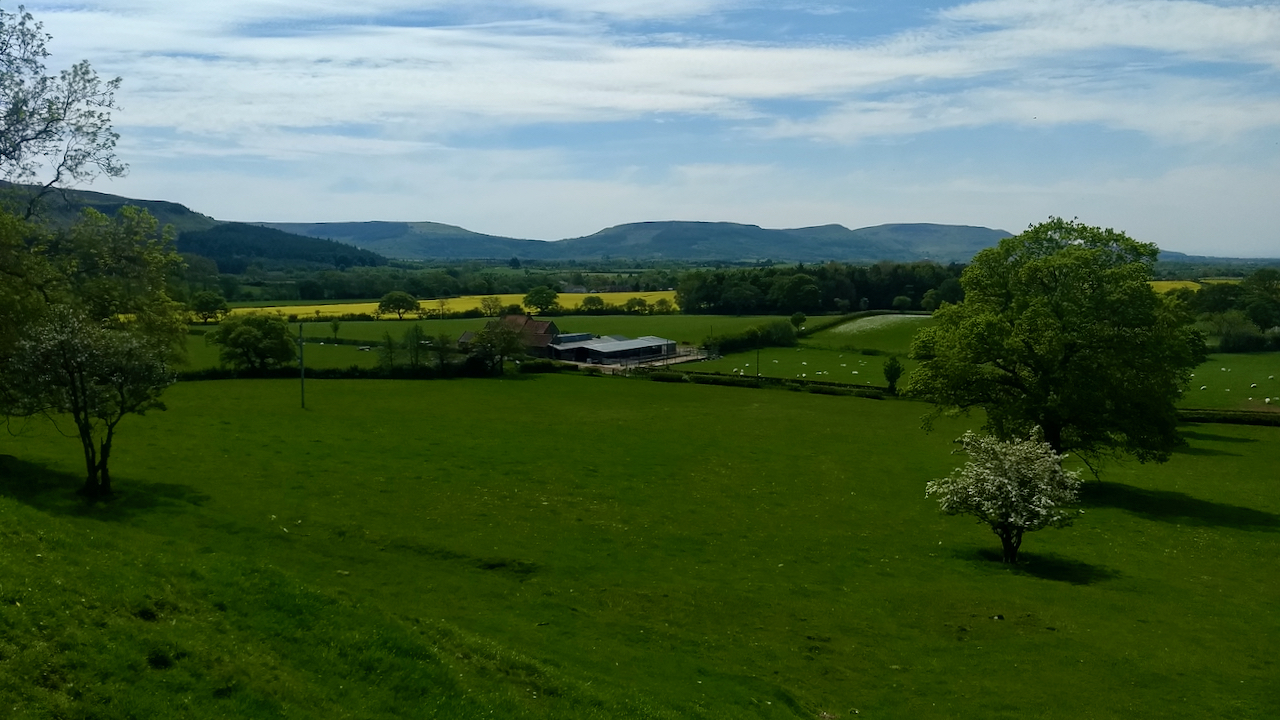
The Cleveland Hills from below Park Nab
An interesting day spent helping on an archaeological dig searching for the long lost chapel of St. Hilda in Kildale. Watch this space. A dearth of photographic opportunities though. This is the Cleveland Hills from below Park Nab. The farm is Low Farm. The hedgerow this side of the rape field, Dundale Beck, forms the…
-
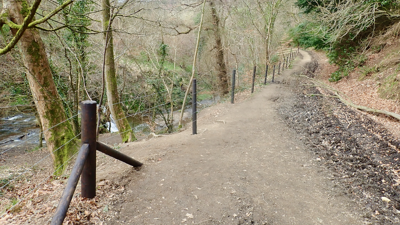
Circulus inextricabilis
Remember back in October when I commented on the estate padlocking their newly constructed steps down to the Old Meggison waterfall in Kildale? Well, the steps have now gone, and a hundred metres or so of post and wire fencing has been erected along the riverside of the track in an attempt to restrict access…
-
The Donkey Pond
I’ve been minded to feature this old whinstone quarry many times before but heavy summer bracken growth has always put paid to that. It’s one of many quarries that sprang up wherever the whinstone outcropped between Eaglescliffe and Sneaton High Moor. Between Cliff Rigg and Kildale there were several smaller and I guess short lived…
-
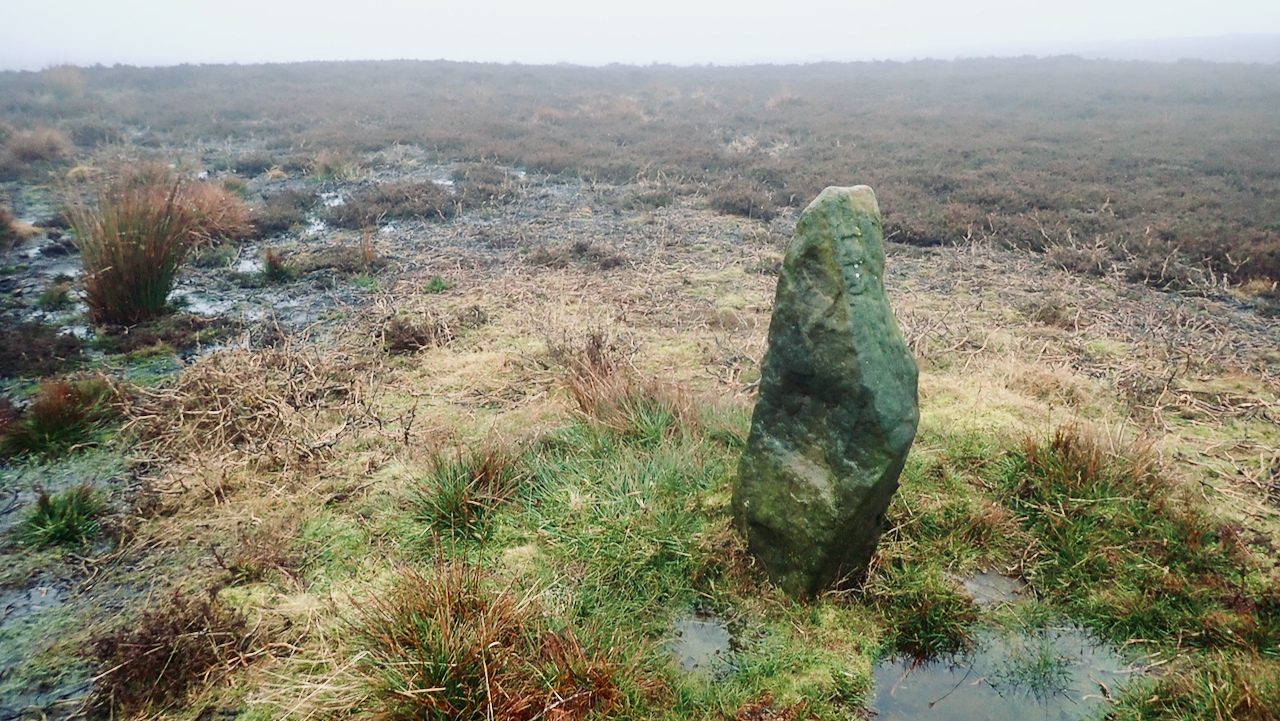
Standing stone on Kildale Moor
I believe this is just a waymarker rather than a boundary stone or religious cross. The North York Moor Historic Environment Record (HER) map suggests it dates from the 19th-century. It stands alongside a path designated as “F.P.”on the 1895 Ordnance Survey map. This is one of the paths The Ramblers have identified during their…
-
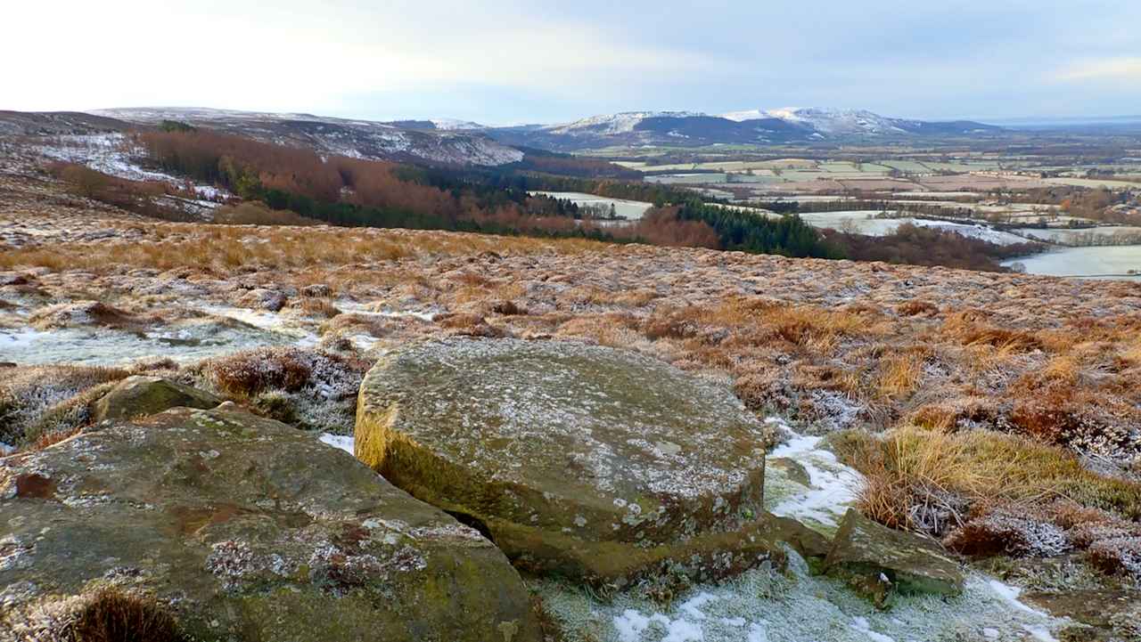
Just off the Baysdale road is an unfinished millstone
One face has been dressed as had the circumferential edge. I guess the plan was to flip it and then work on the underside face. But why and when was it abandoned? The obvious destination would have been one of the two mills at Kildale. Just before the River Leven leaves the parish boundary in…