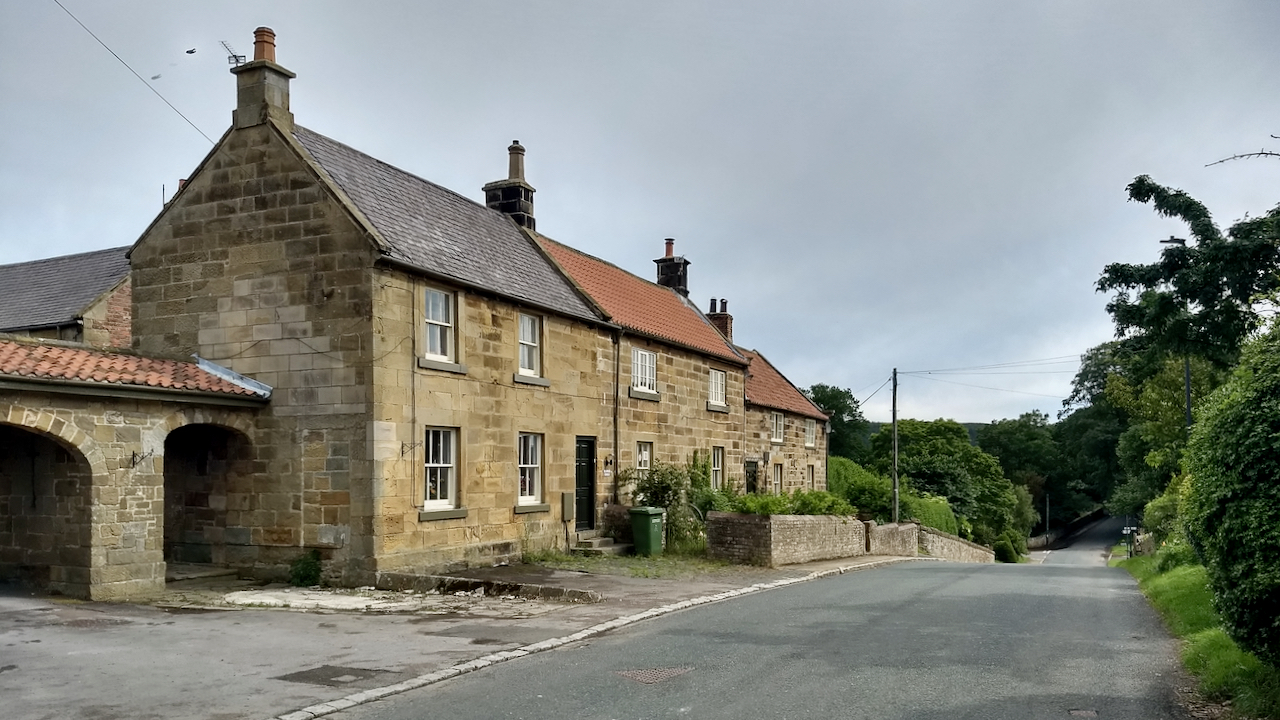
There is a cracking photo of Kildale taken by Michael Heavisides in 1903, taken from almost this same spot, perhaps closer to the middle of the road1Burns, Tom Scott. “Round and About The North Yorkshire Moors: A Glimpse of the Past”. M.T.D. Rigg Publications. Reprinted 1989.. Much safer in those days. A group of four men stand casually chatting outside the “Blacksmith’s Arms”, the first building in the range. There is bunting hanging between the upper windows and a bike is propped up by the door. A unhitched pony trap is in the road, and a young lad, hands in pockets stares at the camera.
Unfortunately I can’t find a copy online, so you’ll have to take my word for it. But here’s a 1960s photo I did find from the Francis Frith collection.
The angle is more acute, but it does shows the single story range, the ghost of which can be seen on the gable.
On the 1856 Ordnance survey map (surveyed 1853) the Public House is named as the “Green Tree”2“View Map: Yorkshire 29 (Includes: Easby; Great Ayton; Ingleby Greenhow; Kildale; Little Ay… – Ordnance Survey Six-Inch England and Wales, 1842-1952.” Maps.nls.uk, 2021, maps.nls.uk/view/102344245#zoom=7&lat=4939&lon=8490&layers=BT. Accessed 7 July 2021.. We know that it was the “Blacksmith’s Arms” in 18583“COUNTRY NEWS.” York Herald, 21 Aug. 1858, p. 5. British Library Newspapers, link-gale-com.ezproxy.is.ed.ac.uk/apps/doc/R3211086138/GDCS?u=ed_itw&sid=bookmark-GDCS&xid=86d08c62. Accessed 7 July 2021.. Sometime after Heavisides’ 1903 photo, it became the “Temperance Hotel”4Ibid. Tom Scott Burns.. Kildale is now a “dry” village.
At the end of the range, the smallest building was the Post Office. In 2005, it still had the familiar red P.O. sign.
- 1Burns, Tom Scott. “Round and About The North Yorkshire Moors: A Glimpse of the Past”. M.T.D. Rigg Publications. Reprinted 1989.
- 2“View Map: Yorkshire 29 (Includes: Easby; Great Ayton; Ingleby Greenhow; Kildale; Little Ay… – Ordnance Survey Six-Inch England and Wales, 1842-1952.” Maps.nls.uk, 2021, maps.nls.uk/view/102344245#zoom=7&lat=4939&lon=8490&layers=BT. Accessed 7 July 2021.
- 3“COUNTRY NEWS.” York Herald, 21 Aug. 1858, p. 5. British Library Newspapers, link-gale-com.ezproxy.is.ed.ac.uk/apps/doc/R3211086138/GDCS?u=ed_itw&sid=bookmark-GDCS&xid=86d08c62. Accessed 7 July 2021.
- 4Ibid. Tom Scott Burns.
Leave a Reply