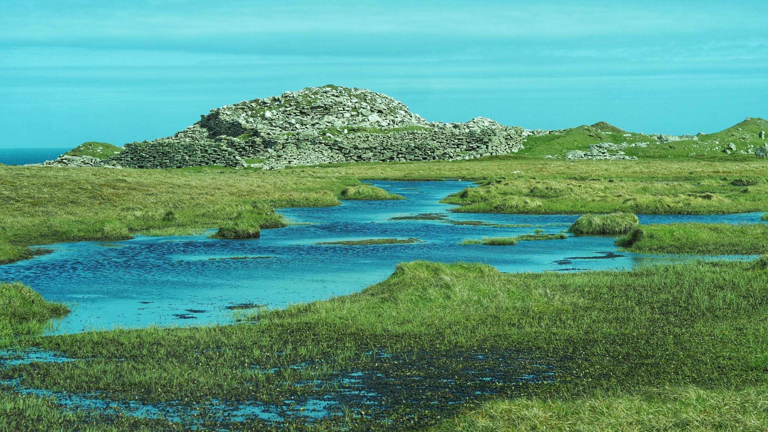
This photograph looks across the Burn of Burgadies, which drains the Loch of Levenwick towards the sea. Beyond the boggy, pool-scattered moor, the broch stands sentinel on the higher ground. This rather damp approach from the nearest tarmac at Southpunds may go some way towards explaining why this remarkable site rarely features in visitors’ plans — even though it is, by some accounts, Shetland’s third best-preserved broch.1Shetland Times – 05 May 2000. “Hard going over boggy ground.” https://www.britishnewspaperarchive.co.uk/viewer/bl/0000666/20000505/198/0023
Two thousand years ago, someone decided this particular lump of Shetland coastline was worth defending. You can hardly blame them.
The Levenwick Broch sits on a rocky coastal promontory roughly 15 metres above sea level, commanding views up and down the east coast of the South Mainland. It was built sometime between 500 BC and AD 200 — a rather broad estimate, but archaeology on a windswept Shetland headland is not the most straightforward of pursuits.
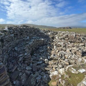 This second photograph looks down into the ruined interior of the broch, where the curved dry-stone walls still stand to a modest height.
The broch has an overall diameter of 54 feet and walls between 12 and 16 feet thick, into the courtyard of which a wheelhouse was later inserted. A broch within a broch, more or less. Brochs have been interpreted as defensive structures, or simply as the prestige dwellings of an Iron Age elite keen to display its status; wheelhouses, meanwhile, have been read as having both domestic and ritual functions.2Historic Environment Scotland. “Levenwick, Broch 515m East of Burgadies.” AncientMonuments.uk, https://ancientmonuments.uk/127001-levenwick-broch-515m-east-of-burgadies-shetland-south-ward. Accessed 23 May 2026.3Royal Commission on the Ancient and Historical Monuments of Scotland. Twelfth Report with an Inventory of the Ancient Monuments of Orkney and Shetland. Edinburgh, 1946, pp. 24–25. Cited in “Levenwick.” Trove.scot, https://www.trove.scot/place/908. Accessed 23 May 2026.4Levenwick, broch 515m E of Burgadies. Historic Environment Scotland, SM2050. https://www.trove.scot/designation/SM2050
The site was first mentioned by Sir Robert Sibbald in his survey of 1711, visited by Sir Henry Dryden in 1855, and excavated by Gilbert Goudie in 1869. Goudie also partially excavated nearby long mounds he called “The Giants’ Graves,” comparing them to the horned cairns of Caithness.
Levenwick is one of over 130 known brochs in Shetland, and one of a chain of similar structures at strategic coastal positions — the nearest being a broch at Clumlie, just 2 kilometres to the south. The people who built these towers were, it is fair to say, not short of ambition.
The monument remains unexcavated since Goudie’s day. Some things are best left to the weather and the terns.
- 1Shetland Times – 05 May 2000. “Hard going over boggy ground.” https://www.britishnewspaperarchive.co.uk/viewer/bl/0000666/20000505/198/0023
- 2Historic Environment Scotland. “Levenwick, Broch 515m East of Burgadies.” AncientMonuments.uk, https://ancientmonuments.uk/127001-levenwick-broch-515m-east-of-burgadies-shetland-south-ward. Accessed 23 May 2026.
- 3Royal Commission on the Ancient and Historical Monuments of Scotland. Twelfth Report with an Inventory of the Ancient Monuments of Orkney and Shetland. Edinburgh, 1946, pp. 24–25. Cited in “Levenwick.” Trove.scot, https://www.trove.scot/place/908. Accessed 23 May 2026.
- 4Levenwick, broch 515m E of Burgadies. Historic Environment Scotland, SM2050. https://www.trove.scot/designation/SM2050
Leave a Reply