Tag: history
-

Hood Grange
Behind this somewhat sad stone farmhouse lies eight centuries of quiet drama. A hermitage stood here before 1138, when monks moved in under Roger de Mowbray’s patronage. Cistercians took the place over, then shuffled off to Old Byland after five years, then on to Byland Abbey proper. Augustinian canons from nearby Newburgh Priory moved into…
-

Petlar’s Bridge Quarry: A Brief Flirtation with Industry
I must have cycled past this old quarry near Petlar’s Bridge a couple of dozen times or so since the plantation hiding it was felled, and it has since been on my list to write about. The quarry likely pre-dates the Eskdale railway by half a century. One unverified internet source claims whinstone was extracted…
-

Saltburn Sands From North Bank
North Bank is the steep cliff behind the Ship Inn at Old Saltburn, and not many know the National Trust owns it. I went there today for a bioblitz. That is jargon for an intensive, time-limited hunt to record every living thing on a patch of land, in this case bumblebees, butterflies, wildflowers, whatever moved…
-

“F RO END”
I have caught sight of this guidestone plenty of times, hurtling past at sixty miles an hour. Stopping on the Blakey Ridge road is no small feat. A bike makes it far simpler. The stone reads “F RO END”, short for “FARNDALE ROAD END”. It dates from around 1720, part of an early eighteenth century…
-
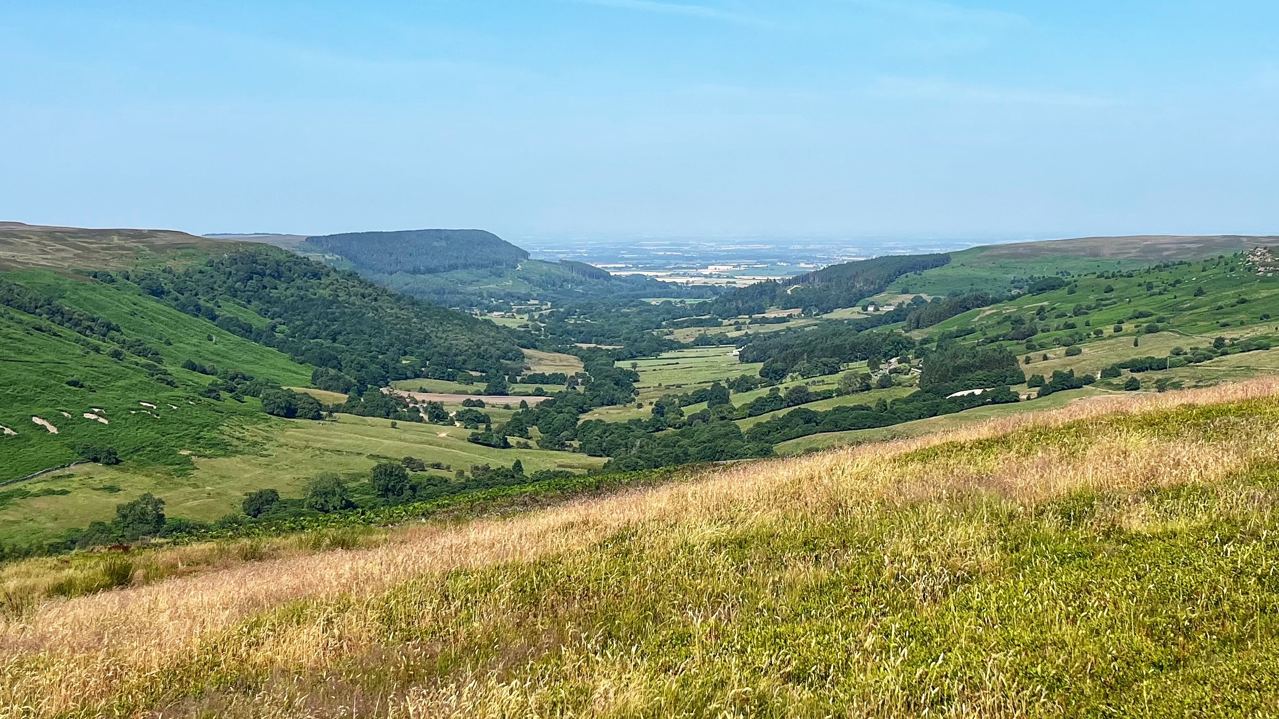
Scugdale: The Valley That Runs the Wrong Way
Scugdale does not behave the way a North York Moors dale ought to. Most valleys here dip eastward, following the grain of the rock. Scugdale cuts north west instead, breaking through the Jurassic escarpment against the run of things. Geologists have never quite settled why. It may be the leftover of a larger dale that…
-
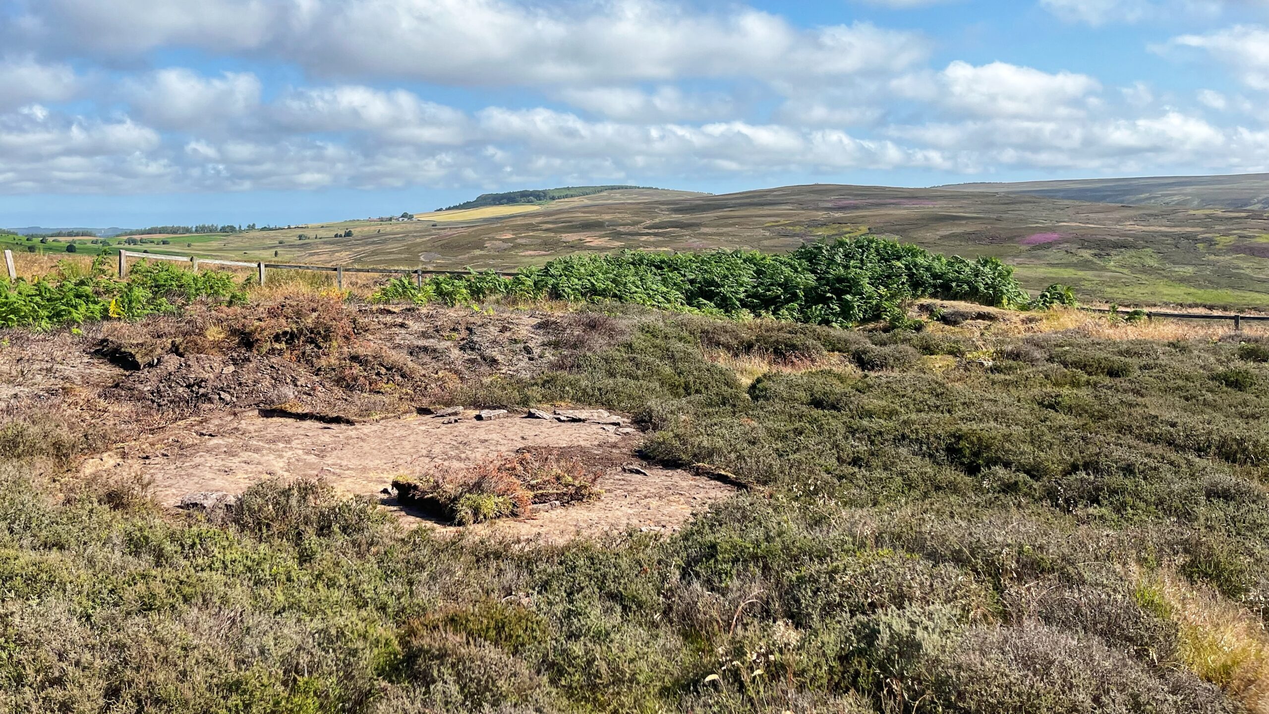
Percy Rigg: Iron Age Living
The heather has gone. Local archaeologists have begun to strip the vegetation back to where the 1960s excavators left off, not to dig fresh ground, but to expose what was already found and read it again with sharper eyes. The aim is a proper sequence: which house came first, which blocked which, and how five…
-

Cock Howe — After the Fall
One thing that does not endear me to the moors is the endless gamekeepers’ access tracks. Miles of the stuff. Dull to run, duller to walk, but perfect for cycling, except our creaking access laws say no, thank you very much. One such track runs along the skyline of Bilsdale West Moor, from the Bilsdale…
-

Potter’s Nab: Farndale’s New Woodland
Farndale East is getting itself a new woodland, courtesy of the Yorkshire Wildlife Trust. In the intake fields below Potter’s Nab. The idea is simple enough. Trees hold soil together, and soil held together does not go washing into the River Dove every time it rains. Sensible stuff. Before a single sapling goes in, archaeologists…
-

Easby Lane Housing Development: Uncovering the Anomalies
I climbed up to Easby Moor before the heat settled in. From the top I could clearly make out the arable field on the edge of Great Ayton that has been earmarked for 68 new houses. It is the field just right of centre, with a crop that is still green. It is easy to…
-
Westerdale: Two Dales, One Village, No Pub
The name Westerdale suggests it’s the westerly dale in the Esk valley, with the river starting life as springs called Esklets high on the moor. But the dale forks in two. One arm mixes wooded ravines with bare moorland and old common land, now grazed by sheep and cattle. This one, drained by Tower Beck,…