Tag: history
-
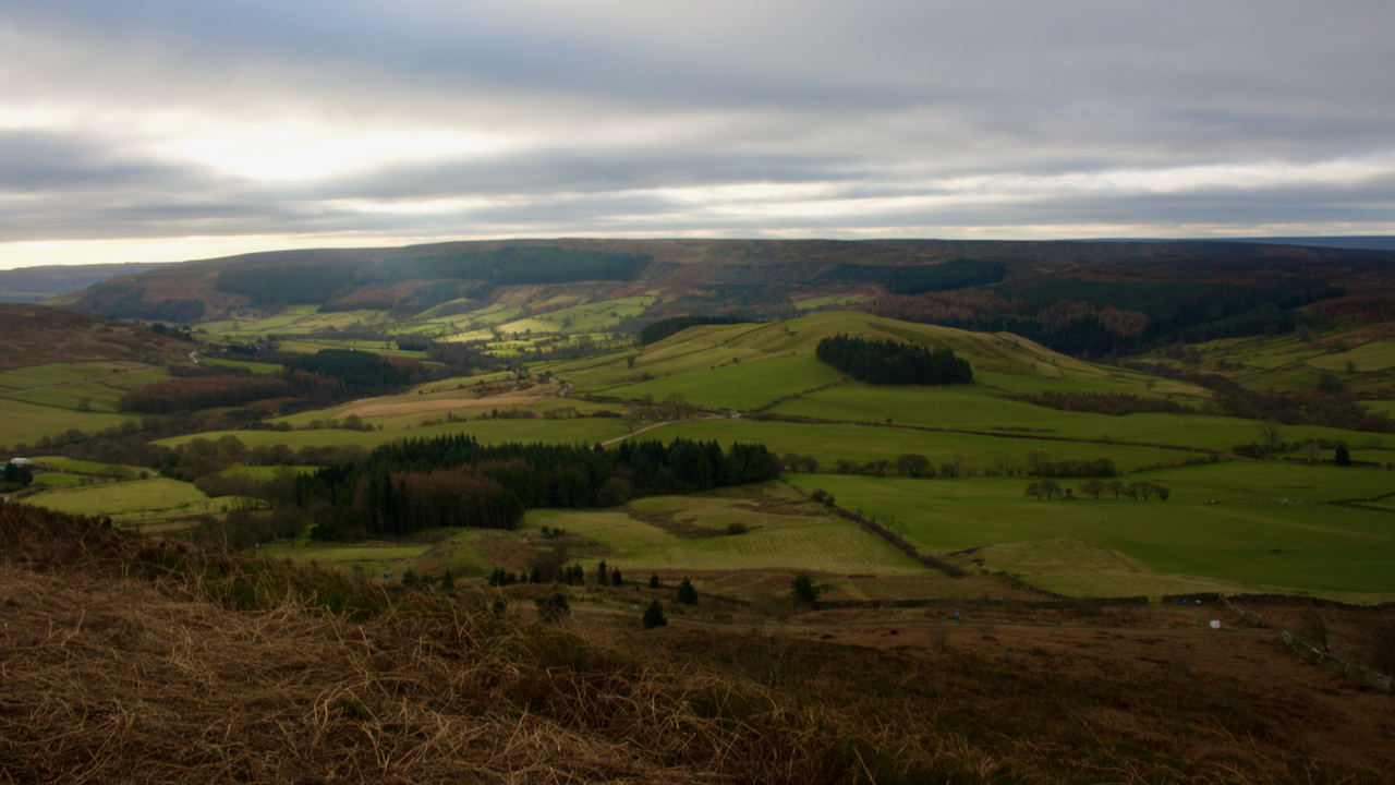
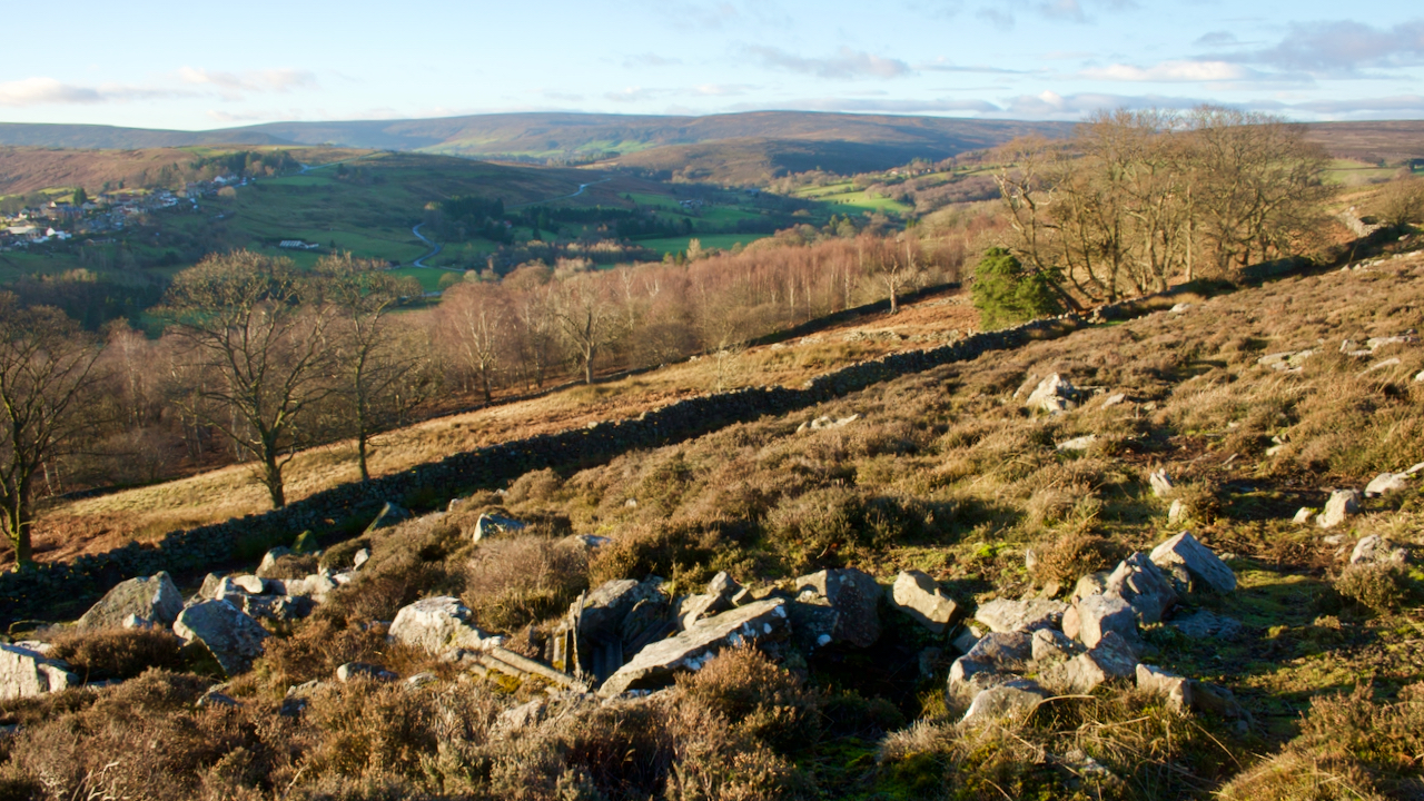
Back o’ Cranimoor
A wander around the back of Cranimoor, more familiarly known as Cringle Moor. On what was an otherwise overcast morning, a patch of sunlight tantalisingly moves up Raisdale before petering out before reaching Wath Hill, the prominent hill at the head of the dale. Raisdale was once a source of building stone for Hartlepool and…
-
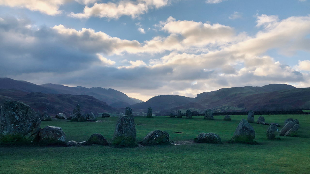
Castlerigg Stone Circle
My early morning run took in the Castlerigg Stone Circle, a 4,500 year old monument built by the earliest farming communities who took advantage of the fertile lands of the valley bottoms. Castlerigg is particularly impressive, giving a 360° panorama of the surrounding fells. This is a view south up the tiny Naddle valley. It’s…
-
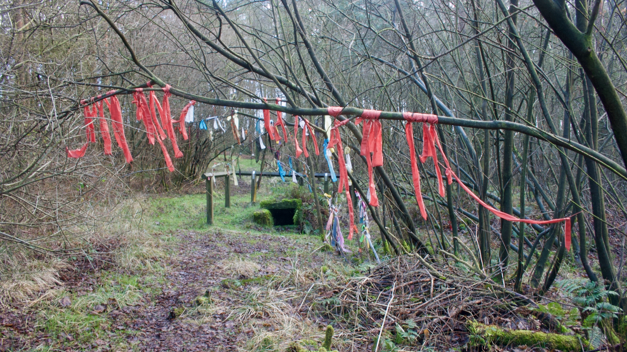
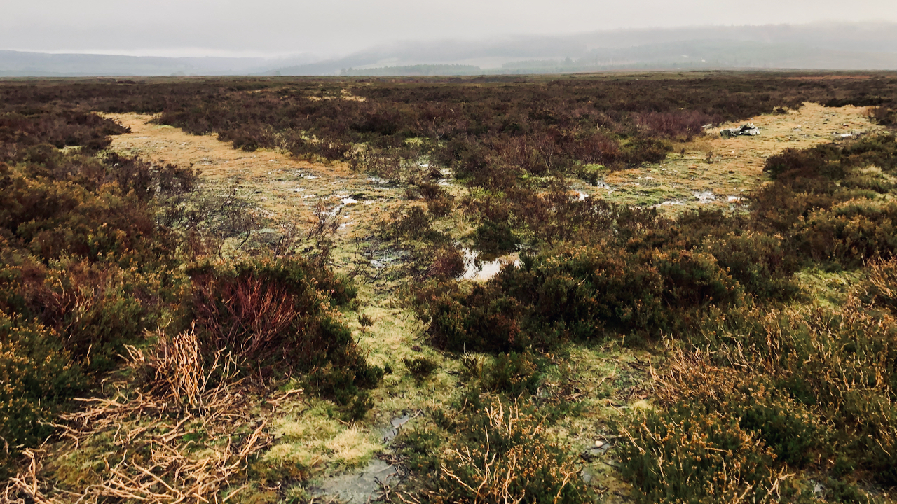
Old Wives’ Well
A chance to explore the moorland south of Goathland known as Simon Howe Rigg and into the depths of Cropton Forest in search of a moorland cross and a well said to be a holy well. The two features are just 373 metres apart which may or may not be a coincidence. Old Wives’ Well,…
-
Cuddy Trail — Tods Loup
On 12 March 1840, the Fife Herald carried an advertisement: LAMBERTON COLLIERY TO LET. To be Let, for such a number of years as may be agreed upon, with entry thereto at Whitsunday 1840, THE COAL FIELD situated on the Farm of LAMBERTON, in the parish of Mordington, and county of Berwick, as formerly occupied…
-
Scallywag hideout
A few weeks ago I had a tip off about a WW2 ‘Auxiliary Unit‘ operations base above Danby Park overlooking Castleton (thanks, Chris). This would have been the hideout for a special detachment of the Home Guard which would have operated as a guerrilla force in the event of a German invasion. Although these were…
-

Wainstones
Seen from Cold Moor, across Garfit gap. The morning’s duvet just about blown off, and the December sunshine hitting the crags for the first time. The Wainstones are a popular climbing venue. It’s difficult to get any idea of scale with this shot. The maximum climb is about 35′, just over twice the size of…
-
Moorland isosceles triangle
A strange feature to come across in the middle of a grouse moor. What appear to be two tracks, coming together at an angle of precisely 60°. The left hand track is about 27 yards long, and meets another track from the right. Again the angle is 60°. Once more, the left hand track is…
-
Cockle Scar
I’ve had my eye on this photo for some time, but either the view is dull looking from this way or very contrasty the other with Roseberry silhouetted. It’s taken looking down Cockle Scar, Roseberry’s steep skirt of Staithes Sandstone Formation on its western side. This morning, a sprinkling of overnight snow puts some depth…
-
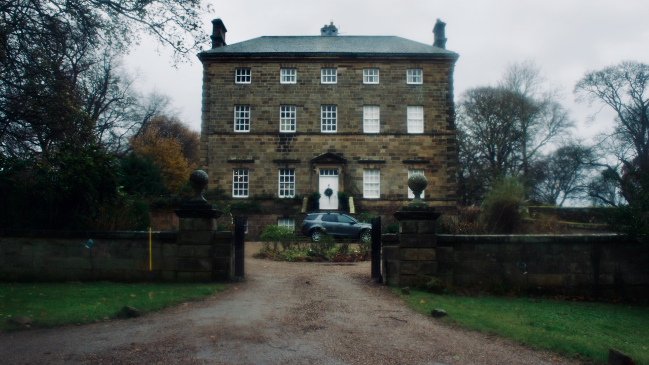
Arncliffe Hall
I’ve often passed by this place just after starting my walks or runs but the higher hills have always had the greater pull. From the grand titled tome “History and Topography of the City of York: And the North Riding of Yorkshire: Embracing a General Review of the Early History of Great Britain, and a…
-
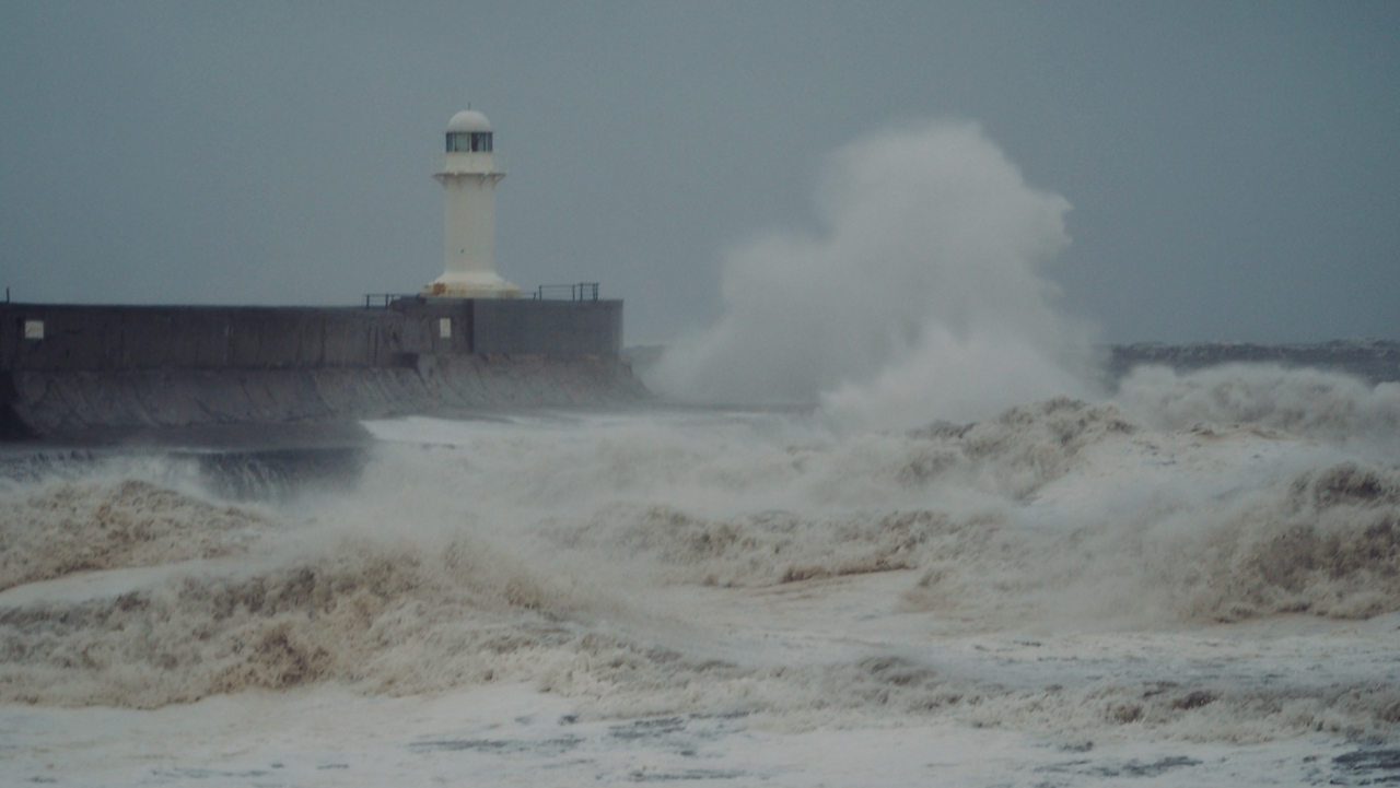
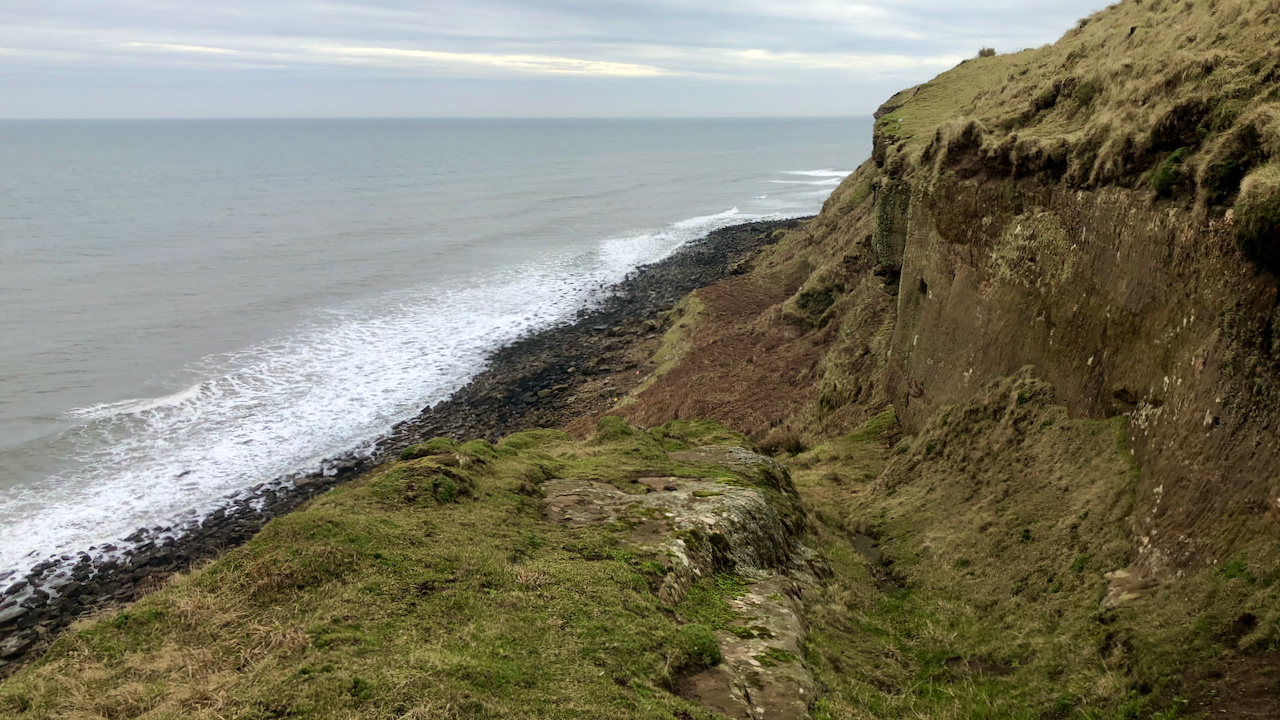
South Gare – Storm Arwen
Even though Storm Arwen was abating, a north wind of 66 mph was still forecasted. A good day for blowing the cobwebs away. And a high tide to boot. The South Gare breakwater, guarding the entrance to the River Tees, was completed in 1888 as one of a suite of projects to improve access to…