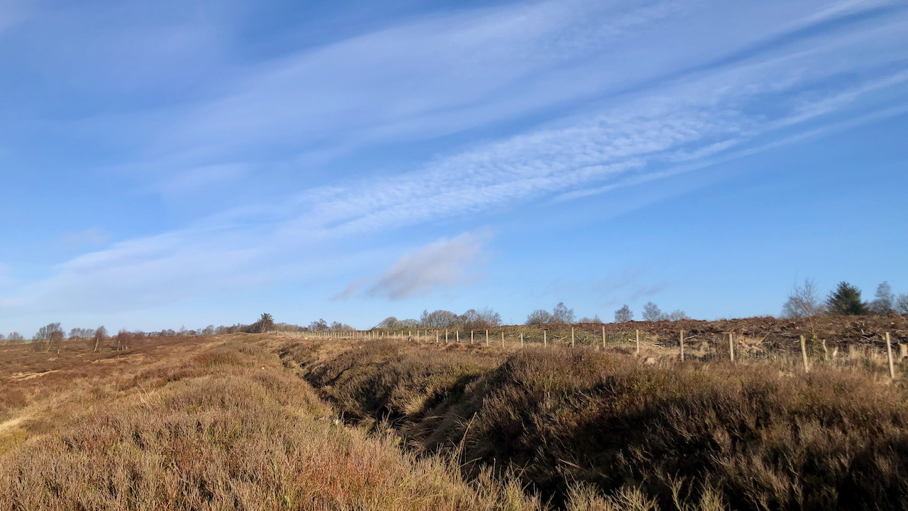
On a pleasant morning at Bridestone Moor, near Dalby Forest, soaking in the apricity, and enjoying the azure sky. Regrettably, clouds gathered post-lunch. However, an opportunity presented itself to inspect an ancient dyke delineating the boundary between National Trust property and the Forestry Commission.
Over several winters, we endured all weathers on this moor, dedicating efforts to clear self-sown conifers and birch from the Scheduled Monument. The tree roots posed a threat to the archaeology, as would the heavy machinery used by the Forestry Commission, who offered to move the boundary ten metres or so east. Subsequently, new fencing was erected. Since then, the forestry on the far side of the fence has been clear-felled.
This dyke, a linear earthwork comprising an earth bank and a ditch, likely dates from the Late Bronze Age/Early Iron Age, spanning nearly a kilometre in length1‘Prehistoric Linear Boundary and Associated Features Centred 500m North East of High Bride Stones, Allerston – 1021099 | Historic England’. 2024. Historicengland.org.uk <https://historicengland.org.uk/listing/the-list/list-entry/1021099?section=official-list-entry> [accessed 1 February 2024].
Present thinking suggests its role as a territorial marker, possibly defining land allocations within or between communities, enhancing natural landscape divisions by rivers and watersheds. Alternatively, they might have functioned in guiding livestock or served as defensive earthworks, potentially crowned with a wooden fence. Such dykes are prevalent in the Tabular Hills.
Constructing these extensive earthworks would undoubtedly have demanded considerable physical effort from a cohesive community. Their size and coordination rule out sporadic individual efforts. The expansive nature and the vast enclosures signify a notable territorial expansion. Moreover, they may have been designed to be visible over long distances, serving as conspicuous declarations of land “ownership”.
Their building must have taken several years, probably serving diverse purposes at different times, ranging from symbolic barriers to community integration. Regardless, constructing them demanded substantial labour from the locals, perhaps akin to a form of taxation. But undoubtedly, their primary function was to demarcate territory and accentuate cultural boundaries.
- 1‘Prehistoric Linear Boundary and Associated Features Centred 500m North East of High Bride Stones, Allerston – 1021099 | Historic England’. 2024. Historicengland.org.uk <https://historicengland.org.uk/listing/the-list/list-entry/1021099?section=official-list-entry> [accessed 1 February 2024]
Leave a Reply