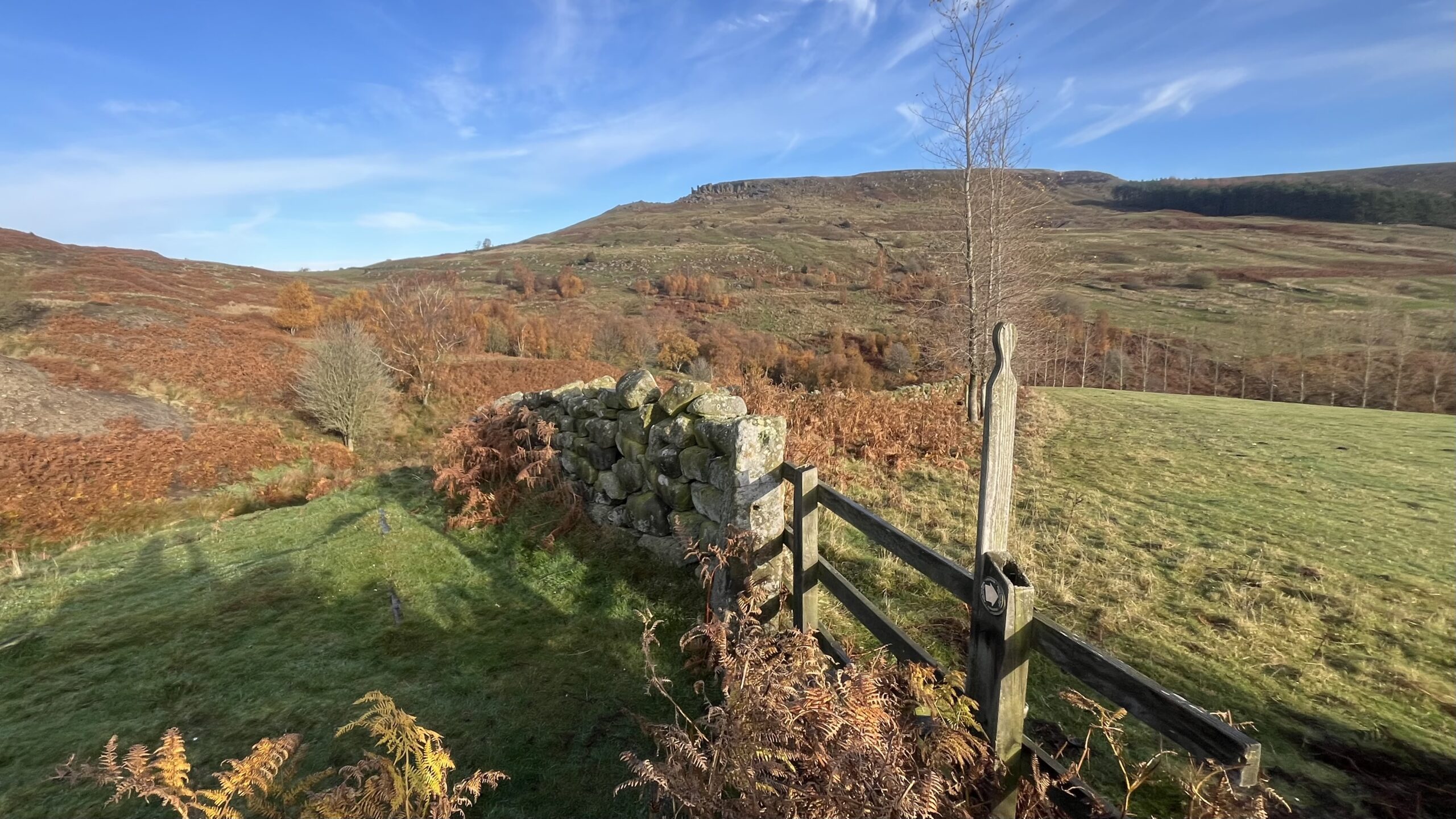
Many people call the whole of this hill Hasty Bank, taking in the Wainstones, that jumble of sandstone boulders and crags at its western end, to down to Hagg’s Gate in the east. I think the name belongs strictly to this southern flank, though Dalesfolk in the day would have said Yasty Bank1“THE SINNINGTON.“ Whitby Gazette. 22 October 1909. Page 2. The col, Garfit Gap, lies further west. Medieval grants record it as Garthwat, meaning an enclosed clearing, but the maps attach the name to the deep re-entrant in the middle ground of the photo rather than to the col2Burns, Tom Scott, A Walker’s Guide to the Cleveland Hills. Page 75. Smith Settle. 1993. The Hob o’Hasty Bank had his home somewhere hereabouts, perhaps among the rocks3“Hob Views.” VOICE 135, North York Moors Association, Issue 135, pp. 12–13. Citing a list by George Calvert, a local folklorist, from 1823..
Neolithic people certainly gathered at Garfit Gap for ritual. They carved rock basins aligned with the setting summer sun. There is no trace of Bronze Age activity, so later generations must have abandoned the ceremonial pass4Smith, Brian A., and Alan A. Walker. Rock Art and Ritual: Mindscapes of Prehistory. The History Press, 2011, pp. 65–71.5Smith, Brian A., Ken W. Grant, and Alan A. Walker. “Three Variations on Probable Ritual Landscapes with Similar Characteristics within the North York Moors Region Including a Strong Fourth Contender.” Teesside Archaeological Society Bulletin, no. 18, 2013, pp. 24–33. Victorian miners burrowed into this slope for jet, and farmers grazed their sheep on it. Hundreds of pheasants now roam the hillside, and each step I take sends up a clatter of birds struggling to get airborne.
- 1“THE SINNINGTON.“ Whitby Gazette. 22 October 1909. Page 2 ↩︎
- 2Burns, Tom Scott, A Walker’s Guide to the Cleveland Hills. Page 75. Smith Settle. 1993 ↩︎
- 3“Hob Views.” VOICE 135, North York Moors Association, Issue 135, pp. 12–13. Citing a list by George Calvert, a local folklorist, from 1823. ↩︎
- 4Smith, Brian A., and Alan A. Walker. Rock Art and Ritual: Mindscapes of Prehistory. The History Press, 2011, pp. 65–71. ↩︎
- 5Smith, Brian A., Ken W. Grant, and Alan A. Walker. “Three Variations on Probable Ritual Landscapes with Similar Characteristics within the North York Moors Region Including a Strong Fourth Contender.” Teesside Archaeological Society Bulletin, no. 18, 2013, pp. 24–33. ↩︎
Leave a Reply