-

When the Sea Brought Fashion to Staithes
Storms wash up all sorts along this stretch of coast. Driftwood. Old rope. The odd sad welly. Coal—see my previous post. In October 1992 they washed up a different windfall. A forty foot shipping container broke loose from its vessel during a gale and settled below these cliffs at Hole Wyke, three miles from Staithes.…
-

Yorkshire Day and a Flag That Behaves Itself
Here we are, then. The World Cup finished weeks ago, the face paint is long gone, yet flags are still tie-wrapped to lamp-posts and hung from windows like a rash that will not clear up. During the football, everyone let it slide. Bunting, jolly, harmless. The tournament is over now, though, and flags remain, and…
-

The Swidden That Would Not Turn Purple
Here, on Great Ayton Moor, a swidden burnt a few seasons back to bring on fresh heather for the grouse. But judging by the tussocks, deer-grass had other plans. The plan was for heather — tender purple shoots laid on like a buffet for red grouse. What grew back was this: a spiky green swathe…
-

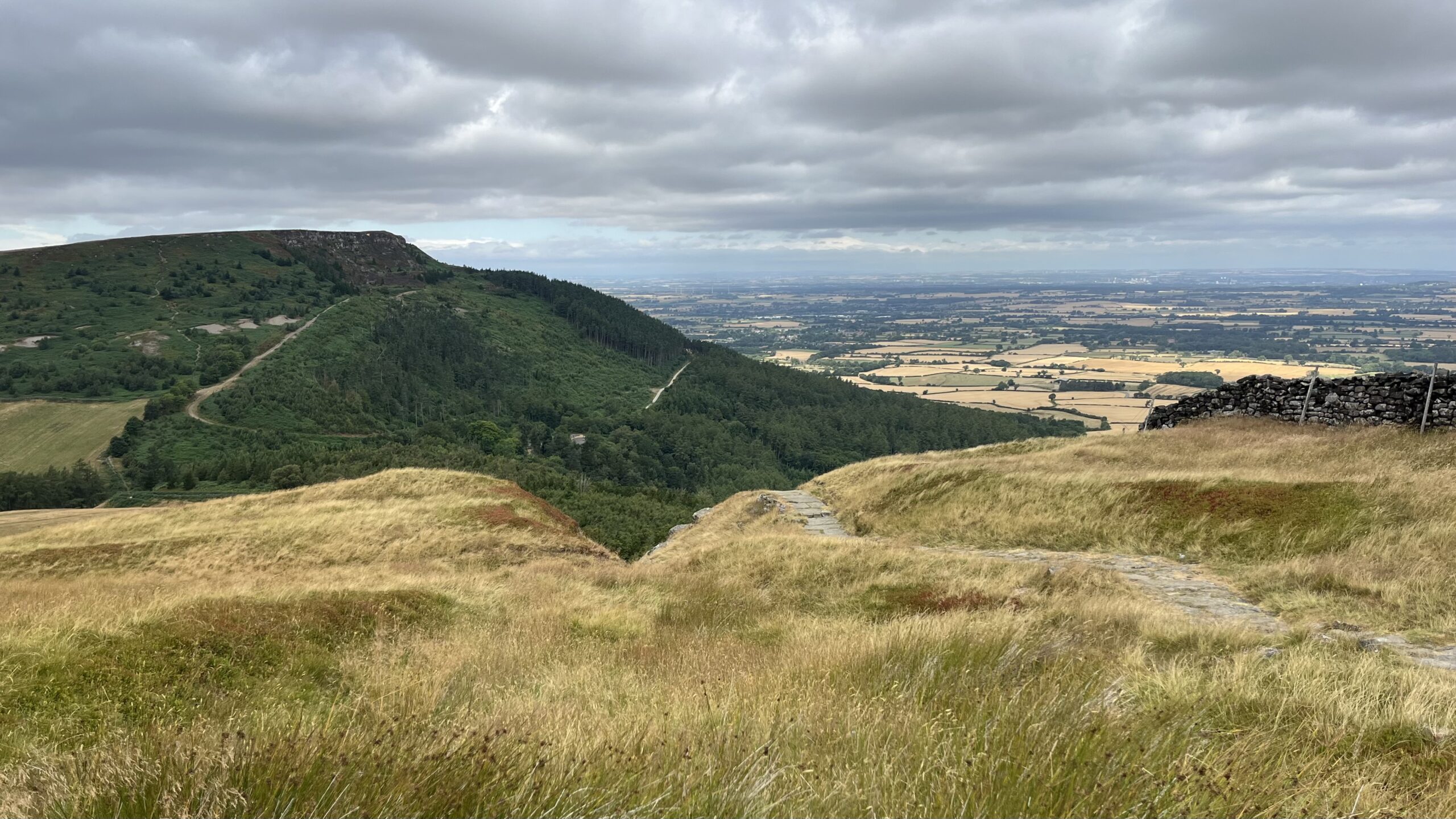
The Symbolic Shield: Decoding the 800-Metre Wall of Scarth Wood Moor
Scarth Wood Moor looks like empty, timeless terrain, but under the heather sits what used to be a busy Bronze Age settlement. This worn line of boulders belongs to an orthostatic wall, which is a fancy way of saying a prehistoric boundary made from big standing stones placed at even gaps. Frank Elgee first noted…
-
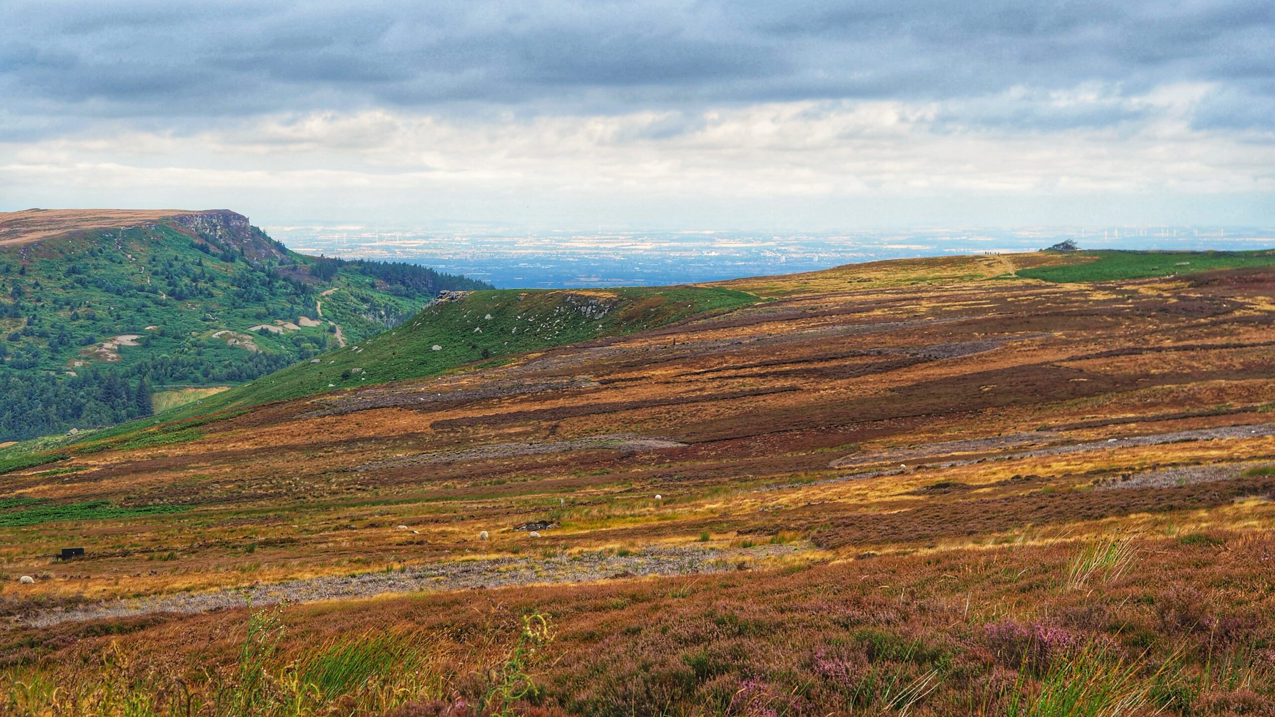
Haggesgate
Walking down from Carr Ridge towards the col at Clay Bank never fails to set me wondering. Is this deep gash in the hillside natural, or did centuries of boots and hooves carve it out, a proper holloway worn into the moor? Go off-piste and you will come across other gullies running alongside it, plainly…
-
The Great Heather Gamble
Europe is burning, and nobody has bothered telling the weather. Wildfires in Spain and France are breaking records while the Cairngorms also feels the heat. The North York Moors is not a stranger to this chaos. A massive blaze last year turned twenty-five square kilometres of one moor into a cinder. The Moorland Association has…
-
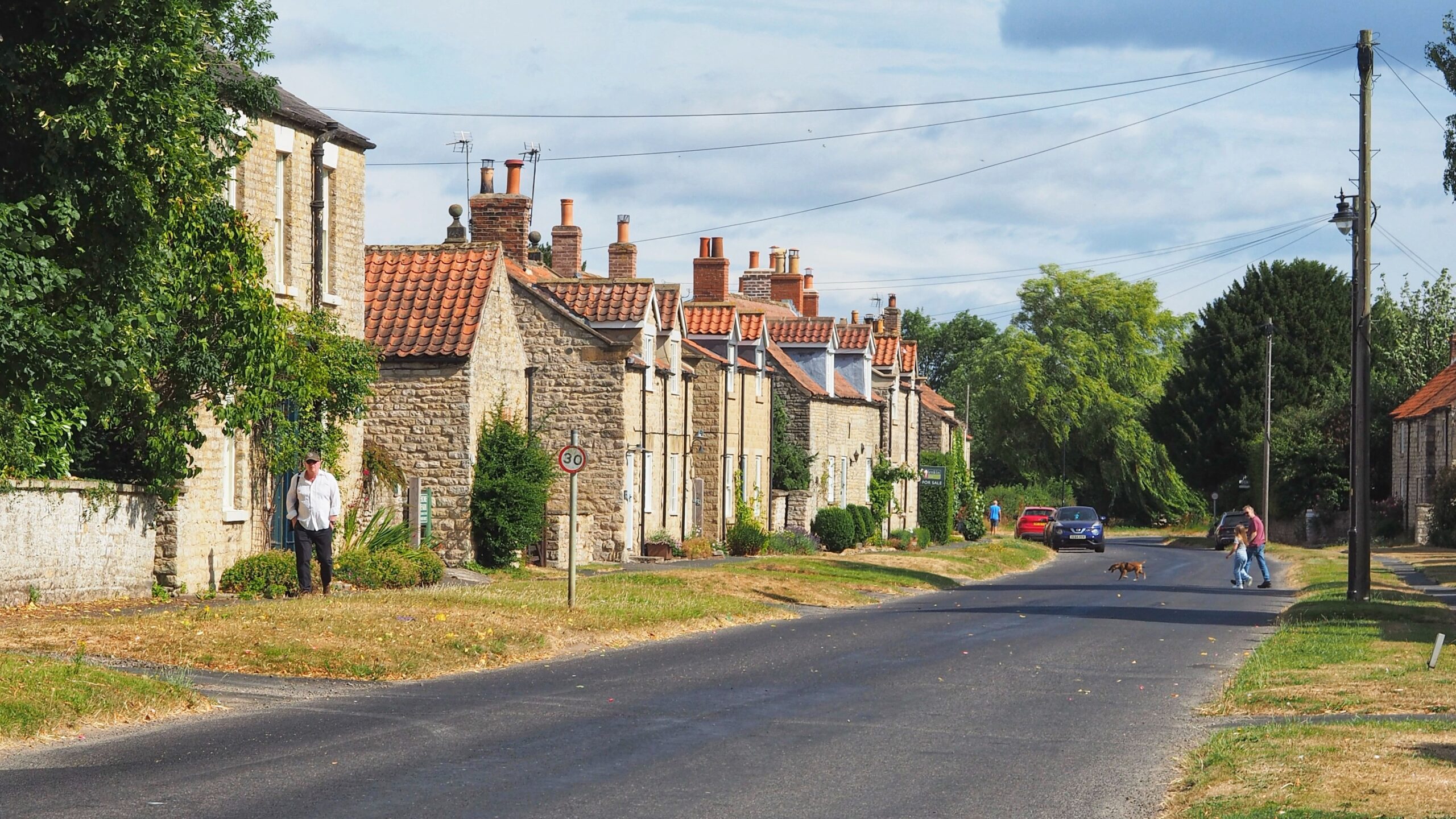
Slingsby — A Street Village
Retirement was meant to cure the Monday morning blues. It has not. That grim feeling still turns up right on schedule, uninvited and entirely unbothered by my pension. So the mind wanders back to the weekend, when we cycled south into the Howardian Hills, fifteen miles of Corallian limestone squeezed between the Vale of York…
-
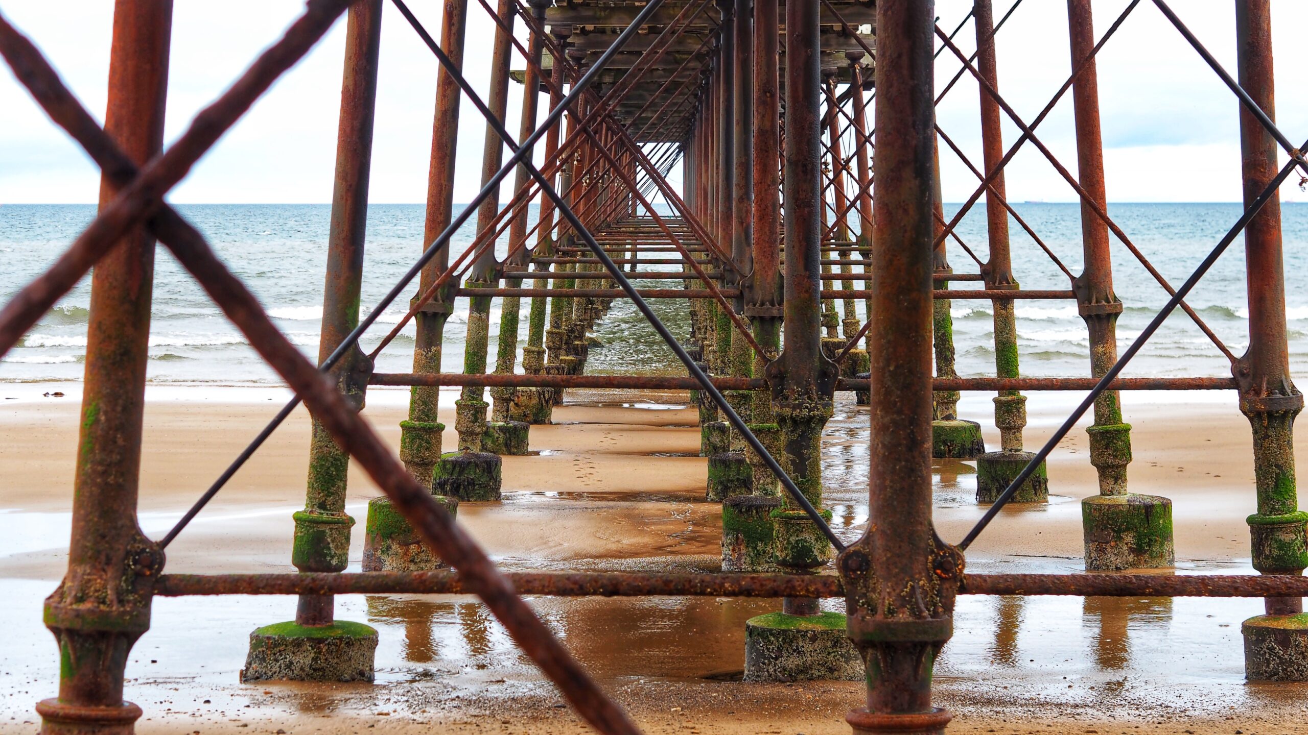
The Sponsored Swim That Ended an Era
Standing below these rusted iron stanchions, I cannot help reflecting on how coincidentally a name can turn up twice in as many weeks. Kathleen Elizabeth Mary Cooper Abbs, the last person to live in the Arts and Crafts house built among the ruins of Mount Grace Priory. She was nobody’s idea of a quiet tenant.…
-
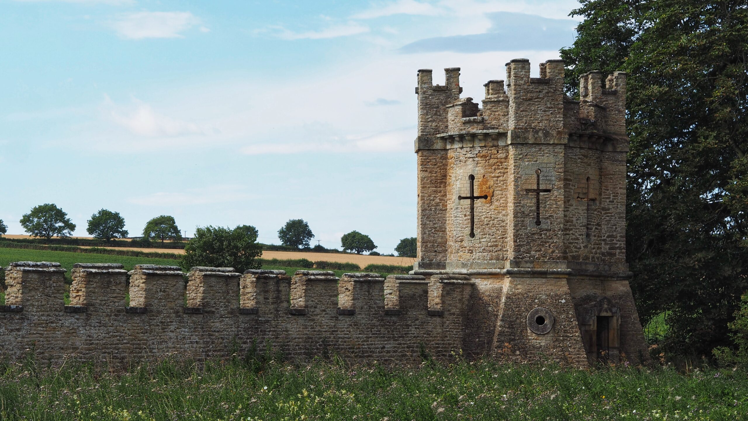
The Mock Medievalism of Carrmire Gate
Carrmire Gate is enormous, and this is merely the East Turret, which tells you everything about scale at Castle Howard and nothing about sense. Nicholas Hawksmoor designed this limestone monster in 1725 as the very first thing a visitor sees on the approach to the house. It was the last part of the whole entrance…
-
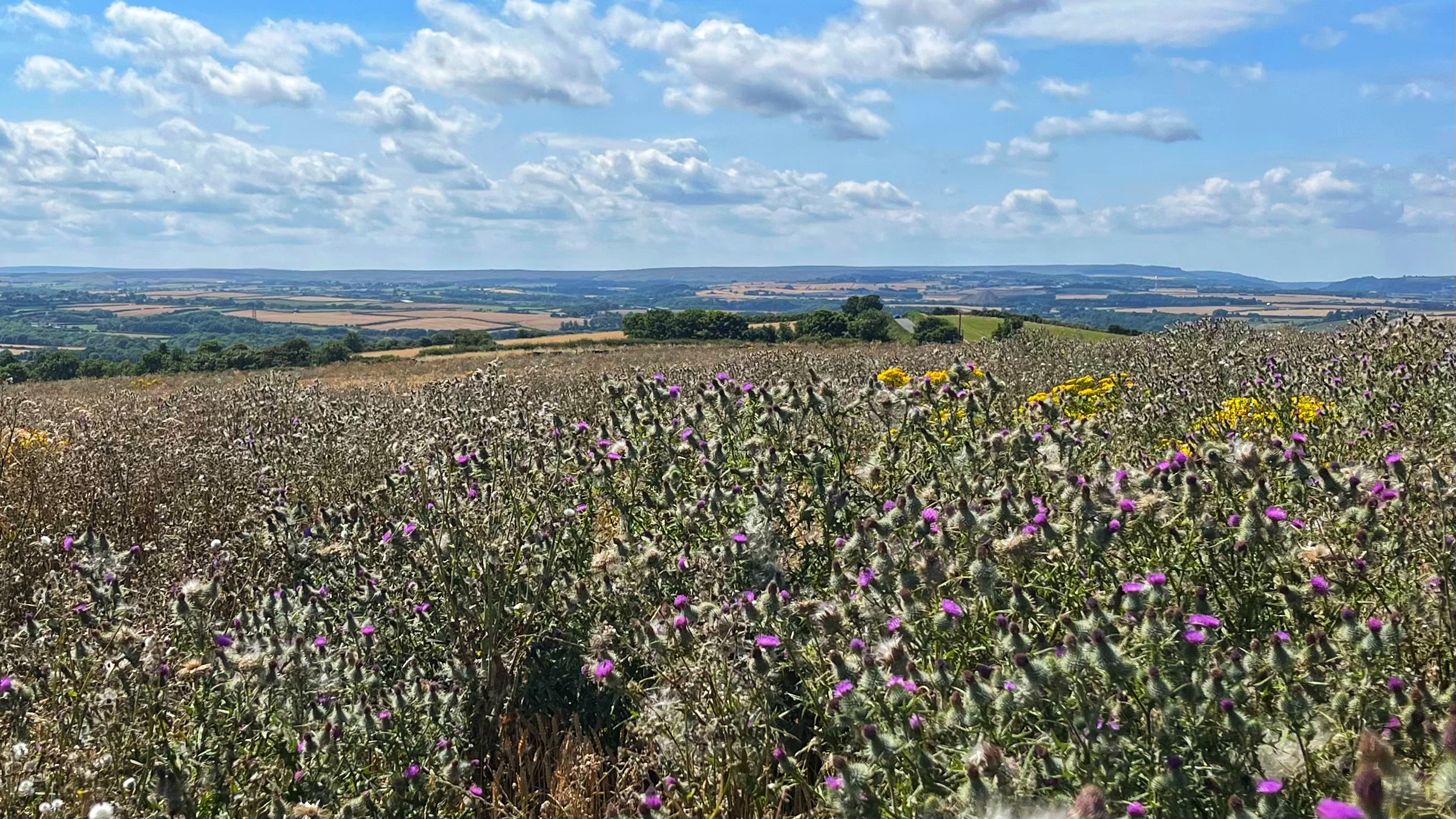
Butterflies, Thistledown and the Long Arm of the Law
Memory plays odd tricks. Yesterday mine dredged up a scene from some Disney film, the heroine wandering through a meadow with butterflies and birds fluttering about her like a doting entourage. Animators loved surrounding young women with woodland creatures. Saved them writing dialogue. This field needed video, really, to do it justice. Thistles stretched as…
Care to comment?