Tag: standing stone
-
The climb out of Grosmont onto Sleights Moor is steep, very steep, but the effort is well rewarded
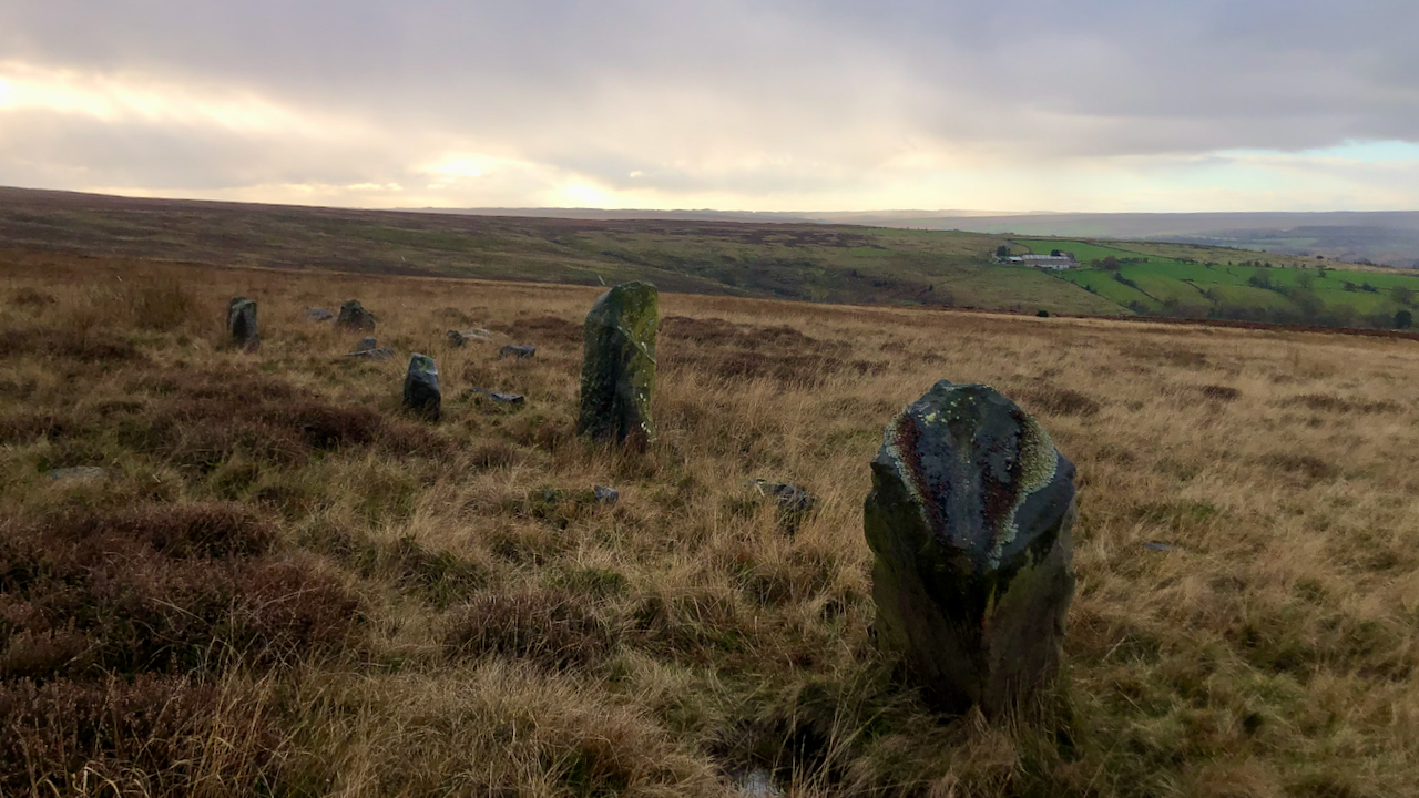
The object was High Bride Stones, a group of, it is said, eleven standing stones “possibly the remains of a pair of Bronze Age ‘four poster’ stone circles” dating to the Bronze Age. I must admit I was a tad disappointed. Most of the stones have fallen, and the tallest one has the ignominy of…
-
Neil’s Howe
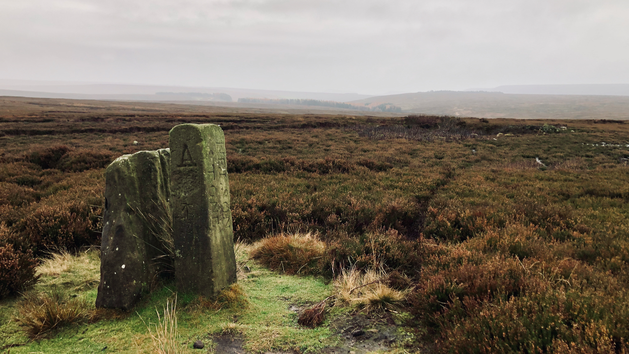
It was pleasing to see the Nelson Stone restored to its correct postion. Or should I say the 19th-century boundary stone. One of the last times I was here, in 2017, it had vanished. I learnt later it had unceremoniously been dumped in a nearby pond. That act of vandalism must have taken some doing.…
-
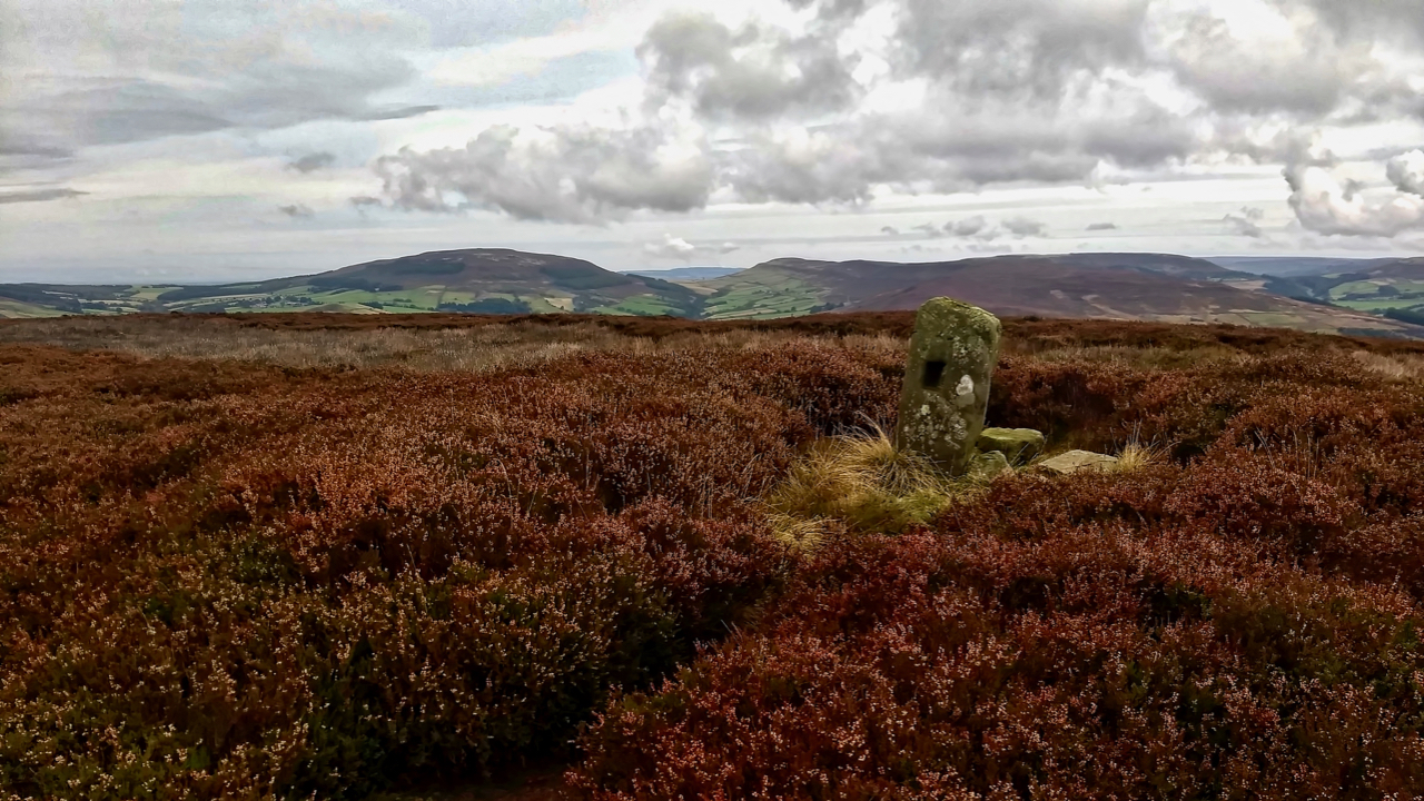
Bilsdale
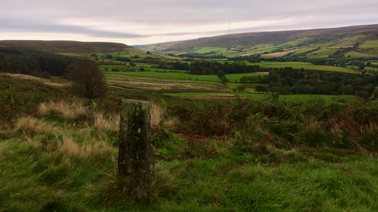
I didn’t realise it this morning but in the skyline is the Bilsdale transmitter mast that was damaged by fire on 10th August. And this afternoon, it was demolished. It is no more. Wish I had known, I would have got a bit closer. And there were blue skies too unlike this morning. The replacement…
-
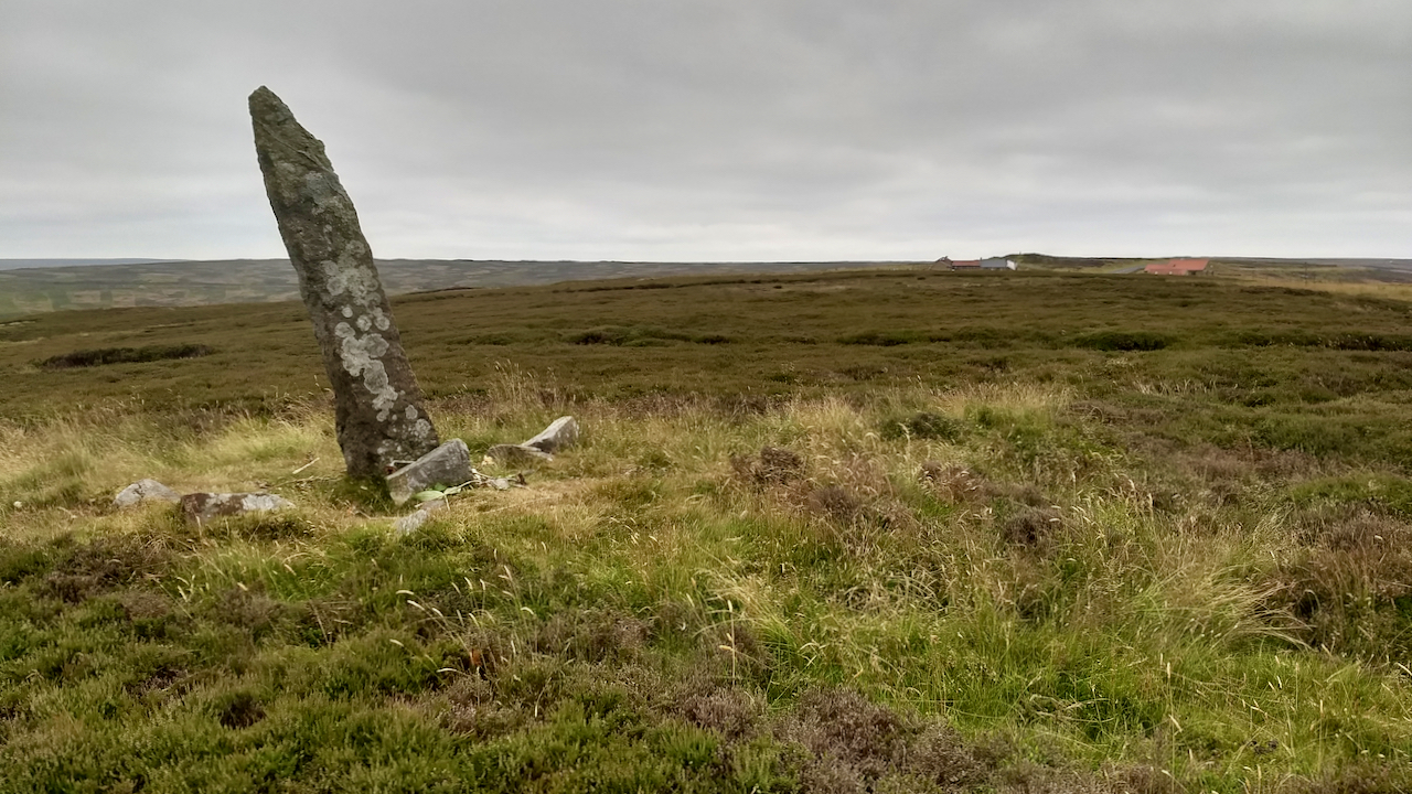
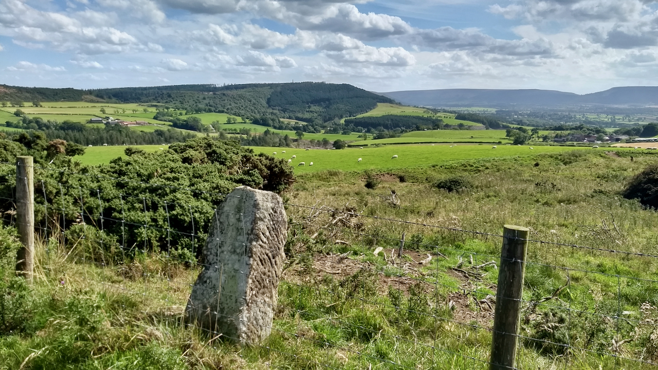
Standing Stone, Rivelingdale
At Percy Rigg Cross, a spur of the moment to pop down to have a look at the spring in Rivelingdale or Codhill Beck. There is one internet source which suggests the spring is a holy well with the name of ‘St. Mary’s Well‘. Apparently, it’s a name referred to by the archaeologist Roland Close…
-
Little Blakey Howe
A Bronze Age burial mound topped by an 18th century boundary stone which is inscribed with the initials ‘TD’, thought to refer to Thomas Duncombe, 18th century owner of the Duncombe Estate. It is thought the stone may be a prehistoric standing stone, in which case it would have been standing when the Crutched Friars…
-
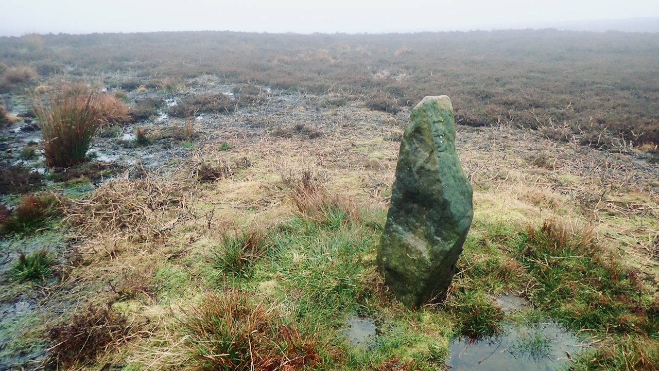
Standing stone on Kildale Moor
I believe this is just a waymarker rather than a boundary stone or religious cross. The North York Moor Historic Environment Record (HER) map suggests it dates from the 19th-century. It stands alongside a path designated as “F.P.”on the 1895 Ordnance Survey map. This is one of the paths The Ramblers have identified during their…
-
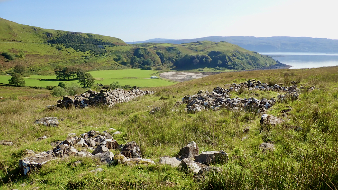
Camas nan Geall
An idyllic south-facing haven on Loch Sunart. A glen rich in history from a Neolithic chambered cairn and standing stone to a 19th-century deserted settlement. In 1737, when Ardnamurchan was sold by the Duke of Argyll to Alexander Murray, Lord Stanhope, the settlement of Camas nan Geall had a population of 35: 9 men, 13…
-
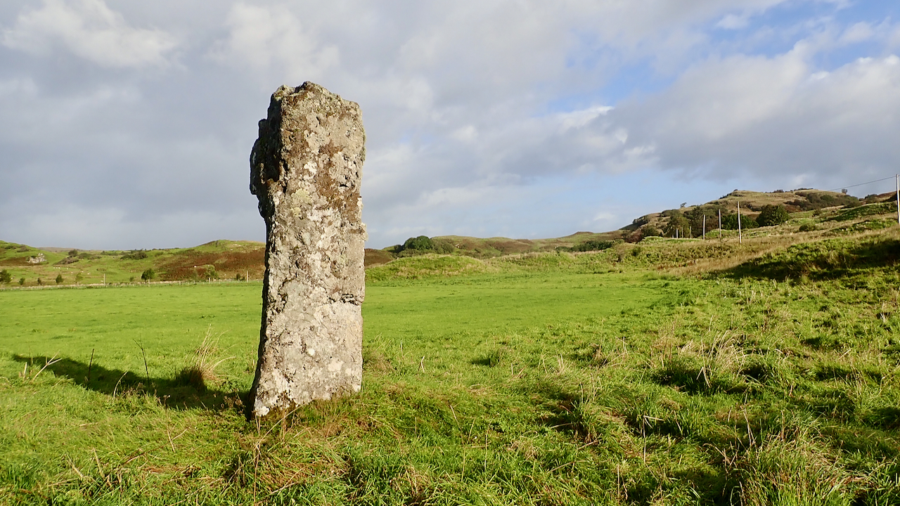
Clach na Carraig
I stumbled across this massive standing stone on my morning run. Well, I tell a lie, I was carrying a map and was attracted to the Gothic font which is a giveaway of something interesting. It is truly a monolith, 12½ feet tall, made of granite, and 13 feet in girth. Probably erected by Neolithic…
-
Standing stone on the south slope of Roseberry
Volunteering all day with the National Trust on Roseberry. Path clearing and repairing a dry stone wall. The stones are getting heavier. I grabbed this photo on the walk home. I can find no listing for the standing stone. It’s of dressed sandstone and stands at around the 230m contour on the southern flank of…
-
Green Howe
Go to almost anywhere on the North York Moors and somewhere on the skyline there will be at least one round barrow. More likely you will be able to spot a dozen or so. The archaeologists tell us 541 of them have been recorded. Marked in Gothic script on Ordnance Survey maps as ‘tumulus’ or…