Tag: ruin
-
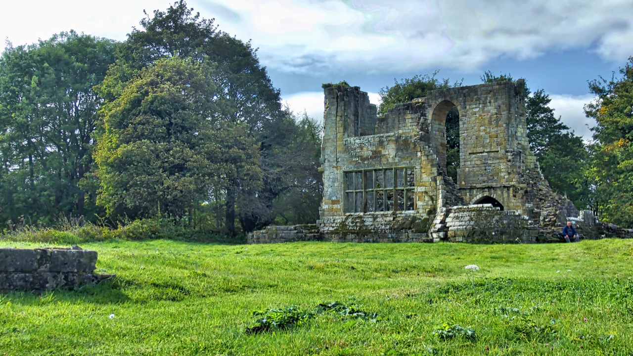
Mulgrave Castle
Standing on a narrow ridge between two parallel wooded valleys, Mulgrave Castle is part of the Mulgrave Estate owned by the Marquess of Normanby. Parts of the formidable curtain wall are Norman but the photo shows the keep which dates to the end of the 13th century. The large window in the east wall is…
-
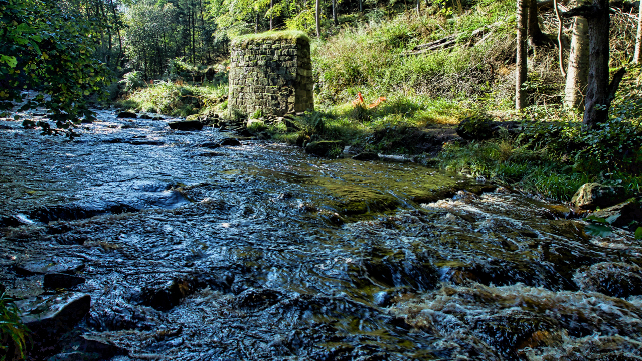
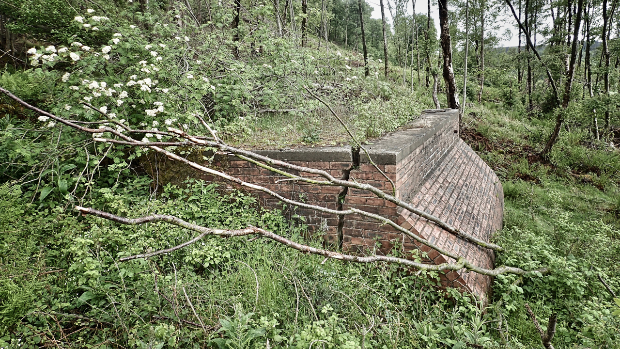
West Beck, Beck Hole
Exploring the excavations of the 19th-century ironstone mining activities in Combs Wood near Beck Hole. These have been carried out by the Land of Iron project over a three year period. We found them easily enough. Most intriguing was a deep pit thought to have contained a waterwheel with a range of remains above which…
-
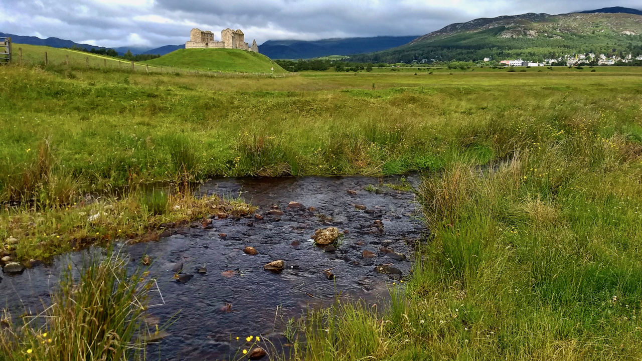
Ruthven Barracks
The history of this 18th-century garrison for Hanoverian troops is well documented. What is not so well known (or at least what I learnt yesterday) is that a stronghold is first documented as being built on the site in the early 1200s, its strategic position recognised as the lowest fordable crossing of the River Spey…
-
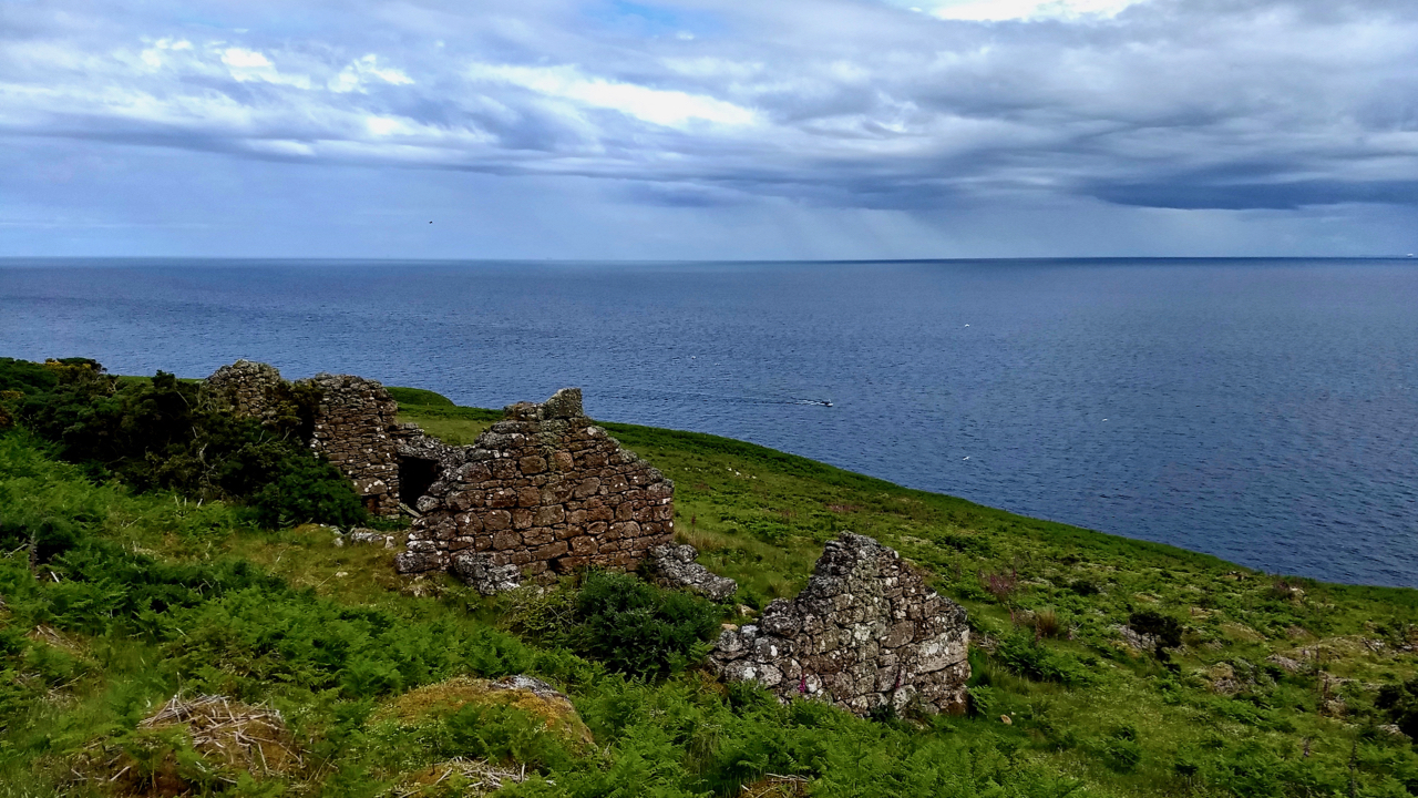
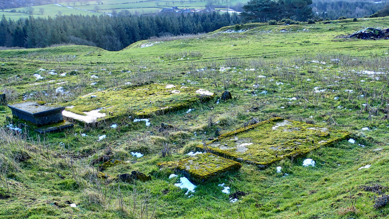
Badbea
I’ve seen before the deserted black houses of communities in fertile straths that were cleared by absentee landlords to make way for vast sheep farms. I had thought the villagers were often provided with a small croft on the east coast in towns such as Wick and left to make a living from the sea.…
-
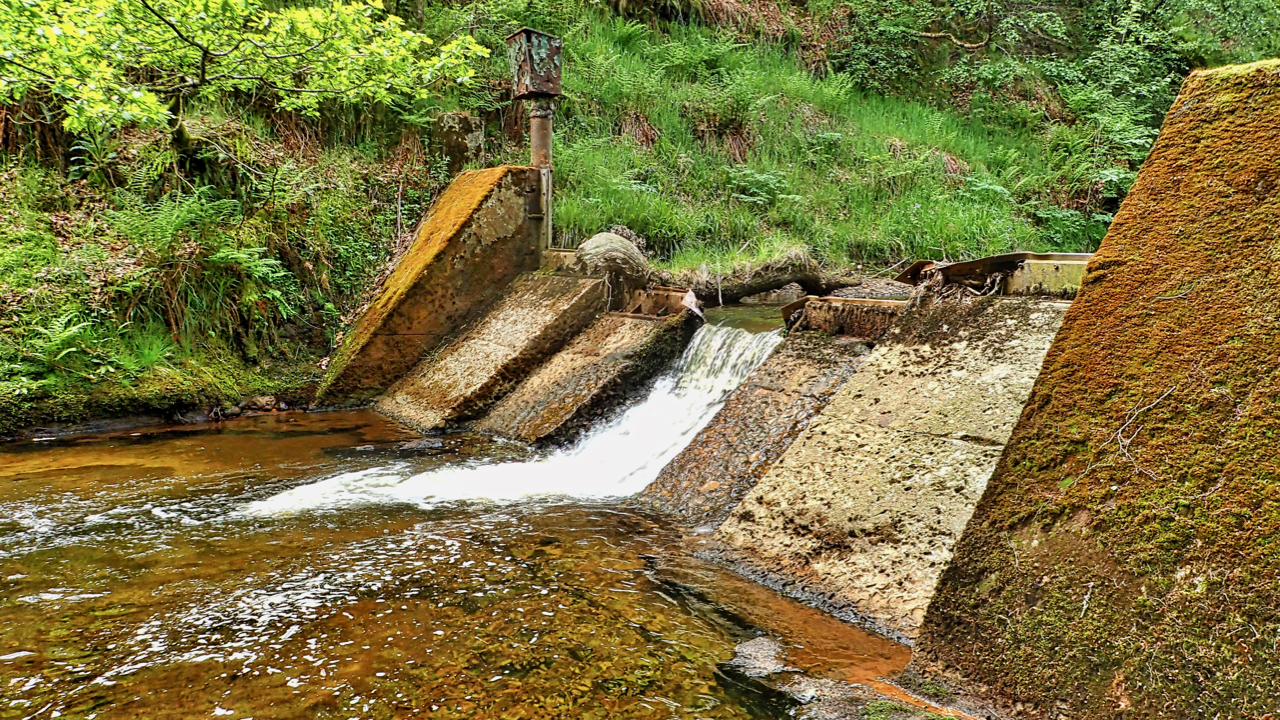
Disused weir, Hodge Beck, Bransdale
I’ve wanted to visit this part of Bransdale for a while, in particular, this disused weir, just below the confluence of Hodge Beck and Shaw Beck. It was built in 1936 as part of the proposed scheme by the Hull City Council Water Board to construct “the second largest reservoir” in the country in the…
-
I’ve been running and exploring the local moors and woods since moving to Great Ayton in 1973
I thought I knew every nook and cranny but today I came across this brick structure on Ayton Bank. Quite chuffed, I feel I’ve made a major discovery. It looks like a water tank or cistern. There is a date scratched on the brickwork of 1952 but I think that is just graffiti. More likely…
-
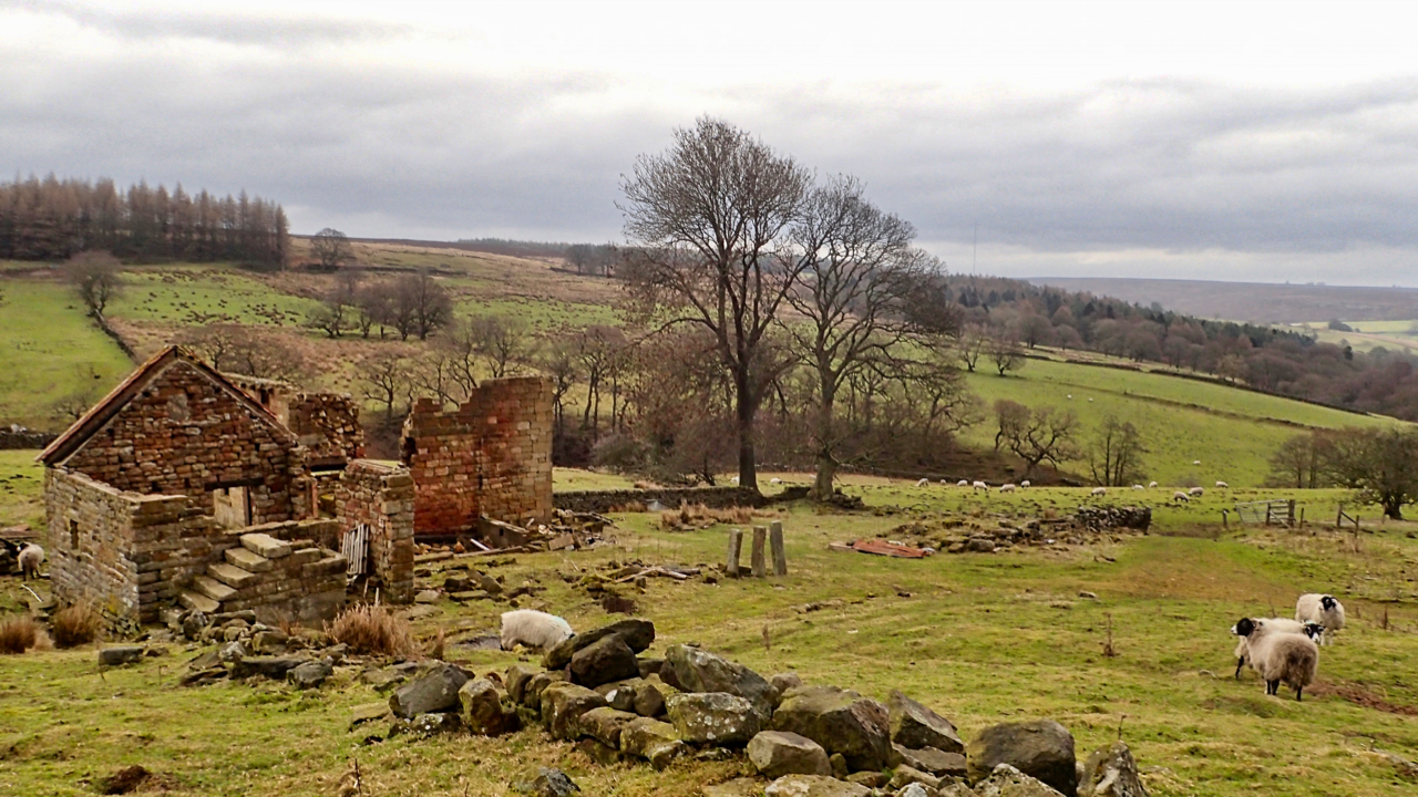
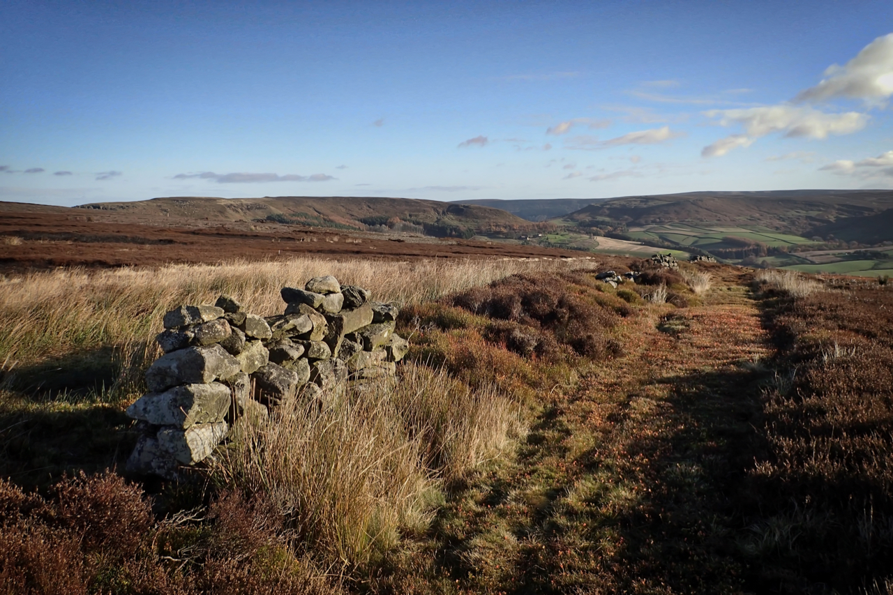
Dale Head
It is actually wrong to describe this valley as Ryedale. By convention, the source of a river is its longest tributary which puts the source of the River Rye at the appropriately named Rye Head near to the Swainby Shooting Hut on Whorlton Moor. The ruined Dale Head overlooks Wheat Beck, a shorter tributary. It’s…
-
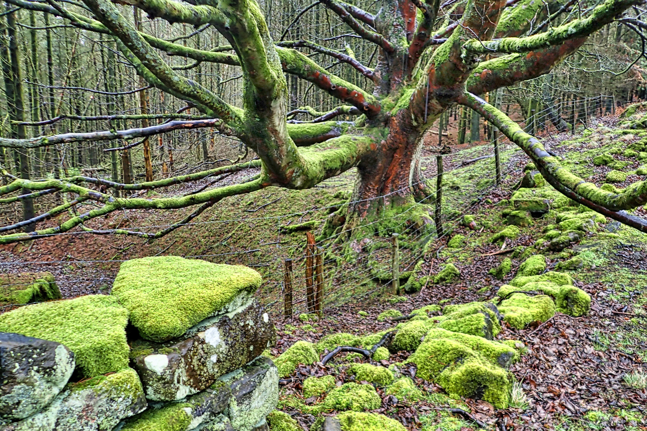
Mossy Oak
I survived about an hour this morning on Carlton Moor. Battered by the wind and soaked by the rain. Decided to return along the north-west facing Faceby Bank following the ruined dry stone wall of Great Bonny Cliff Wood in the shelter of Carlton Moor. Came across this peaceful spot dominated by an amazing old…
-
Roseberry Ironstone Mine
It would have been bleak for the folk of Great Ayton on this day in 1921 when the 220 workers at the Roseberry Ironstone Mine received notice to cease work, at the end of which the mine would be idle. It would have been the talk of the village. The mine had reopened in 1906…
-
adjuster.observer.notched
I keep coming across a system of defining your GPS location using three random words, called unsurprisingly what3words. Someone has divided the world up into 3 x 3 metre square blocks, each one with a unique 3-word address. So here I am at adjuster.observer.notched. This does sound strange but then I am comfortable with latitude…