Month: April 2019
-
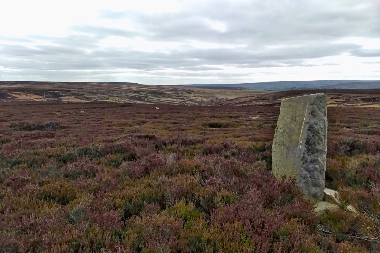
Havelock Stone
In 1716 the Lord of the Manor of Gisborough, Edward Chaloner, ‘perambulated’ around the boundaries of his manor. This annual custom was carried out throughout the country often on Ascension Day and is often known as Beating the bounds. Before the days of modern surveying, it was an important way of reinforcing the parish boundaries.…
-
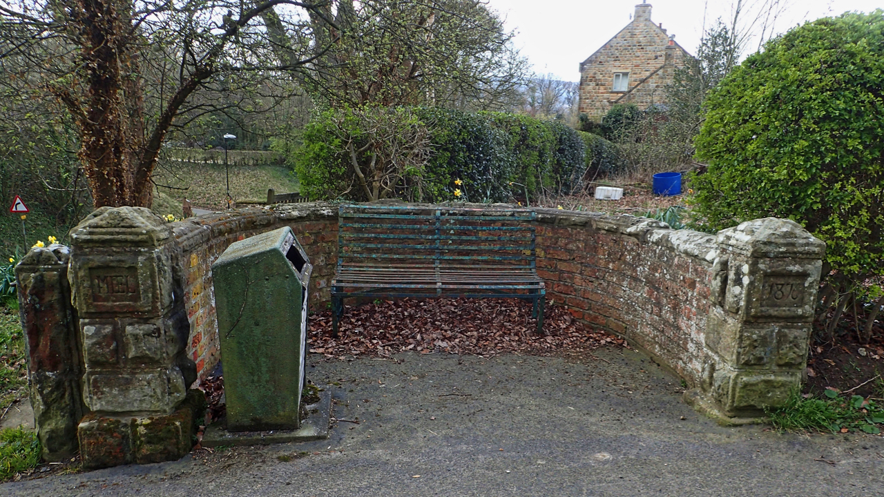
Monkey Stand
It would be interesting to know why this semi-circular wall is called the “Monkey Stand”. The name appears in a heritage leaflet published by the Kirby, Great Broughton and Ingleby Greenhow Local History Group. It’s probably on the site of the village pump although it is not one of the several wells, springs and troughs…
-
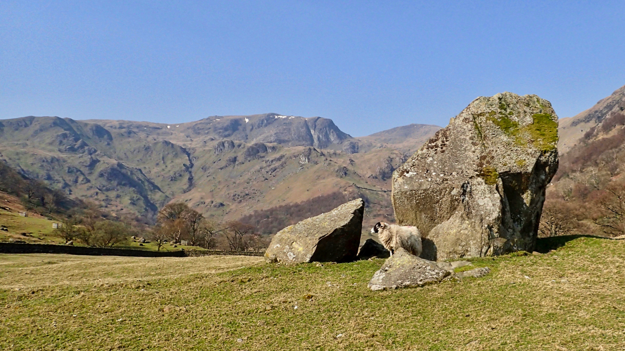
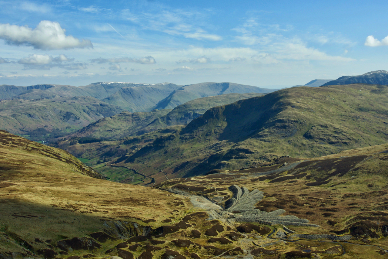
Dove Crag
At 792 metres high Dove Crag is perhaps more famous for its climbing than as a mountain, a blip on the way to Fairfield but Dove Crag was actually the first fell that Wainwright wrote about. Seen here from a field near Hartsop Hall. The boulder is an erratic dumped by the retreating glaciers of…
-
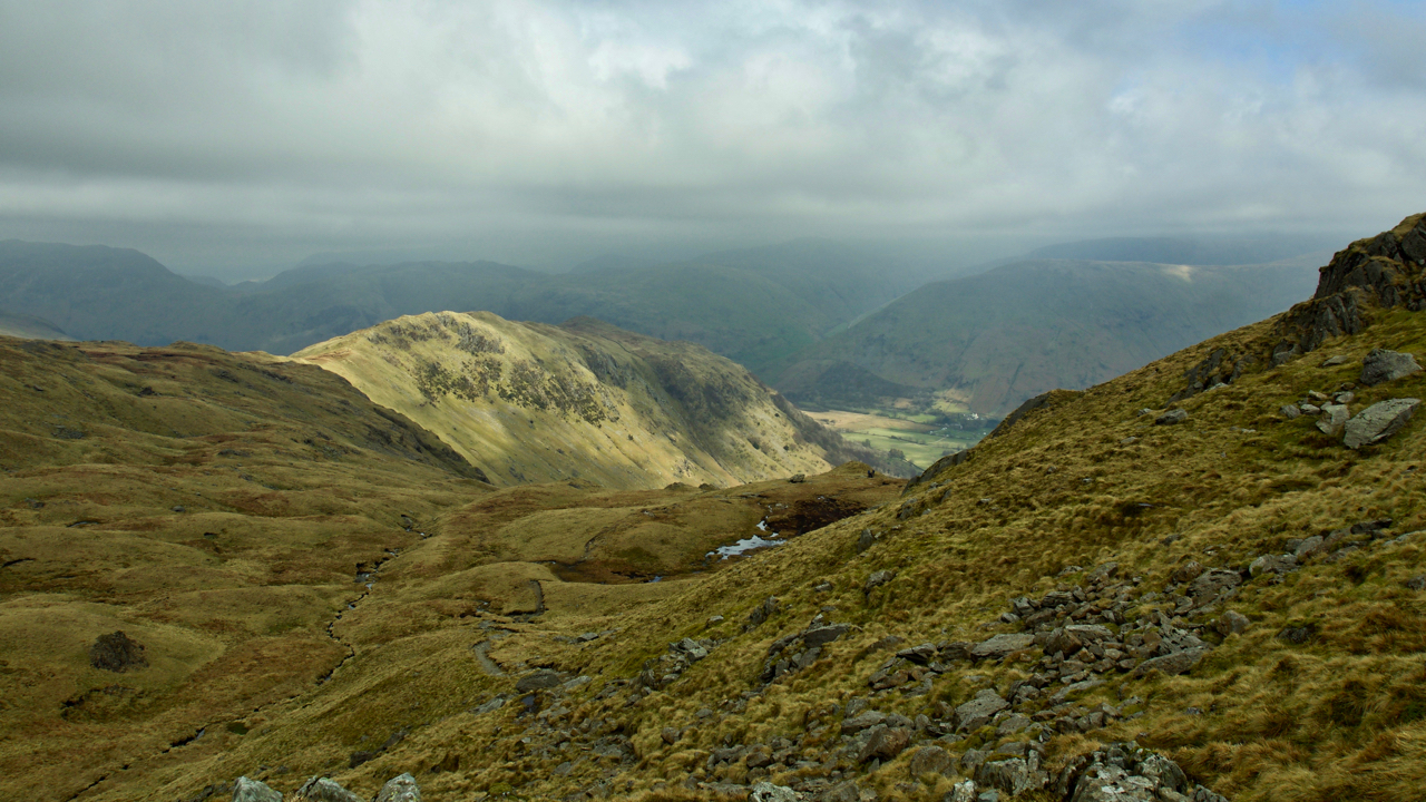
Hartsop above How
A rather gloomy start to the day but climbing below Dove Crag in the eastern Lake District there were signs of breaks in the cloud. This is looking back on the Hartsop above How ridge. By the time Fairfield was summited there were blue skies. Open Space Web-Map builder Code
-
Greenside Mines, Glenridding
In the North East Lakes for the weekend and a wander up Raise. This is looking down on the scene of early lead mining operations which became known Greenside Mine. Mining began around 1690 where the galena vein was exposed at the surface. In 1822 the Greenside Mining Company was formed and more industrious excavation…
-
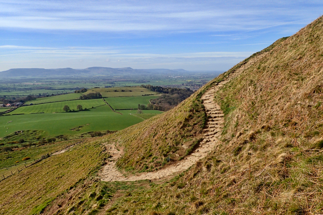
A horse’s route up Roseberry
I was perusing the North York Moors Rights of Way map the other day when I noticed that there is a Public Bridleway that zigzags its way from the top of Roseberry Lane almost to the summit. In the photo, the bridleway comes up the flagged path to the bend and then continues to the…
-
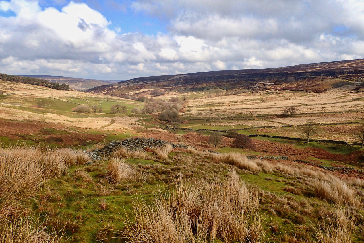
Esklets
The very upper reaches of the River Esk, an island of old improved land surrounded by moorland. Land which somehow managed to escape being classified as Access Land under the Countryside and Rights of Way Act 2000 even though it was last farmed in the 1950s. Activity now seems to be devoted to the grouse…
-
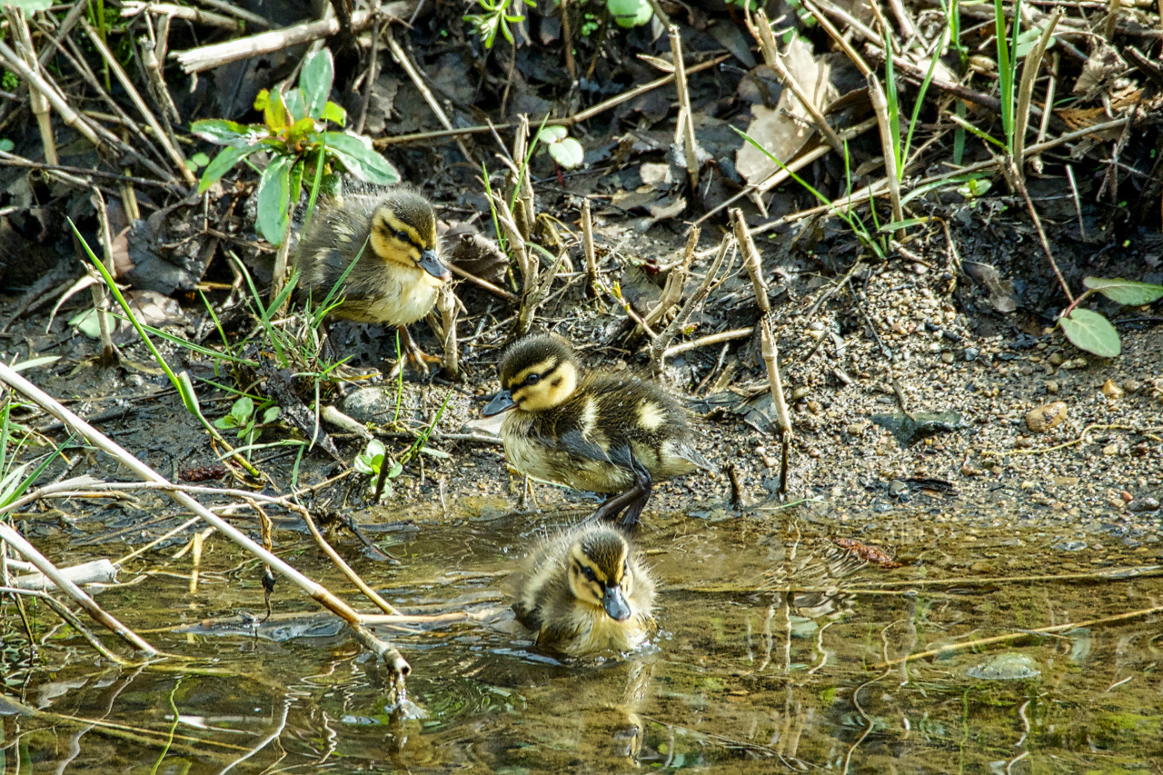
Mallard ducklings, Low Green
Winter returned this morning with a smattering over wet snow on the North York Moors, but new life on the River Leven in the village. The first brood of the year, Mallard ducklings I guess, must have been seven or eight of them, independent, parents nowhere to be seen. Open Space Web-Map builder Code
-
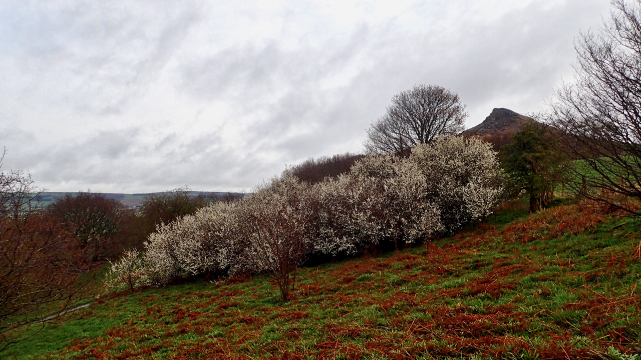
Blackthorn thicket, Newton Wood
A bit of a wet morning, with wisps of cloud skirting the hills. In a few weeks time, this blackthorn thicket will have settled back into an unassuming backdrop to the wonderful display of bluebells in Newton Wood. A few early sprigs are already showing. But for now, the spiny blackthorn takes the stage with…
-
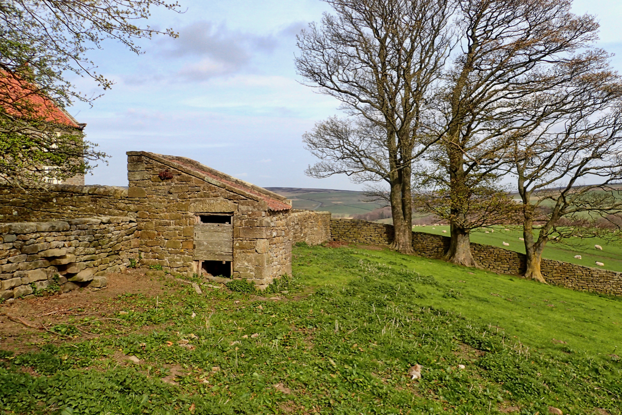
18th-Century Privy
A fine example of vernacular architecture at its best, the outside toilet or privy at the bottom of the garden of Warren House in Kildale. The privy is a Listed Building Grade II in its own right. Rubblestone walls with a pantile roof with, apparently, the wooden-seated privy still inside. I didn’t sneak a look…