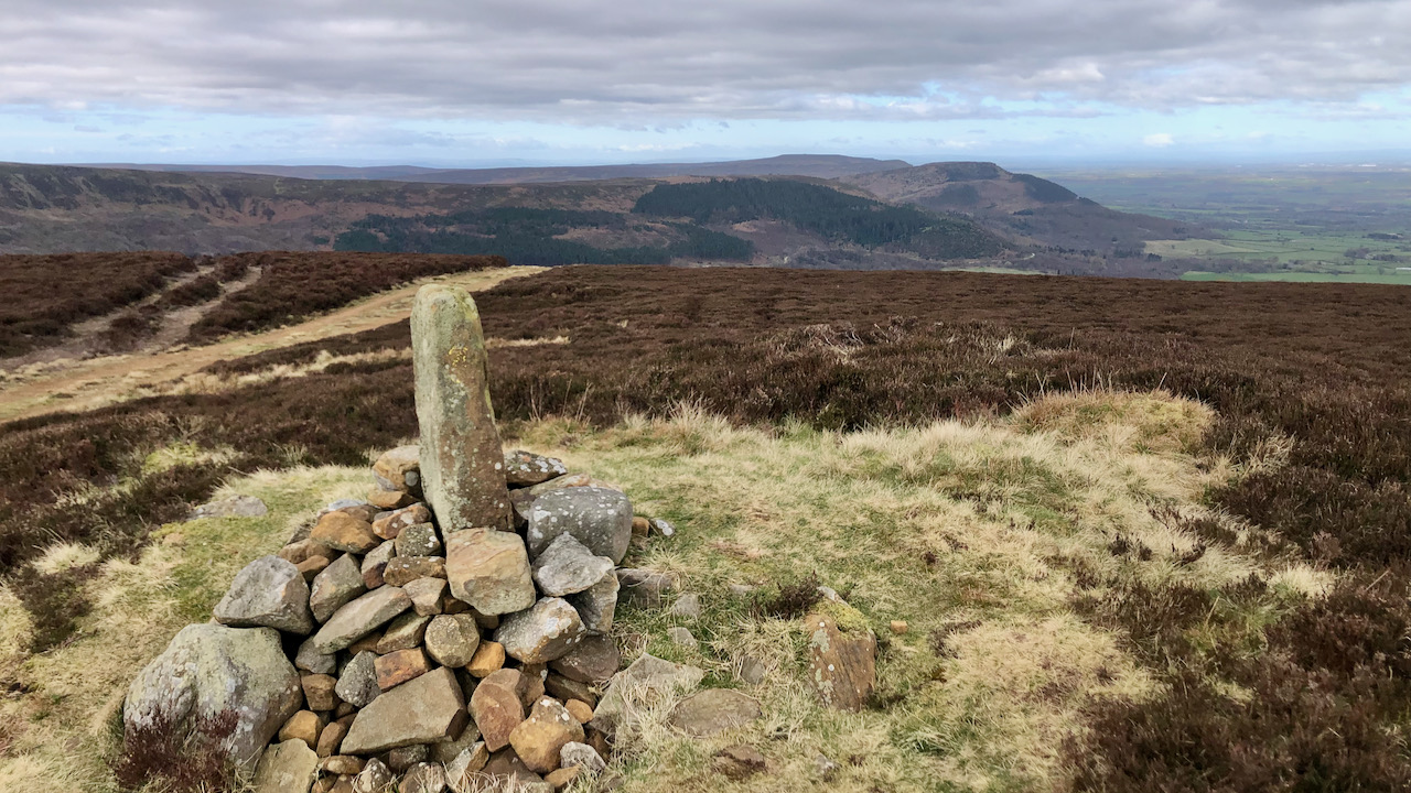
Just adjacent to the Cleveland Way, as it slogs its way along the landrover track on Greenhow Bank, lies Burton Howe, topped with its medieval parish boundary marker stone1NYMNPA HER No: 8196 A post medieval parish boundary and following the western boundary of the Baysdale Estate; marked by at least ten boundary stones.. Perched at an elevation of 433 metres (1,419 feet), it affords a splendid view of the Cleveland Plain, stretching westward along the line of the Cleveland Hills.
However, this stone has been set upon a ‘howe’, or round barrow. Nearby lie three more, composing a Bronze Age cemetery2NYMNPA HER Nos: 3939/3943 A group of four Bronze Age round barrows or burial mounds.. Though all have been disturbed by enthusiastic Victorian antiquarians, it was through an excavation in the early 1960s that it was established that these and hence similar barrows crowning the watershed of the North York Moors, were built not upon an ageless expanse of heathered moorland, but in grassy clearings within a woodland dominated by oak and alder3Sherlock, Stephen. “An Examination of Late Prehistoric Settlement in North East England with Specific Emphasis on the Settlements of the Tees Valley”. Page 9.University of Leicester. 2010.4G. W. Dimbleby (1961). The Ancient Forest of Blackamore. Antiquity, 35, pp 123-128 doi:10.1017/ S0003598X00036000..
Evidence of grassland pollen beneath burial mounds hints at a lusher past. Perhaps the Bronze Age inhabitants created these grasslands to improve grazing, although some argue they cleared the land for crops. By the Romano-British era, tree levels had regressed to a semblance of what we would now see if the moors were not intensively managed for heather — some imagination needed.
Originally constructed from turves, these barrows date from between 6,500-3,400 years ago. Some contain cists or coffins, typically nestled at the heart of the barrow, while others cradled cremated remains within clay urns. Most of these burial mounds are found on prominent ridges. Were they erected to appease departed souls, serve as practical way-marks, or signify territorial markers? Perhaps they merely embodied the whims of a Bronze Age chieftain — a prehistoric vanity project.
- 1NYMNPA HER No: 8196 A post medieval parish boundary and following the western boundary of the Baysdale Estate; marked by at least ten boundary stones.
- 2NYMNPA HER Nos: 3939/3943 A group of four Bronze Age round barrows or burial mounds.
- 3Sherlock, Stephen. “An Examination of Late Prehistoric Settlement in North East England with Specific Emphasis on the Settlements of the Tees Valley”. Page 9.University of Leicester. 2010.
- 4G. W. Dimbleby (1961). The Ancient Forest of Blackamore. Antiquity, 35, pp 123-128 doi:10.1017/ S0003598X00036000.
Leave a Reply