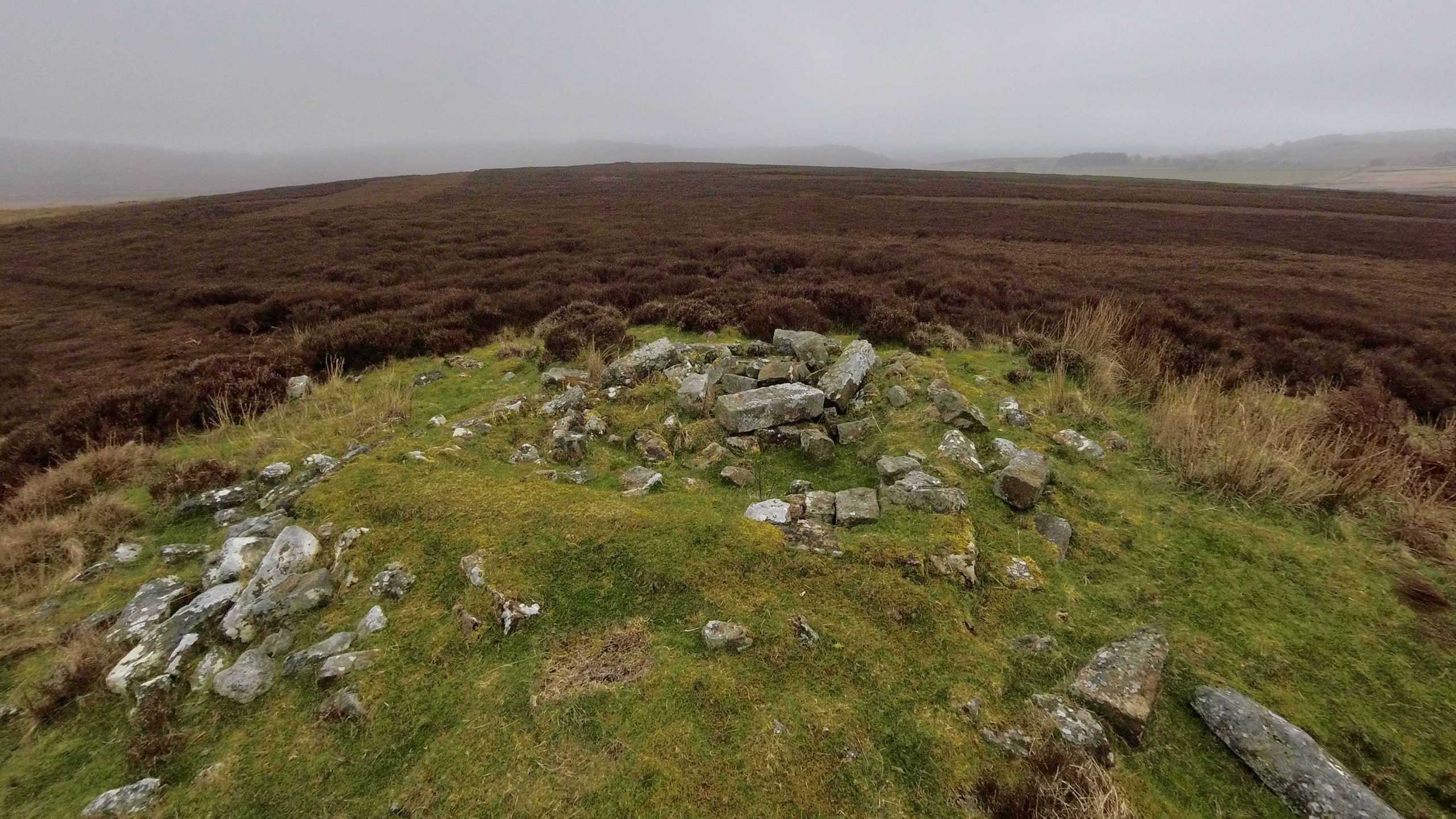
Miley Pike is a type of prehistoric round burial mound that was built during the Late Neolithic period to the Late Bronze Age1‘Miley Pike Round Barrow, Osmotherley – 1015954 | Historic England’. 2023. Historicengland.org.uk <https://historicengland.org.uk/listing/the-list/list-entry/1015954?section=official-list-entry> [accessed 31 March 2023]. These mounds are located in important positions throughout the North York Moors and are an important part of the area’s historical landscape.
Round barrows are ancient monuments that were used for burials. Miley Pike is a specific round barrow consisting of a 23-meter-wide mound made of earth and stone, which stands at a height of 1.5 meters. Unfortunately, there are the remains of a shooting hut that was built in the centre of the mound, measuring 3.5 meters square. The mound was originally surrounded by a ditch that was up to 3 meters wide, but over time, it has become filled in and is no longer visible. These barrows are important because they provide evidence of how land was divided in ancient times. Miley Pike even marks the boundary between two parishes: Snilesworth and Osmotherley.
Miley Pike is first mentioned as in Peter de Hoton’s grant of 1150 to the Priory of Arden: “All the territory of Erdene and Snyleswath with the site of Erdene, from Steppingcrosse to Wyststayndale and thence to Hameldon – and from Potter Keld to Crayaldstane, and thence to Milehowe and to Nelehowe and thence to Rieheved and so to Snyleswath and to Halmeby Church“, a grant confirmed by King John in 1201 (Burton’s Monasticon Eboracensis, 1758). 2Cowley, Bill. “Snilesworth”. Page 83. Turker Books 1993.
The locations of these ancient names can be identified: Nelehowe is now called Nelson Stone, while Crayaldstane is a Norse name that has been changed over time to Grey Hall Stone. Wyststayndale is likely a Norse version of West Stone Dale or White Stone Dale, which is now known as White Gill. This is where the boundary and the Drove Road turn sharply northwest to avoid the top of Black Hambleton. Potter Keld, which is marked on the 1854 Ordnance Survey map, is another example of a Norse name that is still visible today3‘View Map: Ordnance Survey, Yorkshire 57 (Includes: Snilesworth.) – Ordnance Survey Six-Inch England and Wales, 1842-1952’. 2023. Maps.nls.uk <https://maps.nls.uk/view/102344344#zoom=8&lat=3283&lon=3931&layers=BT> [accessed 31 March 2023]. Halmeby is simply a variation of Hawnby. Steppingcrosse is thought to be from the Old English term “Steapinga,” which might mean “the cross of the people of Steapa.” Today, this location is known as Steeple Cross.
- 1‘Miley Pike Round Barrow, Osmotherley – 1015954 | Historic England’. 2023. Historicengland.org.uk <https://historicengland.org.uk/listing/the-list/list-entry/1015954?section=official-list-entry> [accessed 31 March 2023]
- 2Cowley, Bill. “Snilesworth”. Page 83. Turker Books 1993.
- 3‘View Map: Ordnance Survey, Yorkshire 57 (Includes: Snilesworth.) – Ordnance Survey Six-Inch England and Wales, 1842-1952’. 2023. Maps.nls.uk <https://maps.nls.uk/view/102344344#zoom=8&lat=3283&lon=3931&layers=BT> [accessed 31 March 2023]
Leave a Reply