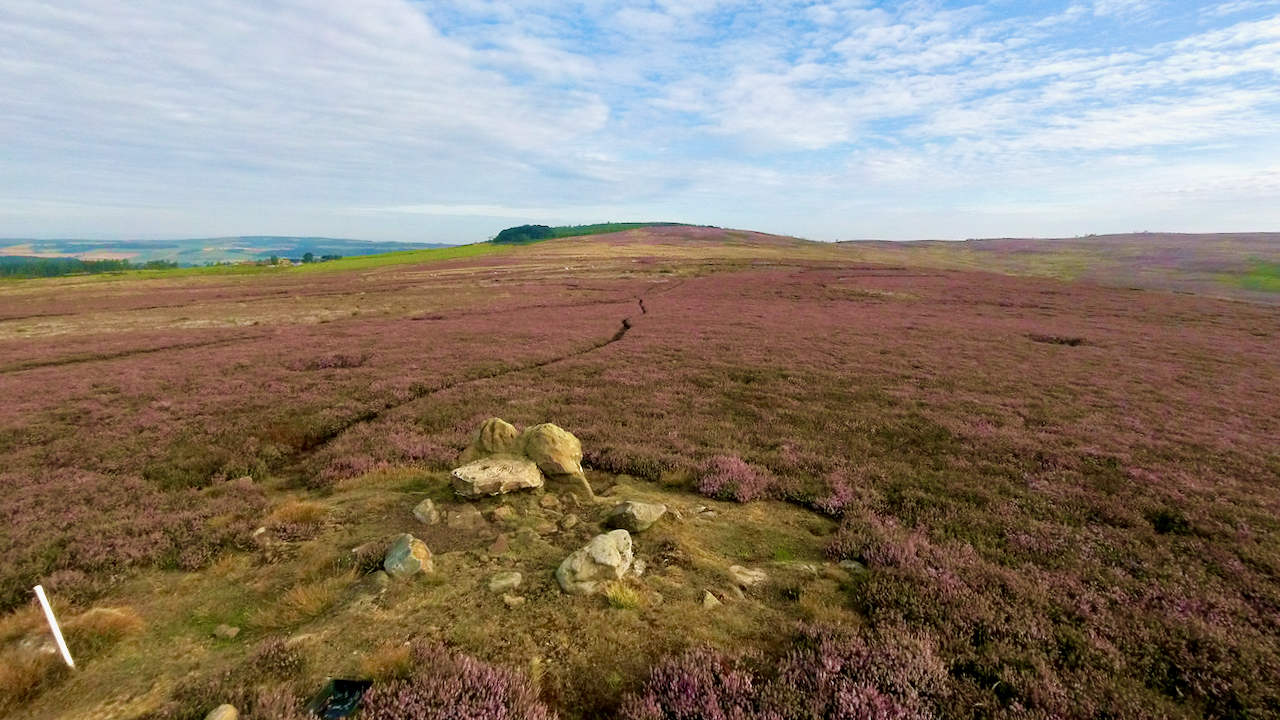
I’ve posted about this Bronze Age bowl barrow many times before, here, here, here and here, but never in the summer, in a sea of purple heather.
It’s on the highest point of Codhill Heights, a low subsidary top of Gisborough Moor and is the most obvious feature on a moor with other barrows, field systems and cairnfields1Historic Environment Records (HERs): Cleveland SMR: 198/562/1163/3685; NYM HER No: 178972‘Round Barrow on Codhill Heights, 860m South East of Codhill Farm, Guisborough – 1016574 | Historic England’. 2012. Historicengland.org.uk <https://historicengland.org.uk/listing/the-list/list-entry/1016574?section=official-list-entry> [accessed 6 August 2022].
The ‘cod‘ element of the name Codhill is said to derive from the word Norse keld, meaning ‘spring‘3Burns, Tom Scott. The Walker’s Guide to the Cleveland Hills. Page 49-50. 1993. Smith Settle.. Presumably this is the Codhill Spring shown on the 1856 6″ O.S.map, located just below the clump of trees in the distance. There is no longer any sign of this spring, the location dominated by gorse. The spring drained west, then north down Bold Venture Gill.
On the other hand, Codhill Slack, the shallow valley to the west of Codhill Heights, is part of the watershed of the River Esk, draining south.
When Henry VIII dissolved the Guisborough Priory, the documents detail “ … one close of pasture called More-close, together with Coddale, otherwise called Rothergate-close, containing by estimation fifty acres; …“4 Ord, John Walker. “The History and Antiquities of Cleveland: Comprising the Wapentake of East and West Langbargh, North Riding, County York.” 1846. Page 575/8. Available online at https://books.google.co.uk/books?id=qPsnAAAAYAAJ&dq=ord&pg=PA122#v=onepage&q=highcliffe&f=false. The opinion is that this refers to Highcliffe Farm — or Cod Hill as it was named on the 1856 map5“Guisborough Before 1900”. Edited by B.J.D. Harrison and G. Dixon. Page 71. 1982. ISBN 0 9507827 0 X.
Which all begs the question: was ‘Coddale’ an old name for what we now know as Codhill Slack, or was it Bold Venture Gill?
- 1Historic Environment Records (HERs): Cleveland SMR: 198/562/1163/3685; NYM HER No: 17897
- 2‘Round Barrow on Codhill Heights, 860m South East of Codhill Farm, Guisborough – 1016574 | Historic England’. 2012. Historicengland.org.uk <https://historicengland.org.uk/listing/the-list/list-entry/1016574?section=official-list-entry> [accessed 6 August 2022]
- 3Burns, Tom Scott. The Walker’s Guide to the Cleveland Hills. Page 49-50. 1993. Smith Settle.
- 4Ord, John Walker. “The History and Antiquities of Cleveland: Comprising the Wapentake of East and West Langbargh, North Riding, County York.” 1846. Page 575/8. Available online at https://books.google.co.uk/books?id=qPsnAAAAYAAJ&dq=ord&pg=PA122#v=onepage&q=highcliffe&f=false
- 5“Guisborough Before 1900”. Edited by B.J.D. Harrison and G. Dixon. Page 71. 1982. ISBN 0 9507827 0 X.
Leave a Reply