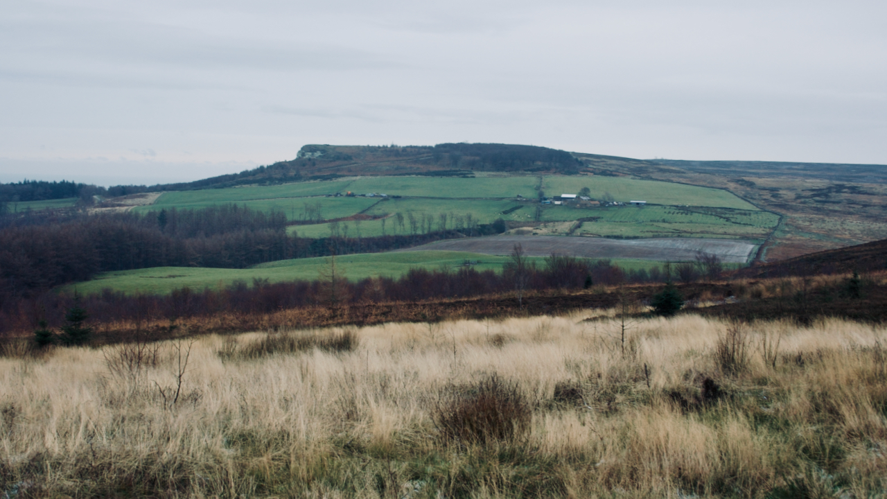
It’s not the most obvious place to site a farm, on the col between Highcliff Nab and Great Ayton Moor. A col unsheltered from both northerly and southerly winds.
The col was formed as a spillway to the south from lakes formed between the north-facing escarpment of the Cleveland Hills and the glacier flowing along what would become the Tees valley1Ypsyork.org. (2021). Percy Fry Kendall | Yorkshire Philosophical Society. [online] Available at: https://www.ypsyork.org/resources/yorkshire-scientists-and-innovators/kendall/#:~:text=A%20lot%20of,to%20Lake%20Eskdale [Accessed 7 Dec. 2021]..
The farmhouse and one of the outhouses at Codhill have been dated to the early 18th-century2North York Moors National Park. (2012). HER Map: North York Moors National Park. HER No: 16553. [online] Available at: https://www.northyorkmoors.org.uk/discover/archaeology/her-map [Accessed 7 Dec. 2021]., but it has been suggested that some land mentioned in a 1602 survey refers to the farm3Dixon, Grace. “Two Ancient Townships – Studies of Pinchinthorpe and Hutton Lowcross”. Page 67. ISBN 0 9507827 2 6 1991..
At this time Codhill Farm was part of the Chaloner estate, and in 1806, Robert Chaloner sold it to his agent, Joseph Hickson, who subsequently sold it to a Ralph Potter4Ibid. — who presumably gave his name to Potter’s Ridge, the northern end of which is Highcliff Nab. By 1820, the farm had been resold three more times5Ibid., so there must be some doubt about its viability.
It was around this time that the dry-stone wall abutting Gisborough Moor was built and an area south-west of the farm developed into fields. This had previously been called ‘Peat Carr Hill‘ but was re-named ‘Bold Venture‘ perhaps because of the boldness of “reclamation”6Ibid. Page 71.. It was said these fields had returned to a rough wild state by the end of that century, and a second attempt at improvement took place shortly afterwards7Ibid.. The name persists in Bold Venture Gill, the upper reaches of which bisects the enclosed fields of the farm.
There were several further changes of ownership in the mid-19th-century culminating in its purchase by Henry Thomas in 1851 who almost immediately leased the farm and mining rights to Joseph Whitwell Pease8Ibid.. He must have foresaw a great potential.
Thomas died in 1866, when Pease was beginning to curtail ironstone mining at Codhill in favour of his mine at Upleatham9Ibid. Page 80.. This meant the rent at Codhill received by Thomas’s widow was reduced. Pease offered to buy the farm outright from her in 1869 but she initially refused, finally accepting three years later10Ibid..
Today, Codhill Farm is called Highcliffe Farm on large scale maps, a name which must now be the ‘official’ one by virtue of its entry into the Post Office’s database of addresses.
- 1Ypsyork.org. (2021). Percy Fry Kendall | Yorkshire Philosophical Society. [online] Available at: https://www.ypsyork.org/resources/yorkshire-scientists-and-innovators/kendall/#:~:text=A%20lot%20of,to%20Lake%20Eskdale [Accessed 7 Dec. 2021].
- 2North York Moors National Park. (2012). HER Map: North York Moors National Park. HER No: 16553. [online] Available at: https://www.northyorkmoors.org.uk/discover/archaeology/her-map [Accessed 7 Dec. 2021].
- 3Dixon, Grace. “Two Ancient Townships – Studies of Pinchinthorpe and Hutton Lowcross”. Page 67. ISBN 0 9507827 2 6 1991.
- 4Ibid.
- 5Ibid.
- 6Ibid. Page 71.
- 7Ibid.
- 8Ibid.
- 9Ibid. Page 80.
- 10Ibid.
Leave a Reply