Month: August 2019
-
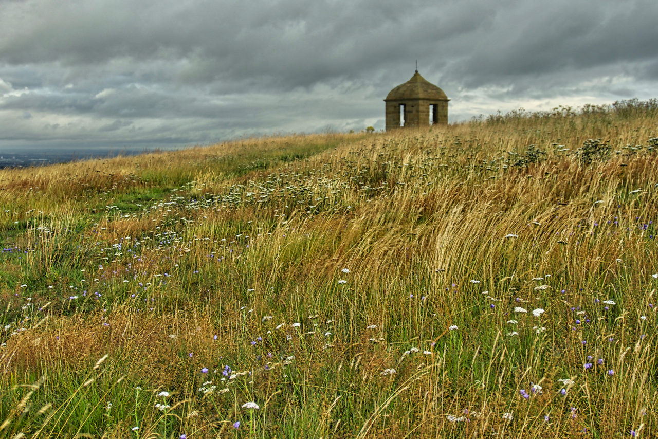
The Summerhouse Field
A lazy day, tired after Lakeland exertions. I just managed to wander up with the dog to what the family calls the folly field but which the Tithe map of 1847 lists, perhaps not surprisingly, as the Summerhouse Field. By this time the summerhouse had been in existence for about seventy years. The map recorded…
-
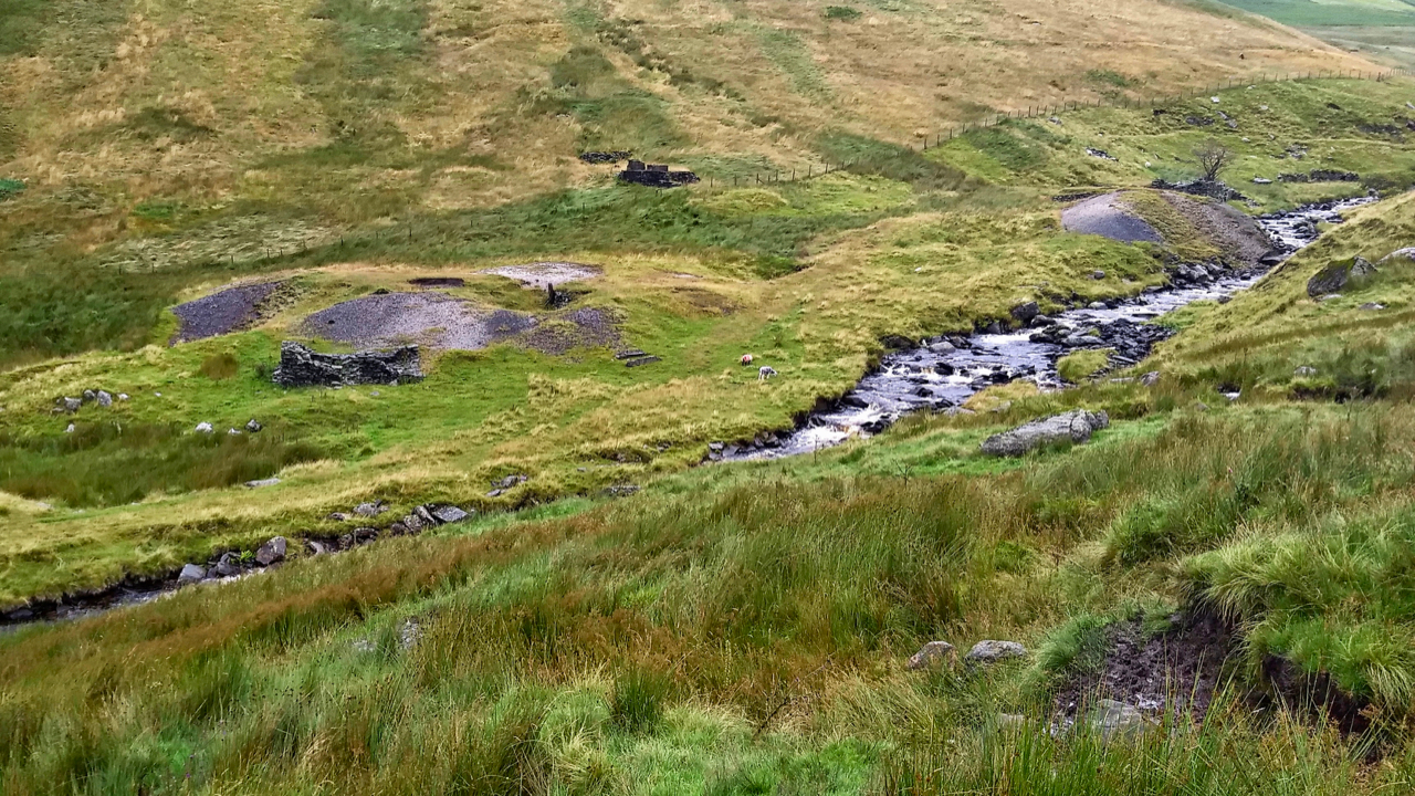
Brundholme Lead Mine
Glenderaterra Beck, a tributary of the River Greta, flows between the massifs of Skiddaw and Blencathra. Waking up to rain and cloud covering the high fells, I explored the mine workings alongside the beck. The ruins tell of a history of hope, hardship and disappointment. Work first began at the Brundholme Mine in 1872 but…
-
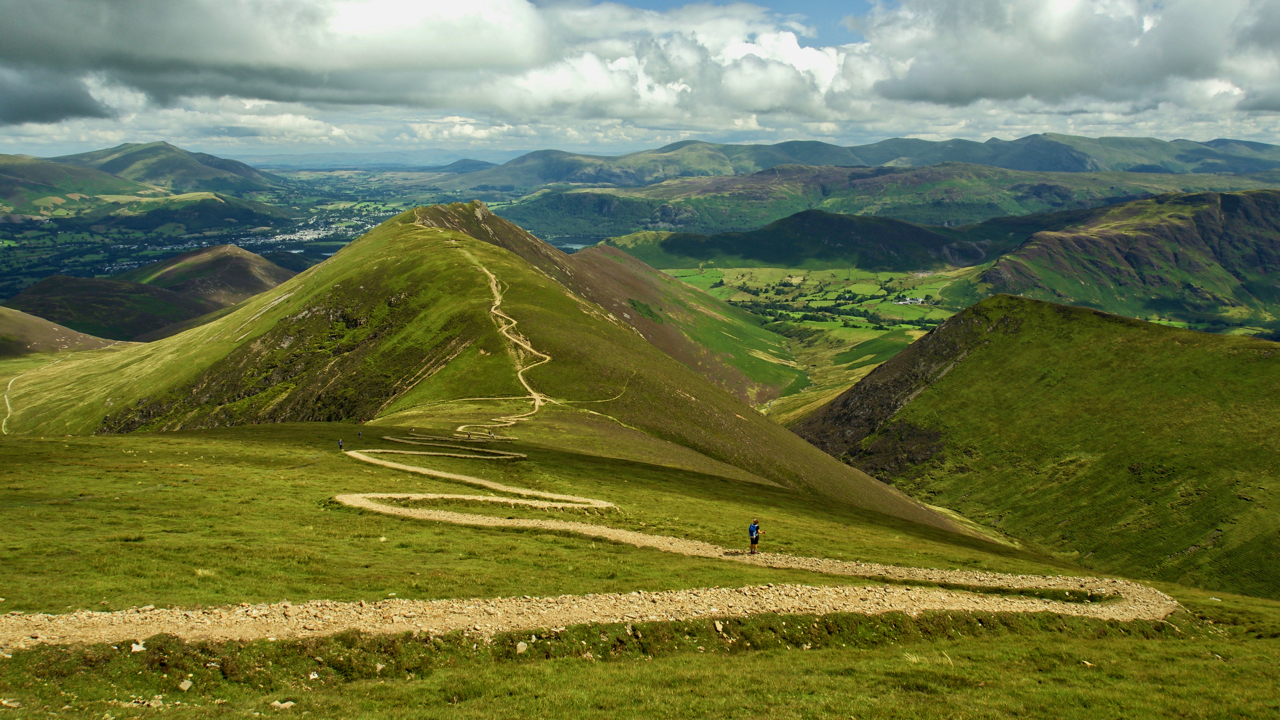
Sail Pass
Which bright spark designed this path? An utter scar. I had no idea this route up from Sail to Causey Pike was so popular to warrant such “improvement”. A lone walker rests while slogging up it but look closely and there are several others taking the “desire line” on the left, a clear path chosen…
-
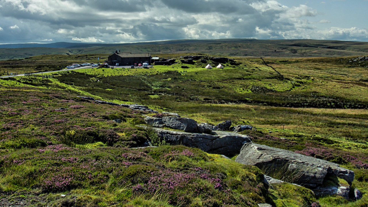
Tan Hill Inn
The famous Tan Hill Inn, highest in Britain at 1,732 feet above sea level. A relentless climb up Arkengarthdale. On reaching the watershed there is still another 2 to 3 km of rolling moorland to go. Into the westerly wind. I didn’t stop, so no chance to inspect the double glazing. You have to be…
-
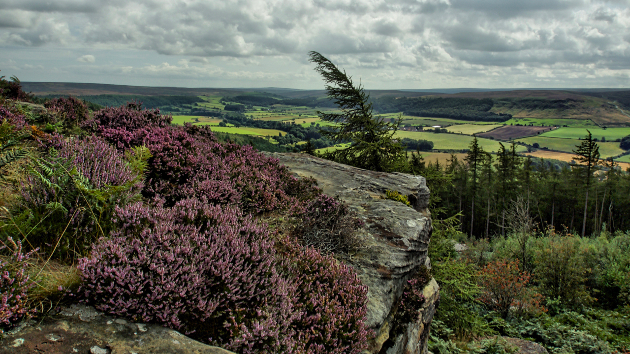
Cook’s Crags overlooking Kildale
Named as Ward Nab on the largest scale maps but known affectionately as Cook’s Crags by the climbing community. The ling is blooming nicely, here seen in a more natural setting than the vast swathes of moorland with which it is normally associated. The low lying shrub has been used through the ages as a…
-
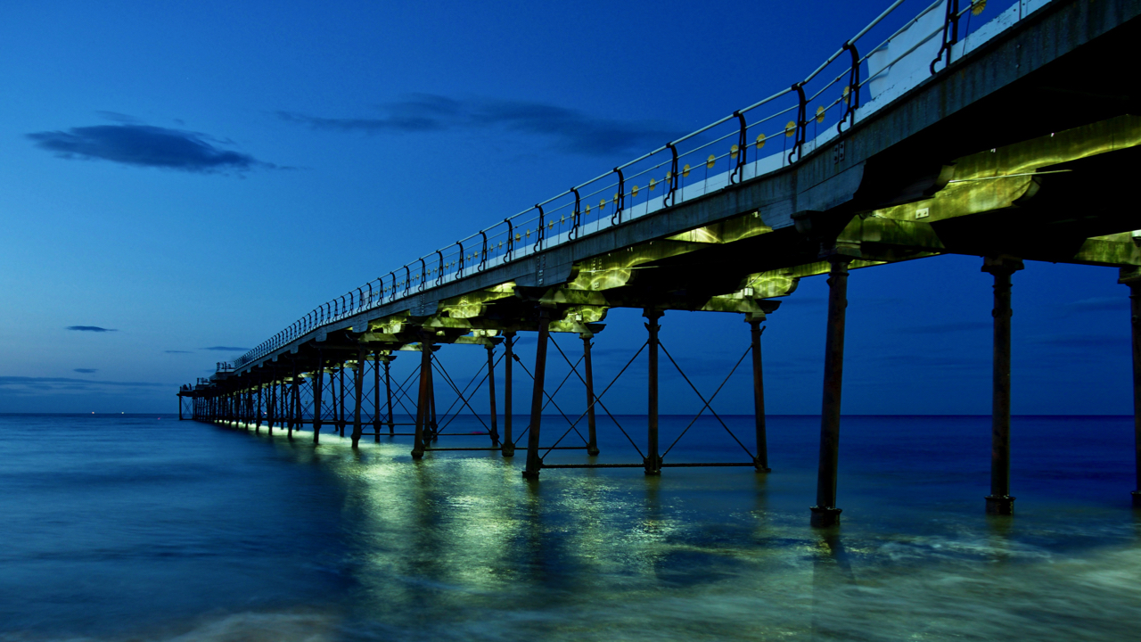
Saltburn pier
A wander around Saltburn on a sultry evening catching the last of the day’s light. A calm sea, no wind but the lighting on the pier was a bit disappointing. Open Space Web-Map builder Code
-
Aireyholme Lane
Aireyholme Farm from the south-eastern flank of Roseberry with the Cleveland Hills in the distance. The view is looking down Aireyholme Lane with the course of the old narrow-gauge tramway from the Roseberry Ironstone Mine to its left. Just before the tree, the tramway took a sharp right and headed across the fields to the…
-
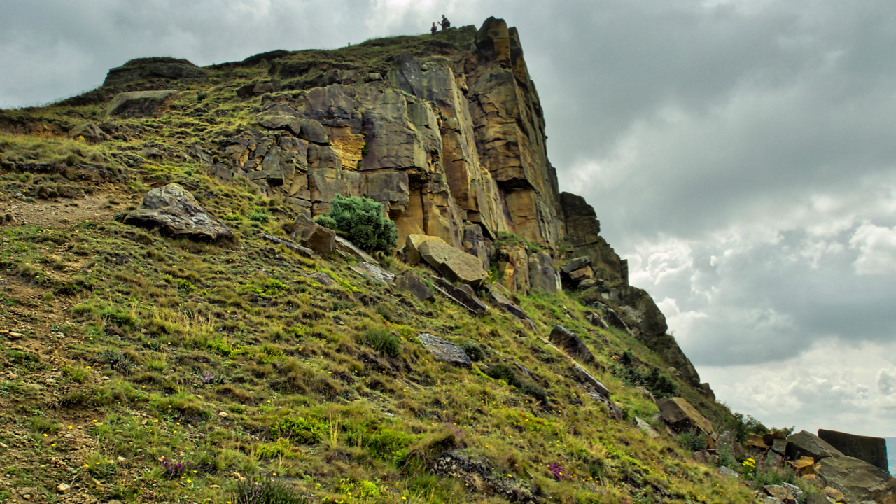
Roseberry Crag Rockfall
I heard there had been a rockfall off Roseberry crag while I was on holiday in Scotland so I headed up and took this to try and show. There are several patches of unweathered rock both on the crag face and on the talus below. One block that has come off is directly below the…
-
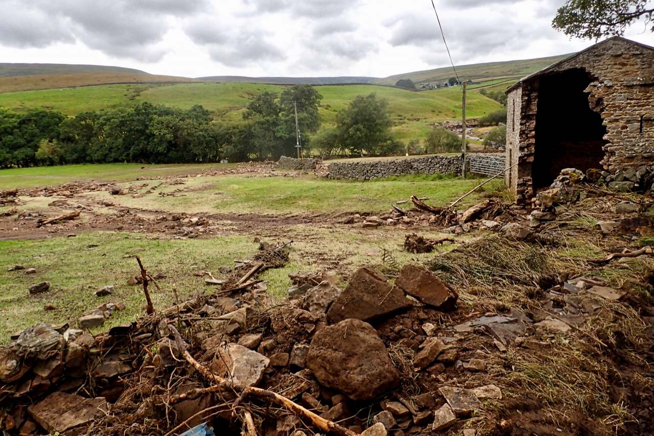
Faggergill, Near Whaw
A disturbing day yesterday. I was in Arkengarthdale helping the local authority assess the immediate needs and deliver food and supplies to the more vulnerable residents of the dale following the flooding last Tuesday night. Roads and tracks washed out prevented many, especially those living in the remote parts of the dale, from getting out.…
-
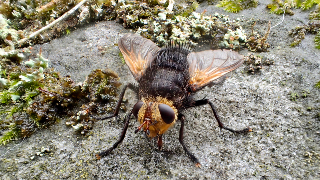
Is this a bee fly?
I have been told that this is a bee fly, a member of the Bombyliidae family but after looking at hundreds of pictures on the internet I am not so sure. There are 5,200 species of flies in the UK. I guess this one’s wingspan was about a centimetre and docile enough to enable me…