Month: April 2018
-
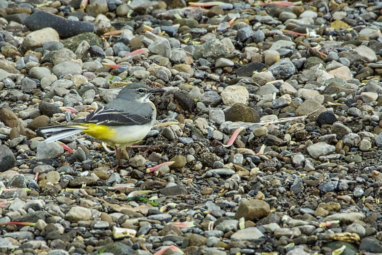
Grey Wagtail
Spotted this little beauty along the River Leven, feeding on insects and invertebrates amongst the gravels. But disappointed to discover it was only a “grey” wagtail. Surely the yellow on its underside would have warranted a better, more expressive name. Scientific name Motacilla cinerea. Open Space Web-Map builder Code
-
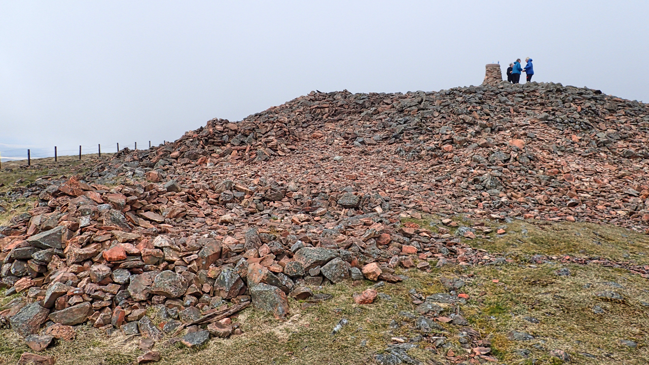
Hill of Fire
Tinto, perhaps the most prominent hill in the Clyde valley. At 707m above sea level it is not particularly high but still a very popular climb. The name means the hill of fire, a reference to the druidic practice of lighting fires on the summit to their sun god. A Bronze Age burial cairn, the…
-
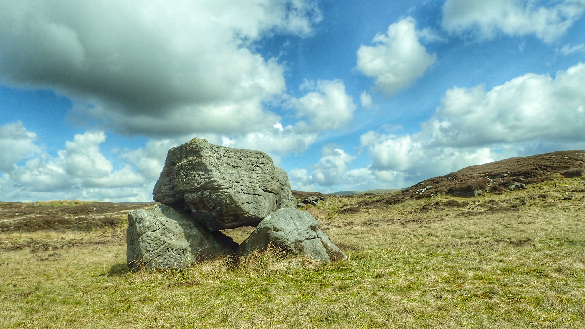
Auld Wives Lifts
Craigmaddie Muir is a boggy heather moor in the Lennox Hills. The name, Craigmaddie, means ‘Rock of God’ but it is the Auld Wives Lifts that provides a geological curiosity. The Lifts are two massive boulders side by side, with a third, eighteen feet long and weighing some 60 tons, lying across them. It is…
-
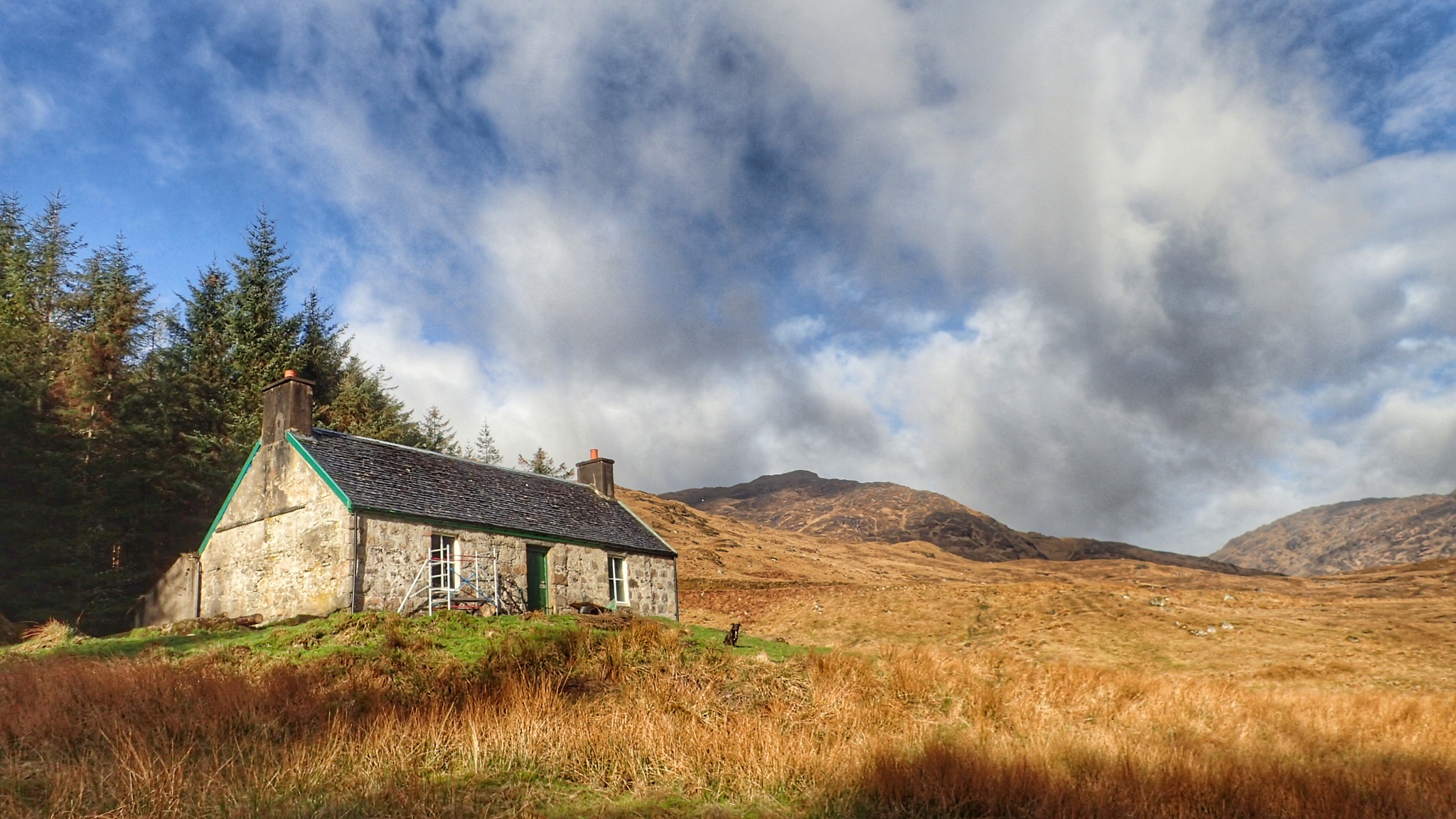
A’ Chuile
A bothy in Glendessary, 30 miles north west of Fort William. Scottish bothies have been romanticised recently with several press articles and TV programmes. Free places to stay in remote locations with congenial company around a roaring log fire without those creature comforts of modern life that most take for granted. Electricity, gas, WiFi and…
-
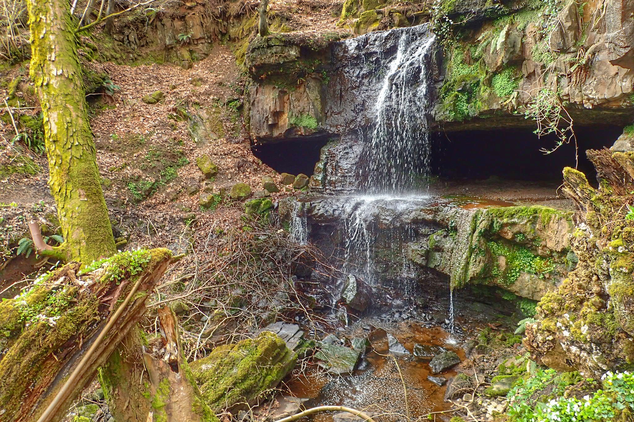
Linn Caves of Baldernock
In the Lennox Hills just north of Glasgow. A sylvan waterfall behind which are man made caves from limestone extraction. Although the caves go in some distance it seems to have been a low key extraction with kilns nearby burning local coal to make lime for agricultural use. Heading north tomorrow. I will be incommunicado…
-
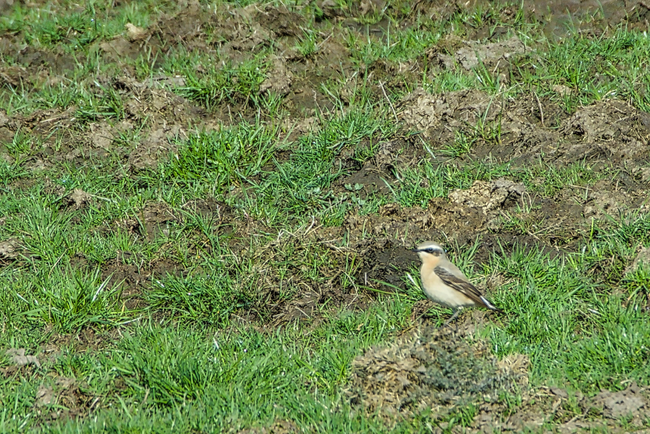
Wheatear
The flashing of white gave it away. My first Wheatear of the year, newly arrived from its warmer African wintering climes. It flitted ahead, alighting on the stone wall, teasing me into thinking I might get just a bit closer before it became bored and took to feeding on the insects in the muck sprayed…
-
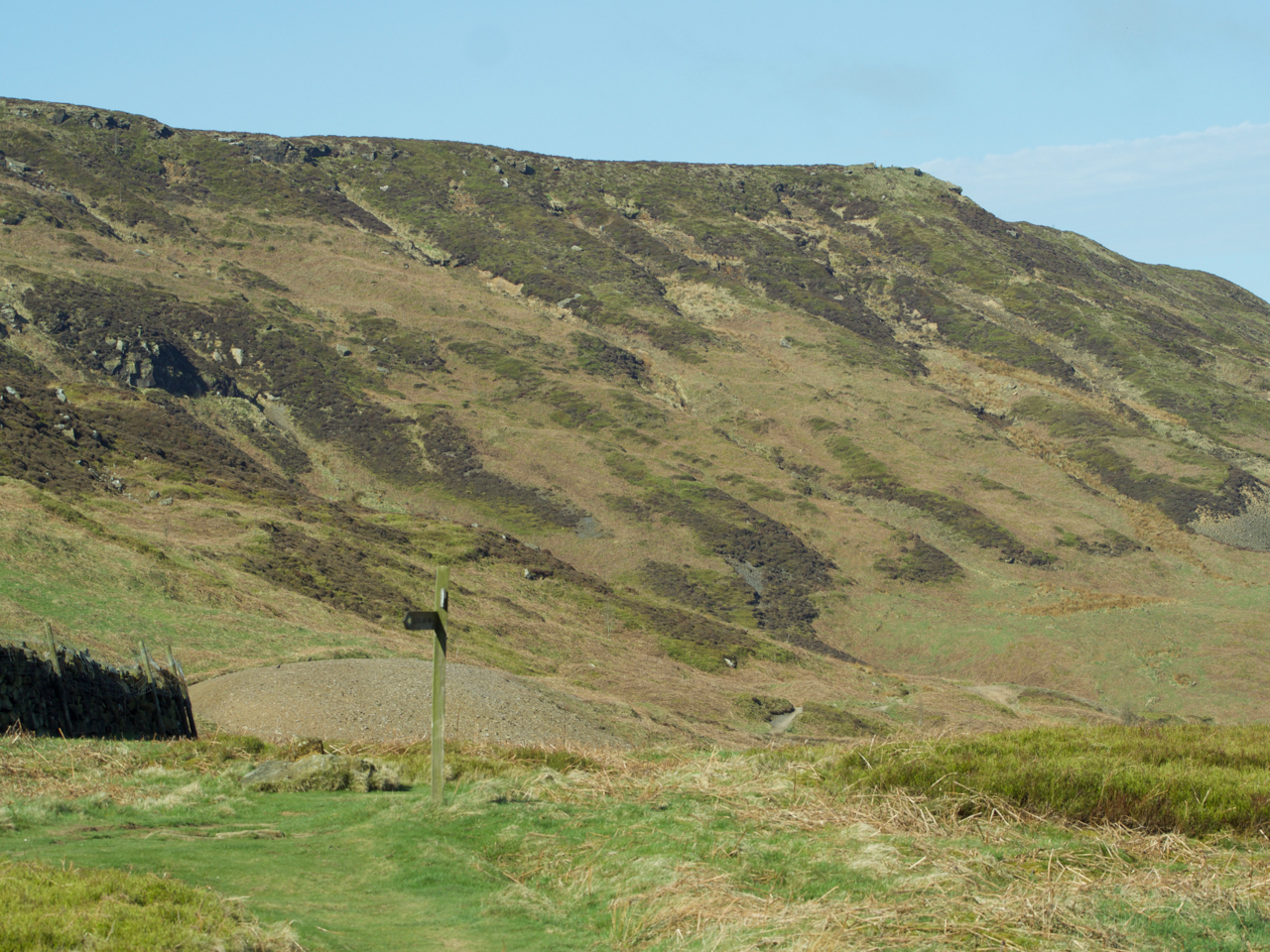
Cringley End
The modern Ordnance Survey map names the nab at the northern tip of the western end of Kirby Bank as Cringle End but I much prefer the Victorian name Cringley End. I notice too that Kirby Bank is referred to as Kirkby just like the village. I think I favour that too. Just to the…
-
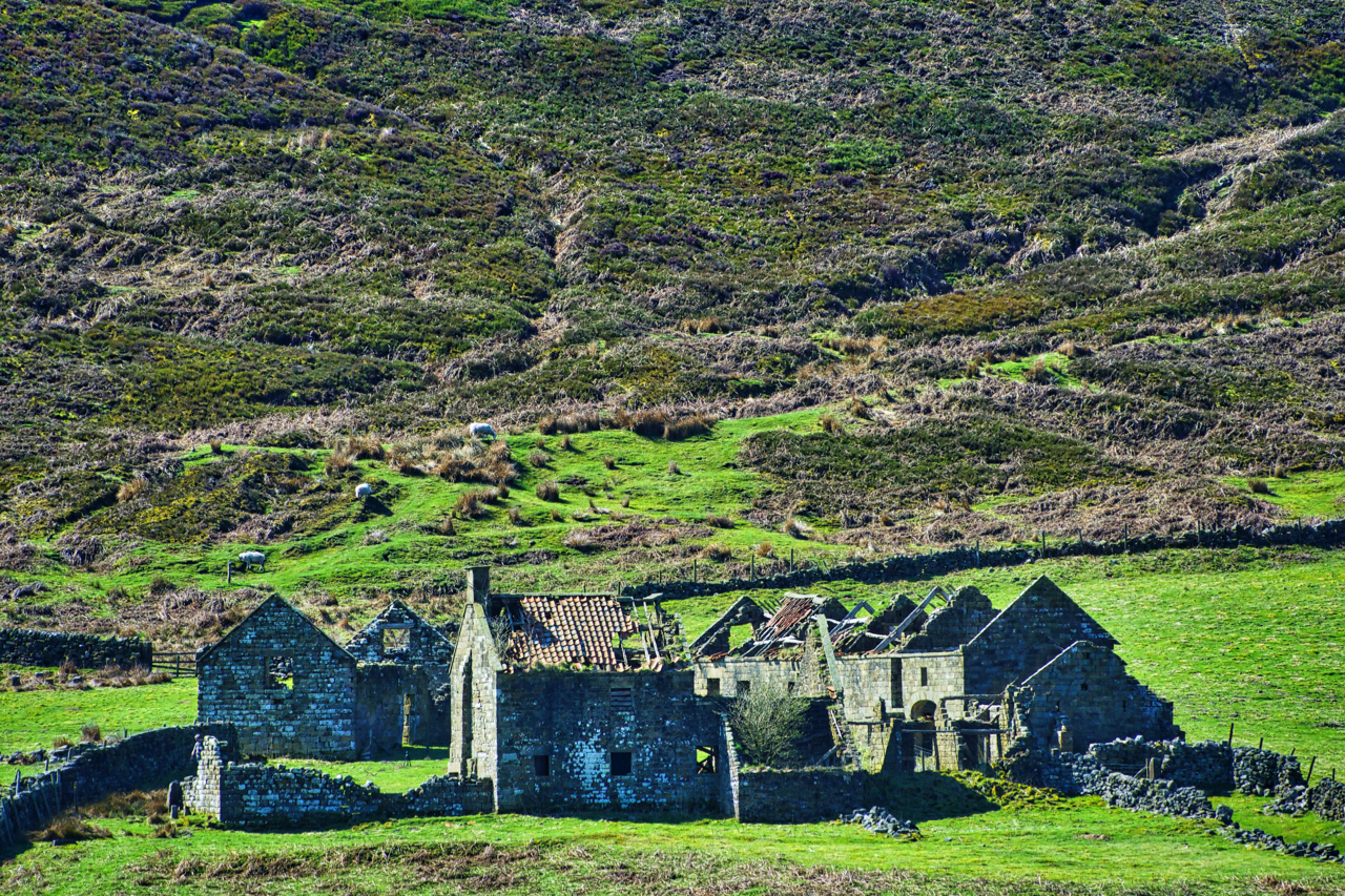
Stork House, Bransdale
Glorious sunshine in Bransdale. Across the dale, the ruinous Stork House soaks up the warmth. This must be perhaps the most desirable site for development on the North York Moors. Of course, being a National Trust property it can not be sold and renovation would be very expensive. The Trust acquired the Bransdale property in…
-
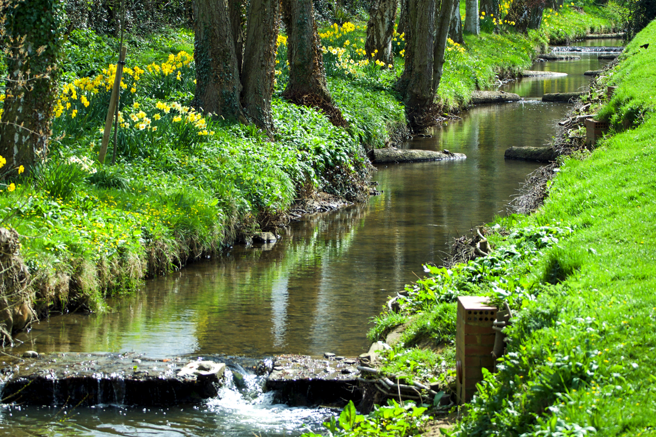
Holme Beck, Great Broughton
Or it may be Broughton Beck, so named on the Ordnance Survey map downstream. Upstream of the village, the map says Holme Beck. And closer to the Cleveland Hills where it tumbles down from its source below Donna Cross the watercourse is called Trows Beck. Three name changes in as many miles. The series of…
-
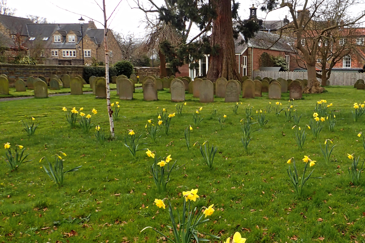
Quaker Graveyard, Great Ayton
The Religious Society of Friends was first recorded in the village in 1689 with the ending official persecution when the magistrates at Thirsk issued a certificate to establish a place of worship. This would have been a room in a private house but by the turn of the century, a specific meeting house had been…