-

A Tale of Erosion and Repair on Roseberry Topping
Roseberry Topping, perhaps the most popular honey pot in Cleveland, bears the weight of incessant foot traffic. Prior to the National Trust’s takeover in 1975, the upkeep was a bit lax, as it was deemed mere agricultural land. Fast forward to 1995, the Trust had rolled up its sleeves and pumped some serious effort into…
-
Ghosts on the Hambleton Road — Echoes of Drovers and a Lost Farmstead
High Mossy Grange, just off High Lane, that’s the local name for this section of Hambleton Road, an ancient route snaking from the southern reaches of England to bonny Scotland. Used to be a post-medieval farmstead, but now High Mossy Grange has all but been wiped off the map. What’s left is this patch of…
-

Why is today, 29th February, Leap Day?
For the first time in God knows how long, today proved unsuccessful in venturing into the hills. So, I am resorted to share one from the archives. On the last Leap Day, the 29th of February, 2020, the skies painted a blue canvas above Roseberry. Oh, those naïve days, as Covid was on the verge…
-

Priest’s Spa Quarry and its elusive spring
On Hither Moor, this 19th century sandstone quarry overlooks the road winding up the Cod Beck dale between Osmotherley and Scarth Nick. Nowadays, the dale is best known for its reservoir that draws quite the crowd. The quarry, mapped as “Priests’ Spa” by the early Ordnance Survey, owes its name to a spring allegedly blessed…
-

Elfi The Dwarf — The Story Told at Ye Sign of the Fox & Hounds, Urra
The notion of transcribing these ancient folk tales of Richard Blakeborough, thought to be a splendid idea at first, an idea born during the Covid lockdown, now gnaws at my conscience with growing unease. Recent reports detailing the modification of Roald Dahl’s cherished works, altering words deemed offensive and rewriting character descriptions in an attempt…
-

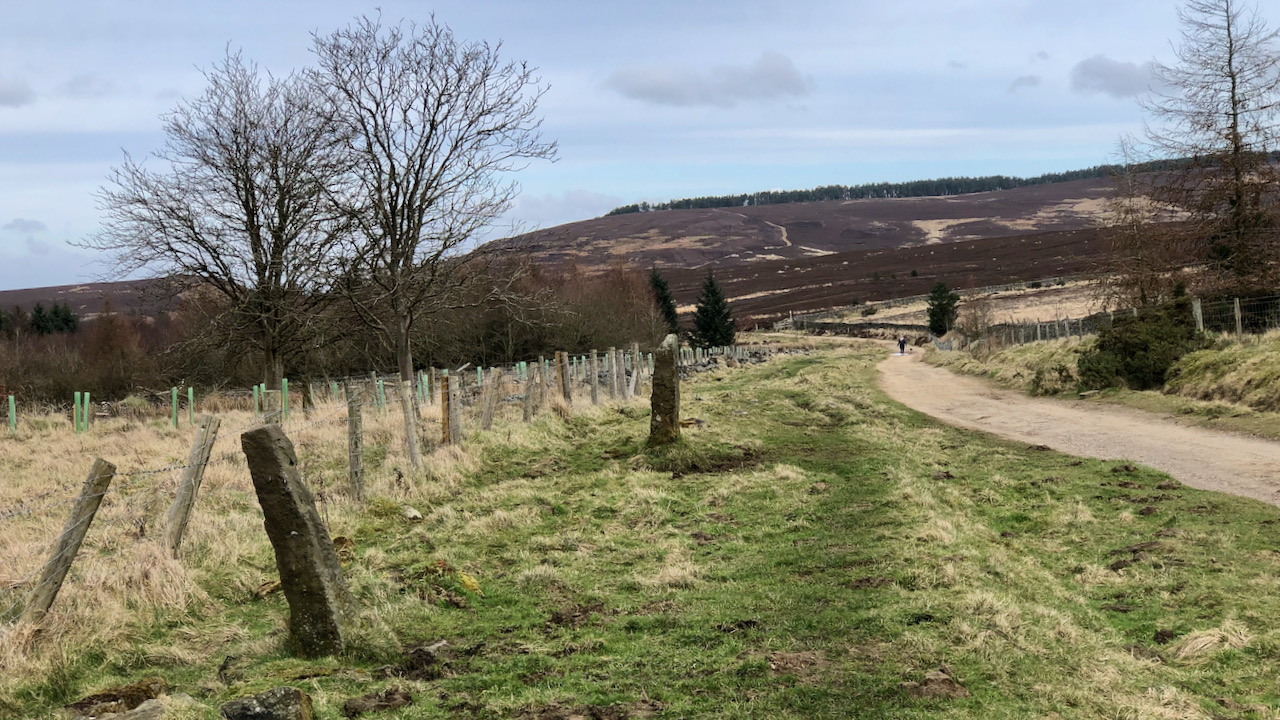
Hutton Moor — Biodiversity vs. Profit
This is Hutton Moor at the northern end of the Percy Cross Rigg track. I see that the self-seeded birch and spruce that have sprouted on the heather moorland have been unceremoniously cut down. The rationale is clear; if left unchecked, the moorland will eventually transform into a birch woodland. However, this does come at…
-
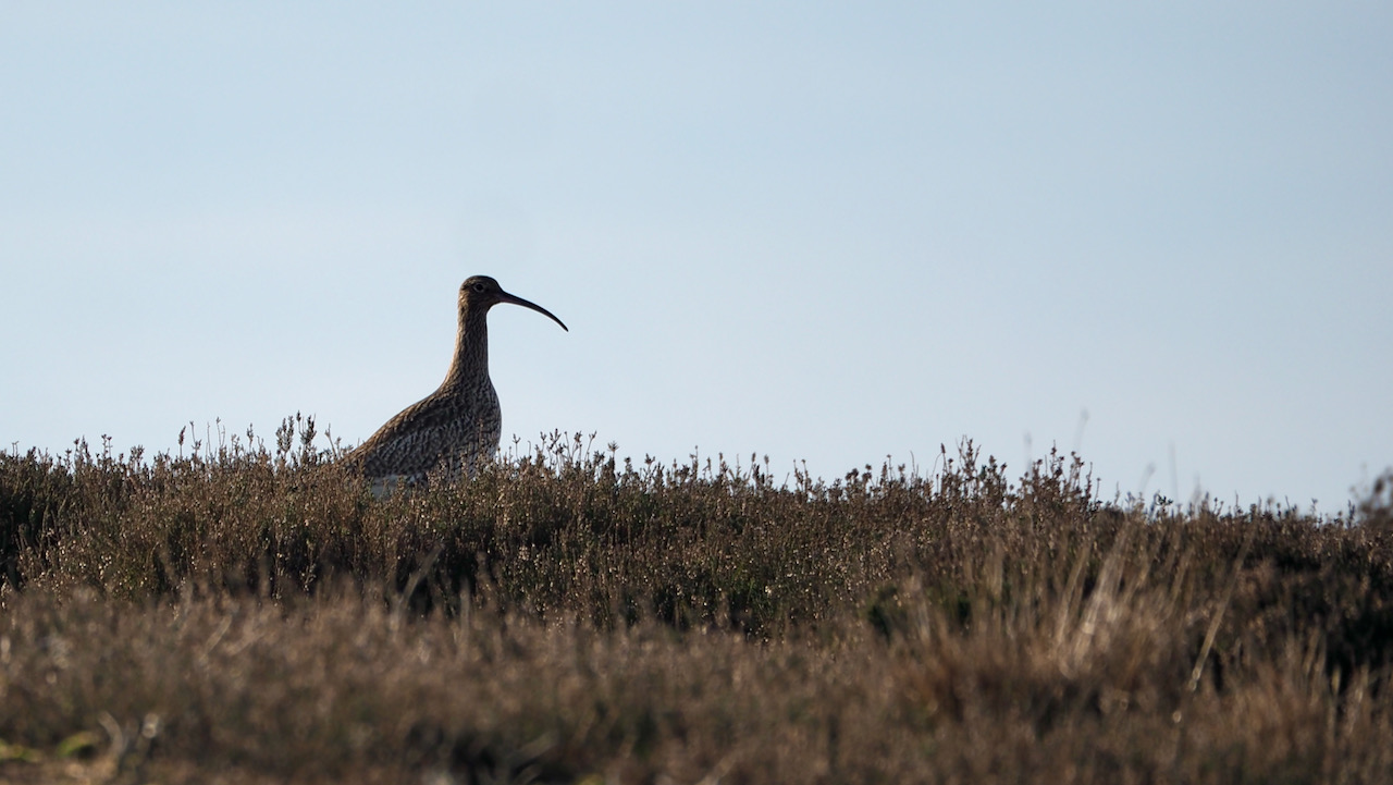
No wheeple from this whaup
No plaintive cry echoed through the air. It was the silhouette that gave it away: that lengthy and slender bill that bent downward. I casually approached at an oblique angle, yearning for a better shot. Amidst the heather, its speckled brown feathers made spotting it quite a challenge. Alas, my audacious closeness prompted it to…
-

The Enduring Enigma of the Sledge Shoe House Reservoir
Situated between Blakey Junction and the west calcining kilns, just before the Rosedale Abbey to Hutton-le-Hole road at Bank Top, there lies a small reservoir near the former farmstead of Sledge Shoe House, sustained by moorland springs. Yet, it has been brought to my attention that this presents a puzzle. It is acknowledged that the…
-

From a Scenic View to Deadly Plots: The Cato Street Conspiracy
On the parish boundary between Easby and Kildale, looking through the self-seeded birch wood toward Ward Nab, a sandstone outcrop the origin of which name escapes my grasp. Therefore, I must lean on hodiurnal past happenings for the rest of this post. In the tumultuous throes of economic strife and political unrest in the early…
-

Easby Moor from Roseberry Topping
The names Easby and Roseberry both derive from Old Scandinavian, but what did the Deiri tribe, nestled snugly between the Humber and the Tees rivers, call these places? Picture Deira as the precursor to Yorkshire, holding court in York. But Deira wasn’t a territorial area. It seems more like a robust dynasty. The exact genesis…
Care to comment?