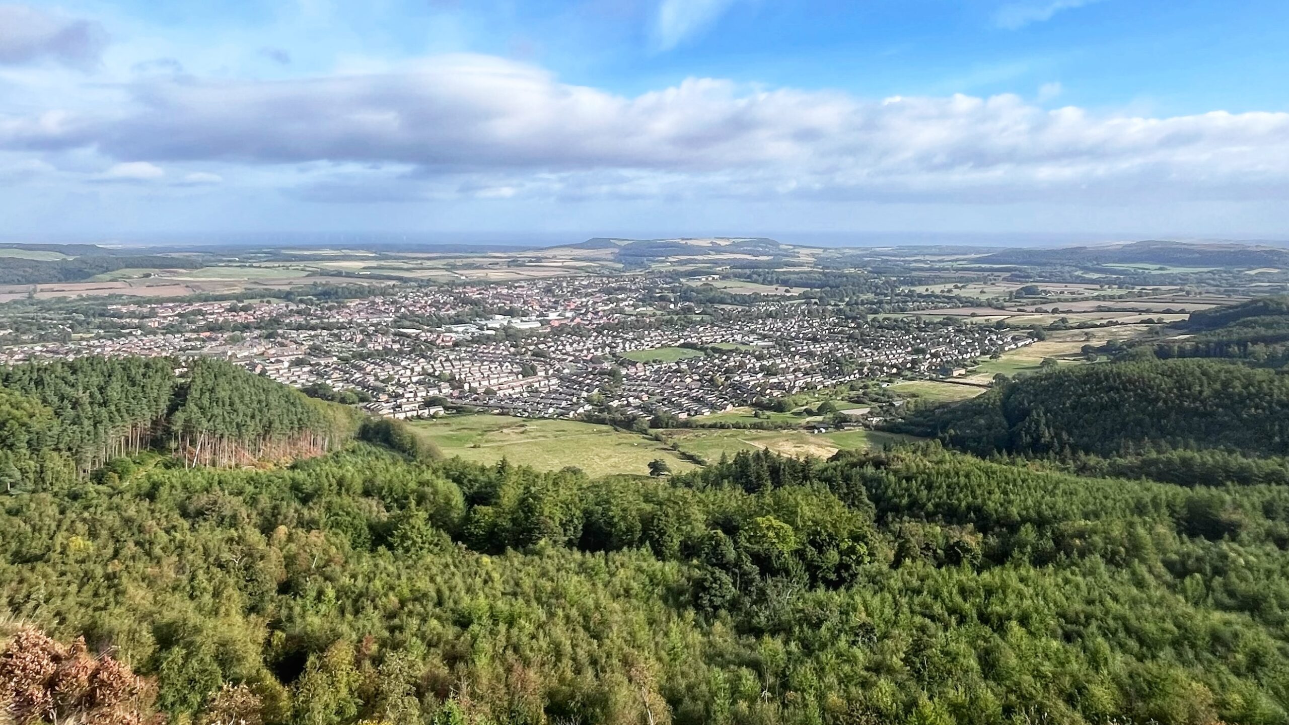
Stand on this sandstone crag of Highcliff Nab today and the wind certainly finds you. Below lies Guisborough, all roofs and roads. Far off, the turbines of Redcar turn in the haze.
In the 1990s, archaeologists dug into this very crag prior to the construction of a new stone footpath needed to address the severe erosion along the Cleveland Way. They found the remains of a Mesolithic hunting camp, with flint tools by the thousand. Some 9,000 years ago, hunters sat on this spot and tended their fires. They looked out on a very different country.
The sea lay far below its present level. The North Sea coast was more distant, and Doggerland, the land that joined Britain to Europe, had not yet been drowned. Nobody needed a ferry ticket, and nobody had yet invented Brexit.
Where the housing estates now stand, the Vale of Cleveland offered the hunters a patchwork of dense mixed woodland interspersed with marshy post-glacial carrs, so these high camps stood like islands in a green sea. Game moved beneath the canopy, and the Nab gave a fine view of it.
From the crag the hunters could watch for movement before choosing where to strike. They had no roads, no shops and no schools. They did have the better view.
Sources
- Rowe, Peter. Hunting the Hunter-Gatherers: Mesolithic Teesside. Tees Archaeology, 2015. https://www.teesarchaeology.com/
- Waughman, Mags. “Hunter-Gatherers in an Upland Landscape: The Mesolithic Period in North East Yorkshire.” Yorkshire Archaeological Journal, vol. 89, no. 1, 2017, pp. 1–22. https://doi.org/10.1080/00844276.2017.1333333
- Carter, Spencer, et al. ICE AND FIRE: The Eston Hills Rescue Archaeology Project Interim HLF Report 2018. Eston Hills Project, 2018. https://estonhillsproject.wordpress.com/
Leave a Reply