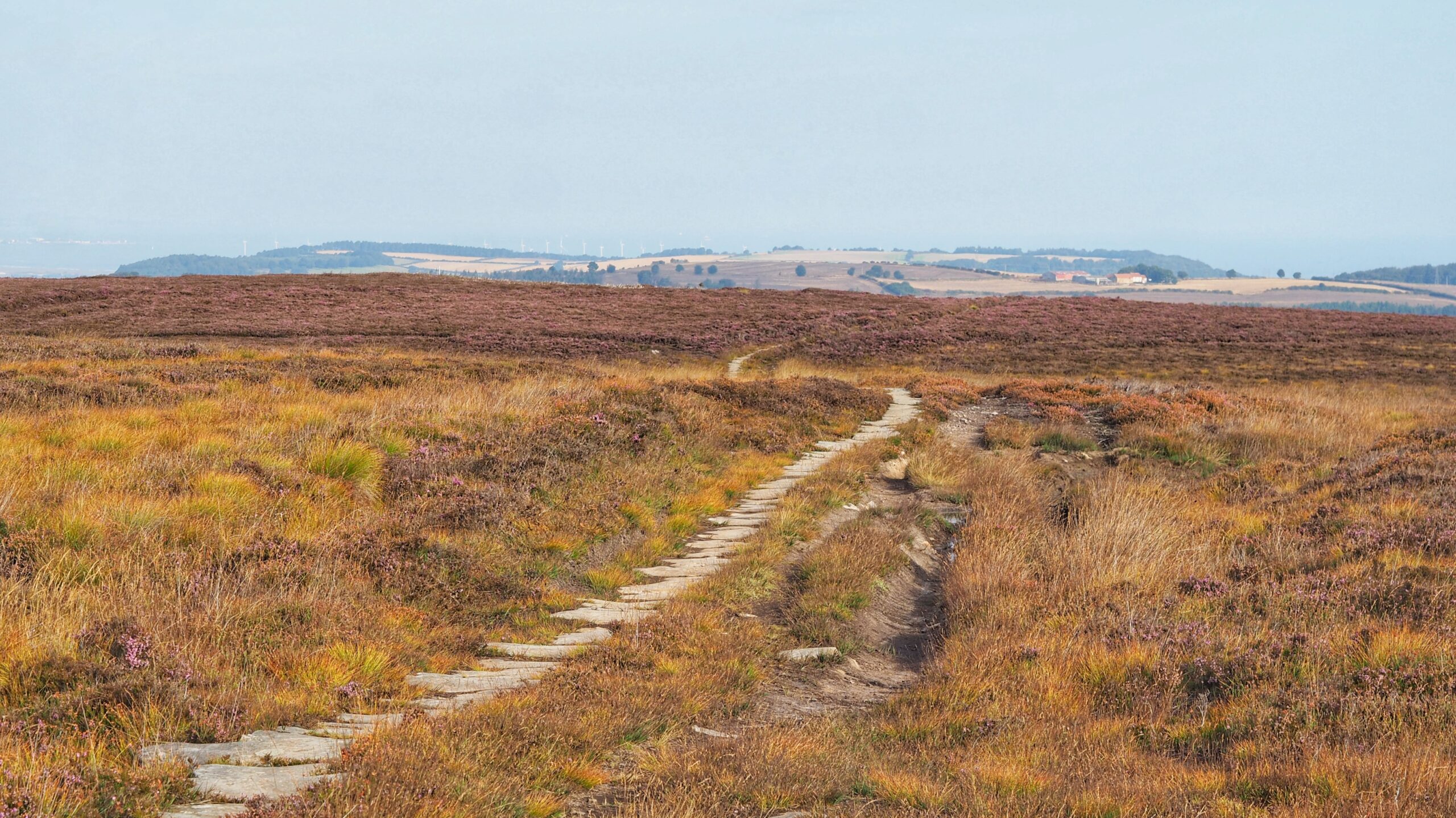
Stanghow Moor has not seen my studs in years, and it is easy to see why. It sits west of Birk Brow, bleak and boggy as you like, with barely a path or sheep trod worth the name cut through it. I can’t believe I used to run over this stuff.
One path does buck that sweeping statement: this stone-flagged trod, grandly marked on the map as the Quaker’s Causeway1NYMNPA HER No: 5155 Trod named Quaker’s Causeway . The name suggests a route between the Friends’ Meeting House in Guisborough and their worship groups in the villages of the dales. Grand claim, shaky evidence. The Quakers did not exist until after the English Civil War of 1642 to 1651, and this path has the weathered look of something far older. Call it a case of the wrong people getting the credit.
Blame the monks instead. Guisborough Priory held the monopoly on ironstone across Fryup, Danby and the whole of Cleveland from its earliest days, and a path like this would have suited them nicely, linking Guisborough to Commondale and on to the Dales and the Priory at Baysdale. Quakers may well have walked it later, using the route the monks had built first2SEWELL, JOSEPH T. AN ACCOUNT OF SOME MEDIÆVAL ROADS CROSSING THE MOORS SOUTH AND SOUTH WEST OF WHITBY. First published with the Whitby Literary and Philosophical Society’s 100th Annual Report. Sold as a supplement, 1923, Re-printed and published by the Society, 1971. Re-printed 1973..
Whitby, meanwhile, kept its back turned to the moor entirely. The main road now known as the A171 only came together around 1800, stitched from smaller moor roads that had gone their own separate ways for centuries. Before that, anyone heading south or south-east travelled hugging the coast, or went by sea, since it did the heavy lifting that roads could not. The town had a saying for it: “The only road to Whitby is the sea.”3Spratt, D.A. & B.J.D. Harrison. NORTH YORK MOORS: Landscape Heritage. Page 186. David & Charles.1989.
The trod pushes on south-east to White Cross, where it meets the old Stokesley cattle road. That one had its own upgrade, turned turnpike in time, running from Kildale in the west out towards Ugthorpe. Paths crossing paths, each with a history nobody quite agreed on.
- 1
- 2SEWELL, JOSEPH T. AN ACCOUNT OF SOME MEDIÆVAL ROADS CROSSING THE MOORS SOUTH AND SOUTH WEST OF WHITBY. First published with the Whitby Literary and Philosophical Society’s 100th Annual Report. Sold as a supplement, 1923, Re-printed and published by the Society, 1971. Re-printed 1973. ↩︎
- 3Spratt, D.A. & B.J.D. Harrison. NORTH YORK MOORS: Landscape Heritage. Page 186. David & Charles.1989. ↩︎
Leave a Reply