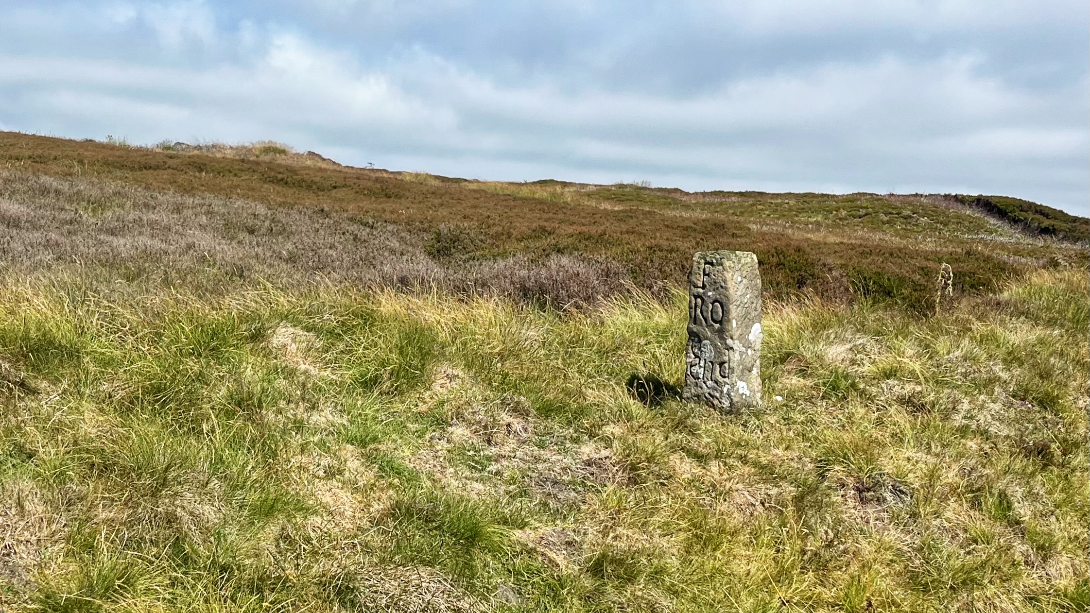
I have caught sight of this guidestone plenty of times, hurtling past at sixty miles an hour. Stopping on the Blakey Ridge road is no small feat. A bike makes it far simpler.
The stone reads “F RO END”, short for “FARNDALE ROAD END”1NYMNPA HER No: 8465. Guidestone on the west side of the road south of the boundary stone known as Margery Bradley at Blakey Ridge . It dates from around 1720, part of an early eighteenth century push to give lost souls a fighting chance on the moors. Good intentions, carved in stone, for anyone who wandered up here hoping for the best.
The old roads were unsurfaced and rough going. Horses used them, along with pannier-trains and small two-wheeled carts called coups or cowps, and occasionally a four-wheeled ox-wagon for the ambitious. Livestock came through too, driven along as droveways. Travellers dodged the deep ruts by veering off to the side, again and again, until a single track became a wide scatter of them. Nearer Hutton-le-Hole you can still see this fanning pattern on the open moorland, right beside the tarmac.
A route along this ridge must have existed since people first turned up in the district. Cockpit Howe, a Neolithic burial mound, sits a mile south, tucked behind the Lion Inn.
Under King Edward III, the ten-acre plot where the Lion Inn now stands was given to the Order of Crutched Friars, who had failed to find a home at York and settled there instead to build an oratory. The friars are thought to have founded an inn in a modest attempt to ease their poverty. Friar inns turn up all over the country, so nothing unusual there.
Trade over land grew steadily through the Middle Ages, and wool drove much of it. By the end of the thirteenth century, the North York Moors were turning out some seventy thousand fleeces a year. Five centuries later, farmers from Commondale, Danby, Fryup and the surrounding area gathered at the inn to sell surplus corn to horse breeders and stable owners down in Ryedale.
From about 1700, the Blakey Ridge road carried lime, as did many of these long-distance routes. A kiln needs roughly one ton of coal to calcine four tons of limestone, yielding about two tons of lime. Building the kiln at the quarry made sense, since coal could be carted in and lime carted out. Kilns went up along the north side of the Tabular Hills, burning coal from the nearby moor collieries, sending lime down to sweeten the acid soils of the Esk Valley. The trade faded in the nineteenth century, undercut by lime shipped from Sunderland to Whitby and limestone brought from Flamborough Head to kilns at Sandsend and Ruswarp.
- 1NYMNPA HER No: 8465. Guidestone on the west side of the road south of the boundary stone known as Margery Bradley at Blakey Ridge
Leave a Reply