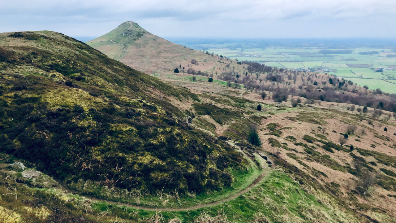
On the hills and moors lie many landscape features, their origins lost in the mists of time. Contemplating their history evokes me with a sense of curiosity. Take, for instance, the path ascending towards the deep notch in the Little Roseberry spur—it stands as a prime example.
The erosion scored into the slope suggests either ancient usage or a deliberate construction. Curiously absent from the Victorian Ordnance Survey maps, it appears as if the path once wound in a hairpin fashion to ascend the western slope of Little Roseberry. Notably, a sandstone quarry is marked at the notch—perhaps it and the path were built to facilitate the transport of stones downhill to the village of Newton. It is clear from the photograph that there are several parallel hollow-ways which obviously pre-date the current route, though they would not have crested the hill at the notch but further eastward.
Medieval charters speak of numerous routes converging upon Roseberry Common. Among them, Melegate seems to have held some importance, tracing a route approximating to the modern Cleveland Way across Newton Moor, from its junction on the Percy Rigg road (itself referred to as Molecros?) to Parvus Othensberg, the medieval name for Little Roseberry.
Some conjecture that the deep notch was used by this route to find a gentler incline northwards, descending ‘Brant Gate’ to intersect with tracks leading over the Carrs to Barnaby Side, Eston Moor, and the lowlands of the Tees1“Guisborough Before 1900”. Edited by B.J.D. Harrison and G. Dixon. Page 65/71. 1982. ISBN 0 9507827 0 X.. The moors were of great importance for rough grazing, and as a source of peat and heather, so the easiest routes off the moors would have been well used.
The present forest track from Hutton village to Roseberry Common is believed to trace the path of the medieval Crossegate, as documented in the medieval charters2Dixon, Grace. “Two Ancient Townships – Studies of Pinchinthorpe and Hutton Lowcross”. Page 47. ISBN 0 9507827 2 6 1991.
Long story short, the path we see today likely supplanted an older route that descended the hill through the centuries. Its well-defined form and proximity to a quarry suggest its use in transporting the stone downhill. While debate persists regarding the precise routes of these medieval routes across the moors, the presence of the quarry and its alignment with established pathways like Melegate and Brant Gate hint at its integral role in the area’s historical transportation network.
- 1“Guisborough Before 1900”. Edited by B.J.D. Harrison and G. Dixon. Page 65/71. 1982. ISBN 0 9507827 0 X.
- 2Dixon, Grace. “Two Ancient Townships – Studies of Pinchinthorpe and Hutton Lowcross”. Page 47. ISBN 0 9507827 2 6 1991
Leave a Reply