I’ve posted about the battle before: here and here. The conventional thinking was that the battle took place on the east side of the town, in fields off Butt Lane1Daniels, Robin & Phil Philo. ‘The First Great Civil War in the Tees Valley 1642-1646’ Page 17. River Tees Rediscovered Landscape Partnership.. But recent metal detector finds suggest another site for the battle — on the west side of the town, to the north of Hutton Hall2‘On This Day in 1643. North Yorkshire. As… – the Battlefields Trust’. 2023. Facebook.com <https://m.facebook.com/story.php?story_fbid=pfbid02WazXzNtFg5BL26EwtZJw75Jip2MsBto8ZCN4pcdFd3qPuSVbZzrFeoQzo7Y8Ua3Ml&id=43259312809> [accessed 16 January 2023].
The Parliamentarian, Sir Hugh Cholmley, was stationed at Malton when he heard that Royalist commander, Guilford Slingsby of Hemlington, had been ordered to join forces with those of Sir Robert Strickland and proceed to garrison Whitby where Cholmley had his estate.
It was this that prompted Cholmley with 80 horsemen, 170 dragoons and 130 foot and two small canon, to set off to march north across the North York Moors to intercept Slingsby.
From Malton the obvious route would be to Kirbymoorside and up Blakey Ridge to Rosedale Head using ancient moorland tracks.
A battle site to the east of the town with Cholmley attacking from the south-east would suggest a route then to Castleton, Birk Brow and Slapewath. I thought that this is not a route I would take if I had to walk. Far better, from there to drop down to Westerdale and then Percy Cross and the Medieval track, Ernaldsti3“The North York Moors Landscape Heritage”. Edited by D.A.Spratt and B.J.D.Harrison. David & Charles. 1989. ISBN 0 7153 93472..
This would meant Cholmley descended down to the west side of Guisborough. It is pleasing to see that, with the mooted new battle site, this route alternative is now being considered4‘Of Things North York Moors: 15 January 1643’. 2023. Of Things Trent-North (Of Things Trent-North) <https://ofthingstrentnorth345431120.wordpress.com/2023/01/15/of-things-north-york-moors-15-january-1643/> [accessed 16 January 2023].
Most of the route from Malton is now covered by tarmac. Ernaldsti is a modern landrover track. It is hard to imagine the state of the route in a 17th-century in winter. Even hugging the ridges, the track would have been very founderous with detours around the boggy sections. Following in the wake of the horses, the poorly shod men would, as well as their knapsacks of supplies, be carrying all their arms — either muskets, 18-feet long pikes or swords — and any armour. And then there’s the two canon which would have been pulled by draught horses.
Progress would have been at best 2-3 mph meaning the 40 mile journey could have taken 15-20 hours — with limted daylight I can’t see this being achieved in less than 3 days.
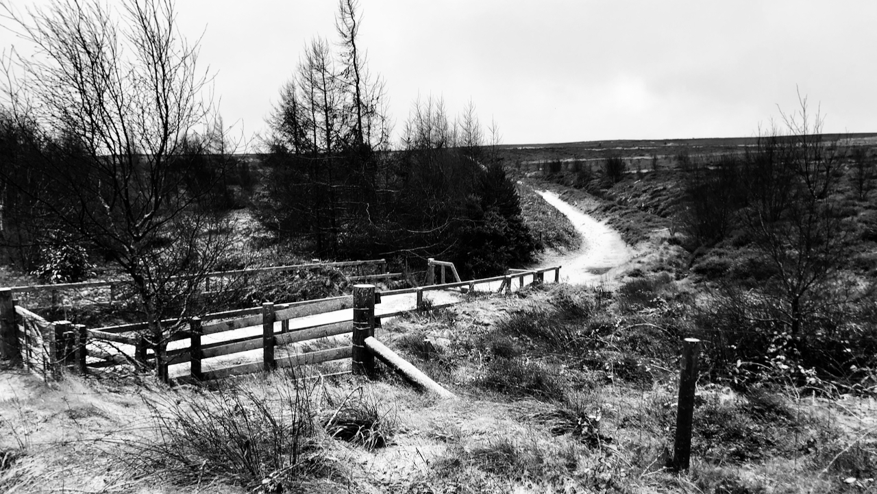
The photo shows the northern end of Ernaldsti, just before it descends to Hutton village.
- 1Daniels, Robin & Phil Philo. ‘The First Great Civil War in the Tees Valley 1642-1646’ Page 17. River Tees Rediscovered Landscape Partnership.
- 2‘On This Day in 1643. North Yorkshire. As… – the Battlefields Trust’. 2023. Facebook.com <https://m.facebook.com/story.php?story_fbid=pfbid02WazXzNtFg5BL26EwtZJw75Jip2MsBto8ZCN4pcdFd3qPuSVbZzrFeoQzo7Y8Ua3Ml&id=43259312809> [accessed 16 January 2023]
- 3“The North York Moors Landscape Heritage”. Edited by D.A.Spratt and B.J.D.Harrison. David & Charles. 1989. ISBN 0 7153 93472.
- 4‘Of Things North York Moors: 15 January 1643’. 2023. Of Things Trent-North (Of Things Trent-North) <https://ofthingstrentnorth345431120.wordpress.com/2023/01/15/of-things-north-york-moors-15-january-1643/> [accessed 16 January 2023]
Leave a Reply