A cold morning with the puddles covering by a skimpy layer of brittle ice, the first of the winter.
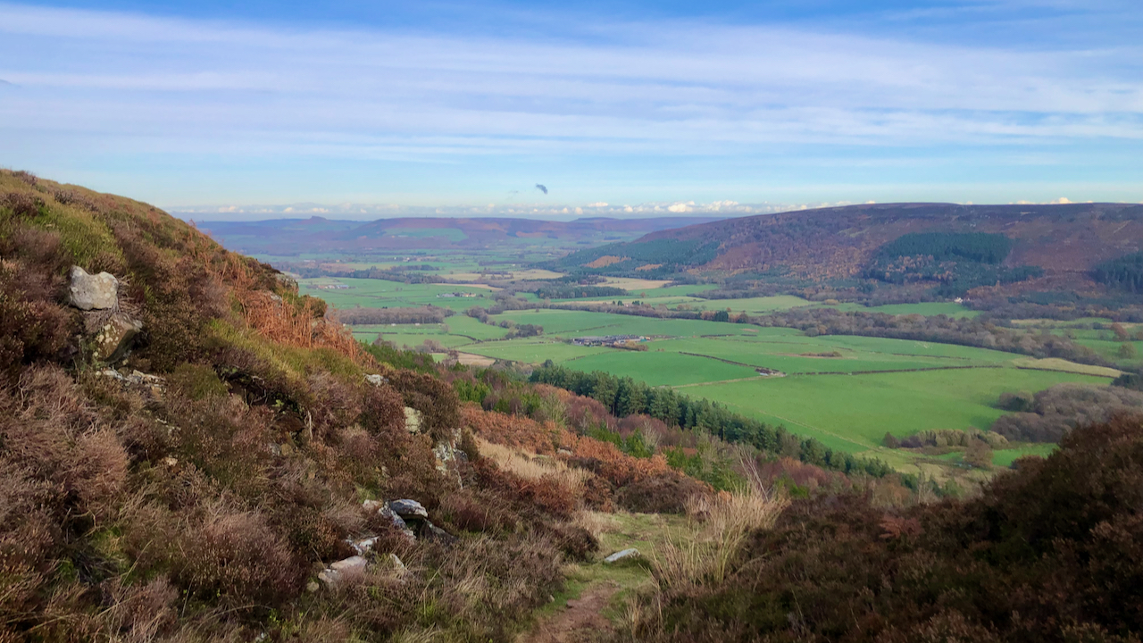
This is looking down on Greenhow Bottom from the top of Jackson’s Bank.
I would love to find out who Jackson was. He is elusive but certainly lived before the first Ordnance Survey was published in 18571‘View Map: Yorkshire 43 (Includes: Bransdale; Farndale West Side; Ingleby Greenhow; Westerd… – Ordnance Survey Six-Inch England and Wales, 1842-1952’. 2022. Maps.nls.uk <https://maps.nls.uk/view/102344293#zoom=6&lat=4743&lon=5838&layers=BT> [accessed 21 November 2022].
Greenhow Bottom is a township in the parish of Ingleby Greenhow, but was probably ‘Camisedale‘ in the Domesday Book2Powell-Smith, Anna. 2022. ‘Camisedale | Domesday Book’, Opendomesday.org <https://opendomesday.org/place/NZ5806/camisedale/> [accessed 21 November 2022].
Jackson’s Bank has given its name to the Public Bridleway as it climbs the steep bank. It’s part of the medieval route from Battersby to Farndale recorded in many places by a stone flagged trod3North York Moors Historic Environment Record (HER) No: 5107..
Battersby and Farndale, two seemingly unimportant places.
Medieval Battersby comprised two manors, one belonging to the Eures of Ingleby4‘Parishes: Ingleby Greenhow | British History Online’. 2022. British-History.ac.uk <https://www.british-history.ac.uk/vch/yorks/north/vol2/pp243-249#p18> [accessed 21 November 2022] and the other to the Percys of Kildale5‘Parishes: Ingleby Greenhow | British History Online’. 2022. British-History.ac.uk <https://www.british-history.ac.uk/vch/yorks/north/vol2/pp243-249#p19> [accessed 21 November 2022]. There was a market in Kildale so I favour that this was the ultimate destination of the trod6“Historical Atlas of North Yorkshire.” Page 103. Edited by Robin A Butlin. Westbury Publishing. Reprinted 2004. ISBN 1 84103 023 6..
Farndale was part of the manor of Kirby Moorside of the de Stutevill family7‘Parishes: Lastingham | British History Online’. 2022. British-History.ac.uk <https://www.british-history.ac.uk/vch/yorks/north/vol1/pp524-529#p10> [accessed 21 November 2022]. Upon ascending Jackson’s Bank, our trod would have joined Haggersgate (a route from Stokesley via Clay Bank), and crossed Thurkilsti (Park Nab to Bransdale Ridge) and another route also from Park Nab heading south along Rudland Rigg.
A Medieval Piccadilly Circus.
These high moorland routes probably followed long established pre-historic routes. The ‘going’ along the ridges would have been easier, less wooded with a reduced risk of ambush, although they would of course have generally been unsurfaced. Where the route became particularly miry and founderous, a route may be paved with stone flags often paid for by the religious houses.
The principal traffic would have been pannier-trains of horses, but the Medieval traveller would also have encountered small two-wheeled carts called ‘coups‘ or ‘cowps‘ or four-wheeled ox-wagons; and maybe livestock being driven8“The North York Moors Landscape Heritage”. Page 188. Edited by D.A.Spratt and B.J.D.Harrison. David & Charles. 1989. ISBN 0 7153 93472..
Wool would have been a major trade item. It is estimated that 70,000 fleeces were produced annually on the North York Moors9Ibid. Page 186..
- 1‘View Map: Yorkshire 43 (Includes: Bransdale; Farndale West Side; Ingleby Greenhow; Westerd… – Ordnance Survey Six-Inch England and Wales, 1842-1952’. 2022. Maps.nls.uk <https://maps.nls.uk/view/102344293#zoom=6&lat=4743&lon=5838&layers=BT> [accessed 21 November 2022]
- 2Powell-Smith, Anna. 2022. ‘Camisedale | Domesday Book’, Opendomesday.org <https://opendomesday.org/place/NZ5806/camisedale/> [accessed 21 November 2022]
- 3North York Moors Historic Environment Record (HER) No: 5107.
- 4‘Parishes: Ingleby Greenhow | British History Online’. 2022. British-History.ac.uk <https://www.british-history.ac.uk/vch/yorks/north/vol2/pp243-249#p18> [accessed 21 November 2022]
- 5‘Parishes: Ingleby Greenhow | British History Online’. 2022. British-History.ac.uk <https://www.british-history.ac.uk/vch/yorks/north/vol2/pp243-249#p19> [accessed 21 November 2022]
- 6“Historical Atlas of North Yorkshire.” Page 103. Edited by Robin A Butlin. Westbury Publishing. Reprinted 2004. ISBN 1 84103 023 6.
- 7‘Parishes: Lastingham | British History Online’. 2022. British-History.ac.uk <https://www.british-history.ac.uk/vch/yorks/north/vol1/pp524-529#p10> [accessed 21 November 2022]
- 8“The North York Moors Landscape Heritage”. Page 188. Edited by D.A.Spratt and B.J.D.Harrison. David & Charles. 1989. ISBN 0 7153 93472.
- 9Ibid. Page 186.
Leave a Reply