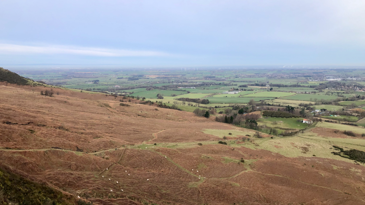
Once a scene of industry, with an ‘alum house’ believed to be on the grassy tract on the right near the patch of gorse![]() . The workings were higher up the bank, out of shot to the left, where the bridle way contours around the hillside
. The workings were higher up the bank, out of shot to the left, where the bridle way contours around the hillside![]() . A wooden channel is thought to have carried the liquor down to the alum house after steeping. I don’t think there is any extant evidence of this industry.
. A wooden channel is thought to have carried the liquor down to the alum house after steeping. I don’t think there is any extant evidence of this industry.
The little white cottage on the right is part of the Toft Hill scout camp![]() although the small gorse covered knoll behind it is called Ricey Hill1Maps.nls.uk. (2022). View map: Yorkshire 42 (includes: Bilsdale Midcable; Carlton; Faceby; Little Busby; Whorlt… – Ordnance Survey Six-inch England and Wales, 1842-1952. [online] Available at: https://maps.nls.uk/view/102344290#zoom=7&lat=6688&lon=13204&layers=BT [Accessed 15 Mar. 2022]..
although the small gorse covered knoll behind it is called Ricey Hill1Maps.nls.uk. (2022). View map: Yorkshire 42 (includes: Bilsdale Midcable; Carlton; Faceby; Little Busby; Whorlt… – Ordnance Survey Six-inch England and Wales, 1842-1952. [online] Available at: https://maps.nls.uk/view/102344290#zoom=7&lat=6688&lon=13204&layers=BT [Accessed 15 Mar. 2022]..
It was built sometime in the late-19th-century as a farmhouse by the name of Warren House. At the turn of the 20th-century, Alonzo Barker was living there with his family. He was a postman. The last residents were John and Francis Alder who left in 1945 when the house still had no mains water or electricity2‘Kirby Bank Heritage Trail”. Kirby, Great Broughton & Ingleby Greenhow Local History Group. 2016. .
- 1Maps.nls.uk. (2022). View map: Yorkshire 42 (includes: Bilsdale Midcable; Carlton; Faceby; Little Busby; Whorlt… – Ordnance Survey Six-inch England and Wales, 1842-1952. [online] Available at: https://maps.nls.uk/view/102344290#zoom=7&lat=6688&lon=13204&layers=BT [Accessed 15 Mar. 2022].
- 2‘Kirby Bank Heritage Trail”. Kirby, Great Broughton & Ingleby Greenhow Local History Group. 2016.
Leave a Reply