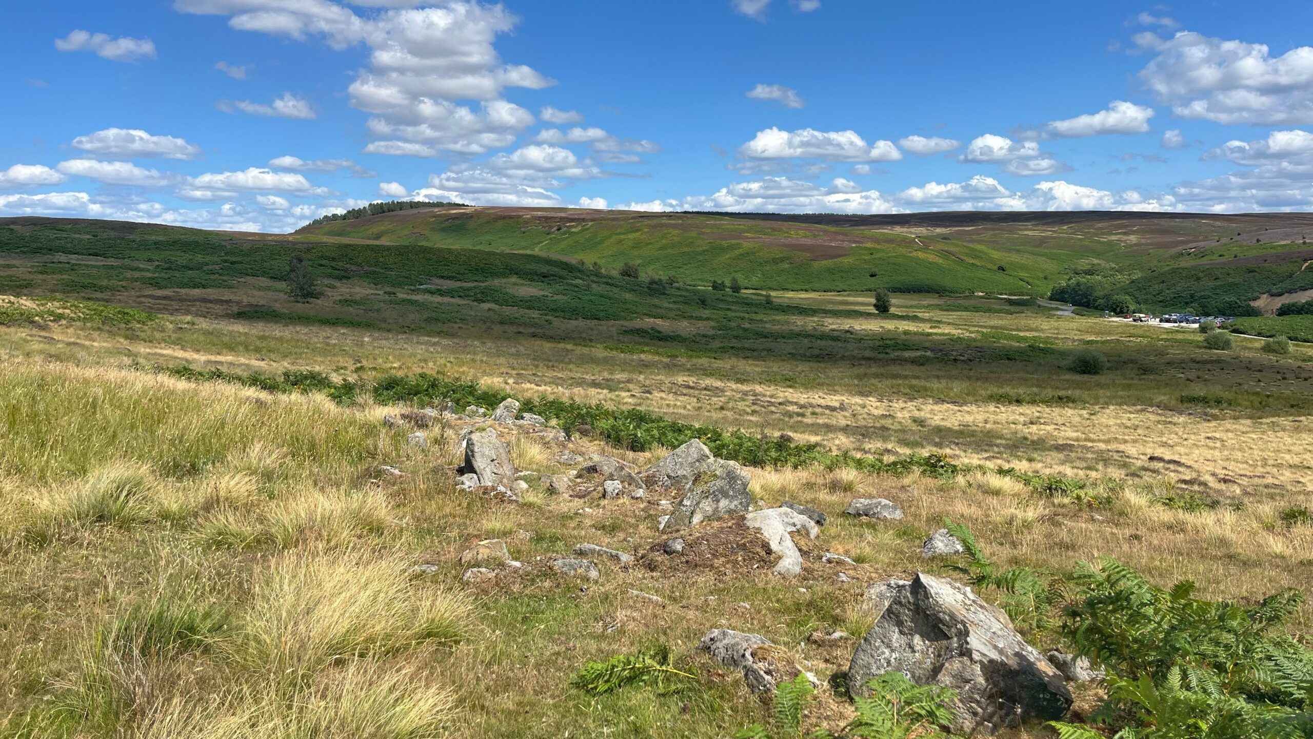
Scarth Wood Moor looks like empty, timeless terrain, but under the heather sits what used to be a busy Bronze Age settlement. This worn line of boulders belongs to an orthostatic wall, which is a fancy way of saying a prehistoric boundary made from big standing stones placed at even gaps.
Frank Elgee first noted it in 1935, and back then it was thought to be a scrap of wall just 82 metres long. Since then, half a metre or so of soil has washed away, and a local archaeologist has done careful work on the site. Between the two, we now know the wall runs for more than 800 metres, down the hillside and pushing into boggy ground as a double row of stones.
Given the size of it, you would think it was built to keep people, or animals, out. Experts reckon otherwise, and the evidence backs them up.
- The ditch sits on the uphill side, which is no use at all against anyone attacking from below.
- Boundaries from this period round here tend to have gaps built into them on purpose, so they were never going to hold anyone back.
- No one has found any sign of protected homes inside the wall’s boundary.
So this huge undertaking, which must have taken hundreds of man-hours to complete, was probably never about defence at all. It marked out land, most likely for social or religious reasons, for the people living there four thousand years ago.
Sources
- Thorniley-Walker, Jane, and Robert Thorniley-Walker. “Sheepwash in the Bronze Age.” Osmotherley Messenger, issue 100, 2012, https://www.osmotherley.org.uk/wp-content/uploads/2012/02/issue-100-insert.pdf.
- Thorniley-Walker, Robert. Guided walk on Scarthwood Moor held as part of the Festival of Archaeology for the Council for British Archaeology, 1 Aug. 2021.
- Vyner, Blaise. “Cross-Ridge Boundaries on the Cleveland Hills.” Voice of the Moors, issue 142, Winter 2020, pp. 12-13.
- “Two round barrows on Scarth Wood Moor, Whorlton.” Official List Entry, Historic England, https://historicengland.org.uk/listing/the-list/list-entry/1018949.
Leave a Reply