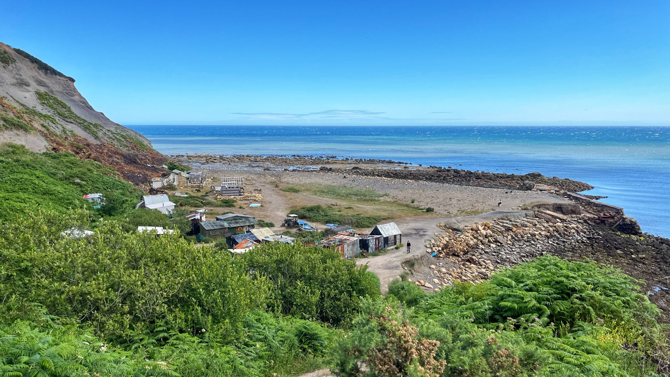
The National Park has put in new wooden steps down to Port Mulgrave, and for once a public body has done something rather useful. The path gets you most of the way from the cliff top to the scatter of huts below, clustered round what is left of the harbour. Walk it and you get some sense of what the old quay workers faced every single day, lugging themselves down to the cranes and gantries and tips. Typically, though, the path upgrade gives up before the job is done. The last stretch is left to fend for itself, and the timber treads are already looking worse for wear. Nothing changes.
I call them fishermen’s huts out of habit rather than accuracy. Hardly anyone fishes from here now. Walter Walker winched his home-built boat, the Steelaway, down the cliff in the mid 1990s, and that was likely one of the last boats ever to leave Port Mulgrave harbour under its own steam.1Port Mulgrave. Out & About. http://www.fhithich.uk/2021/12/19/port-mulgrave-2/
There is a forlorn feel to the place, but not an unpleasant one. Quite the opposite, really. The light on those rough timber doors, the rust on the corrugated iron, the peeling paint on patched-up roofs — there is something in a good bit of decay that suits the English coast down to the ground.
Not every shed has given up the fight, mind. A few have gone full “Grand Designs”, solar panels and CCTV and all. One is halfway through growing a second floor, though I am told it comes with a Cease and Desist order attached, which rather takes the shine off.
That raises a fair question: who gave anyone permission to build these in the first place? No rent changes hands, as far as I can tell, which makes the lot of them squatters in all but name. The cliff down to Mean High Water belongs to the National Trust. Below that line, the foreshore belongs to the Crown. Neat enough on paper.
Except nobody can quite agree where Mean High Water actually sits, and the Ordnance Survey map is not the last word on it either.
The harbour itself silted up badly towards the end of the last century, worse with every tide by some accounts. One report from 1996 put the silt at twenty feet deep, which is not a small amount of mud. A scheme to clear it using unemployed labour was backed by the National Park, the Countryside Commission, and the Crown Commissioners — and then, in the way of these things, it never actually started.2Port loses in its sea battle. Whitby Gazette. 16 February 1996.https://www.britishnewspaperarchive.co.uk/viewer/bl/0001103/19960216/073/0009
It cannot have helped that part of the old harbour wall, built during the iron ore mining boom, was blown up in the Second World War to stop it being used by an invading force. Once you dynamite your own defences against progress, silt rather has the upper hand.
Even so, England flags still fly over the whole lot — the shacks, the rusting tractors, the odd abandoned hulk — flying in the face of the tide with the sort of stubbornness this country does rather well.
- 1Port Mulgrave. Out & About. http://www.fhithich.uk/2021/12/19/port-mulgrave-2/
- 2Port loses in its sea battle. Whitby Gazette. 16 February 1996.https://www.britishnewspaperarchive.co.uk/viewer/bl/0001103/19960216/073/0009
Leave a Reply