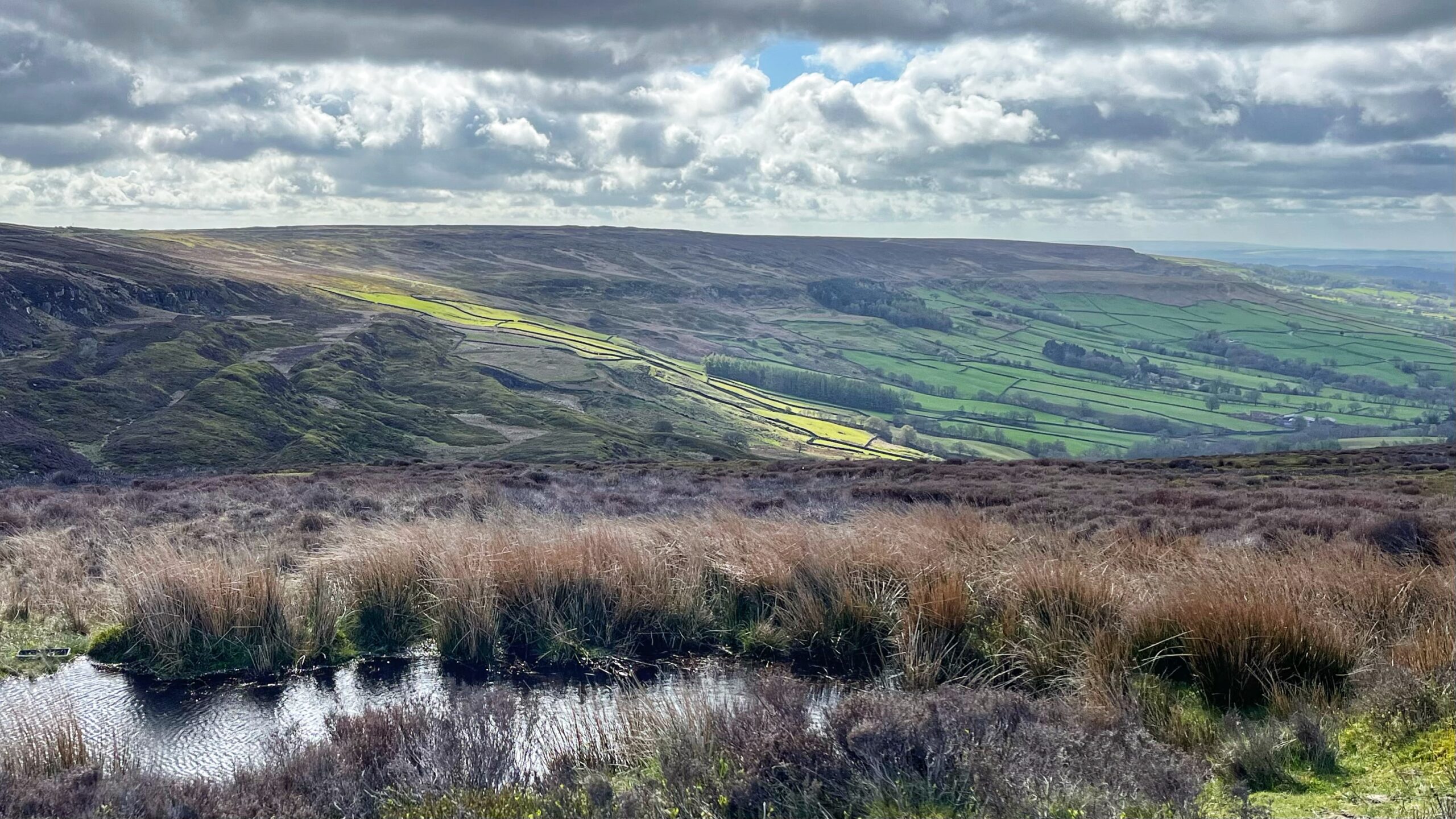
A shaft of sunlight illuminates the bright green fields of Farndale, seen from the old ironstone railway line on High Blakey Moor. Brown rushes surround a small peaty pool in the foreground. Dark drystone walls cascade down the hillside beneath a wide, cloud-filled sky.
The view tells a story in two colours. Up here: the browns of open heather moorland. Down there: a patchwork of vivid green fields, stitched together by drystone walls. The line between them is not accidental. It is the result of centuries of hard work.
Those bright green fields have a name. They are ‘intakes’ — parcels of land literally “taken in” from the moorland edge and brought under cultivation, mostly for stock grazing. Farmers built the drystone walls from whatever stone lay about, carving small enclosed fields out of the wild. The work began in medieval times and continued well into the 19th century. A typical intake covers around 12 hectares. The word is used almost exclusively in the north of England, and you will sometimes see it spelt ‘intack’, or hear the land called ‘Unthank’.
Below the intakes, closer to the farmstead, lies the ‘inbye’. This is the best ground on any upland farm — more sheltered, more fertile, used for hay and silage in summer and for winter grazing when the higher ground becomes too harsh for livestock.
Together, intake and inbye tell the story of a landscape shaped not by nature alone, but by generations of farmers pushing the boundary between the wild and the tamed — one drystone wall at a time.1North. 2016. ‘A to Z: A Jumble of Is, Js and Ks’, The Official Blog for the North York Moors National Park <https://northyorkmoorsnationalpark.wordpress.com/2016/09/13/a-to-z-a-jumble-of-is-js-and-ks/> [accessed 5 March 2020]2Intake (land). https://en.wikipedia.org/wiki/Intake_(land) [Accessed 19 April 2026]
How much further up the hillside might that boundary yet move — or could it one day move back the other way?
- 1North. 2016. ‘A to Z: A Jumble of Is, Js and Ks’, The Official Blog for the North York Moors National Park <https://northyorkmoorsnationalpark.wordpress.com/2016/09/13/a-to-z-a-jumble-of-is-js-and-ks/> [accessed 5 March 2020]
- 2Intake (land). https://en.wikipedia.org/wiki/Intake_(land) [Accessed 19 April 2026]
Leave a Reply