Repairs to fencing offered a rare glimpse into a part of Bransdale not open to the public.
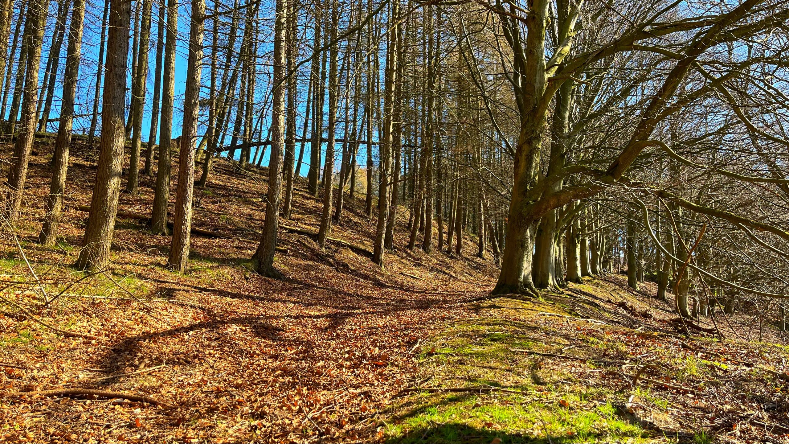
The photograph shows Hall Plantation, where a line of beech trees accentuates what is clearly an old trackway, its course still visible beneath a deep carpet of last year’s leaves.
The track has been sitting quietly here since at least the 1850s, when the Duncombe family extensively remodelled Bransdale Lodge. Those renovations appear to have included the construction of a formal carriage drive from the Helmsley road and a new bridge over the Hodge Beck1National Trust Heritage Records Online. Track, SW of Bransdale Lodge, Cockayne, Bransdale. Record ID: 32629 / MNA146598. https://heritagerecords.nationaltrust.org.uk/HBSMR/MonRecord.aspx?uid=MNA1465982National Trust Heritage Records Online. Bransdale Lodge, Bransdale. Record ID: 31367 / MNA144862. https://heritagerecords.nationaltrust.org.uk/HBSMR/MonRecord.aspx?uid=MNA144862.
What you cannot easily see, but what is absolutely there, is the road itself. Erosion has revealed cobbles and stone beneath the leaves and moss. The aged beech trees grow on a low bank, half a metre high and a metre wide, and in one section the buried footings of a wall break the surface. The National Trust’s own records describe it as “a wide terraced track” — which is rather an understatement.
It would have formed the main road around the head of the valley, running from just east of the Hodge Beck bridge through the woods and around the front of Bransdale Lodge. It passed through what the records describe as “a well-engineered gate” before continuing as a three-metre-wide terrace across the Lodge lawns. Probing beneath the grass apparently still reveals a metalled surface underneath. Whether the hoi-polloi were allowed to use this road especially when Lord Feversham had one of his shooting parties is, sadly, not recorded.
The route appears on the Ordnance Survey six-inch map of 1857. By 1914, the OS map shows the final section already rerouted along what became the present drive, and the modern road at the bottom of Church Banks does not appear even on the 1958 map. The old road was quietly retired, but the beech trees stayed.
This track is not a Roman road, nor a Bronze Age drove road, nor a medieval pilgrim way. It is a Victorian track, at least 170 years old, built simply to provide a convenient approach to a shooting lodge. And yet it survives — terraced into the hillside, cobbled beneath the leaf litter, banked on its southern side — because the land remembered it long after the maps stopped bothering.
- 1National Trust Heritage Records Online. Track, SW of Bransdale Lodge, Cockayne, Bransdale. Record ID: 32629 / MNA146598. https://heritagerecords.nationaltrust.org.uk/HBSMR/MonRecord.aspx?uid=MNA146598
- 2National Trust Heritage Records Online. Bransdale Lodge, Bransdale. Record ID: 31367 / MNA144862. https://heritagerecords.nationaltrust.org.uk/HBSMR/MonRecord.aspx?uid=MNA144862
Leave a Reply