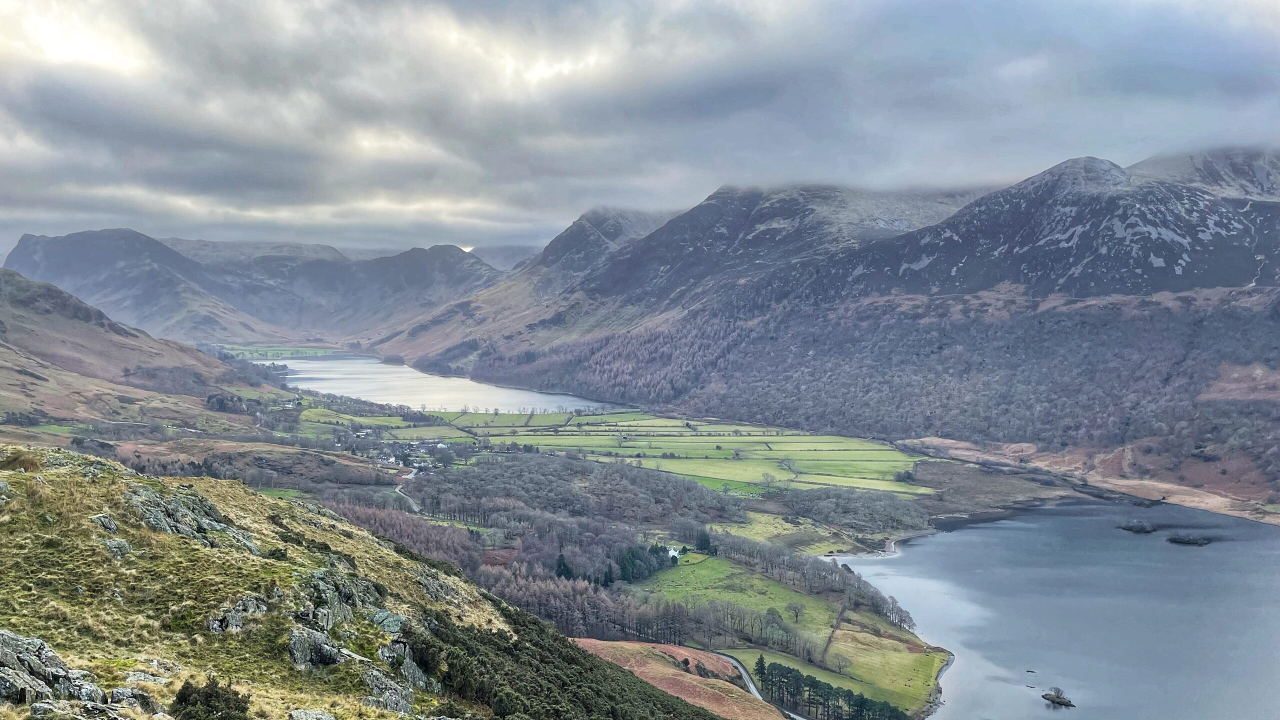
That flat sweep of rich green pasture is not there by chance. It sits on the land bridge between Buttermere and Crummock Water, quietly doing the job of keeping the two lakes apart. It was built by a geological feature known as a fan-delta, courtesy of the steady graft of Mill Beck.
Long before maps and walkers, Buttermere and Crummock Water were one and the same. In prehistoric times, a single large lake filled the valley. The two basins have been likened to Windermere, barely divided, with little more than a shallow bar and a few islands getting in the way.
Then Mill Beck got busy. Over time, it rewrote the landscape. Mill Beck is what Sail Beck is called once it reaches Buttermere village, at the spot where a horizontal click mill once stood until the mid-18th century1192 ART. XX.—Click Mill at Buttermere and Buttermere Notes. By NICHOLAS SIZE. Read at Carlisle, July 2nd, 1935. tcwaas_002_1936_vo136_0022.pdf. Interesting, but back to the point.
This land bridge is a textbook fan-delta, formed where a steep mountain stream runs straight into a lake. It has two parts. The upper section is an alluvial fan. The lower section is the delta itself, spreading out beneath the waterline.
What we see today is the end result. A flat, grassy stretch of land to the south and west of Buttermere village, neat as a bowling green.
Mill Beck worked like a patient builder with no deadline. Grain by grain, it tipped rock and soil into the heart of the old lake until a solid barrier emerged. In the end, one large lake became two, split cleanly by nothing more dramatic than persistence.
Source:
Wilson, Peter. Lake District Mountain Landforms. Page 151. Scotforth Books. 2010.
- 1192 ART. XX.—Click Mill at Buttermere and Buttermere Notes. By NICHOLAS SIZE. Read at Carlisle, July 2nd, 1935. tcwaas_002_1936_vo136_0022.pdf
Leave a Reply