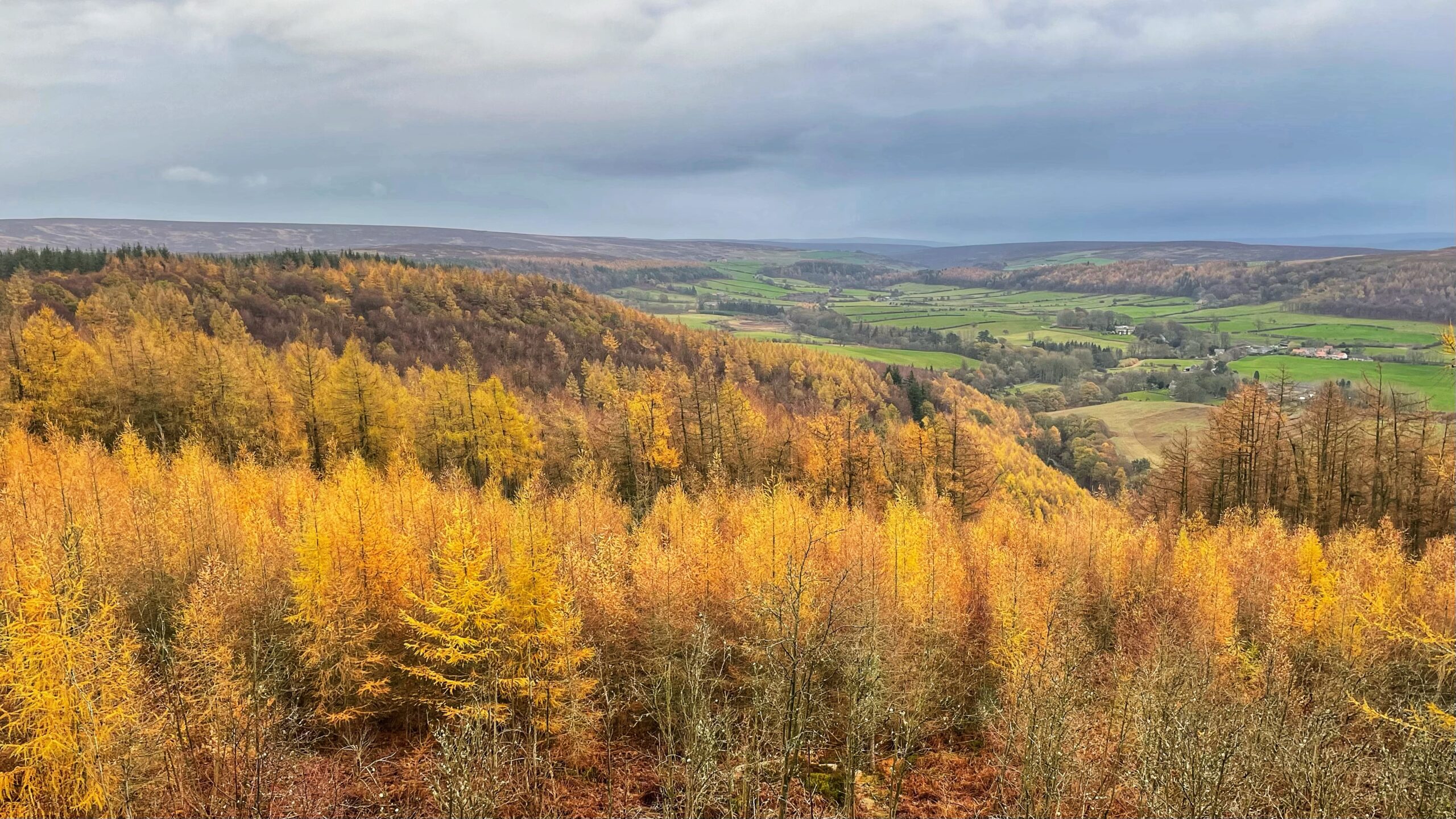
A view from the top of Coate Moor towards the head of Kildale, an obsequent valley biting back into the Cleveland escarpment. The glacial upheaval forced the River Leven to scour a narrow gorge through the shales and sandstones below Coate Moor. I have posted about this before1Out & About passim http://www.fhithich.uk/2025/05/07/the-terminal-moraine-at-kildale-elgee-revisited/.
But Kildale has another, somewhat obscure, point of interest. A map from 1612 still survives, one of the earliest for this part of Yorkshire, reveals a parish already edging its way into the age of improvement2Mitchell, Peter K. (1965) West Cleveland land use, circa 1550 to 1850, Durham theses, Durham University. Available at Durham E-Theses Online: http://etheses.dur.ac.uk/7973/. Enclosure had begun along the valley floor and the gentler slopes, but the walls of the gorge held out were just too steep. Coate Moor, held as common land within the lord’s own estate, fared little better. The soils were thin, the underlying iron pan unforgiving, and any farmer with sense would have thought twice before breaking his back for so little reward.
These moorland commons and wastes, including Coate Moor, remained untouched by enclosure until the sweeping Act of 1775. It was groundbreaking for the west of Cleveland, an ambitious attempt to bring order to a landscape that had long shrugged off human ambition, and it could only be carried out on such a large scale on the lord’s land, the demense.
Today’s photograph is dominated by ranks of larch, privately owned and marching across the slopes with all the subtlety of a regiment on parade. North of the Cleveland Way, Coate Moor has been leased to the Forestry Commission since 1950, a status that kept it outside the realm of open access under the CROW Act3Coate Moor Forest Plan. FP 32. 2023. Yorkshire Forest District. Forestry England. On this woodland to the south, in private hands, there is similarly no right to roam, leaving much of this old moorland as elusive as the ironstone workings beneath it.
- 1
- 2Mitchell, Peter K. (1965) West Cleveland land use, circa 1550 to 1850, Durham theses, Durham University. Available at Durham E-Theses Online: http://etheses.dur.ac.uk/7973/
- 3Coate Moor Forest Plan. FP 32. 2023. Yorkshire Forest District. Forestry England
Leave a Reply