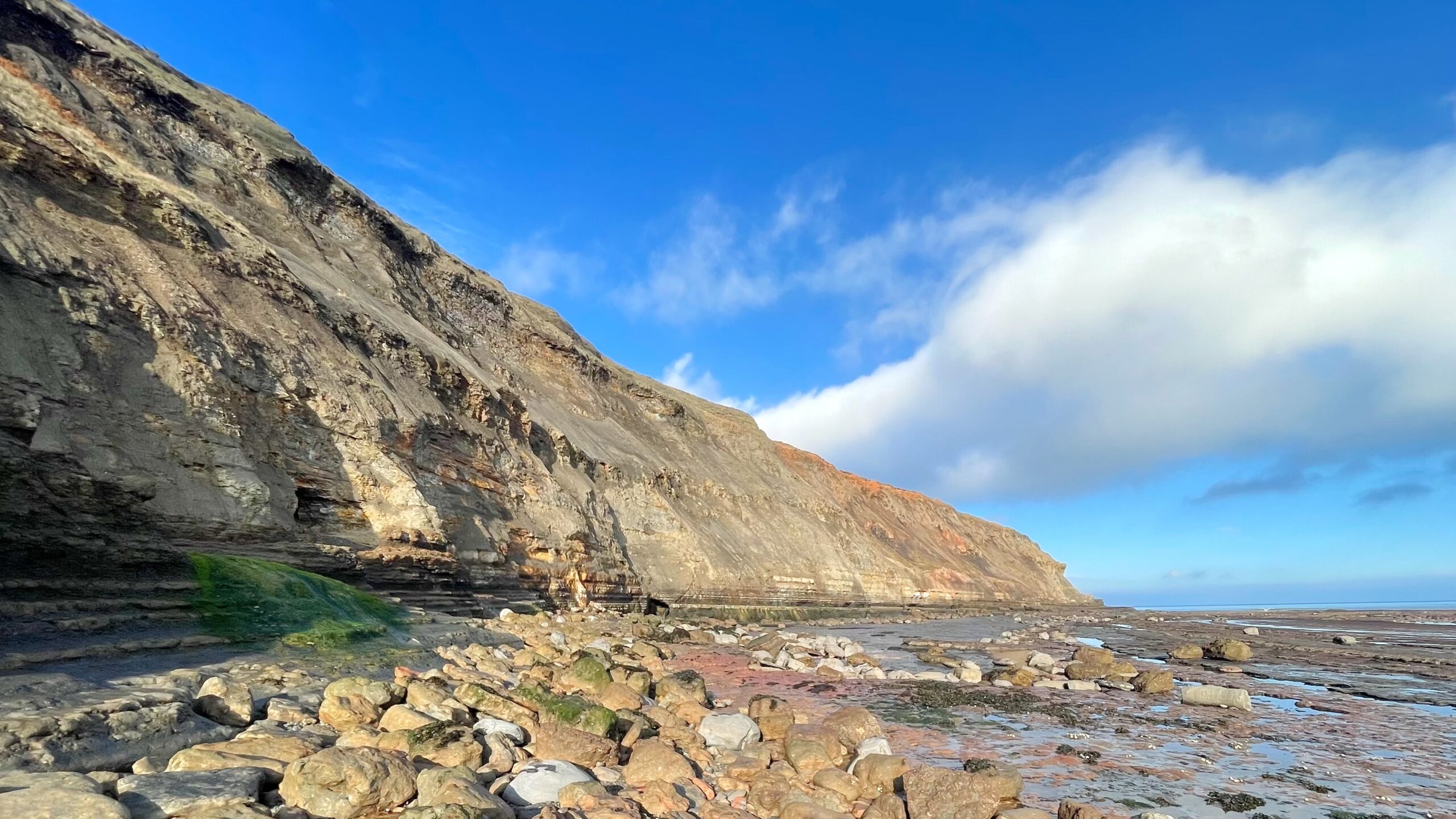
Only when the sea has receded at low tide can one safely pick a path along the foot of the cliffs at Brackenberry Wyke. Here lie the ghostly remains of the old ironstone workings, where men once hacked at the exposed seams before hauling their spoil through an adit to join the great warren of tunnels beneath Port Mulgrave. From there, the ore made its way to the harbour and the waiting ships that fed an empire’s hunger for iron.
In time, the miners turned their tools on the so-called Pecten Seam, with the Main Seam brooding just above it. Both beds sloped southward, vanishing beneath the shore, and today the scars of their labour are written into the cliffs—collapsed passages, fractured pillars, and half-devoured tunnels that the sea now reclaims with patient malice. From the Cleveland Way above, the scale of the devastation is clearer still, a reminder too of how much of the coastline has simply vanished in the past century and a half. Down on the shore, it is difficult to grasp that these workings stretched almost a kilometre inland, nearly as far as the A174, the seams twisting and dipping in strange, serpentine fashion as they go.
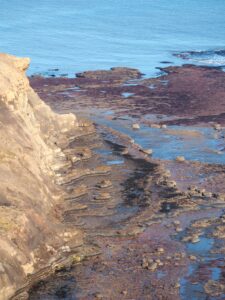
It was the upper block of the Main Seam that was once quarried on the exposed scar with particular zeal, leaving behind curious unworked fragments at both ends. Two seawards drainage cuts still survive—one of them a remarkable piece of Victorian ingenuity. Along its sides are twin grooves where planks could be slotted to hold back the tide, turning the quarry into a temporary fortress against the sea’s assault.
Higher up the cliff face, several collapsed adits gape like the mouths of forgotten beasts. The northernmost cuts into the Pecten Seam itself, with a narrow gully draining its flank. Below it, traces of a ramp and bridge suggest this was the path once taken by laden carts by which ironstone from the scar quarry was drawn into the Port Mulgrave mine, vanishing underground before emerging again at the harbour.
It is hard to picture the lives of the men who worked here, bound to the rhythm of the tides. For perhaps an hour either side of low water they quarried the exposed rock; then, when the sea returned, they descended into the adits to mine in the dry gloom. Their shift ended not with rest, but with a punishing walk—through dripping adits to Port Mulgrave and then up the steep cliff to their cottages above. Even today, with modern steps and a well-graded path, the ascent is enough to leave one breathless.
Sources
- Goldring, Denis. “Along the Scar”. published by Peter Tuffs 2001.
- Tuffs, Peter. “Catalogue of Cleveland Ironstone Mines”. Cleveland Ironstone Series 1996.
Leave a Reply