-

The Marwood family
A tranquil River Leven as it flows through Great Ayton below the stone bridge. The edifice on the left is the Marwood primary school which opened in 1851 when the Postgate school closed up the top end of the village. It was endowed by the Rev. George Marwood, a major landowner in the village whose…
-

I love it when I can get to somewhere new
Even to see a different view of a familiar place. This is Bloworth Slack, the easternmost fork of upper Bransdale. There is no peace and quiet though — contractors were felling the coniferous plantation on the left with their heavy machinery. Bransdale is perhaps the remotest dale in the North York Moors. It’s hard to…
-

The mysterious coffin of Stokesley Church
When the nave of Stokesley Church was restored in 1771, a coffin was unearthed and, as it was found broken, it was opened. It was completely empty; there was nothing inside except “sawdust and shavings“. The coffin was supposed to contain the mortal remains of “Elyzabeth Hornsby” as recorded in the parish register books: “Buryed…
-

Clither Beck
Ruined cottages at Clither Beck. In the distance is Clitherbeck Farm or ‘Doubting Castle’ as it used to be called. Why, oh why was it renamed? This valley was once the scene of extensive coal mining activity. The coal comprised two seams overall 38cm thick with 10cm of shale in the middle at a depth…
-
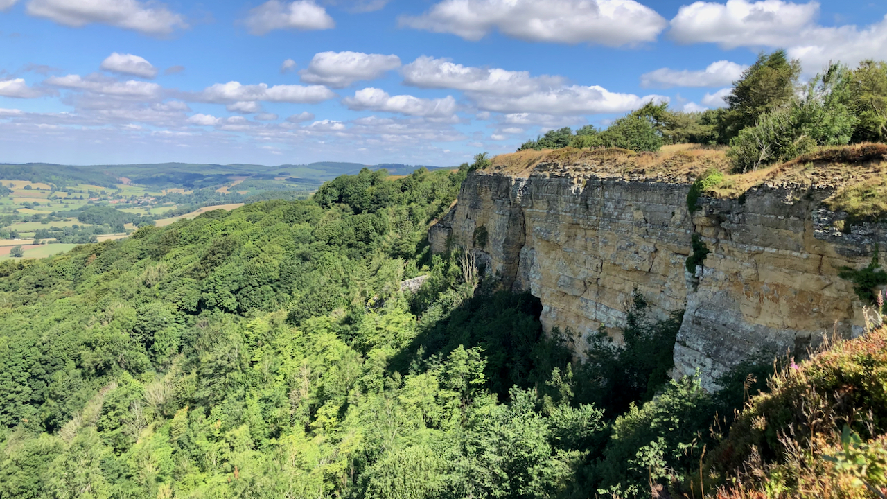
Whitestone Cliff or White Mare Crag
The pride of the Tabular Hills. Not really white, but a pale-buff-colouring. Comprised of limey sandstone and oolitic limestones, it’s alternative name is supposed to come from a tempermental thoroughbred racehorse which galloped from the training ground on the plateau and leapt down the crag with her rider. The rock looks friable and the base…
-
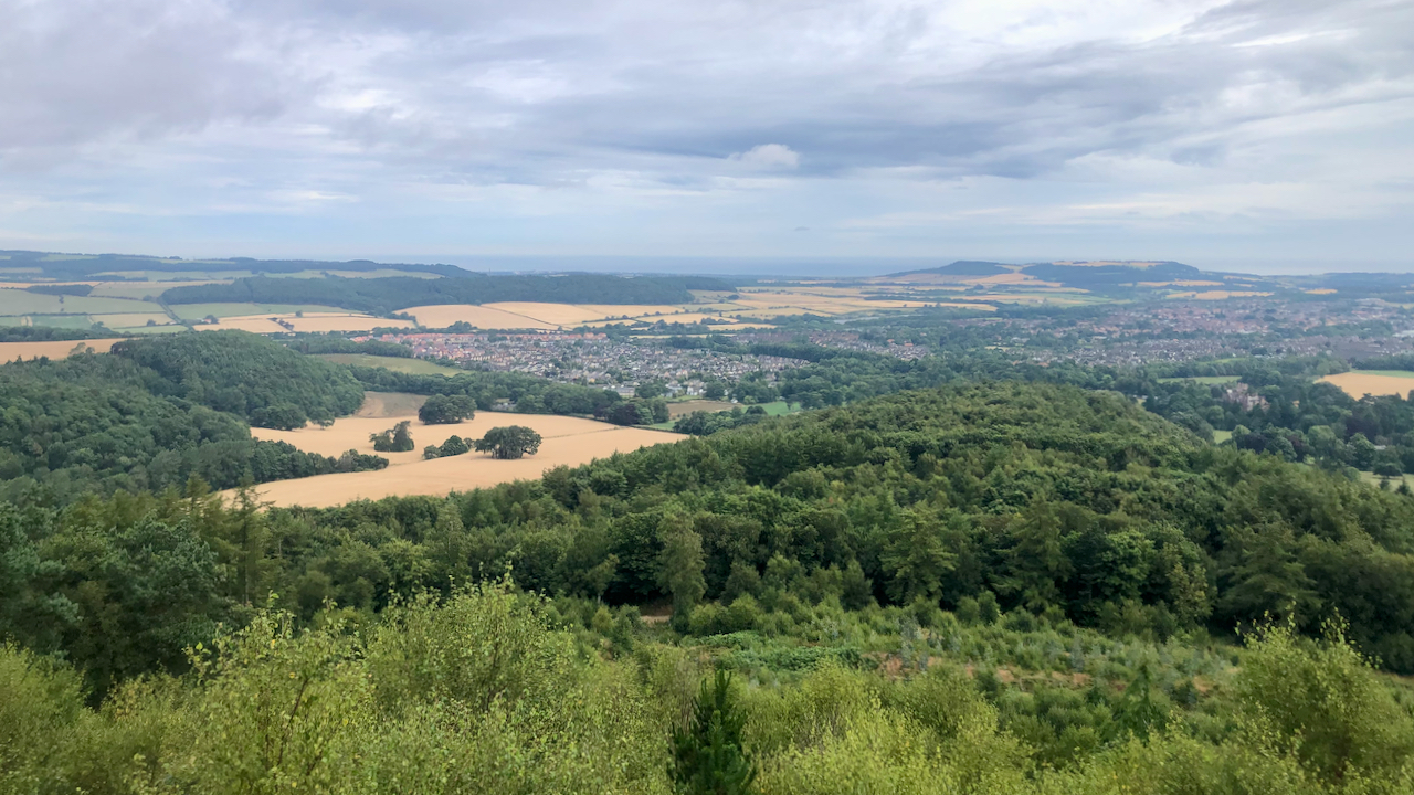
The Vale of Guisborough
In the 2011 census, the population of Guisborough was 16,979; way back in 1851 it was 2,062. The decade that followed saw the arrival of the railway and the rapid development in the ironstone industry. Although the railway was built initially to serve the needs of the Peases’ ironstone mine at Codhill, it also would…
-
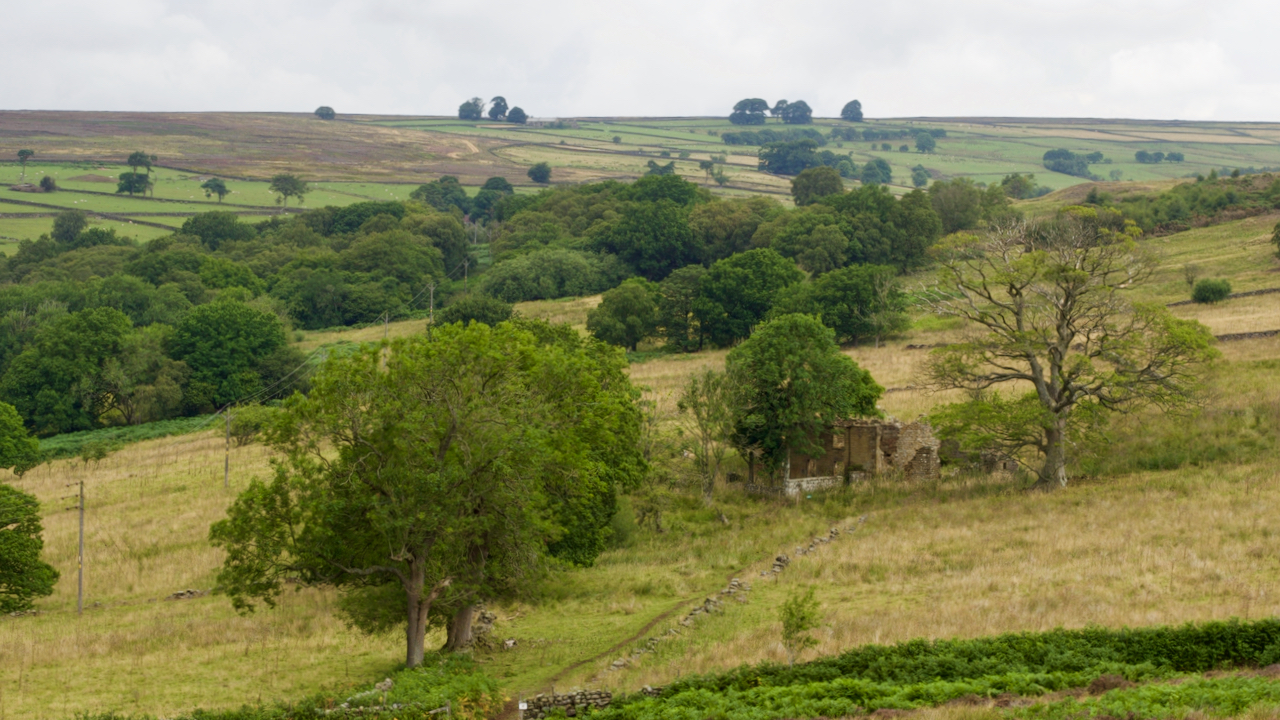
Ladhill Gill
Ladhill Beck separates the parish of Hawnby from Bilsdale Westside. The upper reaches have a desolate feel with forlorn farmsteads: Honey Hill, Sike House, Low and High Twaites, Hazelshaw House, Sod Hall, Weather House, and Bumper Castle. That’s Bumper Castle in the photo, right of centre. It seems to have grown more forlorn since the…
-

One of the few areas of natural moorland on the North York Moors
There are very few areas of relict semi-natural moorland to be found on the North York Moors which has not been extensively managed solely to maximise the grouse population. The National Trust’s Bridestones Moor is one such area and, visually, is currently at its best with the ling coming into bloom. Although the vegetation is…
-

Lower Lonsdale with Kildale beyond
Before the Norman Conquest Kildale was held by Orme, a thane of the king, who also seems to have been associated with Ormesby. When the church was rebuilt in 1868, several Scandinavian skeletons were discovered along with old swords, daggers. etc., all dating from the 9th-century. Perhaps one of these was Killi, from whom Kildale…
-

Roseberry Summit
A rather unusual view of the summit crag, the result of playing with a GoPro on a selfie-stick. The rock face is not as vertical as I remember but that may be due to an optical illusion due to the wide angle lens. The sandstone crag looks good but is considered unstable by the climbing fraternity.…
Care to comment?