-
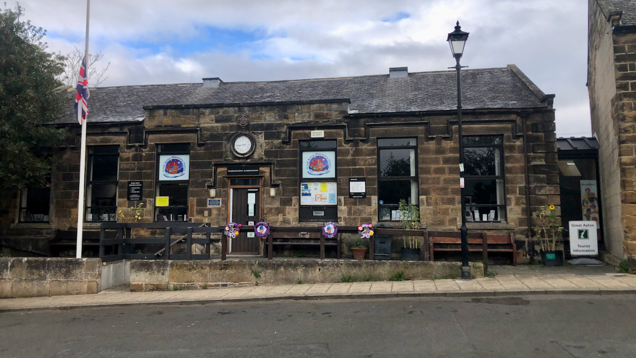
The British School
It’s rare to find a view in the village without parked cars. This is Great Ayton’s Discovery Centre, a community run library set up in 2013 if I recall, after the North Yorkshire County Council threatened the existing library with closure. The Union flag is at half-mast in respect of HM Queen Elizabeth II. The…
-

Flashback to 1948: ‘Yorkshire dale to begin new life’
Bransdale Eastside and the farmsteads of Smout House (formerly Loft House and now the National Trust’s office and stores), Toad Hole, and Cow Sike. I came across an interesting article in the Yorkshire Post dated 27 November 1948, which gives a very good insight of what life was like in Bransdale in the first half…
-

A view across Kildale to the side valley of Lonsdale.
In the right distance is ‘New Row’, a terrace of six single story cottages built by the Lonsdale Mining Company in 1865-7, and added to by six 2-story houses for the Whinstone miners. In front of New Row is the Kildale Sports Field, newly decked out for the forthcoming football season. In the late 1970s,…
-
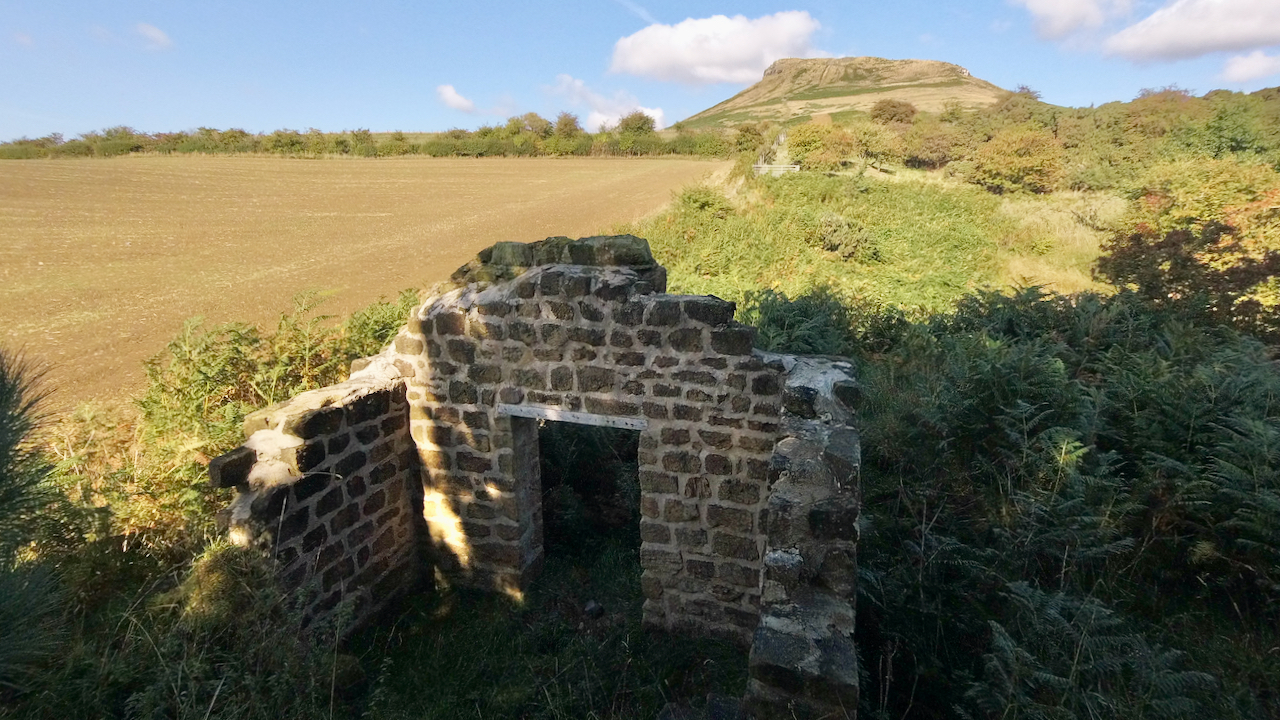
Powder House at Roseberry Mines
Had a wander down to the old Powder House to see how it’s faring. The pointing applied to conserve the gable wall facing Roseberry looks as though it’s doing its job. The rest of the stone walls, reduced to a few courses, are grassing over. The tramway down is a jungle of bracken. At this…
-
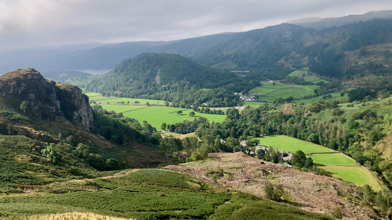
The Green, St. John’s in the Vale
Mondays have always brought on a state of dysphoria after the euphoria of a weekend away. I think another post of St. John’s in the Vale is justified — a day late but heigh ho. The photo is taken looking south from Lad Knott overlooking the hamlet of ‘The Green‘, which, legend has it, was…
-
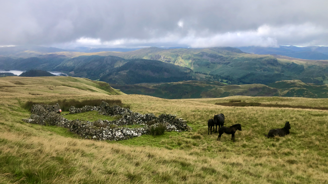
Who was Jim?
Jim’s Fold, on the Eastern Fells below Calfhow Pike and overlooking St. John’s in the Vale. This was used as checkpoint on this year’s Lake District Mountain Trial. Taken on Saturday, the day before the event, when the fold was occupied by two wild fell ponies and their foals. But the question remains — just…
-
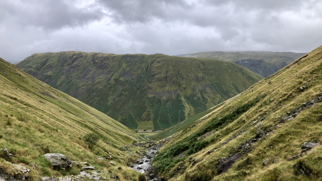
Dunmail Raise
A view down Raise Beck to Dunmail Raise.
-
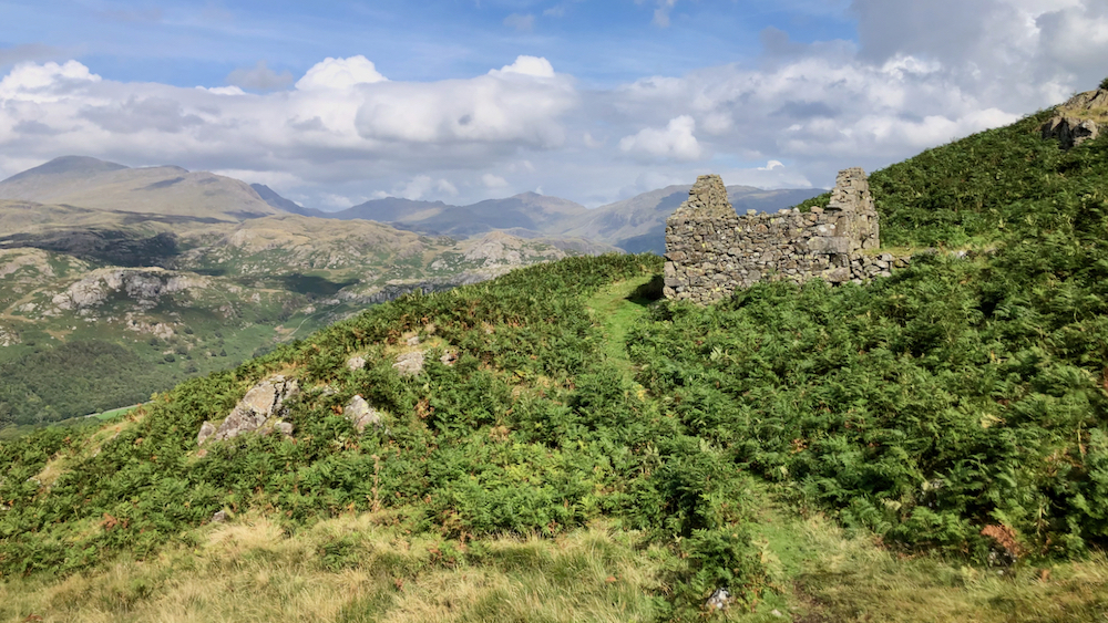
Peat storage hut, Birker Fell
I came across this ruin on the descent of Harter Fell. The Scafell range of fells provide a stunning backdrop. It is one of 35 huts that have been identified in the Eskdale area that were used for the storage of peat turves. Its date of construction is unclear, certainly post-medieval but it was still…
-
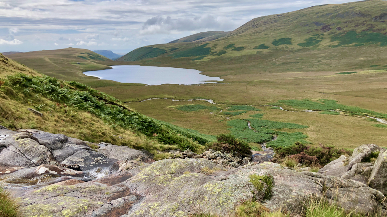
Burnmoor Tarn
Described by Coleridge as “flounder-shaped” with “it’s Tail towards Sca’ Fell, at its head a gap forming an inverted arch with Black Comb & a peep of the Sea seen thro’ it“. He was on his ascent of Scafell in 1802, and took the direct route from Burnmoor Tarn, so he could well have passed…
-
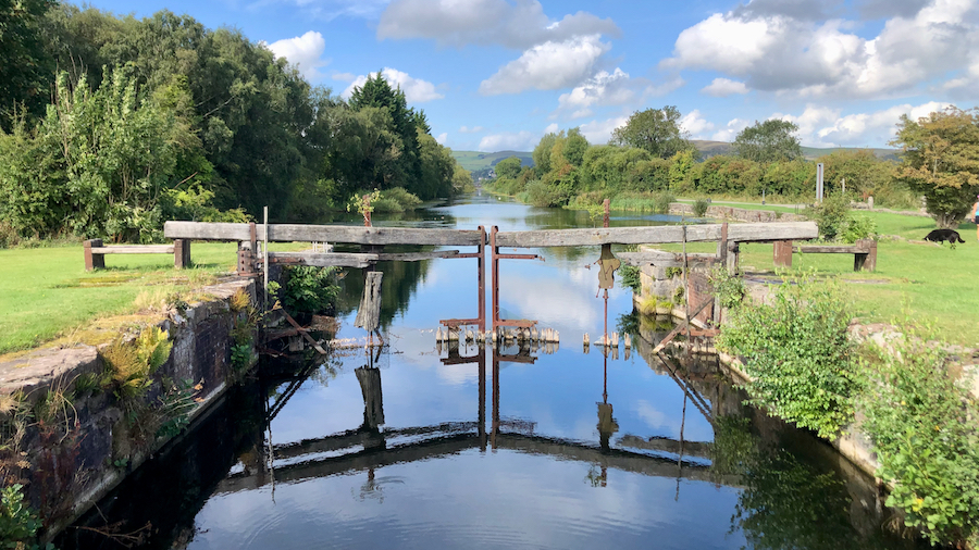
Ulverston Canal
I had it in mind to try to find the ‘Devil’s Chair’, a rock carved stone chair, on Hord Hill near Ulverston, and was intrigued to notice a canal from the town to the sea. A canal! In the Lakes! Perfectly straight, 1¼ miles long. It turned out to be a little gem, brimming with…
Care to comment?