-

Two villages: “Cherchbi” and “Broctune Magna”
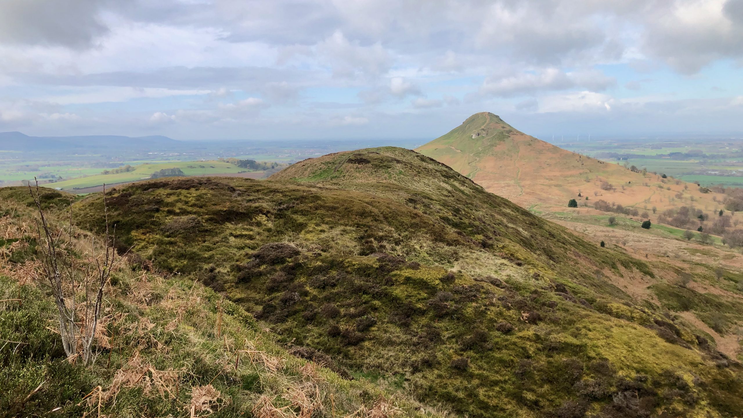
It’s been a windy day on Cringle Moor, but the sky has been clear. The moving clouds created a beautiful display of shadows over the vale of Cleveland. I could see below me the villages of Kirkby-in-Cleveland and Great Broughton, both of which were mentioned in the Domesday Book. Kirkby-in-Cleveland was referred to as “Cherchbi”…
-

The Rise and Fall of Alum Production in Great Ayton
As I descend from Capt. Cook’s Monument, approaching Gribdale Terrace, the former whinstone quarrymen’s cottages gleam white, with Cliff Rigg rising behind them. Before me, in the centre of the photo is a range of sandstone buildings mapped as Bank House Farm on the 1853 OS Six-inch map, but an auction advertisement in the Yorkshire…
-
W.T. Stead and the birth of tabloid journalism
On this day, April 10th, 1912, the luxurious liner Titanic embarked on its maiden voyage from Berth 44 at the White Star Line dock in Southampton, with the destination of New York. A total of 920 passengers were on board, comprising 179 First-Class, 247 Second-Class, and 494 Third-Class passengers. Among the First-Class passengers was William…
-
Nan Hardwicke — Witch or Hare? The Folklore of Cleveland
There are very few Cleveland villages which, at one time or another, one of the inhabitants had not been stigmatised as a witch. More often than not, it was some lonely old woman, past her childbearing age, probably widowed but more than likely without any degree of patriarchal protection. The most celebrated of these witches…
-
Old Byland, a pretty little village in the Tabular Hills
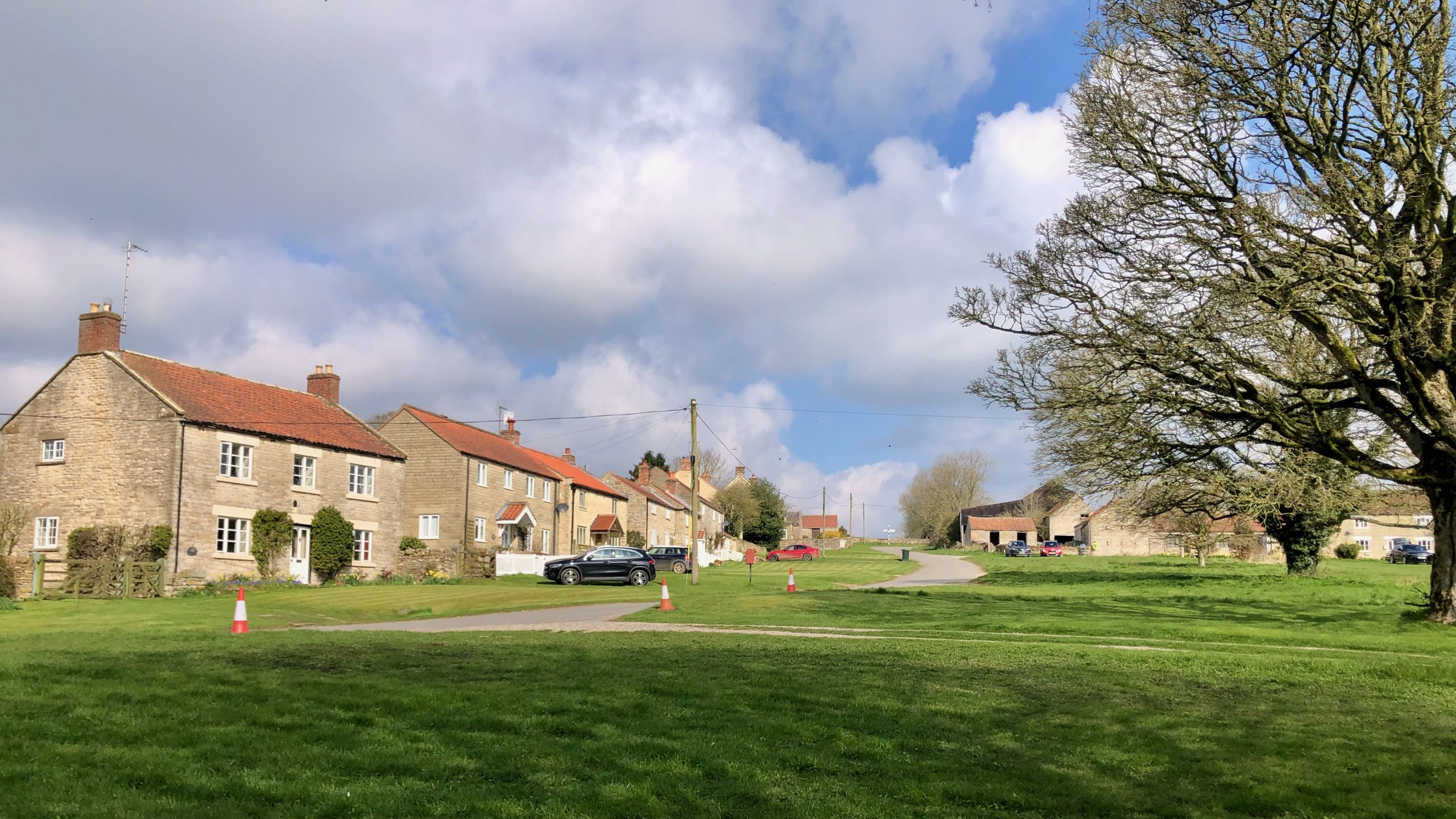
When you enter the village of Old Byland, you’ll be greeted by charming pale yellow-grey cottages made of ooidal limestone surrounding a spacious village green. Getting there is a bit of a journey — we climbed up the long, dry valley of High Gill. But the effort was worth it, as it felt like a…
-

Tussock-Skipping and Bog-Trotting — Adventures in Rivelindale
Today’s misadventure took me to a wide, flat valley flanked by low heather-clad moors. Sounds lovely, right? But Codhill Slack, or Rivelindale to use its Medieval name, has a bottom that is a boggy morass with plenty of standing water, thanks to yesterday’s heavy rain. In the distance are a couple of well-known landmarks. Highcliffe…
-

Cockayne — Bransdale’s ‘centre’
Bransdale is a peaceful community consisting of dispersed farmsteads that has remained seemingly unaltered throughout history. At one time, Eastside and Westside were two separate townships, each belonging to different parishes. Nonetheless, they were combined in 1873 to establish Bransdale-cum-Farndale. Bransdale differs from typical communities in that it lacks a central village. However, Cockayne, a…
-

Through Mist and Mud
Amidst the bleakness of a dreary day near the old site of Summerhill Farm, stand these lichen covered gate posts, a testament to times long gone. The muddy path between them is now only trod by sheep, and the ruinous dry stone wall adds to the sense of abandonment. Yet, in the midst of it…
-

The graceful and capricious roe deer
I’ve had many close encounters with roe deer over the years. Many times have I disturbed them on my woodland runs and walks, just catching a glimpse as their bouncing white rumps quickly disappeared through the trees. Occasionally I’ve been lucky to get a closer look when the breeze has been in the right direction…
-

The Shops and Businesses of Hutton Rudby — A Nostalgic Look Back
If you look at old black and white pictures of Cleveland villages and compare them to what they look like today, you can see that there’s a big difference in the amount of trees. It seems like people didn’t really like having trees around until later in the 18th century. Hutton was no exception. In…
Care to comment?