Tag: medieval
-
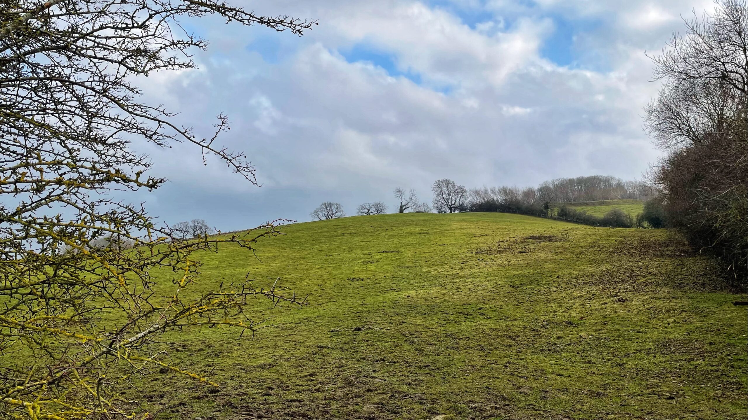
Tinghou: From Meeting Place to Housing Estate
Not the most flattering view for today, I will admit. A quiet field, currently earning its keep as horse pasture, pressed up against Lowcross Farm. I took the photograph for two reasons, neither of them aesthetic. First, for the record. This field sits under a planning application for a new estate of 117 houses. If…
-
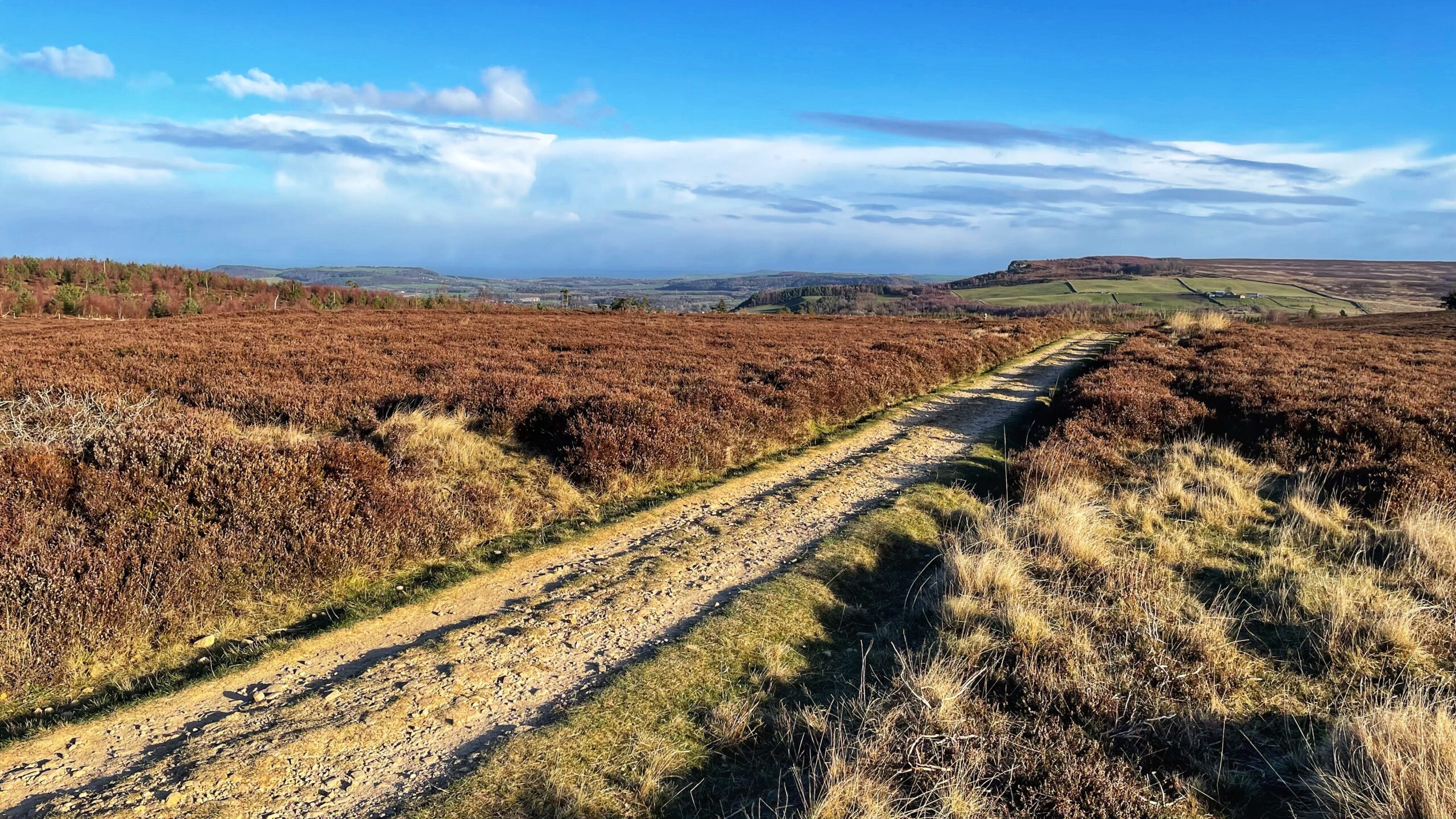
Grey Weather and Old Ways on Newton Moor
A crisp, delightful morning on Newton Moor, in spite of a forecast that promises trouble. A depression over the Baltic is dragging down sharp northerly winds. That slab of grey on the horizon looks close enough to touch, yet, if that is so, it will be hanging over Scandinavia. In the foreground runs a straight,…
-
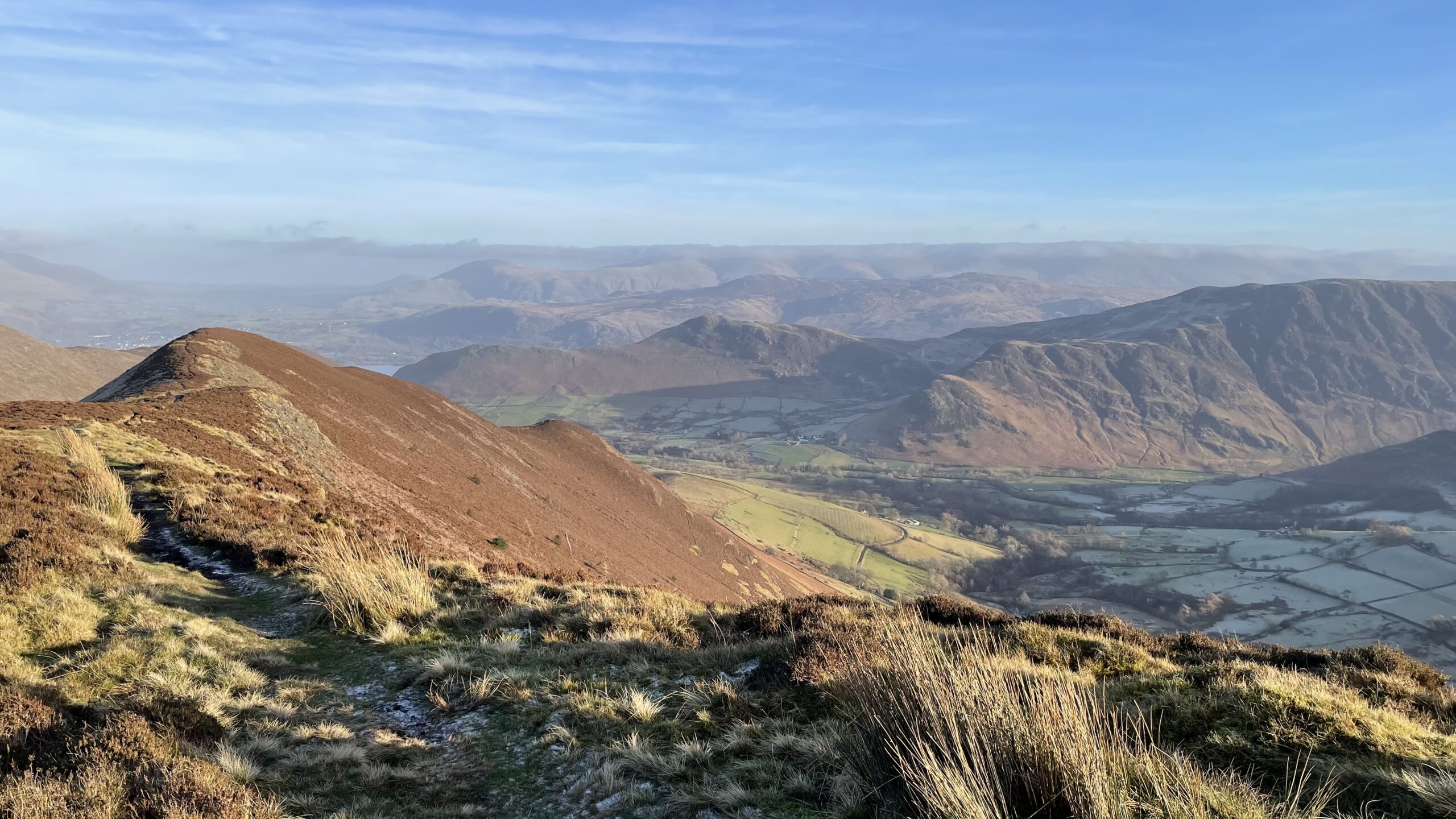
Aitkin Knott and Keskadale
A sweeping, high-angle view drops into Keskadale, better known as the Newlands Valley, seen from the brown, heathered spine of Ard Crags. At the end of the ridge sits the small knoll of Aitken Knott. Here Earl Ackin, a leading Norse-Cumbrian lord and brother of Earl Boethar, was buried, set high above the land where…
-
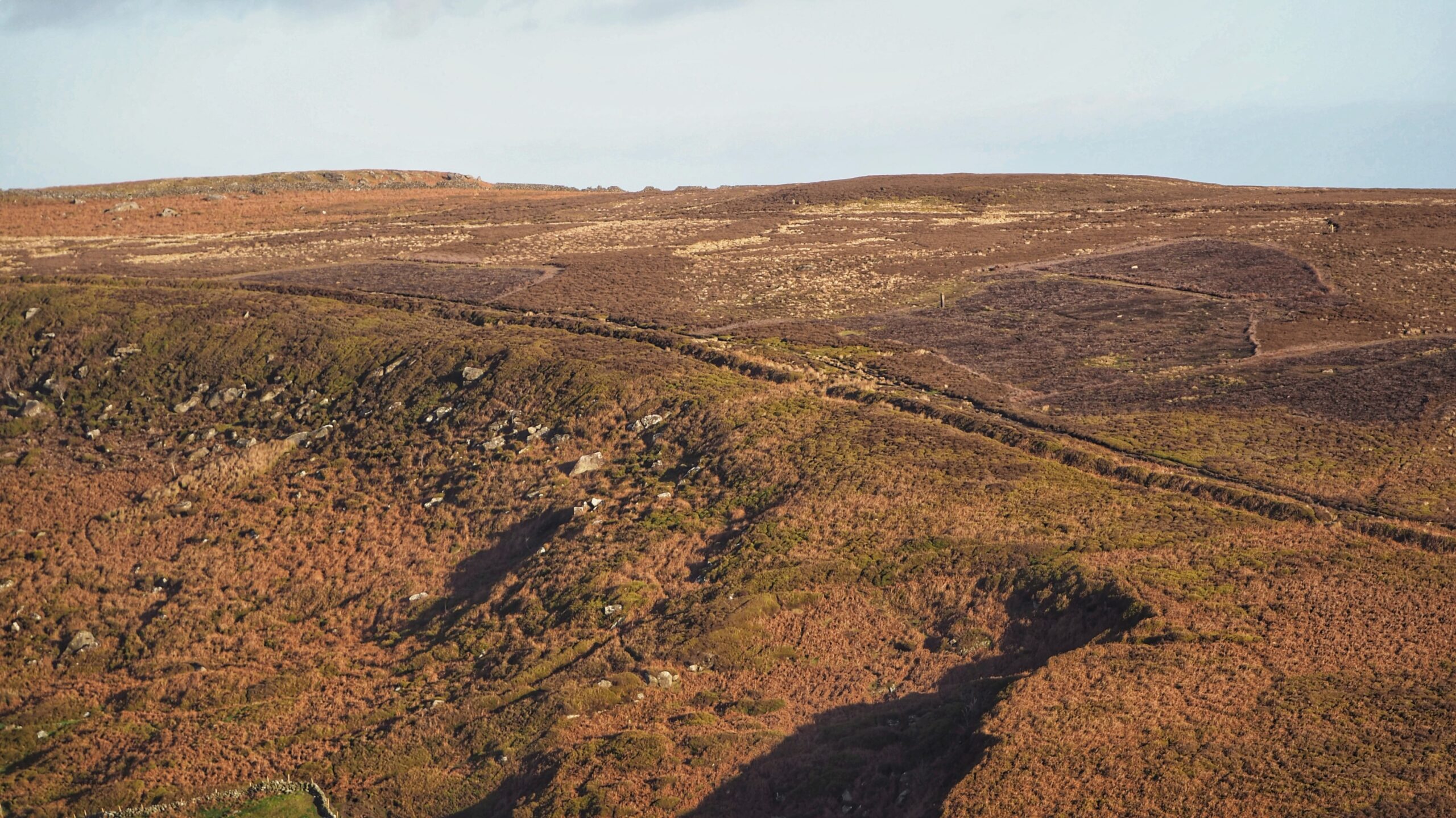
Billy’s Dyke on the High Moor
Just after the midwinter feast of 1070, William the Conqueror, fresh from Christmas in York, marched north to settle a score. His garrison at Durham had been slaughtered, and he meant to answer blood with fire. What followed was ruin on a grand scale. Villages, farms, whole stretches of countryside were wiped clean, with no…
-
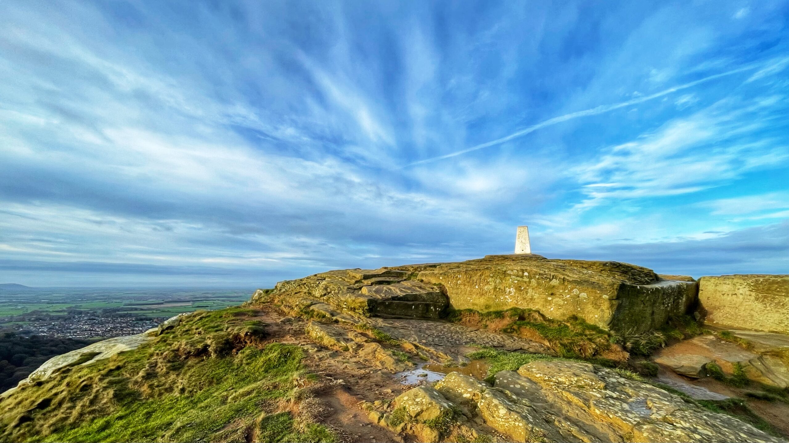
Before Satellites Spoilt the Fun: The Rise of Triangulation
Trig points cling to hilltops like relics from a time when humans trusted metal and masonry rather than shining toys orbiting the earth. This one on Roseberry’s summit keeps being repainted in traditional white, only to be graffited again by passing aritists who imagine posterity cares about their scribblings. With GPS now doing the clever…
-
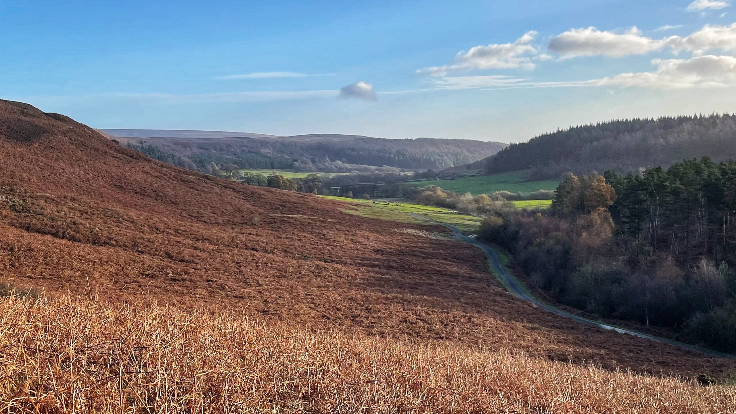
Winter Colour beyond Gribdale Gate
A photograph dominated by bracken in its dry, reddish-brown winter state. From Gribdale Gate, the narrow road winds down beside the beck which marks the parish boundary between Great Ayton and Kildale. In the shadowed south side of the dale, the conifers of Coate Moor plantation rule. This abundance of bracken across the northern slope…
-

The Tofts and the Wandels: Echoes of the Deserted Medieval Village of Danby
One of the most striking features of Danby Dale is its parish church, standing rather alone about three kilometres from the present village. Castleton and Ainthorpe sit a little closer, yet the church remains a solitary figure in the landscape. In the photograph, it can be seen just to the right of centre, north of…
-
Little Roseberry and an Echo of Old Norse
From this viewpoint on Ryston Bank the knoll of Little Roseberry takes on a presence rather more commanding than its shy appearance on the O.S. Map, where it is denied even a ring contour. If the name Roseberry grew out of “Othenesberg”, the Old Norse for Odin’s Hill, it seems a touch peculiar that its…
-

The Priory Gatehouse: Overshadowed but Not Forgotten
I had reason to visit Guisborough today and took the chance to walk around the old priory. I have posted before of its great east wall—impressive as it is, it remains only a fragment of what must once have been a formidable complex. The priory met its end in 1540 with the Dissolution. Ten years…
-

A Hidden Hollow-Way on Coleson Bank
This morning’s constitutional threw up a surprise. I have used the so-called ‘Green Lane’ on Coleson Bank before, climbing out of Battersby, and even posted about it. You can just make out a glimpse of it in the photo. But I do not go that way often. The narrow gulley attracts off-road motorbikes, which makes…