Tag: history
-
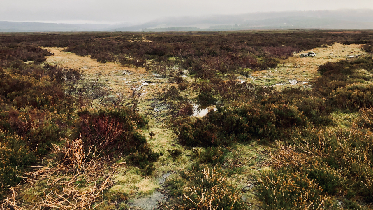
Moorland isosceles triangle
A strange feature to come across in the middle of a grouse moor. What appear to be two tracks, coming together at an angle of precisely 60°. The left hand track is about 27 yards long, and meets another track from the right. Again the angle is 60°. Once more, the left hand track is…
-
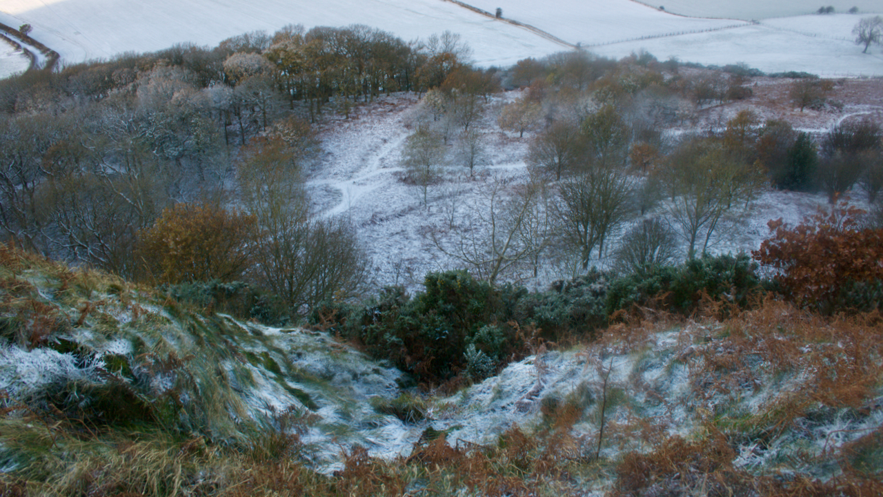
Cockle Scar
I’ve had my eye on this photo for some time, but either the view is dull looking from this way or very contrasty the other with Roseberry silhouetted. It’s taken looking down Cockle Scar, Roseberry’s steep skirt of Staithes Sandstone Formation on its western side. This morning, a sprinkling of overnight snow puts some depth…
-
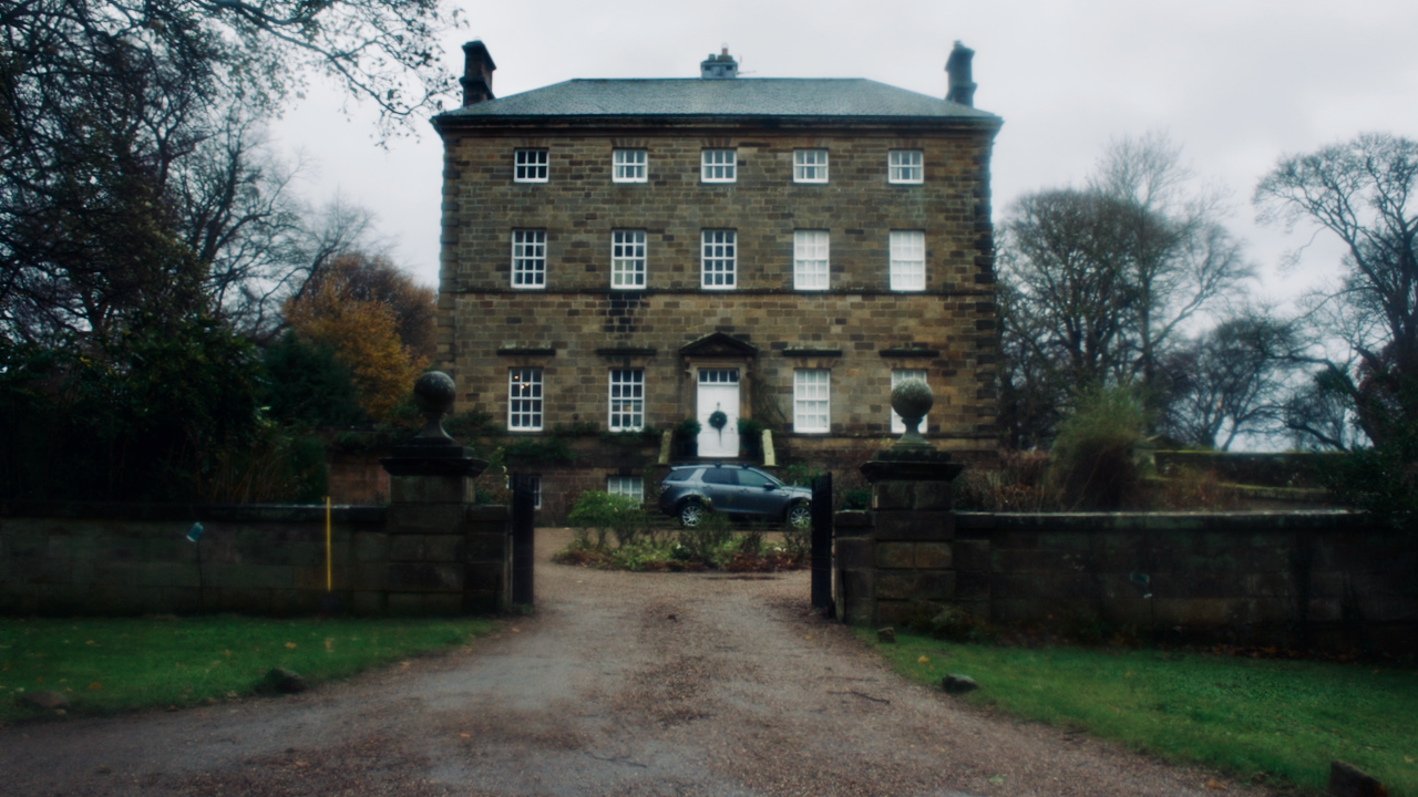
Arncliffe Hall
I’ve often passed by this place just after starting my walks or runs but the higher hills have always had the greater pull. From the grand titled tome “History and Topography of the City of York: And the North Riding of Yorkshire: Embracing a General Review of the Early History of Great Britain, and a…
-
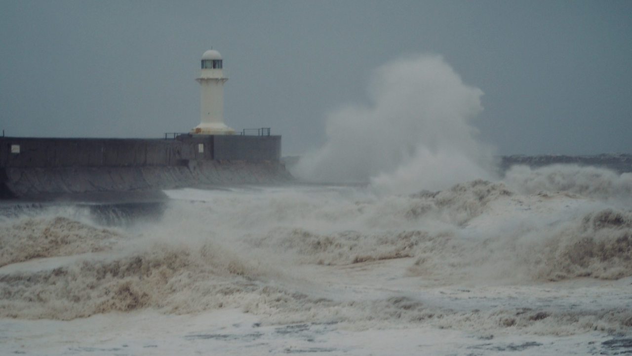
South Gare – Storm Arwen
Even though Storm Arwen was abating, a north wind of 66 mph was still forecasted. A good day for blowing the cobwebs away. And a high tide to boot. The South Gare breakwater, guarding the entrance to the River Tees, was completed in 1888 as one of a suite of projects to improve access to…
-
Bousdale Hill Farm
Early morning jog up Roseberry. The day before the storm — Arwen, I hear it’s been named — a character from Lord of the Rings? A farm had been established on Bousdale Hill, the long spur extending northwards by Roseberry Common, by 1868. Prior to this it would have been rough upland pasture. The farm…
-
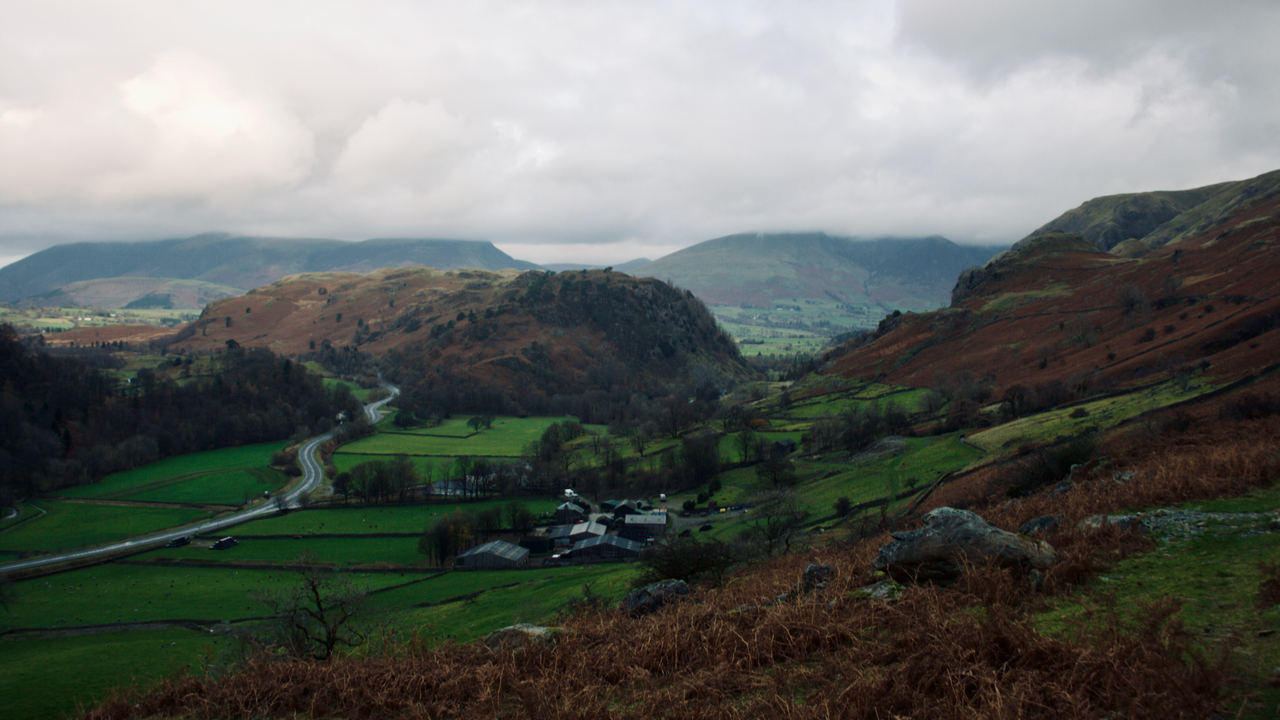
Stanah, St. John’s in the Vale and Thirlmere
A low walk before the rain set in. I’m not sure what to call this valley. Thirlmere, Thirlspot, St. John’s in the Vale? Helvellyn Gill flows down it before its confluence with St. John’s Beck, the natural outflow of Thirlmere, which lies in the Wythburn valley. It’s all very confusing, but maybe not if you’re…
-
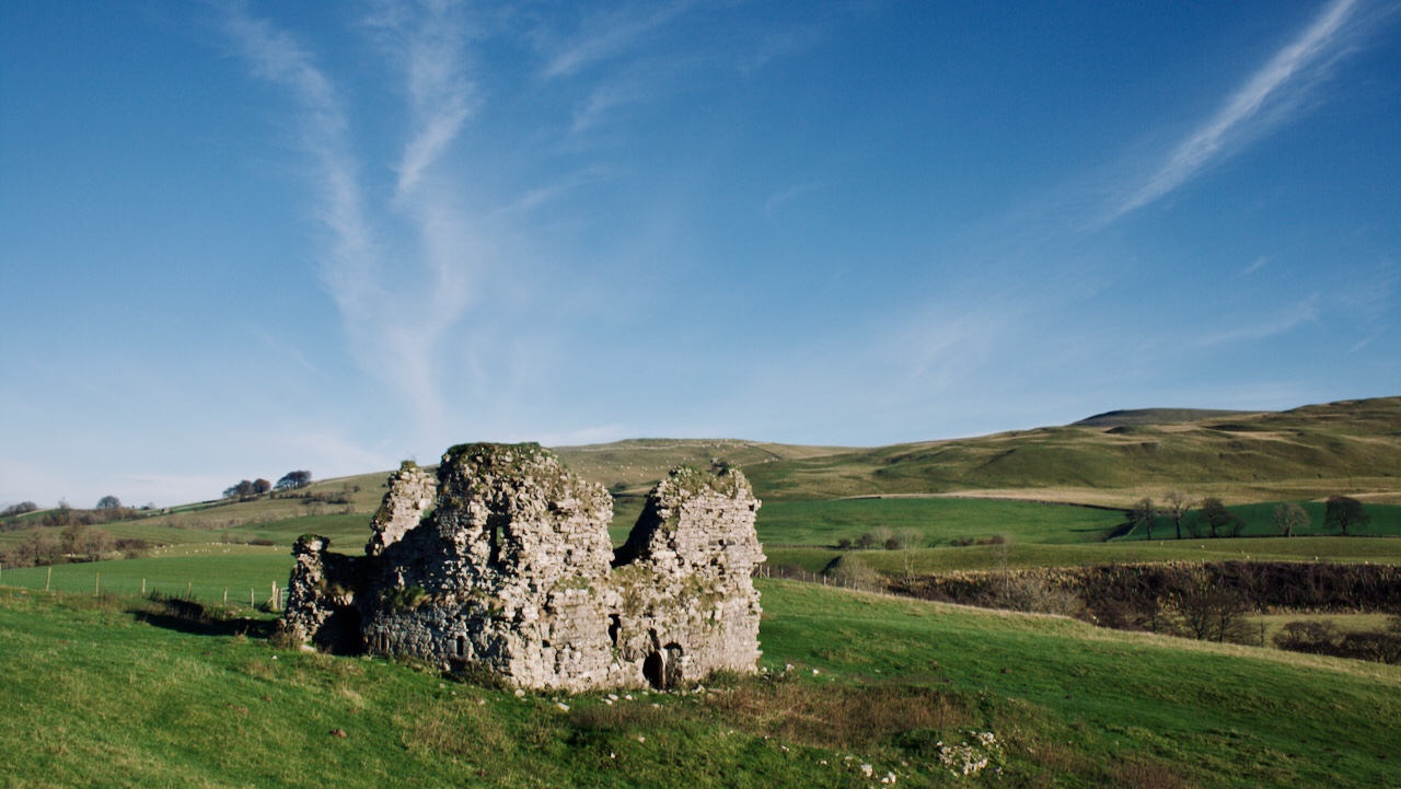
Lammerside Castle
In the Mallerstang valley overlooking the River Eden, the ruined Lammerside Castle dates from the 14th-century. It is a Peel-house, a fortified house built by a lesser landowner to protect his family, livestock, and retainers against predatory raids. Life in the Middles Ages was hazardous, particularly so in Northern England where a state of insecurity…
-
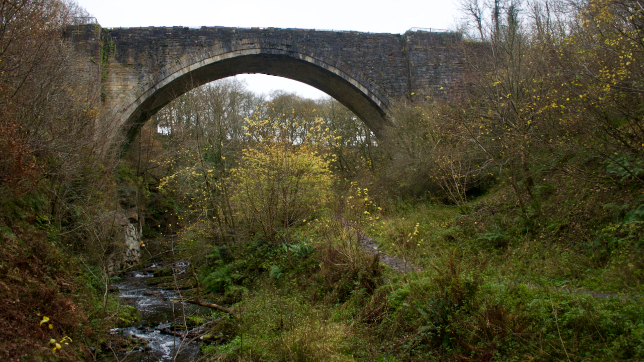
Causey Arch
Prior to the late 17th-century, transportation of materials across the country was slow and difficult. Either by horse drawn carts or teams of ponies. More forward thinking industrialists were developing wagon-ways, horse-drawn first with wooden rails and rollers, then with flanged iron wheels. In the 1720s, when coal-owners were considering exploiting the coal fields below…
-
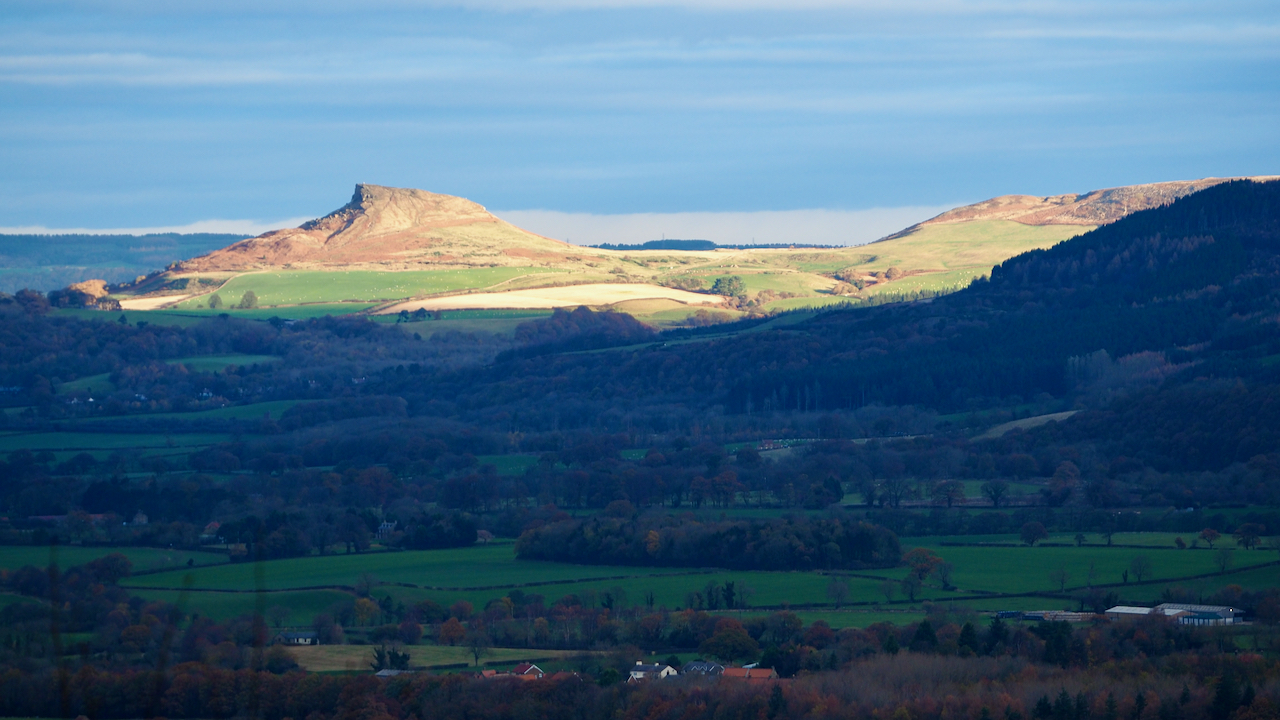
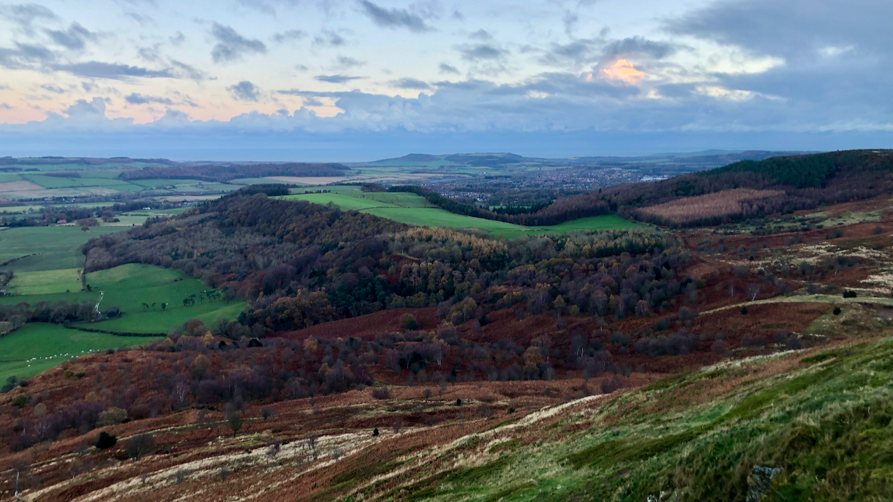
Roseberry from Carr Ridge
It seems a bit of a waste. Posting a distant photo of my local hill. I had planned a wander over Urra Moor. A dull start but I could see this patch of sunlight slowly making its way over the Eston Hills. I figured sooner or later it would shine on Roseberry. I wasn’t disappointed.…
-
Cod Beck Reservoir
The head of the reservoir in the Sheep Wash valley captures the low-lying November sun. Cod Beck Reservoir was opened in 1953 for the Northallerton and District Water Board, but one had actually been mooted in the 19th-century as part of a proposed scheme by the Borough of Stockton-on-Tees. In the Parliamentary session for 1869,…