-
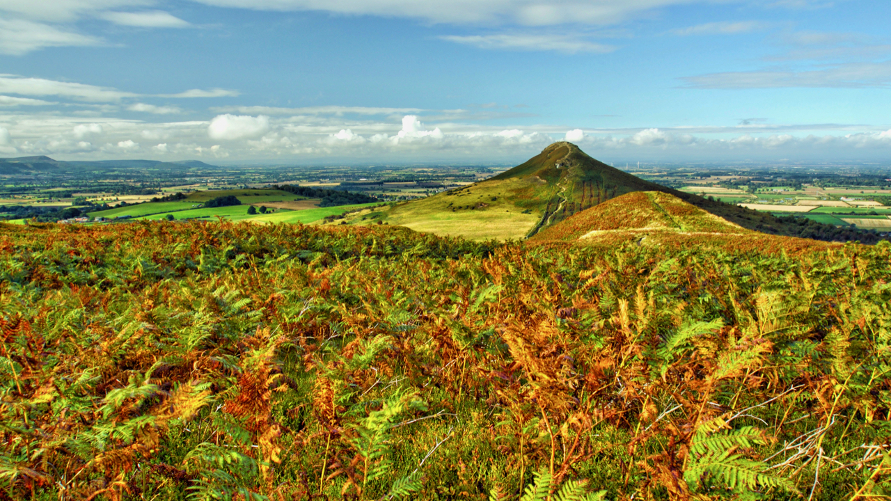
Autumn Equinox
At 08:50 this morning the ecliptic path of the Sun crossed the celestial equator and day and night were of equal length. For those of us in the northern hemisphere it’s the Autumn Equinox. So my project for today was to take an autumnal photo. I had in mind a palette of “feuille-morte” of the…
-
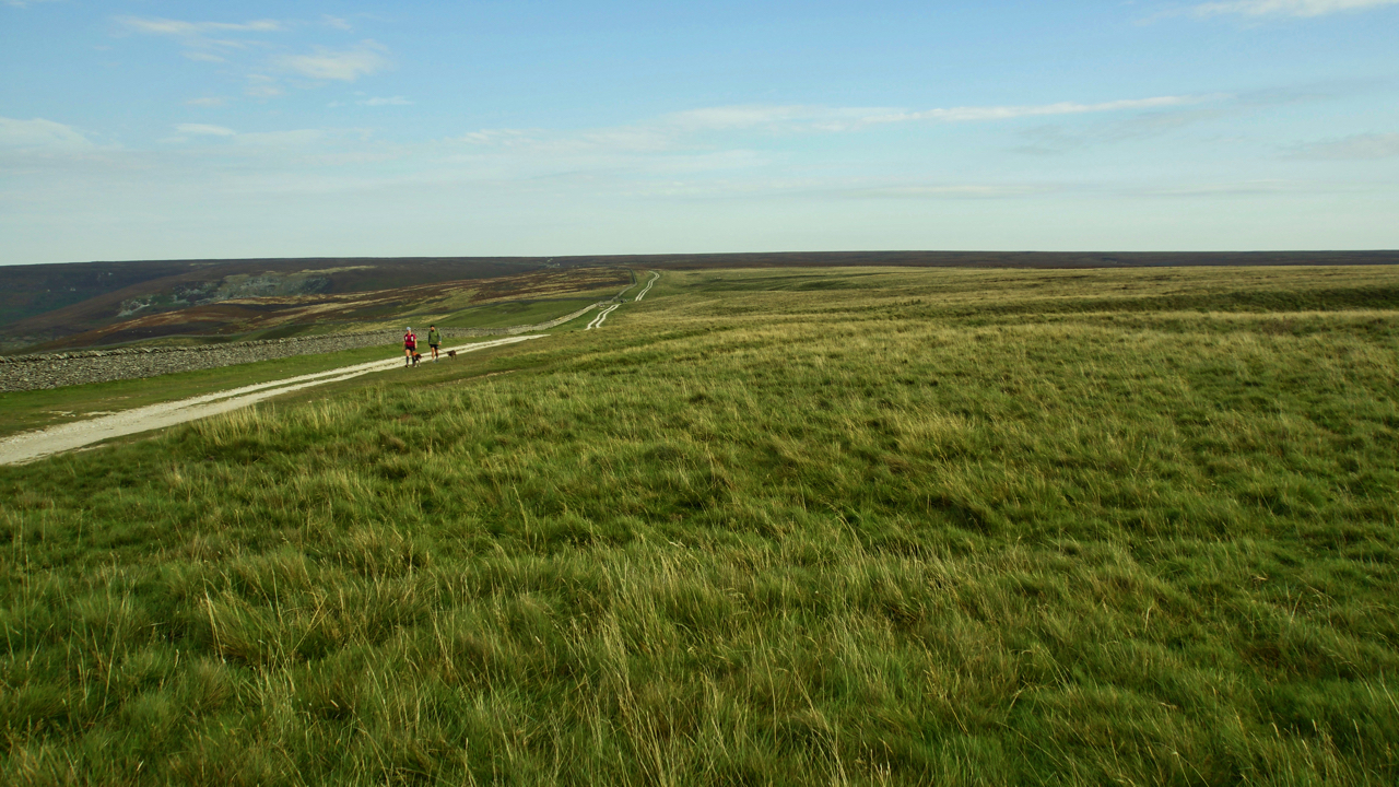
Hambleton Street
I find this track, between Sneck Yate with Square Corner, to be one of most tedious on the North York Moors. It follows the old drovers’ route between Scotland and the south of England. The term ‘street’ may suggest a Roman origin but although the Romans may well have used it (there have been Roman…
-
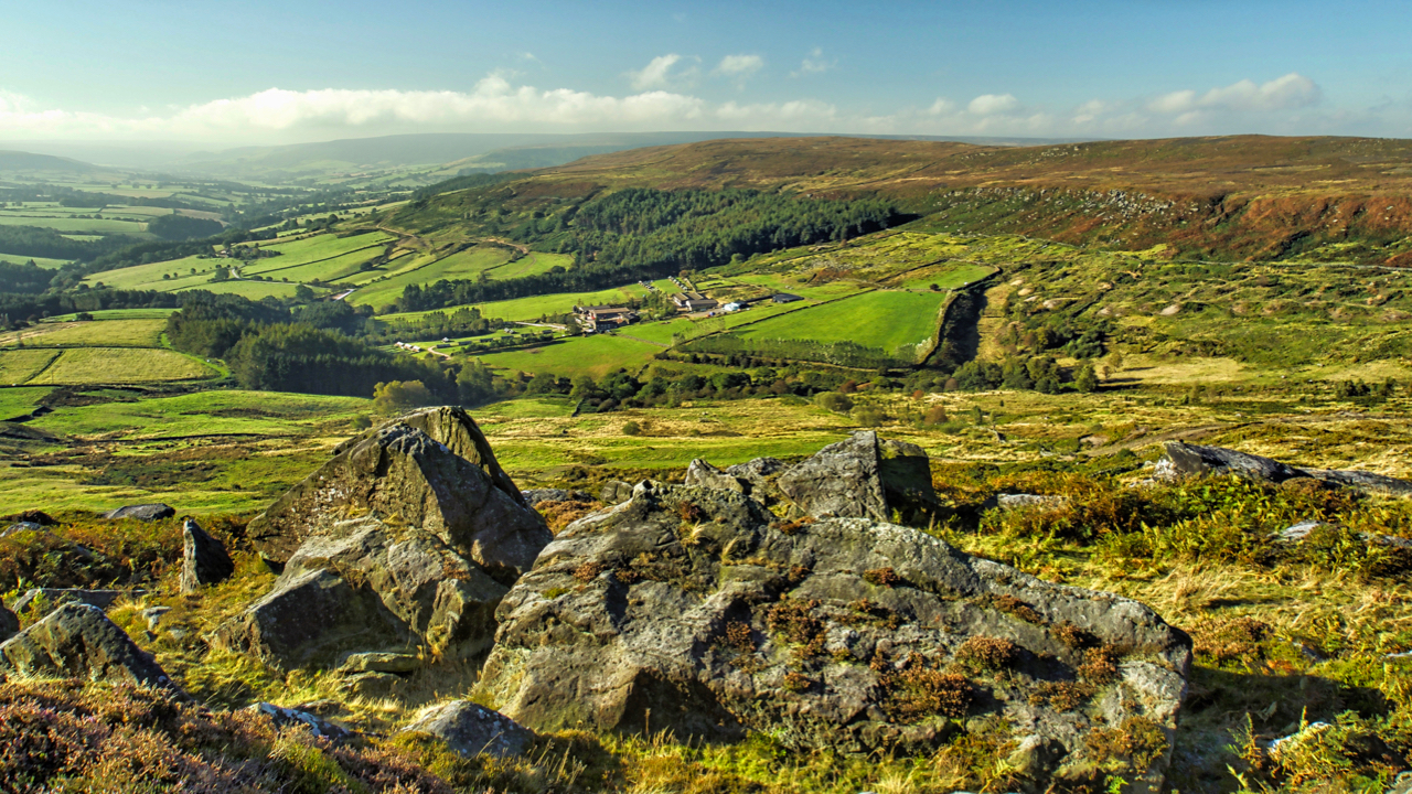
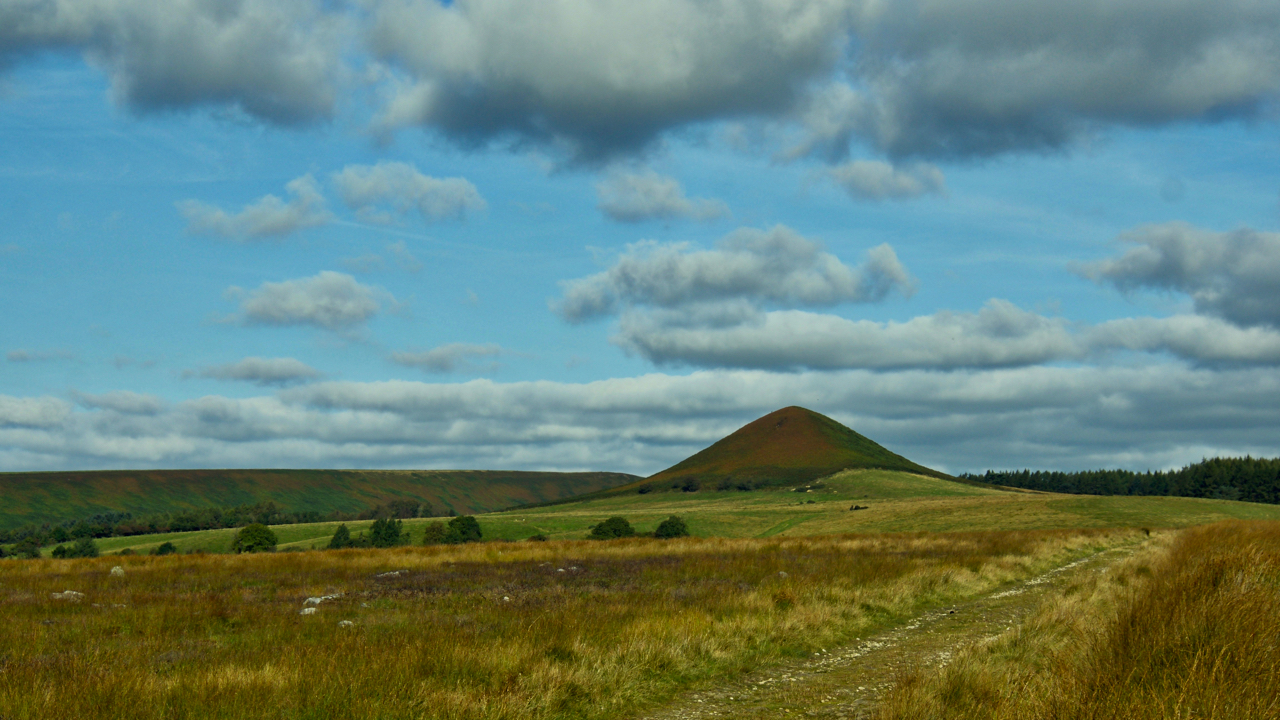
The Bilsdale Bombardier
A view down Garfit Gap and into Bilsdale. The farm in the centre is Whingroves, which seems to have diversified into an industrial pheasant rearing farm. In 1896 though it would have been a typical North York Moors dales mixed farm, run by Isaac Garbutt, a family name that has been recorded in the Bilsdale…
-
Freebrough Hill and Dimmingdale
Around the time when Robert the Bruce defeated the English forces at the Battle of Bannockburn, Edward Trotter was farming in Dimmingdale, near the distinctive Freebrough Hill. One spring evening in May, Edward was checking his sheep and lambs grazing on the slope of Freebrough Hill. Suddenly, something spooked one ewe which ran off with…
-
Blakey Topping
Some say it was the giant Wade that created Blakey Topping when he had a tiff with his wife, Bell, and threw lumps of earth at her as she ran across the moor. Where he scooped up the earth is now known as the Hole of Horcum. Of course, the geologists tell us it is…
-
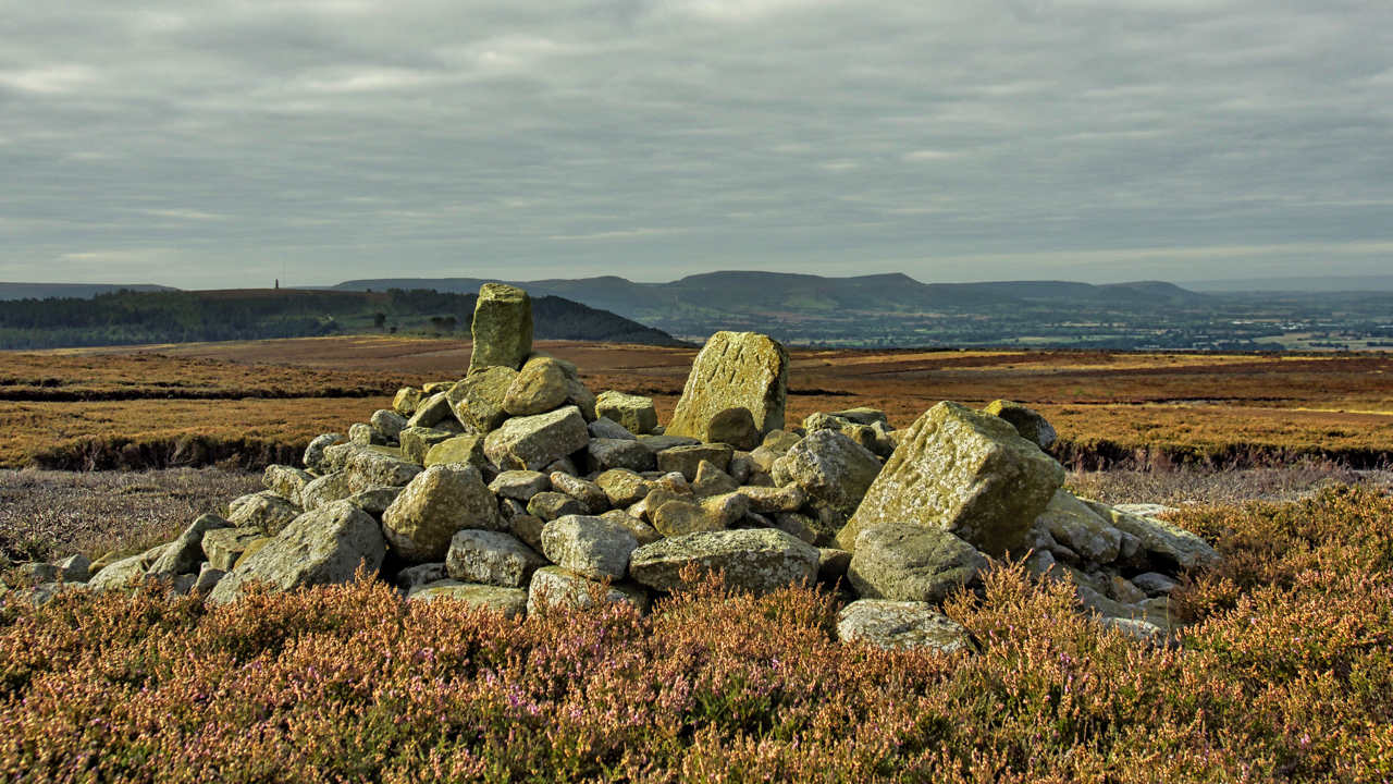
Two boundary stones and a Bronze Age round cairn
On Great Ayton Moor, a jumbled pile of stones on top of a Bronze Age round cairn and partly buried are two roughly dressed limestone boundary stones. One is inscribed “TKS 1815” while is inscribed “RY 1752” on the east side and “GN” on the west side. I don’t know about the “TKS” or “GN”…
-
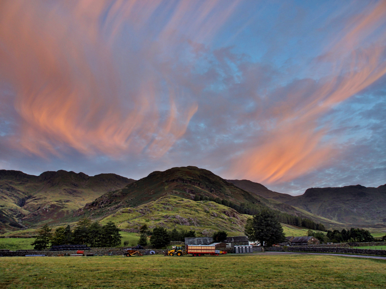
Stool End Farm, Great Langdale
Still the worse for wear after Sunday’s exertions in the Lakes so stayed local. Perhaps it’s cheating a bit but I took this photo yesterday morning when we woke up to a cracking sunrise. Stool End Farm at the foot of The Band, a relentless 800m ridge climb to Bowfell. Open Space Web-Map builder Code
-
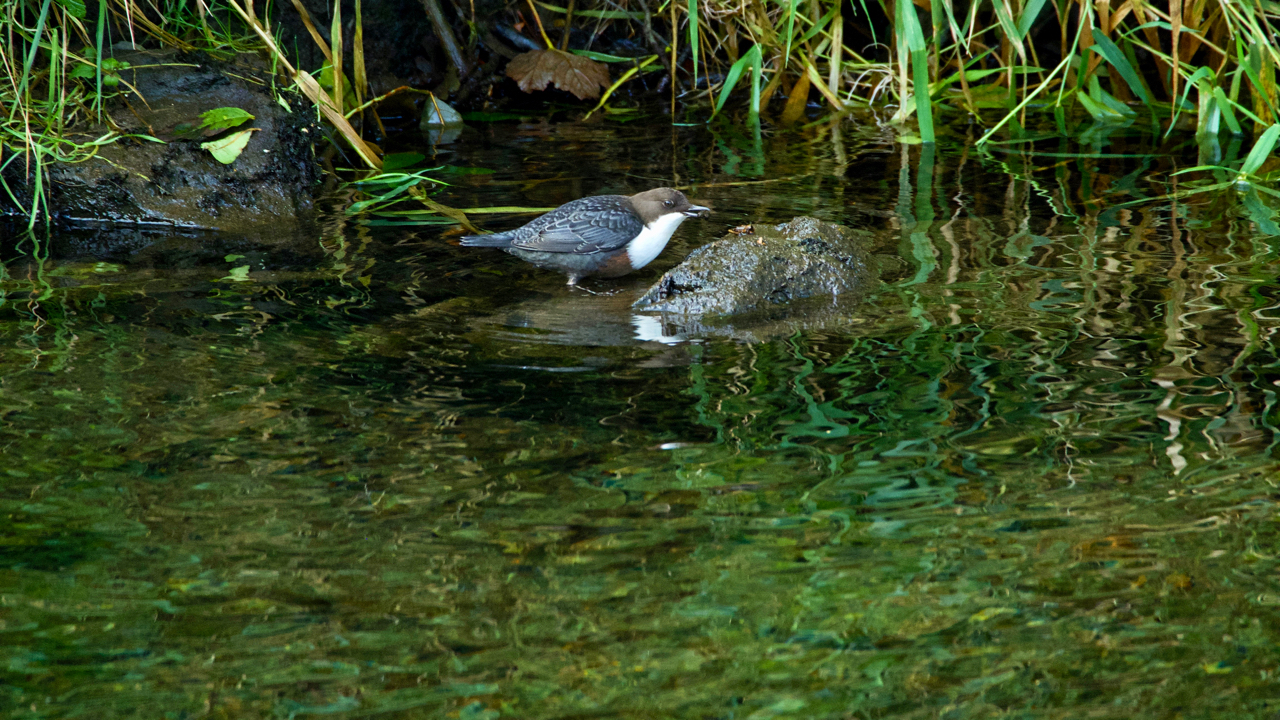
White-throated dipper, Great Langdale Beck
Watched this little fellow for a while. Cinclus cinclus is its scientific name. Fairly common but elusive and delightful to see. A very busy bird, diving into the beck in search of invertebrate larvae and returning to the stone to eat. Open Space Web-Map builder Code
-
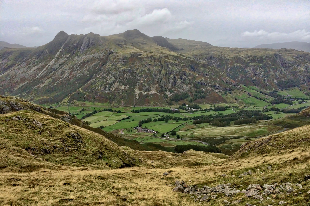
Langdale Pikes
A view across Great Langdale to the Langdale Pikes. The tallest point on the Left is Pike of Stickle. Just to the right of this pike is a scree run at the top of which the archaeologists tell us was the site of the stone age Langdale axe industry. Axes of the Greenstone rock have…
-
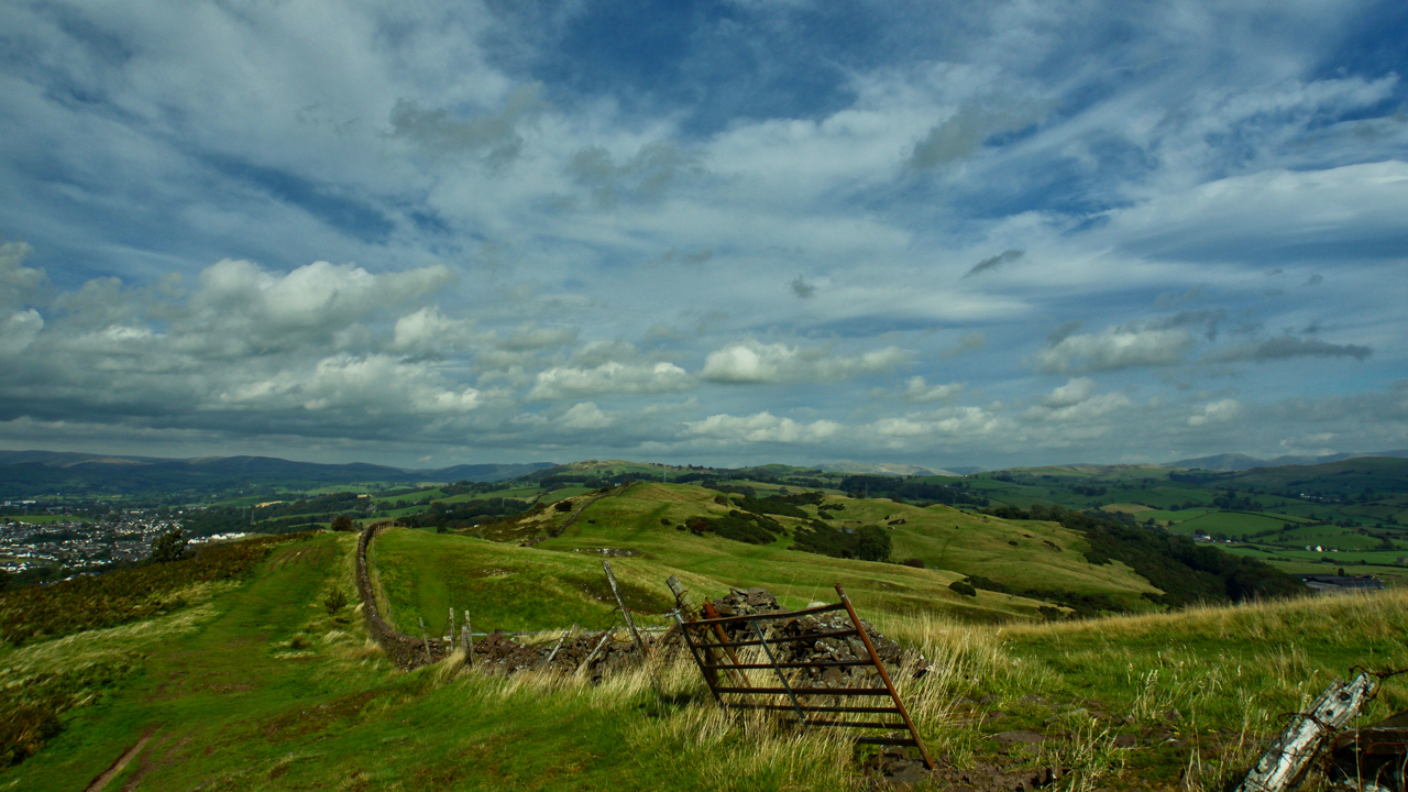
The Helm, Oxenholme
I have always thought of Oxenholme as just the railway station on the West Coast mainline with its junction to Windermere. In fact, it’s a small neat village of the outskirts of Kendal overlooked by a ridge of Open Access Land known as The Helm. I had a few hours to kill so I took…
Care to comment?