-
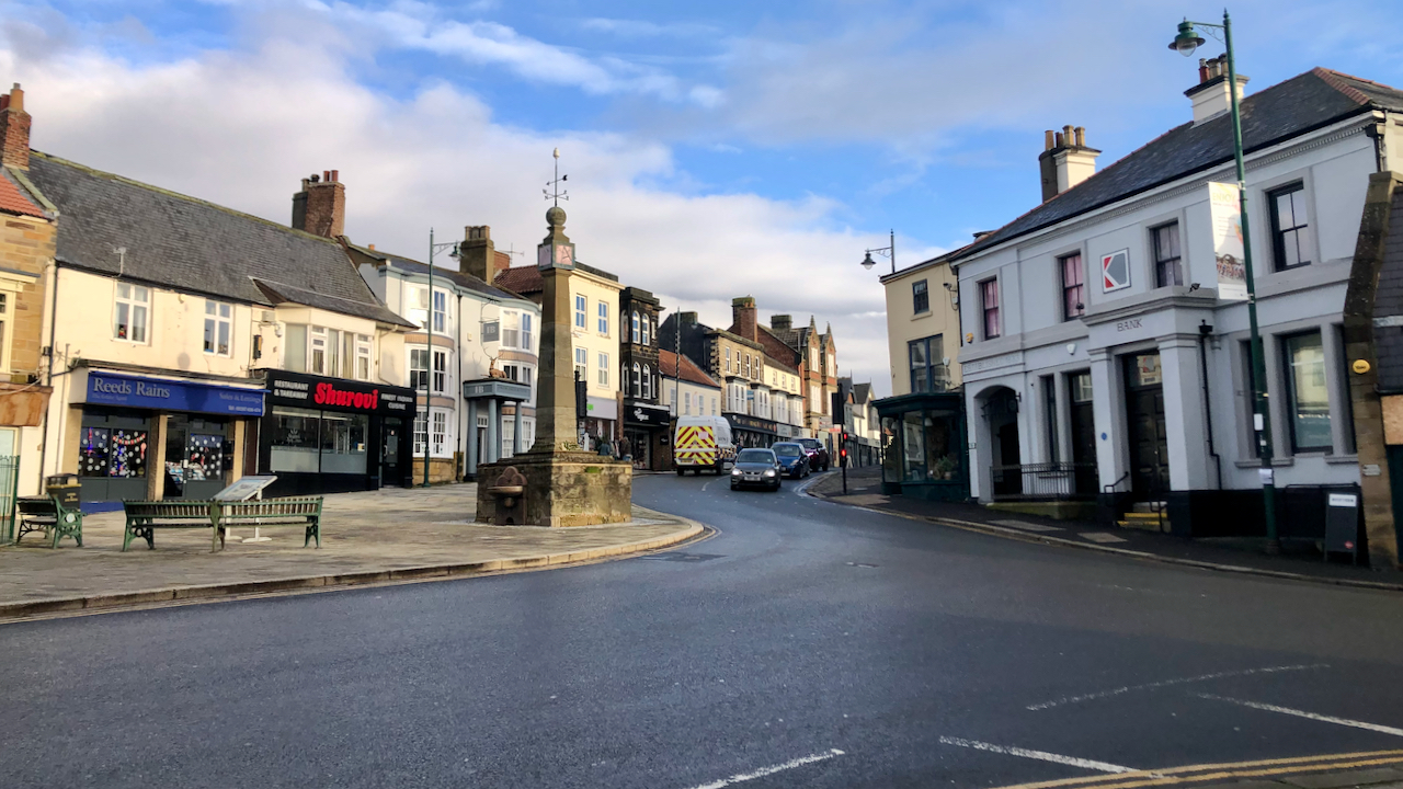
On me bike which meant I had to negotiate Guisborough’s busy town centre!
Surprisingly quiet. The town cross is relatively modern but the steps are worn, perhaps part of the Medieval Market cross although a 17th or 18th century engraving shows circular steps. Perhaps the engraving also shows the town’s bull-ring which was located very near the cross. Yes, bull-baiting was a very popular in this period and…
-
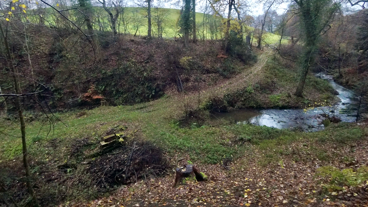
One of the opportunities of winter is the reduction in tree cover
The woodland floor becomes airy and light. New vistas are opened up. Climbing up the steep path from the River Leven through Bleach Mill Intake my interest was piqued by a stack of dressed stones in the defile below. Although I don’t think the stones are in their original position they are evidence of the…
-
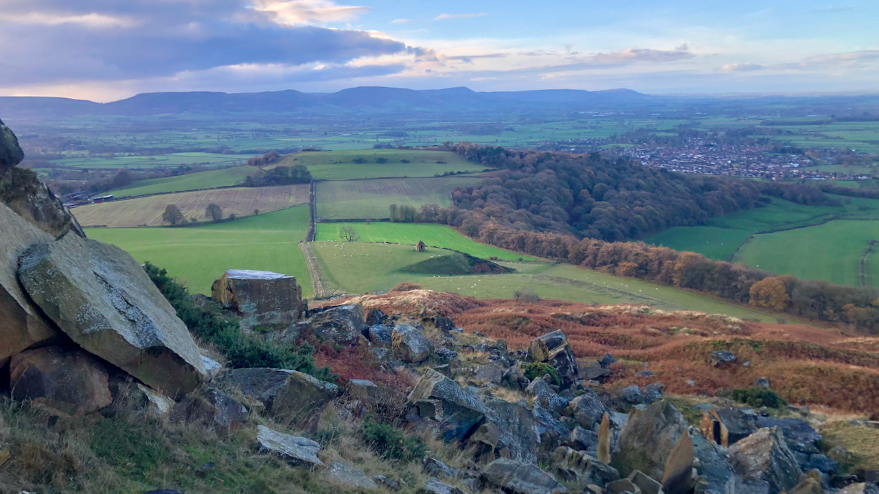
The talus of sandstone boulders at the foot of Roseberry Topping resulting from the landslip that occured in 1912
A scene of rocky confusion. ‘Talus’ is a strange word. It’s a word I actually find uncomfortable to use, long past its sell-by date. In this context it means the slope of rock debris but an alternative meaning is an anklebone. Each derives from different Latin words. Until 1830 talus was more often referred to…
-
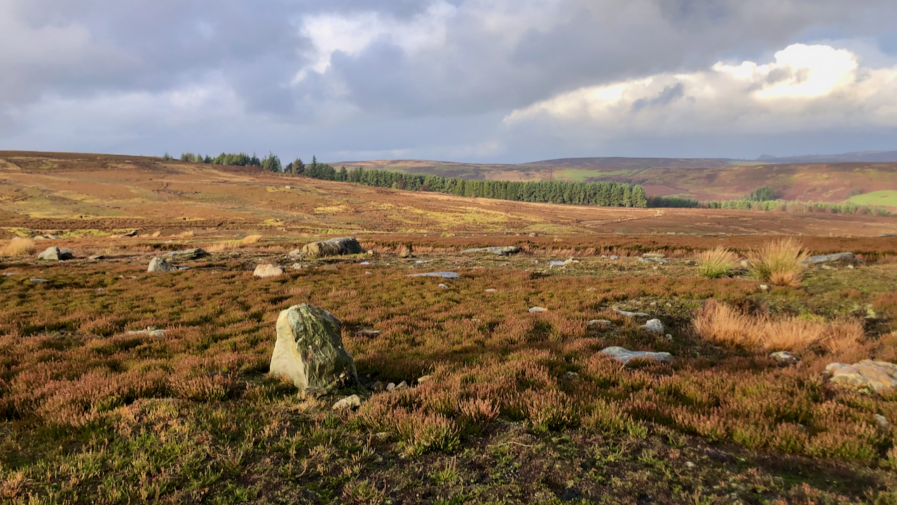
Some days photographic opportunities are few and far between
Today was such a day. Rain, drizzle, a brief interlude of bright sunshine, then more drizzle, followed by a touch of rain. I was on the bridleway mapped as Skinner Howe Cross Path crossing Great Hograh Moor when the sun made one of its brief appearances. This is looking north-west across Baysdale, look closely and…
-
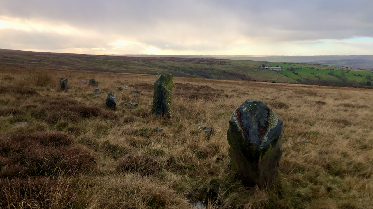
The climb out of Grosmont onto Sleights Moor is steep, very steep, but the effort is well rewarded
The object was High Bride Stones, a group of, it is said, eleven standing stones “possibly the remains of a pair of Bronze Age ‘four poster’ stone circles” dating to the Bronze Age. I must admit I was a tad disappointed. Most of the stones have fallen, and the tallest one has the ignominy of…
-
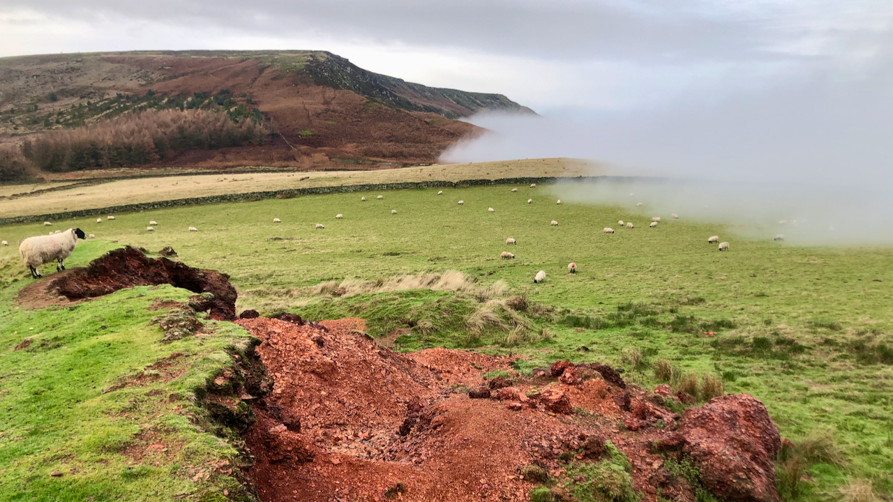
A temperature inversion covered the lowlands around Stokesley this morning, inching up the steep banks of the Cleveland Hills
The sheep munching away on the col between Cringle and Cold Moors are apathetically unaware of the creeping cloud. The distinctive red earth is a spoil heap from jet working that has been burnt to convert the soft, crumbly shale into a hard, flakey material for use in building up farm tracks. The burning seems…
-
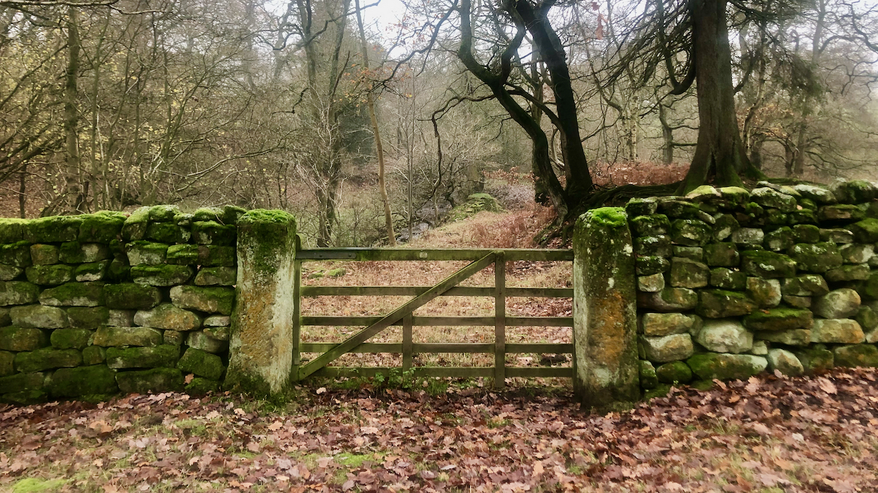
Two-stoop yate
‘Gate’, as in Westgate and Belmangate of Guisborough, is an old Scandinavian word meaning a ‘way’ or ‘road’. This is etymologically different to the modern useage of the word, which stems from the Old English word ‘geat‘ for a “door, opening, passage, or hinged framework barrier”. In Yorkshire though, we say ‘yate’, ‘yat’ or ‘yet’.…
-
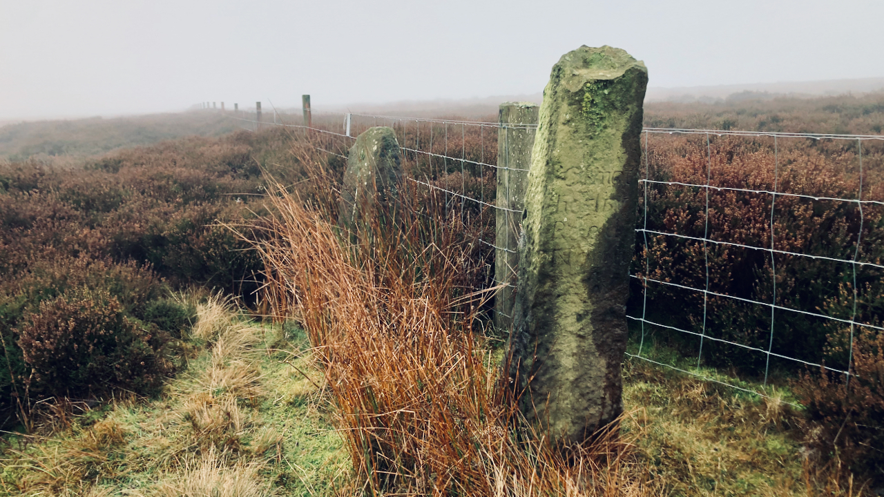
Crayaldstane
A dreary damp day with hardly no visibility so a fall back to that ubiquitous feature of the moors: standing stones. Man has erected stones upright for many reasons: to delineate a boundary, as a waymarker, a religious symbol or a monument. At Oakdale Head, on the parochial boundary between Hawnby and Nether Silton, you…
-
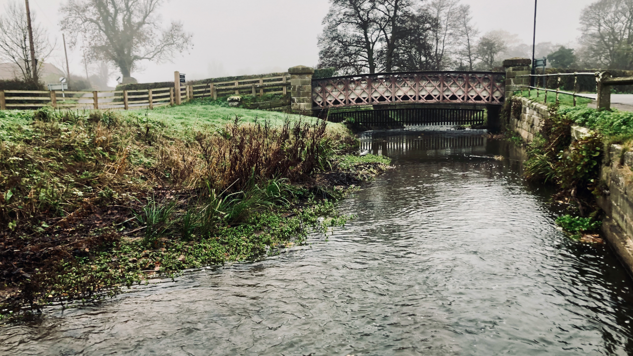
Quiz time: what links this photo to the Yangon-Mandalay railway in Myanmar?
Myanmar was once a province of British India which, from 1824 to 1948, and was known as British Burma. The British first introduced a railway to Lower Burma in 1877 connecting Rangoon (Yangon) to Prome (Pyay) — 161 miles long. Subsequent developments included, in 1884, a 166 mile line along the Sittaung River from Yangon to…
-
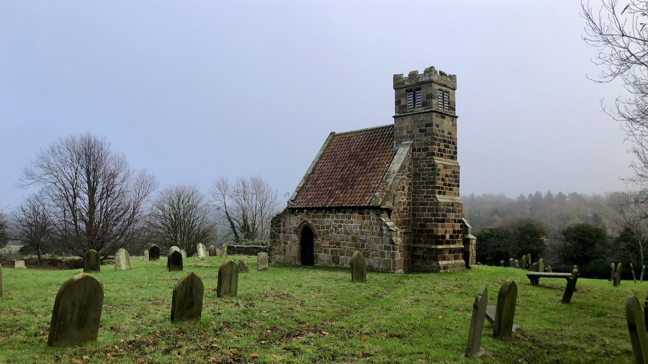
The Hobman of Upleatham
Upleatham Old Church, once referred to as “the smallest church in England”, a superlative that is usually disputed — but which has, as far as I know, never been refuted. However it is not this quaint little church which concerns me in this post but a small hill just over mile to the north east,…
Care to comment?