Category: Westerdale
-
Gallow How: Where Danby Meets Westerdale
On Thursday the first of August 1907, Danby staged its customary ‘Riding the Boundary’, a grand ritual meant to affirm the limits of the Manor, and by extension the Parish, while also paying annual homage to the Lord of the Manor, Hugh Richard, Viscount Downe. The bailiff opened the day with a ringing “Oyez, Oyez,…
-
Folklore, Foxes and the Turf: The Life of John Fairfax-Blakeborough
Another view of Low House in Westerdale, this time from the south-east. As mentioned yesterday, this was once the home of John Fairfax-Blakeborough, folklorist, writer, and stalwart of old Cleveland. Major John Fairfax-Blakeborough (1883–1976) first saw the light of day in Guisborough on 16 January 1883. Known as Jack, he was the son of Richard…
-
Barwykerowe: The Forgotten Hamlet beneath Castleton Rigg
Castleton Rigg is one of those places everyone knows from the car window yet almost no one bothers to walk upon. I can remember only two previous visits, one before and one after the arrival of that monstrous vanity project masquerading as public art (here and here). Today’s visit offered then the chance to look…
-
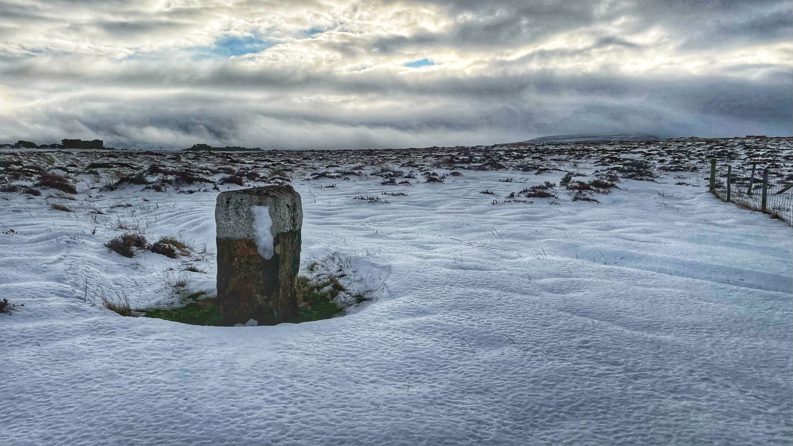
The Pike Stone: From Waste to Common Land
The Pike Stone marks the boundary between the common land of Westerdale and the “wasteland” of Baysdale Moor. At first glance there is little difference: both are heather moor, both are Open Access. Yet the distinction matters, and the Open Spaces Society is seeking to have Baysdale Moor registered as common land. Common land is…
-

Westerdale: From Templars to Ironmasters
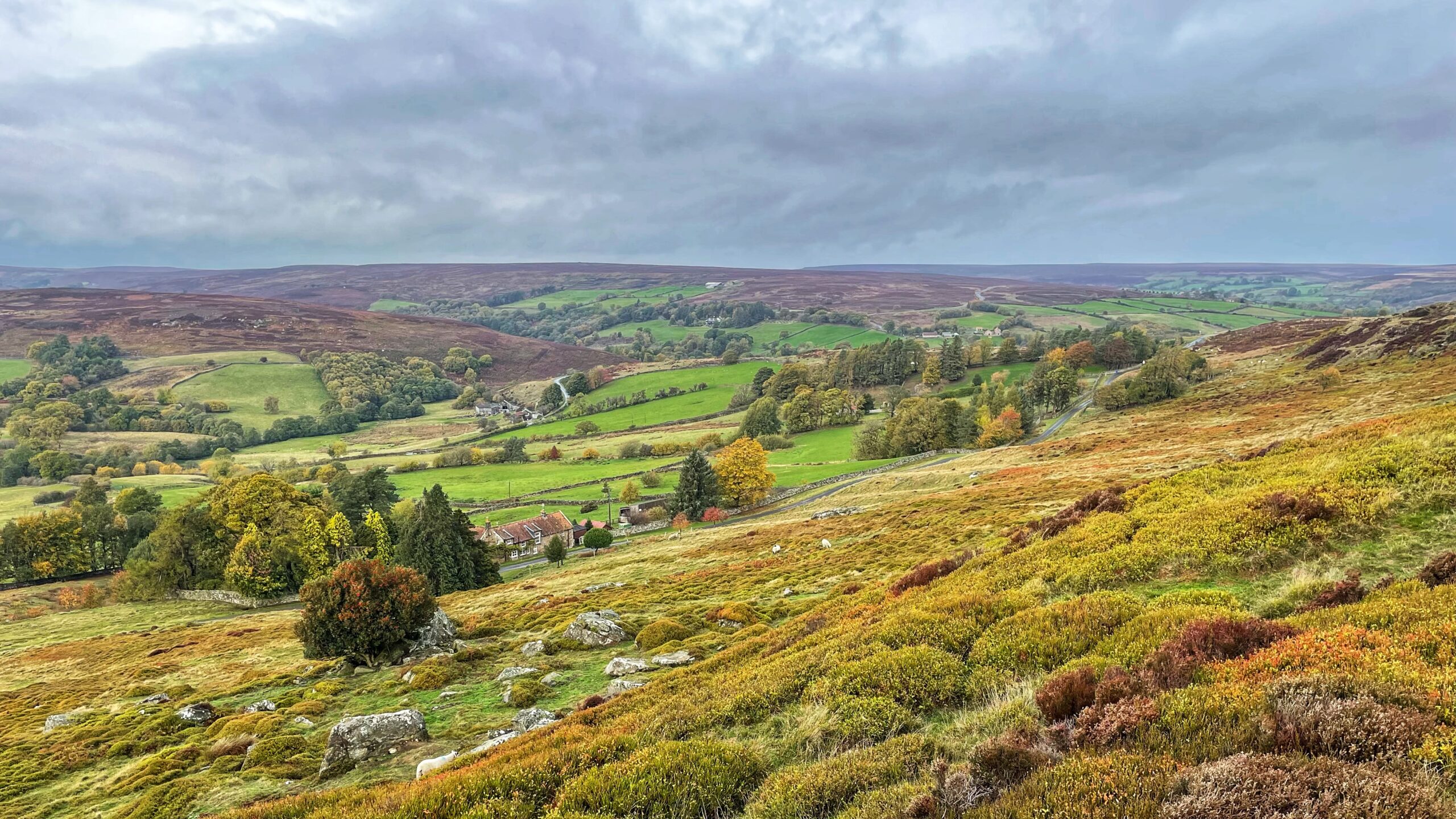
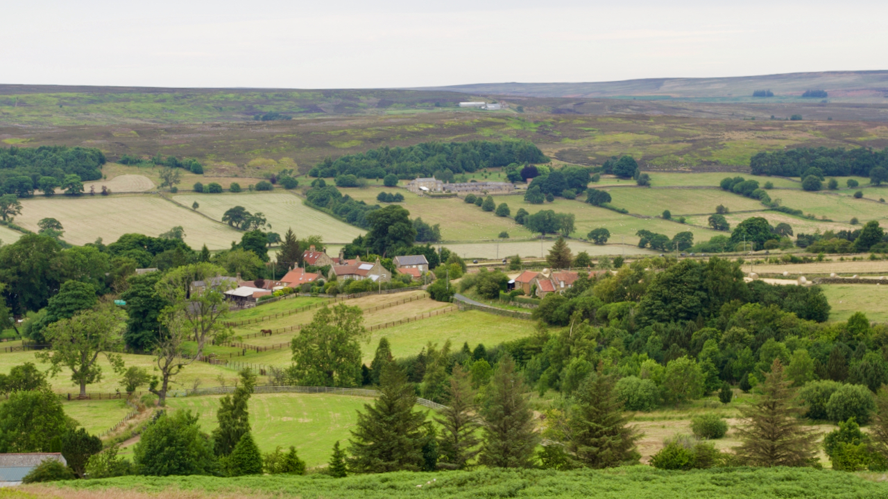
A rare chance the other night to climb Top End, the nose of the rigg that leads up to Young Ralph’s Cross. Usually I pass this way in a rush—driving, or sometimes cycling—keen not to lose momentum on the steep bank. Below me lies Westerdale, so named for its place as the westernmost dale in…
-

From a Templars’ Retreat to a Cobbler’s Last Stand: The Many Lives of Brathwatte
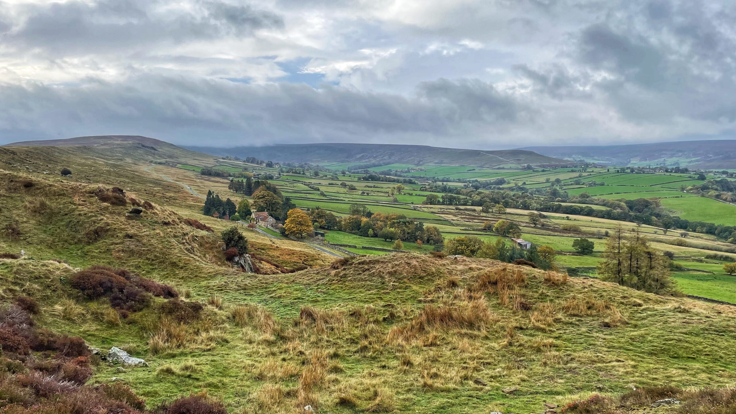
I see a rock outcrop on the crest of a hill and feel a maddening urge to investigate. So, naturally, I ended up on Tor Hill Crags, gazing down over Westerdale. Or, perhaps, that should be Camisedale—a name found in the Domesday Book, while Westerdale, notably, is not. The general presumption is that they are,…
-
Shadow of suspicion: gamekeepers and the Red kite’s plight
As I cycled my way through picturesque Westerdale, I held out a glimmer of hope, albeit a rather optimistic one, for a sighting of magnificent Red kites. More specifically, I yearned to catch a glimpse of that one resilient Red Kite who may had managed to survive the cruel onslaught of illegal, heartless, and downright…
-
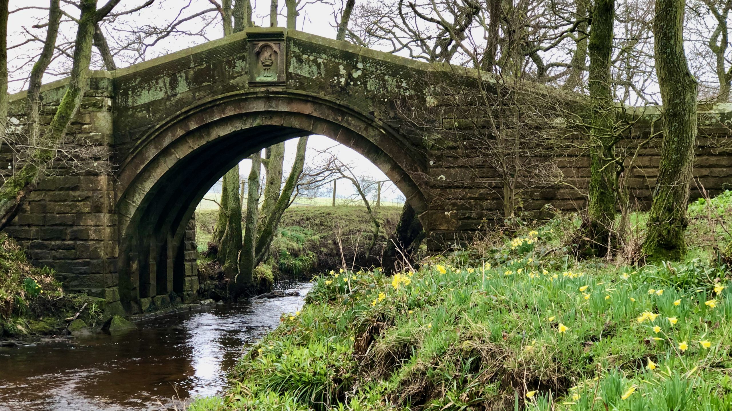
Hunter’s Sty Bridge
The River Esk has a few single-arched bridges, but the best one is probably the Hunter’s Sty Bridge. It’s located at the bottom of Huntersty, the ‘steep path of the hunters,’ just past the northern end of Westerdale village. Hunter’s Sty Bridge was most likely built in the late 13th century to provide access to…
-
The old road to Westerdale
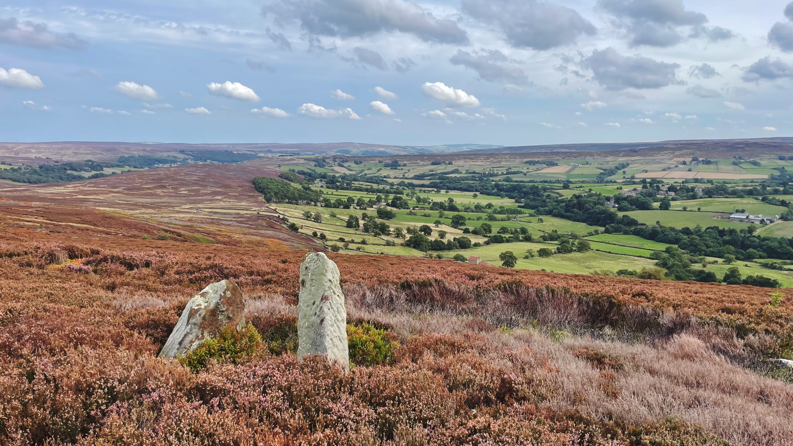
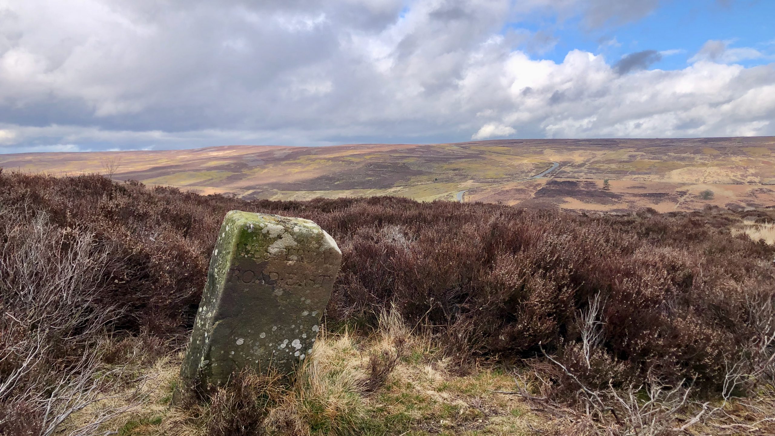
The moors are filled with standing stones that span across different periods in history. You can find prehistoric monoliths, medieval structures, and even contemporary edifices scattered throughout the vast terrain. According to the 1853 6″ O.S. map, there is a boundary stone labelled Stockesley Cross located near the ruins of a supposed smugglers’ hideout called…
-
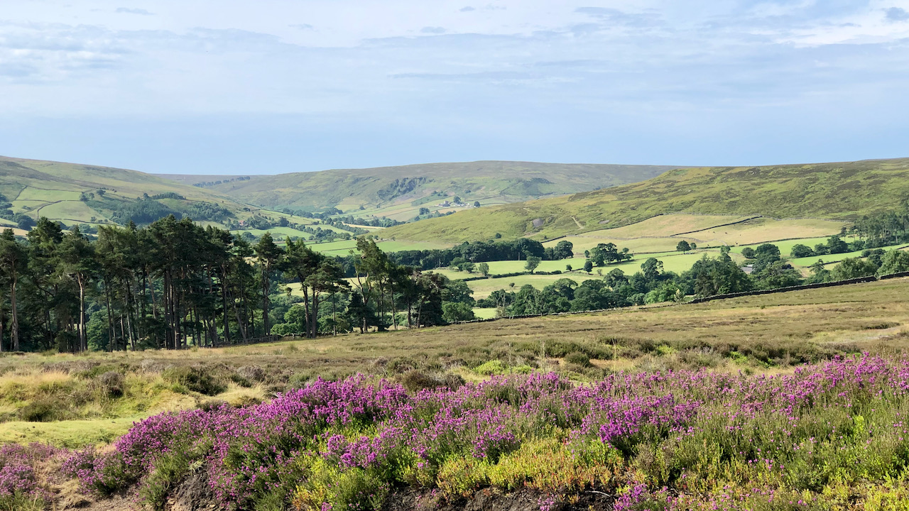
The hills look down on Westerdale, and Westerdale looks at the hills
So the Whitby gazette wrote in 1911, borrowing heavily from Lord Bryon’s poem about the battle at Marathon. Today it’s such a sleepy village, home to about a hundred and thirty retirees and professionals, with a handful of working farms. Its location is not conducive as a base for walking, so most of us fly…