Category: Tabular Hills
-

Hawnby
Described as a “traditional nucleated settlement”, modern Hawnby really has two nuclei. The high one at the foot of Hawnby Hill and the low one centred on the old mill by the River Rye. Both have quaint sandstone buildings with red pantile roofs distinctive of the Tabular Hills. The village is mentioned in the Domesday…
-
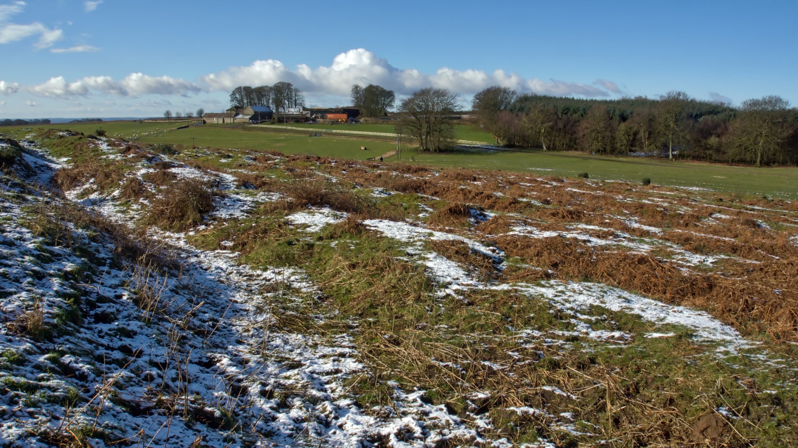
Cockmoor Hall Earthworks
The Tabular Hills have a high concentration of Neolithic or Bronze Age earthworks: linear boundaries in the form of ditches and earthbank and round barrows and at the head of Wy Dale, before Stainton Lane descends steeply into Toutsdale, is an extensive area of a confusing mixture of prehistoric earthworks overlain by medieval. Only a…
-
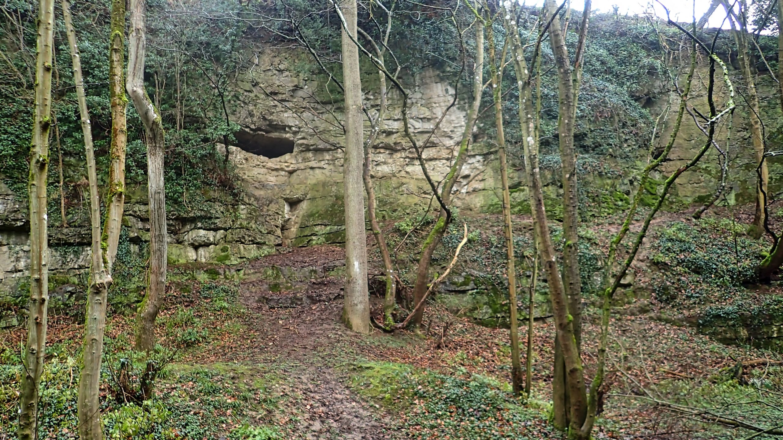
Kirkdale Cave
Whilst Cleveland basked in the winter sunshine, the Tabular Hills were covered in a grey corrugated duvet of low wet cloud. I had parked in Fadmoor for a circular wander along dry valleys and field tracks aiming to visit Kirkdale Cave. I’ve never actually seen the cave before and I don’t suppose any bones of…
-
On Hood Hill
Rain before seven, Lift before eleven. So the old saying goes, but, ok the rain had stopped but the cloud still blanketted the 250m glacial outlier of Hood Hill. We climbed the hill to explore the earthworks of a medieval fortification, a motte and bailey castle. And to talk of the legends of witches…
-
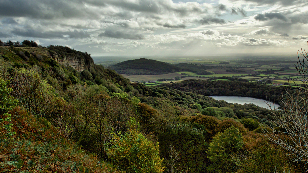
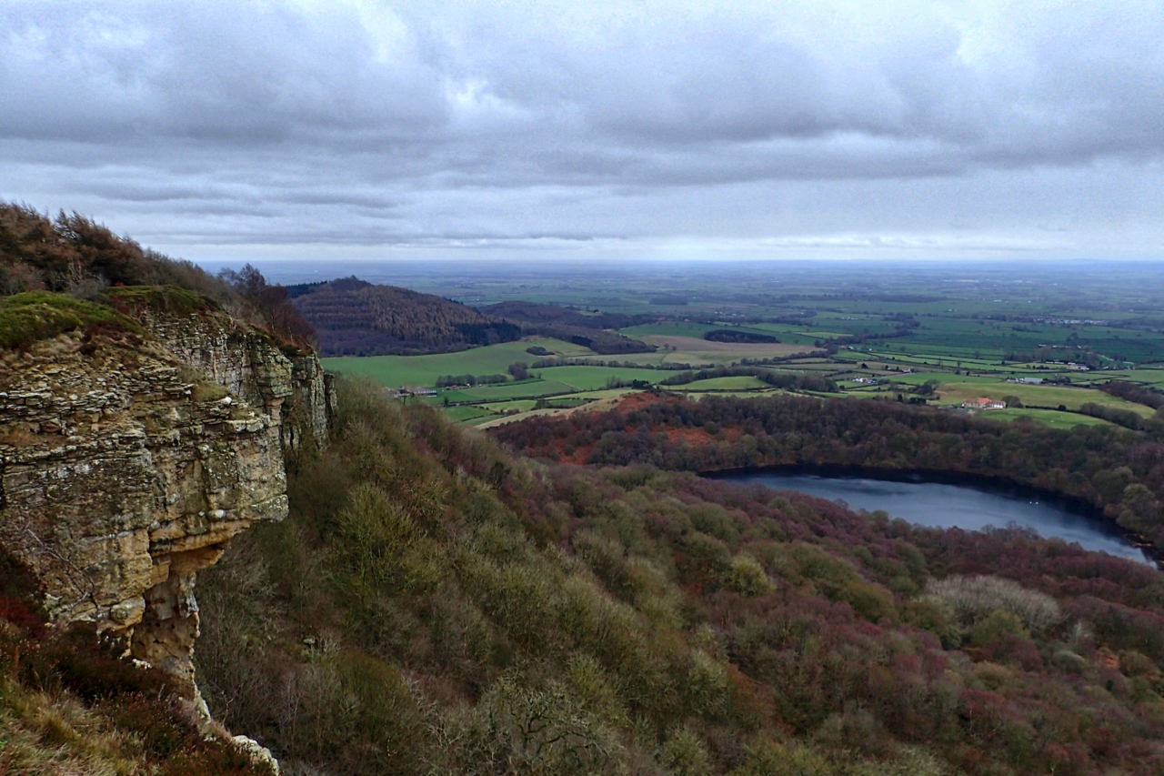
Whitestone Cliff and Gormire Lake
Looking down onto Lake Gormire near Sutton Bank. A place of myth and legend. In the distance is the elongated Jurassic outlier, Hood Hill with where Druids were said to have made sacrifices. Some say Lake Gormire was made when an earthquake swallowed up a whole town. The roofs of the houses and chimneys can…
-
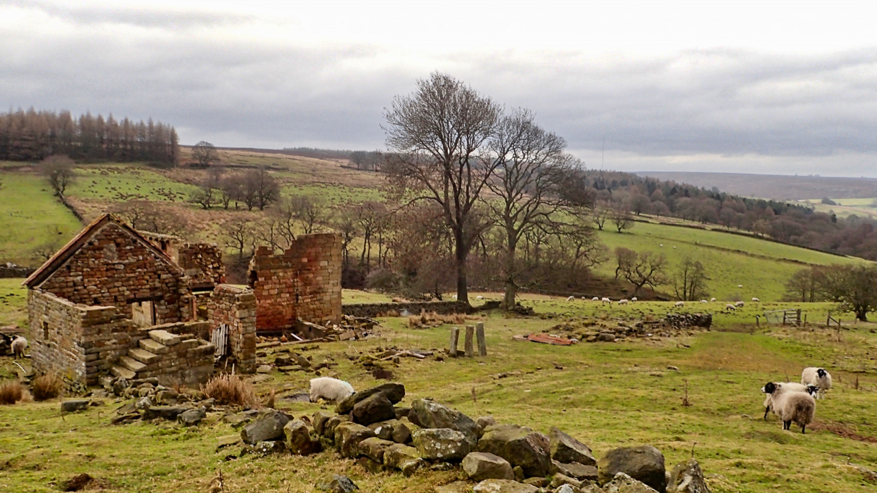
Dale Head
It is actually wrong to describe this valley as Ryedale. By convention, the source of a river is its longest tributary which puts the source of the River Rye at the appropriately named Rye Head near to the Swainby Shooting Hut on Whorlton Moor. The ruined Dale Head overlooks Wheat Beck, a shorter tributary. It’s…
-
White Mare Crag
Perhaps better known as Whitestone Cliff. The Calcareous Grit crag is supposed to have formed in the eighteen century when the steep scarp slope slumped, an occurrence recorded by the Rev. John Wesley, the Methodist preacher, in his journal: “1755. On Thursday, March 25th, many persons observed a great noise near a ridge of mountains…
-
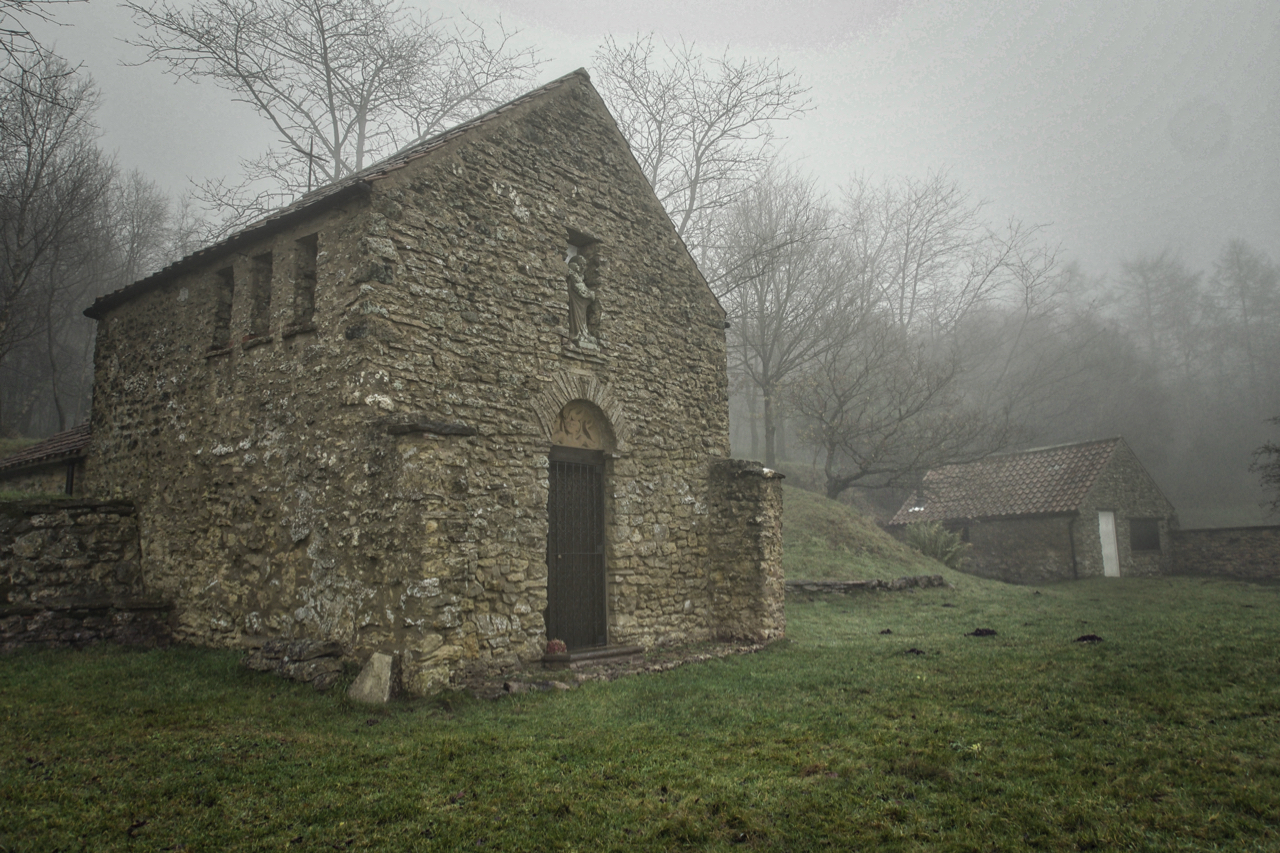
Scotch Corner Chapel
I’m currently reading “The Plot” by Madeleine Bunting. It is the story of her father’s obsession with an acre of land adjoining the old Hambleton drovers’ road as it descends from the high moors to Oldstead and the Vale of York. Although I’ve passed by before, it is not an area I know that well.…
-
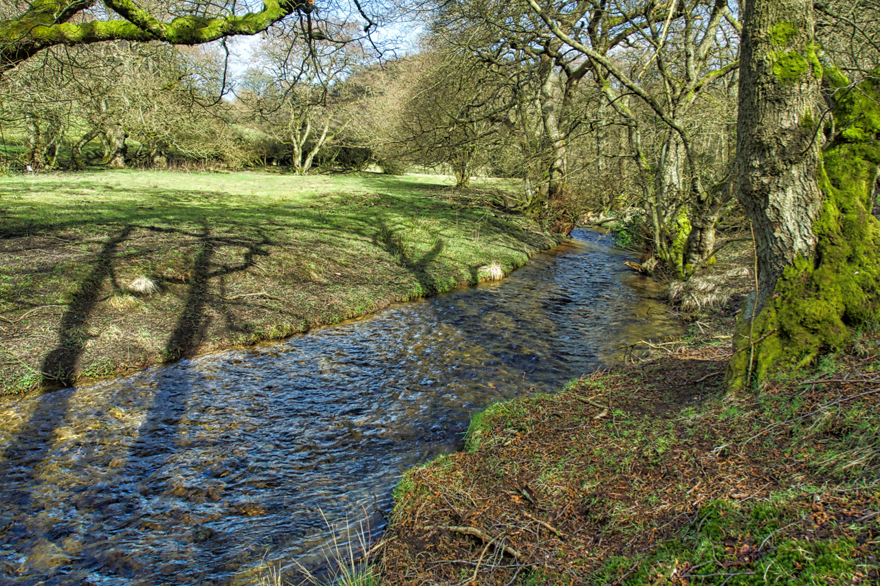
Staindale Beck
On what must be the warmest day of the year. Sunshine and the peaceful bubbling of the stream. A lotic moment at Low Staindale in Dalby Forest, time out while helping with some fencing for the National Trust. Open Space Web-Map builder Code
-
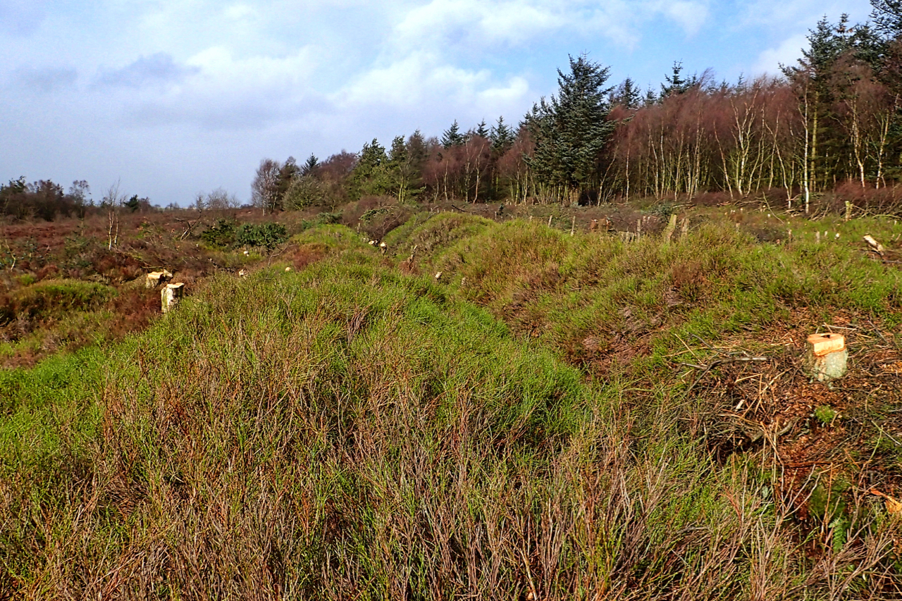
Prehistoric linear boundary at the Bridestones
The National Trust’s second winter season of tree and scrub clearance of the prehistoric linear boundary at Bridestones is almost over. Tree felling stops in the spring and summer to avoid disturbance of nesting birds. Just remaining for this winter is to stack the brashings and logs to create wildlife refuges. The Bronze Age earthwork…