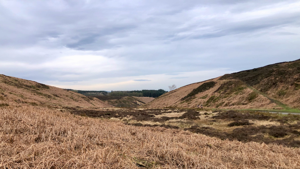
I am curious as to how many among you will succeed in locating this photograph without resorting to further reading or consulting the map provided at the bottom of the page.
The two cyclists may give it away or else that slither of tarmac on the right.
It is, of course, Scarth Nick, a pass used by many in a car (or on a bike) but not so many nowadays on foot venturing just a little way off the road. At the height of the summer, when the bracken is at its highest, tarmac is the only option. This short yet wide valley falls into Crabdale, where a substantial mound of gravel lies, known as Round Hill. This mound, in fact, is part of a delta, indicating that during the time when Scarth Nick overflowed from the glacial Lake Scugdale, there existed a significant body of water in Crabdale, likely another glacier-formed lake1Elgee, F. Nature Notes. | Northern Weekly Gazette | Saturday 28 November 1903 | British Newspaper Archive. [online] Available at: https://www.britishnewspaperarchive.co.uk/viewer/bl/0003075/19031128/113/0014 [Accessed 31 Mar. 2022]..
In the last Ice Age, approximately 15-20,000 years ago, a glacier descended from the north, encasing the moors in a layer of ice measuring over 300 metres in thickness. While it did not fully blanket the moors, it did advance into Scugdale, where it confined a lake and left behind a collection of gravels, sand, and rocks sourced from regions including Scotland, Cumbria, and Durham.
This lake in Scugdale eventually overflowed, carving a channel through Whorlton Moor pouring into Holy Well Gill, eventually joining Crabdale Beck. As the ice retreated, the lake in Scugdale spread into the small amphitheatre beneath Scarth Wood. Subsequently, the waters found another overflow, cascading over Scarth Nick.
Easily seen from miles north and south, Scarth Nick is a natural pass that has been used by prehistoric man, the Romans, and continued as a route from medieval times to the modern age, serving as a way through the formidable Cleveland Hills escarpment. It is best known as the former drove road leading to Sheepwash, the old Chequers Inn, and extending across the Hambleton Hills toward Sutton Bank.
It is conceivable that this route was used by the Scottish forces led by Robert Bruce in 1322, as they pursued the retreating English army of Edward II, eventually engaging them in a battle near Byland Abbey. Local lore suggests that the Scots, in their haste, compelled locals to guide them with torches through Scarth Nick. Allegedly, confusion ensued when these guides extinguished their lights simultaneously2Grainge, William. ‘The Vale of Mowbray: A Historical and Topographical Account of Thirsk and Its Neighbourhood’. 1859. Simpkin, Marshall, & Co. Internet Archive <https://archive.org/details/valeofmowbrayhis00grai/> [accessed 20 December 2022]. However, I seem to recall reading that some historical accounts suggest that Bruce’s army departed from Northallerton on that morning. Nonetheless, the tale retains its charm.
- 1Elgee, F. Nature Notes. | Northern Weekly Gazette | Saturday 28 November 1903 | British Newspaper Archive. [online] Available at: https://www.britishnewspaperarchive.co.uk/viewer/bl/0003075/19031128/113/0014 [Accessed 31 Mar. 2022].
- 2Grainge, William. ‘The Vale of Mowbray: A Historical and Topographical Account of Thirsk and Its Neighbourhood’. 1859. Simpkin, Marshall, & Co. Internet Archive <https://archive.org/details/valeofmowbrayhis00grai/> [accessed 20 December 2022]
Leave a Reply