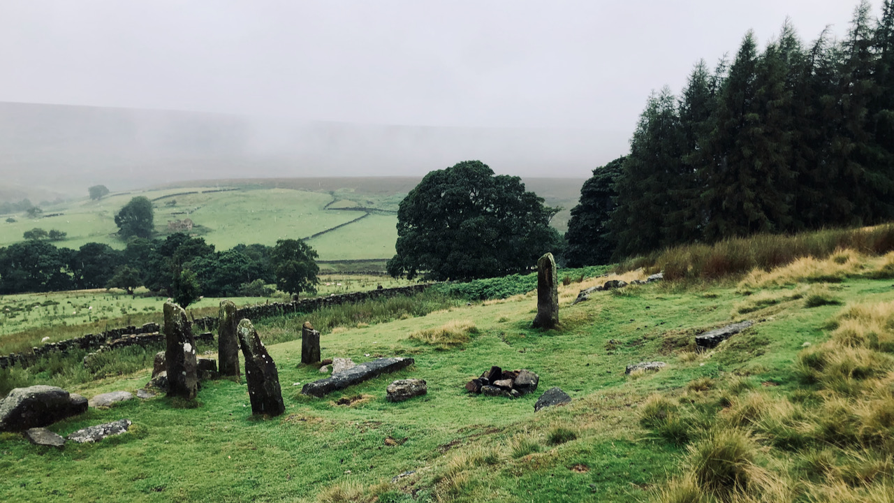
In a misty embrace of swirling mizzle, this place of intriguing standing stones has been dubbed as “Snilesworth’s Callanish,” though officially it is known as Stephen Thwaites, an old medieval farmstead1Stephen Thwaites/High Farm NYM HER No: 10595.. Its enigmatic air whispers tales of times long past.
The name was coined by Bill Cowley (1916-1994), better known as the founder of the Lyke Wake Walk, in his interesting booklet on the history of the Snilesworth area2Cowley, Bill. “Snilesworth”. Turker Books 1993..
“Stephen Thwaites” was recorded as extant on the 1857 OS 6″ map. Yet, historical records reveal its true name, “Stebynthwayte” or “Stebbinthwaite,” harking back to a holding documented in the 1537 Dissolution Document of Byland Abbey. This name, steeped in Norse heritage, likely predates the establishment of the monastery in circa 1150. Stone stoops, sunken tracks, and dykes containing large orthostatic stones hereabouts certainly evoke wonder, their origin shrouded in mystery. But could there be traces from the Bronze Age buried within this ancient landscape?
Curiously, just across the valley from this medieval farmstead is an extensive and proven Bronze Age site, but astonishingly, no signs of similar occupation appear on this side of the Wheat Beck3Field system at Wheat Beck. NYM HER No: 2226.. Ancient dykes, descending to Wheat Beck, mirror those found on the south side, enclosing small enclaves with solitary orthostats, devoid of any gateways. While the evidence seems scant, a trio of V-shaped cattle tracks, known as hollow ways, hint at a possible prehistoric heritage, leading down from Douglas Ridge towards the farm ruins.
Perhaps the prehistoric decision to settle on the far side of Wheat Beck stemmed from the presence of bigger, denser woodland on this side. Waterfall Wood, separating Stebbinthwaite from Low Cote fields, hosts towering beeches planted over a century ago. Along some of the old wall lines, oaks continue to thrive, bearing witness to the efforts made in clearing the land long ago. Stebbinthwaite’s name, suggesting a clearing from which tree stumps and roots had to be grubbed out, is rooted in Norse tradition, and points to a settlement emerging in that period, with only the faintest of traces of earlier Bronze Age occupation.
Notably, the centre of agricultural interest in this part of the dale lies in the grange of Byland Abbey at Low Cote, thus beginning over eight centuries of continuous cultivation. Such enduring occupation may have concealed any remains of an earlier past. Though scattered stretches of orthostatic walls, adorned with elevated banks and lynchets, stand as evidence of human endeavour, no cairns or direct links to the Bronze Age appear evident. It is undeniable that there was something captivating about this place that lured the Byland monks to choose it as their grange, yet the enigma persists, for our Neolithic predecessors seemingly overlooked its appeal.
- 1Stephen Thwaites/High Farm NYM HER No: 10595.
- 2Cowley, Bill. “Snilesworth”. Turker Books 1993.
- 3Field system at Wheat Beck. NYM HER No: 2226.
Leave a Reply