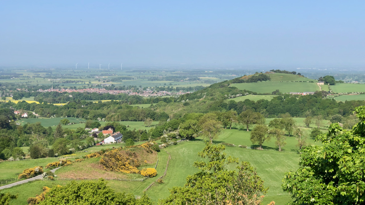
A view looking down on Gribdale Terrace, a row of white cottages built to accommodate the quarrymen employed at the adjacent whinstone mine and quarry.
The line of the Whinstone or Cleveland Dyke can clearly be seen in the photograph, stretching from Cliff Rigg in the distance to behind the cottages where it follows the line of the road. The presence of the yellow gorse bushes which thrive in the specific soil conditions created by the igneous rock is a good indication of the line of the Dyke. Interestingly, a dialect name for gorse is ‘whin’.
The Dyke emerged through a long fissure between 22 to 28 meters wide, created when powerful earth movements unleashed a torrent of basaltic lava near the Island of Mull, just off the west coast of Scotland. This geological feature can be traced through southern Scotland, Cumbria and County Durham. It crosses over the River Tees at Eaglescliffe and continues its journey across Cleveland until it reaches the Blea Hill Rigg on Fylingdales Moor. Wherever this Dyke breaks through the surface, it has been quarried and mined.
Due to its exceptional hardness, durability, and minimal dust production, whinstone was in demand. The streets of Yarm, Stockton, Stokesley, Hutton Rudby, Guisborough, Whitby, and other towns beyond this region are all surfaced with whinstone cobblestones, which have endured the test of time. Throughout the 19th century, quarrying operations were intensified to meet the rising demand for paving setts in the newly established towns along the Tees River. In the 1890s, the Leeds City Corporation acquired the Cliff Rigg quarry to serve as a source of paving materials for its streets. As the use of macadamised road surfaces gained popularity, the worth of whinstone chippings was further recognised. Consequently, several quarries continue to be maintained, as the stone can also be crushed to produce high-quality concrete.
The three outcrops on the Tees plain have always been extensively quarried due to the demand from the nearby settlements. A significant amount of stone has been extracted from the Dyke at Eaglescliffe, on both sides of the river.
At Great Ayton, the Dyke has been extensively quarried at Cliff Rigg, Gribdale and the prominent ridge of Langbaugh, which lent its name to the former local government district, and marks the boundary of parishes along its length. At this location, the ridge measures 120 metres deep, with a base width of 24 metres and a crest width of 6 metres.
Leave a Reply