The moors are filled with standing stones that span across different periods in history. You can find prehistoric monoliths, medieval structures, and even contemporary edifices scattered throughout the vast terrain.
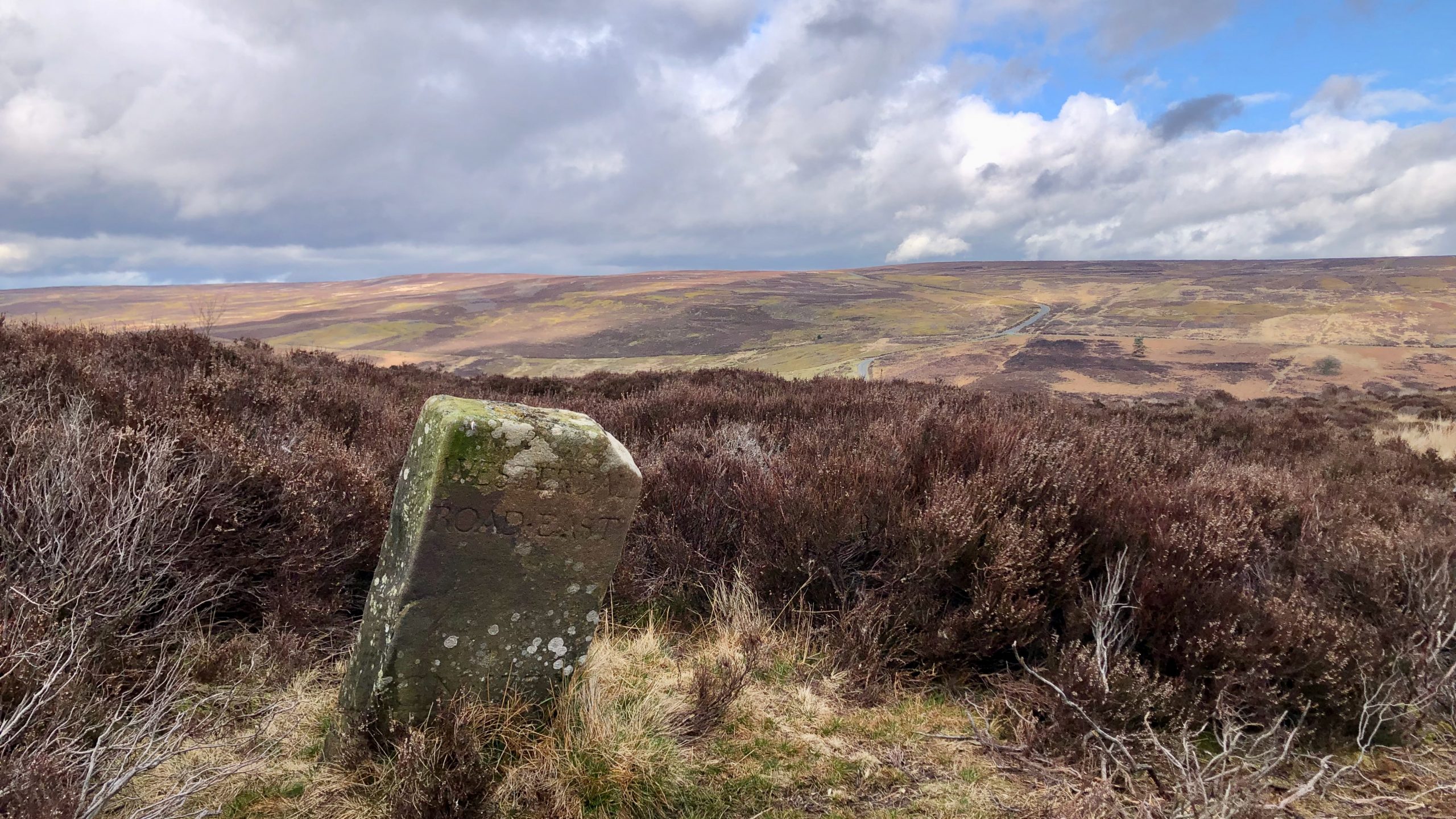
According to the 1853 6″ O.S. map1‘View Map: Ordnance Survey, Yorkshire 30 (Includes: Danby.) – Ordnance Survey Six-Inch England and Wales, 1842-1952’. 2023. Maps.nls.uk <https://maps.nls.uk/view/102344248#zoom=8&lat=1597&lon=1244&layers=BT> [accessed 21 March 2023], there is a boundary stone labelled Stockesley Cross located near the ruins of a supposed smugglers’ hideout called Gin Garth or Jane Frank Garth2‘Heritage Gateway – Results’. 2023. Heritagegateway.org.uk <https://www.heritagegateway.org.uk/Gateway/Results_Single.aspx?uid=1856262&resourceID=304> [accessed 21 March 2023]3‘Heritage Gateway – Results’. 2023. Heritagegateway.org.uk <https://www.heritagegateway.org.uk/Gateway/Results_Single.aspx?uid=ec38db92-3b56-42aa-bbde-caec5c026583&resourceID=19191> [accessed 21 March 2023]. However, on the 1952 map, it’s referred to as Stokesley Cross, a more familiar name4View Map: Ordnance Survey, Yorkshire XXX.SW (Includes: Commondale; Danby; Kildale; Westerdale.) – Ordnance Survey Six-Inch England and Wales, 1842-1952’. 2023. Maps.nls.uk <https://maps.nls.uk/view/100942037#zoom=6&lat=2473&lon=1581&layers=BT> [accessed 21 March 2023]. Coming across the stone in the photograph, I thought I had found it, but apparently Stockesley Cross no longer exists5‘Heritage Gateway – Results’. 2023. Heritagegateway.org.uk <https://www.heritagegateway.org.uk/Gateway/Results_Single.aspx?uid=8b6238f5-4e41-4b6a-ba19-f2b2e93ba2b3&resourceID=19191> [accessed 21 March 2023].
What we did find was this stone way marker inscribed with the words ‘WESTERDALE ROAD EAST 1735.’ It is located close to the former parish boundary that once divided Westerdale and Baysdale, suggesting that it may have also functioned as a boundary stone6NYM NP HER No: 7702.
What’s quite intriguing is that the modern Hob Hole road to Westerdale, which is clearly depicted on the 1853 6″ O.S. map, lies just over 300 meters away from this stone way marker. Why include the word ‘ROAD’ on the inscription? It seems unlikely that it was intended for the benefit of the smugglers who frequented the area.
A few hundred yards up-stream from the Hob Hole ford along Baysdale Beck, you’ll come across two ancient stone gateposts. And if you take a closer look, you can even spot the remnants of a buttress to an old packhorse bridge. From here, on the southern side, a collection of sunken pathways ascend the hillside and lead directly to Gin Garth. However, evidence of a path on the northern side up Kempswithen Moor isn’t as apparent.
This leads me to suppose the old 18th-century route to Westerdale, and perhaps, the medieval Ernaldsti, climbing past Gin Garth. Perhaps it was after a new road was built that the old thatch farmstead became involved in storing contraband, for which the owners received payment from the illicit traders.
However, to go back to the missing Stokesley Cross, you might have wondered what the association was with Stokesley, a town some 10 miles distant over pretty arduous terrain.
During the medieval era, Westerdale was closely associated with the parish of Stokesley and was considered a chapel of ease, serving as a subsidiary place of worship to the main parish church of Stokesley. The 1577 Saxton’s map of Yorkshire even identifies it as ‘Westerdale chapel.’ Despite its isolation, Westerdale was always granted rights for burial and baptism, likely due to its remote location. The nuns of Baysdale Abbey were even permitted to have their own churchyard within Westerdale parish for the interment of nuns and brothers, but their servants had to be buried at the mother church of Stokesley. Given the distance between Westerdale and Stokesley, it would have been impractical for the villagers to attend church in Stokesley. It wasn’t until the rebuilding of the parish church in 1858 that Westerdale became a district parish7Wilson, Carol M. “Westerdale: the origins and development of a medieval settlement”. Page 14. ISBN 978-0-9565779-2-4 2013.
- 1‘View Map: Ordnance Survey, Yorkshire 30 (Includes: Danby.) – Ordnance Survey Six-Inch England and Wales, 1842-1952’. 2023. Maps.nls.uk <https://maps.nls.uk/view/102344248#zoom=8&lat=1597&lon=1244&layers=BT> [accessed 21 March 2023]
- 2‘Heritage Gateway – Results’. 2023. Heritagegateway.org.uk <https://www.heritagegateway.org.uk/Gateway/Results_Single.aspx?uid=1856262&resourceID=304> [accessed 21 March 2023]
- 3‘Heritage Gateway – Results’. 2023. Heritagegateway.org.uk <https://www.heritagegateway.org.uk/Gateway/Results_Single.aspx?uid=ec38db92-3b56-42aa-bbde-caec5c026583&resourceID=19191> [accessed 21 March 2023]
- 4View Map: Ordnance Survey, Yorkshire XXX.SW (Includes: Commondale; Danby; Kildale; Westerdale.) – Ordnance Survey Six-Inch England and Wales, 1842-1952’. 2023. Maps.nls.uk <https://maps.nls.uk/view/100942037#zoom=6&lat=2473&lon=1581&layers=BT> [accessed 21 March 2023]
- 5‘Heritage Gateway – Results’. 2023. Heritagegateway.org.uk <https://www.heritagegateway.org.uk/Gateway/Results_Single.aspx?uid=8b6238f5-4e41-4b6a-ba19-f2b2e93ba2b3&resourceID=19191> [accessed 21 March 2023]
- 6NYM NP HER No: 7702
- 7Wilson, Carol M. “Westerdale: the origins and development of a medieval settlement”. Page 14. ISBN 978-0-9565779-2-4 2013
Leave a Reply