Search results for: “Ernaldsti”
-

Ernaldsti, never a RUPP
Ernaldsti, that medieval track associated with the Percy family crossing Hutton Moor, down Percy Rigg and over to Ralph Cross, via Westerdale. I suspect that the true line of this historical route over the moor lies concealed within the hollow-way, just a stone’s throw to the right of the modern track, and to the left…
-
Percy Cross Rigg’s Hut Circles
I thought I would take a re-look at the Percy Rigg Iron Age hut circles. It has been quite some time. Alas, the perimeter fence lies in disrepair, casting a pall of melancholy over the entire site. Located on the Percy Cross Rigg, just 460 metres down from the remains of the medieval cross, this…
-
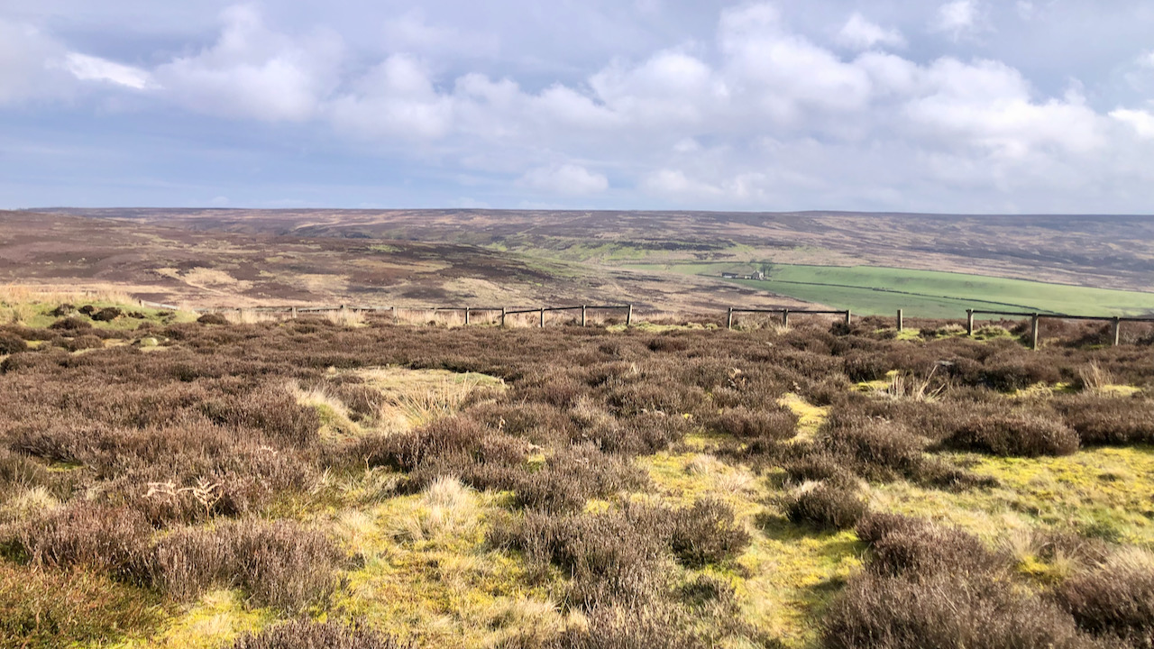
The old road to Westerdale
The moors are filled with standing stones that span across different periods in history. You can find prehistoric monoliths, medieval structures, and even contemporary edifices scattered throughout the vast terrain. According to the 1853 6″ O.S. map, there is a boundary stone labelled Stockesley Cross located near the ruins of a supposed smugglers’ hideout called…
-
Today is the 380th anniversary of the Battle of Guisborough, fought between the Royalists and the Parliamentarians in the English Civil War
I’ve posted about the battle before: here and here. The conventional thinking was that the battle took place on the east side of the town, in fields off Butt Lane. But recent metal detector finds suggest another site for the battle — on the west side of the town, to the north of Hutton Hall.…
-
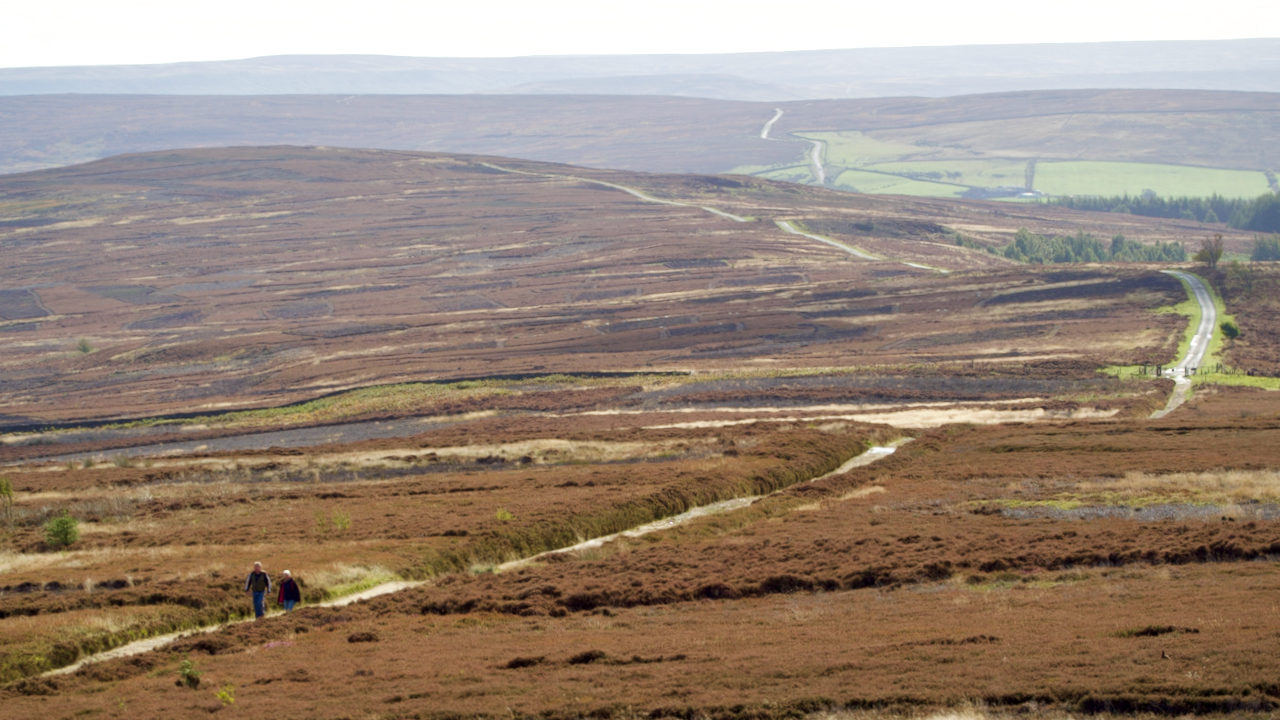
Percy Cross Rigg
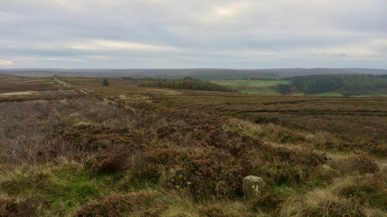
Without looking at the map, I would have said the track along Percy Cross Rigg, or to use its Medieval name, Ernaldsti, on its journey south across Great Ayton and Kildale Moors, and on to Westerdale follows a pretty straight route. But this telescopic photo shows just how sinuous it actually is. The name is…
-
Percy Cross Rigg
These posts often result from a faint memory which I then spend an hour or so trying to verify or research further in the evening — it beats watching ‘Strictly …’. But then, every so often, I plunge head first down a rabbit hole after I’ve pressed the post button. Yesterday was a case in…
-
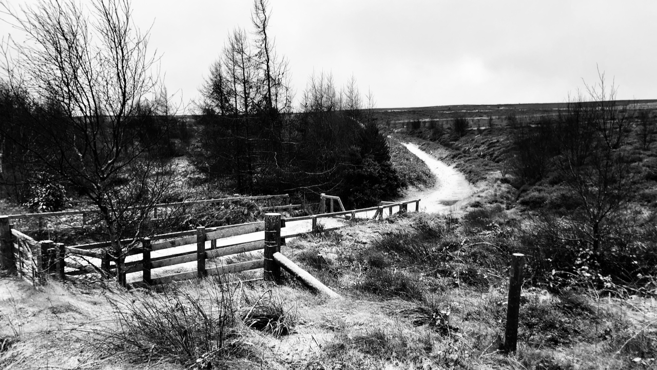
Haswell’s Hut
Dull, overcast, and menacing rain. The blue skies over a snow blanketed moors seem an age ago. ‘Haswell’s Hut (Site of)’ is a feature named on the 1856 Ordnance Survey map that has intrigued me for some time. It is shown as just south of the Spot Height of 714 feet and east of the…
-
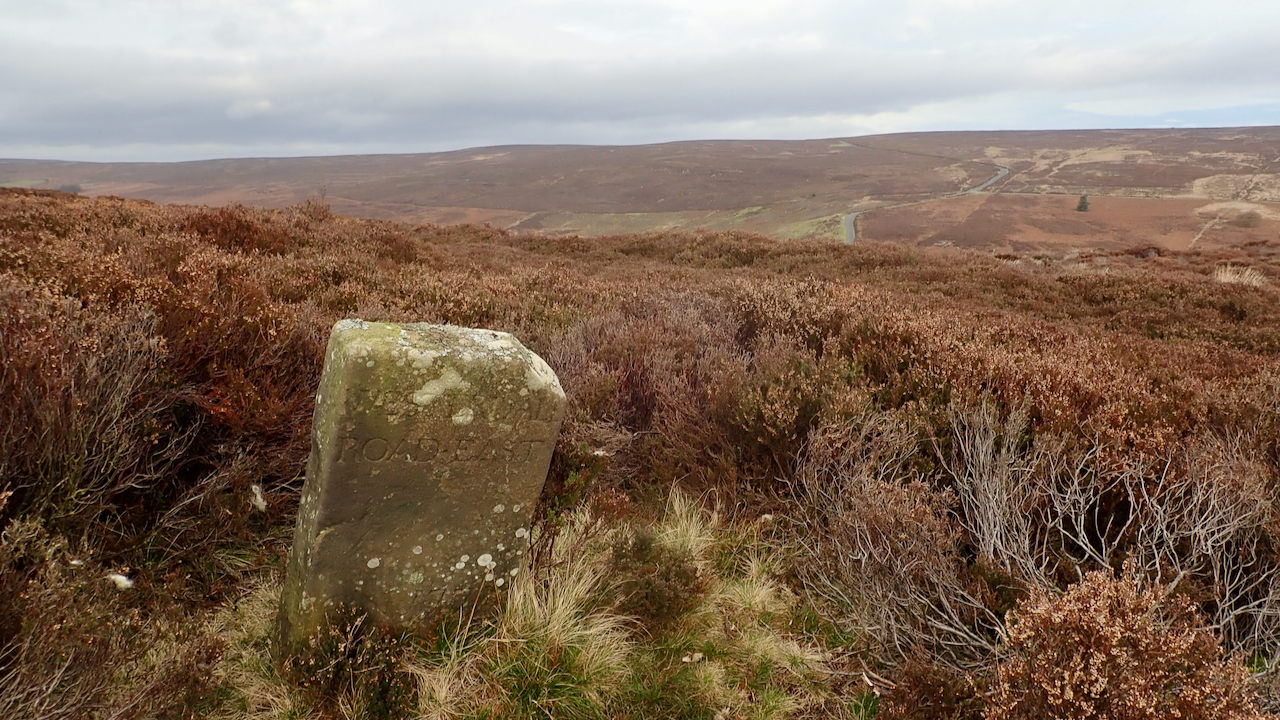
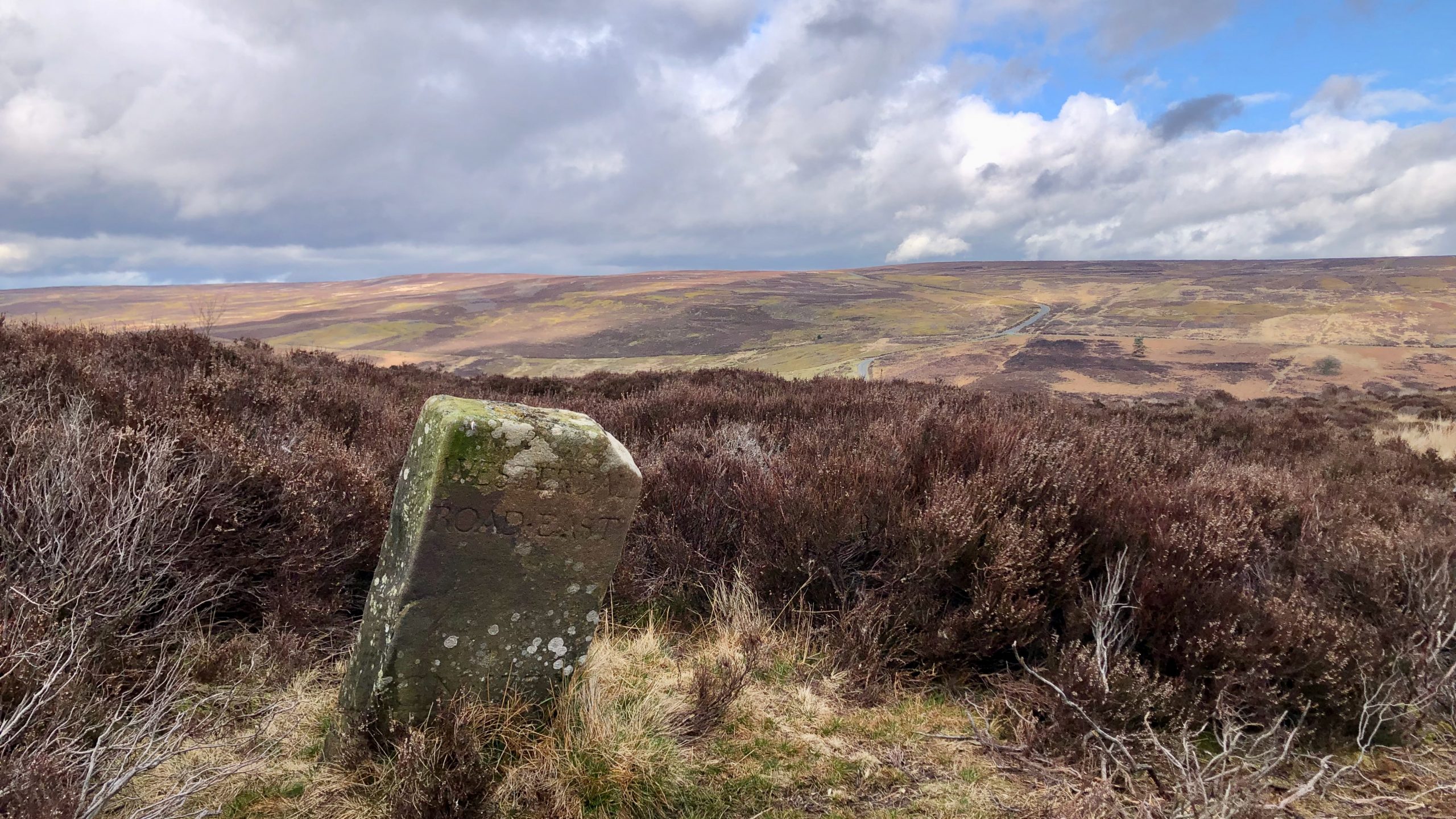
18th-Century Marker Stone
Very close to the ruined farmstead of Jane Frank Garth above Hob Hole and inscribed with ‘WESTERDALE ROAD・EAST‘. It’s located on Little Hograh Moor, about 350 metres from the Hob Hole to Westerdale Road and away from any modern footpaths, Tucked way in the heather. Jane Frank Garth is more locally known as ‘Gin Garth‘…
-
Percy Rigg Farm
In 1806, Sir Charles Turner of Kirkleatham had a cash flow problem and was forced to sell his Kildale and Westerdale Estates. His family had owned them since 1662 when they were brought from the Earl of Northumberland, who would have been Algernon Percy, the 10th Earl. The Sale Advertisement exists and makes interesting reading.…
-
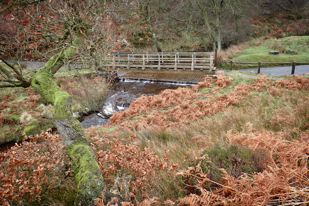
Hob Hole
A popular picnic spot since at least the Edwardian times. The very name ‘hob‘, perhaps a shortening of hobgoblin, evokes an image of a remote place, an abode of mischievous elves that prey on weary travellers. The ford, where the Kildale to Westerdale Road crosses Baysdale Beck is accessed by a hair-raising descent followed by…