Barker Plantation is a reasonably sized larch plantation covering Scot Ridge, the hill between Hodge Beck and Shaw Beck.
The plantation is due to be felled, and to do this, a contractor will be brought in, but the amongst the conifers there are many birch, oaks and Scots Pine which the Trust want to retain to form a good foundation for their eventual plans for a deciduous woodland.
If the tall conifers are suddenly removed, these birch and oaks will be susceptible to the elements. They need a season’s toughening up and our task is to “halo” the trees, felling conifers within 20 metres or so around each tree, and giving them the chance to bulk out a bit.
The felled trees need to be cut into 3 metre lengths and stacked ready for the contractors. It’s a task which will keep us occupied for most of the winter.
Barker Plantation has been around for some time. It is shown on the 1857 O.S. map, although I suspect it has been replanted sometime in the intervening period.
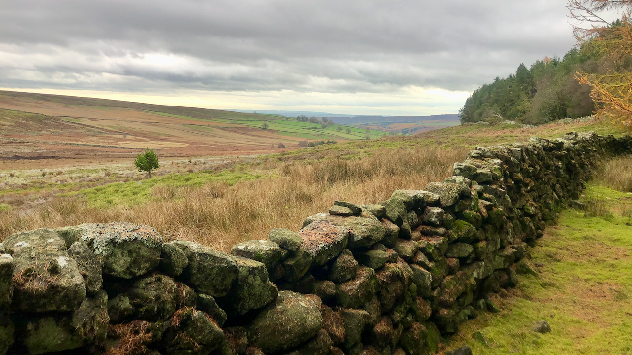
The featured photo is of the shallow valley containing Shaws Beck and was mapped on the 1857 O.S. map as ‘Shaws‘ although this name seems to have become forgotten.
On the far side of the valley a prehistoric or medieval field system has been recorded1North York Moors Historic Environment Record (HER) No: 8149..
Closer, just beyond the dry-stone wall, a medieval trackway has been identified, surviving as a trackside ditch2North York Moors Historic Environment Record (HER) No: 8147.. Closer to the beck, there is evidence of another medieval trackway, running parallel3North York Moors Historic Environment Record (HER) No: 8148..
The route of the nearer trackway has been identified as a ‘Lost Path’ by the Ramblers in their ‘Don’t Lose Your Way’ project4‘Don’t Lose Your Way – Volunteer Map’. 2022. Astuntechnology.com. ID: 141120. <https://gis-dlyw-ramblers.astuntechnology.com/map/?pathId=141120> [accessed 10 November 2022]. If they are successful in getting this path designated as a Right of Way it will be a great addition to the Rights of Way in Bransdale connecting Sprout House with High Lidmoor.
- 1North York Moors Historic Environment Record (HER) No: 8149.
- 2North York Moors Historic Environment Record (HER) No: 8147.
- 3North York Moors Historic Environment Record (HER) No: 8148.
- 4‘Don’t Lose Your Way – Volunteer Map’. 2022. Astuntechnology.com. ID: 141120. <https://gis-dlyw-ramblers.astuntechnology.com/map/?pathId=141120> [accessed 10 November 2022]
Leave a Reply