Just after the midwinter feast of 1070, William the Conqueror, fresh from Christmas in York, marched north to settle a score. His garrison at Durham had been slaughtered, and he meant to answer blood with fire. What followed was ruin on a grand scale. Villages, farms, whole stretches of countryside were wiped clean, with no one left to work the soil. The north was laid low, scorched like a field after a bad frost.
When the business of revenge was done, William turned south. He crossed the River Tees and struggled back toward York by way of Bilsdale and Helmsley. The journey was close run. Snowstorms battered the army, and the men limped into York half-frozen, soaked through, and worn to the bone. They were lucky to arrive at all.
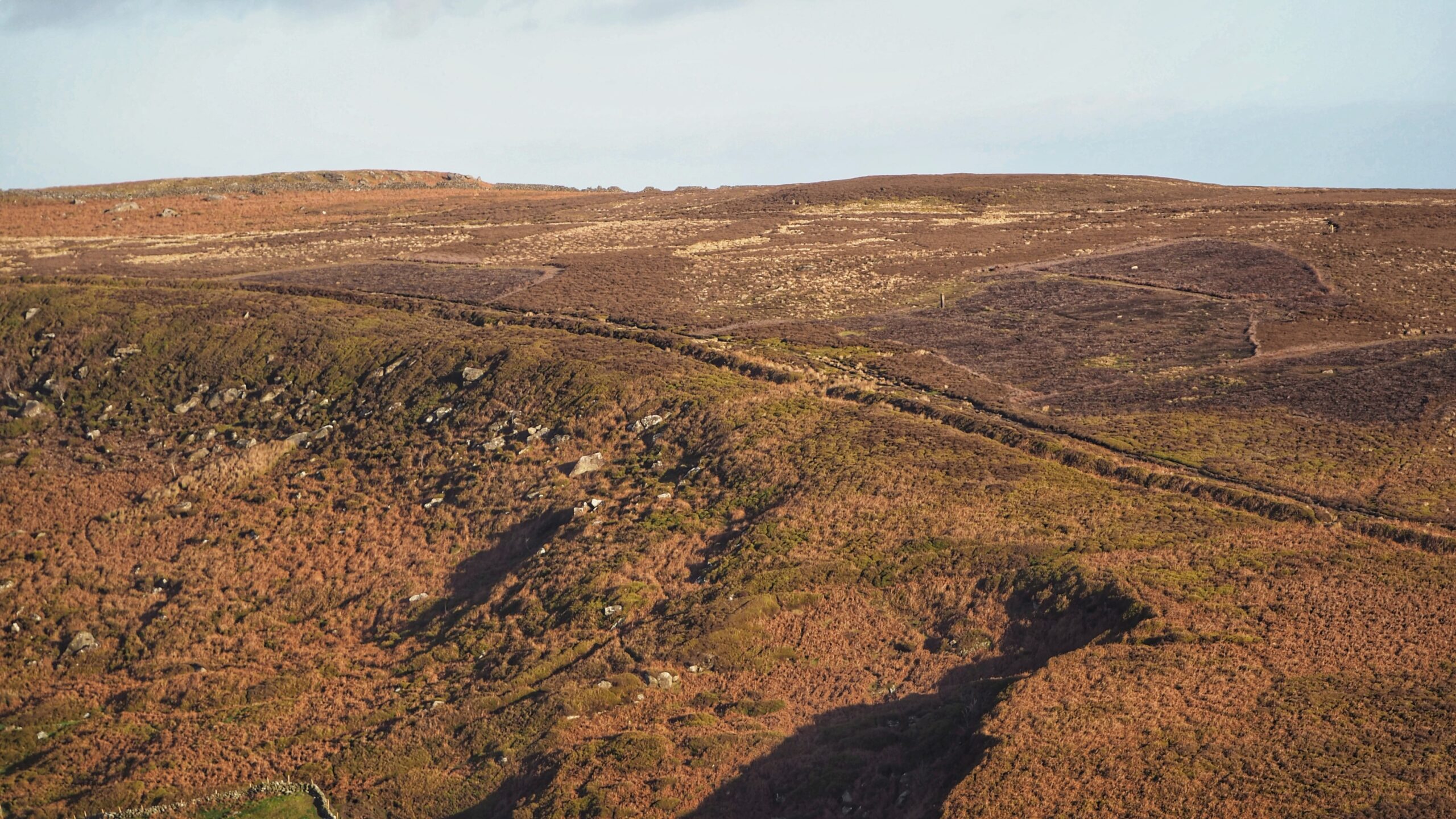
So runs one local tale explaining why a long, ancient earthwork, stretching for about four and a half kilometres, came to be called Billy’s Dyke1Where Billingham now stands by “STRANTONIAN” Hartlepool Northern Daily Mail – 19 March 1938. https://www.britishnewspaperarchive.co.uk/viewer/bl/0000378/19380319/093/00032Hudson, Martyn. “on blackamoor”. 2020. ISBN 978-1-9164257-9-8.. The story claims that William, deep in hostile country, lost almost his entire force and spent a miserable winter night, perhaps within the shelter of this dyke, in Bilsdale with only a handful of followers. A king brought low, shivering in the snow. History likes that sort of thing.
The truth is less dramatic and far older. The dyke long predates the Normans. It was probably built in the Middle Bronze Age, somewhere between fifteen hundred and five hundred years before Christ. Later generations may have reused it, perhaps as part of a medieval deer park, but it was already ancient by William’s day.
Its sheer scale tells its own story. This was not the work of a few bored locals with spades. It demanded serious effort and careful planning, which points to a large and organised community behind it. Most scholars think it was a showpiece, a bold line drawn across the land to mark territory or serve some ritual purpose. A statement, not a barricade.
The climate at the time was turning colder and wetter. The high moors were slipping into bog, and the landscape itself was changing shape3“Historical Atlas of North Yorkshire.” Edited by Robin A Butlin. Page 42. Westbury Publishing. Reprinted 2004. ISBN 1 84103 023 6.. In that setting, a grand boundary would have mattered, whether for power, belief, or both4Historicengland.org.uk. (2012). Urra Moor prehistoric linear boundary on the western edge of Urra Moor, Bilsdale Midcable – 1015955 | Historic England. [online] Available at:https://historicengland.org.uk/listing/the-list/list-entry/1015955?section=official-listing [Accessed 14 Jan. 2022]..
Early antiquarians liked to imagine the dyke as a defensive wall, thrown up by the people of Cleveland to stop some shadowy enemy marching up the dale. It is an idea that sounds sturdy until one thinks about it. Holding such a line would have needed an army all of its own. And even with a fence or hedge on top, it would not have stopped anyone with legs and intent. Unless, of course, crossing it carried a deeper fear. Sometimes the strongest barriers are the ones people believe in.
- 1Where Billingham now stands by “STRANTONIAN” Hartlepool Northern Daily Mail – 19 March 1938. https://www.britishnewspaperarchive.co.uk/viewer/bl/0000378/19380319/093/0003
- 2Hudson, Martyn. “on blackamoor”. 2020. ISBN 978-1-9164257-9-8.
- 3“Historical Atlas of North Yorkshire.” Edited by Robin A Butlin. Page 42. Westbury Publishing. Reprinted 2004. ISBN 1 84103 023 6.
- 4Historicengland.org.uk. (2012). Urra Moor prehistoric linear boundary on the western edge of Urra Moor, Bilsdale Midcable – 1015955 | Historic England. [online] Available at:https://historicengland.org.uk/listing/the-list/list-entry/1015955?section=official-listing [Accessed 14 Jan. 2022].
Leave a Reply